![]()
There's an old saying: "If you haven't run aground, and you haven't been to the Benjamins, then you haven't been to the North Channel." Of course, you can satisfy both these requirements by trying to visit the Benjamins!
The Benjamin Islands are the most popular destination in all of the North Channel. Formed from beautiful pink granite, they provide a rocky refuge for the cruising sailor. The two principal islands, North Benjamin and South Benjamin, are skirted by a number of smaller rocks to the southeast, known as The Sow & Pigs and The Boars.
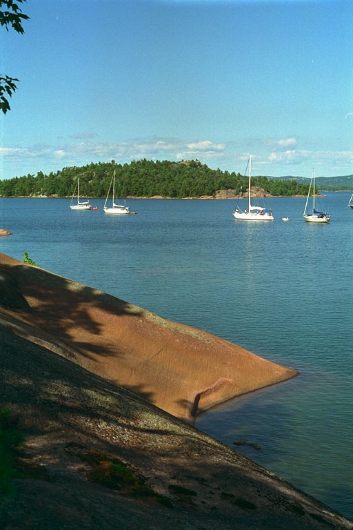
There are two main anchorages: the large cove on the southern side of South Benjamin Island, and the much larger bay (shown here) formed by the north shore of South Benjamin and the southern shore of North Benjamin Islands. In addition, there are many smaller coves with varying depths that permit boats to snuggle in if their draft is suitable.
The anchorage on the south side of South Benjamin is easy to enter from the Clapperton Island Passage. A large rock divides the mouth of the harbor in two; most boaters leave the rock to port when entering.
![[Photo: North Harbor of Benjamin Is.]](images/279.jpeg)
The harbor on the northern side of South Benjamin is somewhat more difficult to approach. There are two possible routes: for the daring, you can make passage with a minimum of 15 feet of water by entering from the west between two huge sets of pink granite rocks at the gap between North and South Benjamin islands. If you click on the picture to the left, you'll get a much enlarged view that shows the harbor entrance clearly. [It's worth a look!]
For the more cautious, you can approach from the east, skirting the Sow & Pigs by sailing close to Secretary Island, then crossing the hazard-free water due west from Porcupine Island. (Porcupine Island is not named on most charts, but is the large, rounded island north of Secretary Island.)
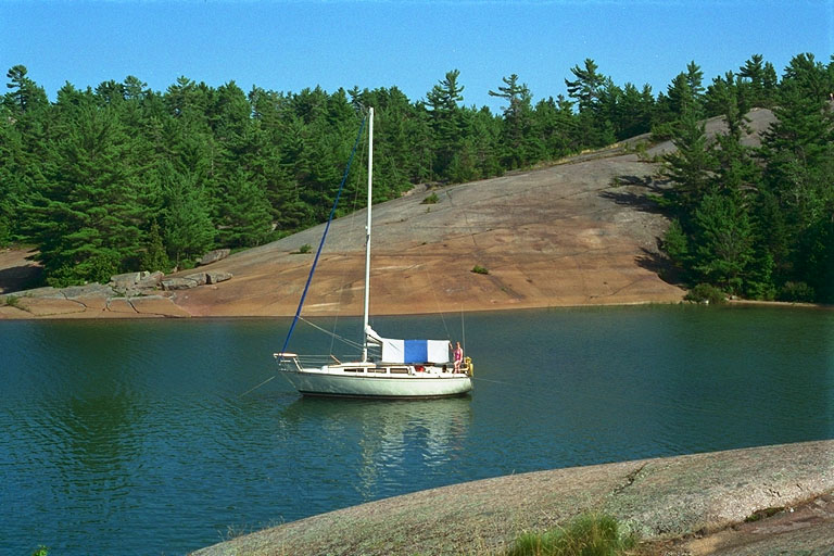
![[Photo: Southern Cove of Northern Harbor, Benjamin Is.]](images/275.jpeg)
Our favorite spot is in the larger cove on the north shore of S. Benjamin Is. The depth is about five feet (at Low Water Datum), and during typical July-August lake levels, you'll have a couple of feet more. If you look carefully, you'll find a few stainless steel mooring rings cemented into the rock to make your mooring even simpler. You'll also see some big underwater rocks, visible astern of Voyager III. That is Fox Island in the background, with the North Shore in the distance.
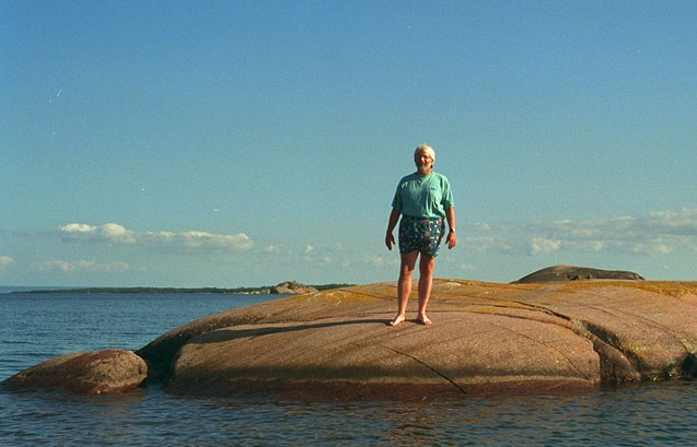
Here is a photo of your author, standing on a small rock just east of South Benjamin Is. In the background to the southeast, you can see the larger members of The Boars and The Sow & Pigs island groups. These rocky islets rise very rapidly. Just a few feet from this rock there are depths to thirty feet or more. Navigation among the Sow & Pigs and The Boars is best left to your dingy or yawl boat on a calm day.
Despite their popularity as a cruising destination, access to the natural beauty of the Benjamins has been threatened. About c.1993, someone obtained title to a portion of the land and erected a cottage on South Benjamin. Perhaps they decided to remove it, as we could not locate it during our 1996 visit to the northern side of South Benjamin. Also, we heard a tale of how attempts were being made to quarry granite from the islands. Apprently the same company that currently is removing dolomite from Badgeley Island had plans in place to remove the beautiful pink stone that makes the Benjamins such a distinctive destination. Fortunately, both these incursion on the pristine wilderness of the Benjamin Island group seem to have been turned back.
![]()
![]()
![]()
![]()
![]()
![]()
This article first appeared in 1996.
Copyright © 1996, 1997, 1998, 1999 by James W. Hebert. All rights reserved.
This is a verified HTML 4.0 document served to you from continuousWave
URI: http://continuouswave.com
Last modified:
Author: James W. Hebert