![]()
When leaving the Bustards, you get a chance to look into the huge outlet of the French River. The river actually has already split into several channels, but this is the main one. The French River system drains huge Lake Nippissing, located several hundred miles to the northeast.
The water levels in the Great Lakes vary from year to year. In a year of "high water", lake levels can be as much as six feet above chart datum! This tends to alter the appearance of many charted objects.
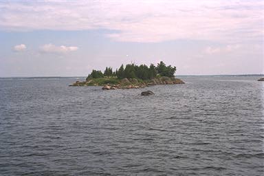
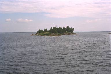
With that in mind, here are two views of James Island, which is guarded by an unnamed rock that rises steeply from 36 foot depths. The photograph on the left was taken in a year of moderate water levels, perhaps only 30 inches above low water datum. The photograph on the right was retouched to simulate the appearance of the same scene, but in a year with higher water levels, say 48-60 inches above datum. The rock would then be just submerged, making it a rather nasty hazard.
That pink cast to the sky gives us thoughts of "Red Skies at Morning...," but the weather holds fair with good south-southwesterly winds. We turn southwest and line up on the range marks on the Bustard Rocks.
![]()
![]()
![]()
![]()
![]()
![]()