![]()
Although not named on Canadian charts, the large cove on the south side of Baie Fine is well known as "Mary Ann Cove." It lies about two miles beyond the narrow Frazer Point entrance to Baie Fine, that beautiful, long inlet which some claim to be a true fjord. Mary Ann Cove provides an excellent anchorage for boaters who do not want to make the long trek to The Pool, about twenty miles or more farther inside Baie Fine.
Besides neglecting to name the cove, the Canadian cartographers have
shown soundings more shallow than
those actually found here. Usually in this area we are blaming ancient chart
2286, but this time it is otherwise excellent small craft chart 2205 that
mistakenly shows most of the cove as having less than six feet of water
and featuring a rock awash in the middle. Neither feature is accurate,
as my sketch below shows.
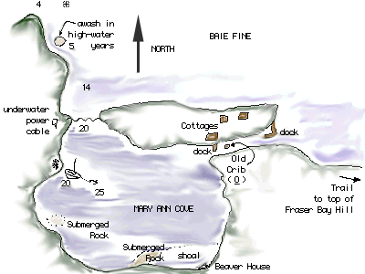
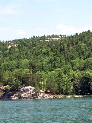
While anchored in the cove, you can enjoy the scenery and watch a steady parade of boats heading back and forth in Baie Fine. The island which forms the northeastern side of the cove is privately owned and contains several cottages, but in all our visits we have never seen them occupied. Towering above you to the east is Frazer Bay Hill, the summit of the Killarney Ridge of the South La Cloche Range. In the North Channel there are many opportunities to climb to points of lookout, but the trip to Frazer Bay Hill is perhaps the best of them all. This view is from our anchorage (shown in the sketch above), as we look eastward at the hill some 575 feet above the lake.
The trail begins along the shoreline, east of Mary Ann Cove.
Take your dingy through the narrow channel behind the cottages,
and come ashore about 100 yards east. You will find a trail
that initially follows the shoreline then abruptly heads inland
and upland, marked by red ribbons tied in the tree branches.
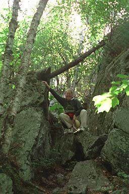
As you climb the hill, the trees thin out and so do the red ribbons. Soon, little stone cairns replace them as trail markers. After about thirty minutes of just being able to walk uphill, you have to do some climbing. The worst spot is this deep split in a huge granite rock, and this picture fails to convey the amount of vertical climb necessary to transit this obstacle.
It turns out to be easier going up than coming down through this
little chasm, by the way. But after making it above here, you are on
the home stretch to the top. Your legs will probably be burning a
little, and you will be out of breath for sure, but the lure of
the crest of the hill will pull you upward for another ten minutes
of climbing. Continue on, because you will be rewarded for your efforts!
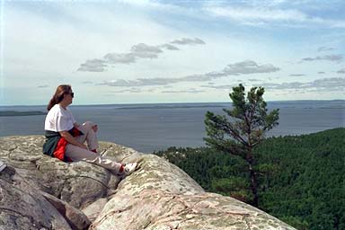
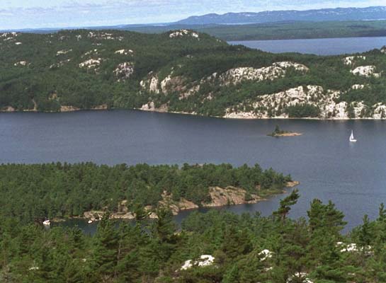
On top of Frazer Bay Hill, the panorama is spectacular. Chris rests
and takes in the view to the southwest, across Frazer Bay to Heywood Island
in the distance. With such a well marked trail, we could anticipate that
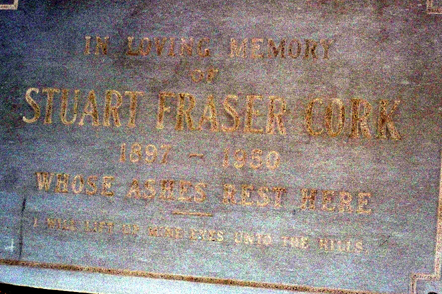
many others had visited here before us, but we were surprised to find that
the summit was the final resting place for a fellow climber.
Finally, here the view of Mary Ann Cove from the top of Frazer Bay Hill. You can
just see our boat anchored along the western side of the cove.
For more photographs of Frazer Bay Hill, see the Sail-Log from our
1997 visit.
![]()
![]()
![]()
![]()
![]()
![]()
Copyright © 1997 by James W. Hebert. All rights reserved.
Last modified: December 18, 1997
URL:http://continuousWave.com/north-channel/maryAnnCove.html
JWH