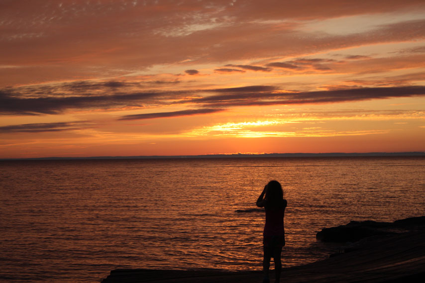
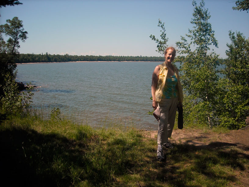
On Devils Island, our friends John, Holly, and Emmarie saw this beautiful sunset. The red skies correcty predict the fair weather we will have tomorrow. Photo by John Raby.
A narrative of a week of cruising Lake Superior in the Apostle Islands of Wisconsin, with two days in the Les Cheneaux Island of Lake Huron on the way home.
| Date: | Wednesday, July 4, 2012 |
| Weather: | Warm and sunny |
| Winds: | Light |
| Traffic: | Light |
| Departure: | Beverly Hills, Michigan |
| Destination: | Iron Mountain, western Upper Peninsula of Michigan |
| Distance: | 480 miles by highway |
For our 2012 early Summer cruise we are combining business and pleasure. We have a business meeting in Iron Mountain, Michigan, in the western Upper Peninsula, and after spending a day there we can continue onward to Wisconsin and the Apostle Islands. We plan to stop around Escanaba for the night, perhaps sleeping on the boat by staying in the parking lot of a boat launch ramp, but this turns out to be not possible. We can't find the first ramp we are looking for, and our fallback ramp is the center of a fireworks display. Its parking lot is jammed with cars and people. We decide to just keep going on to Iron Mountain.
At the junction of US-2 and US-41 in Powers, the weather makes a very sudden and dramatic change. We pull over in 40-MPH winds and, as fast as we can, we put the big canvas cover on the boat. Just a moment—literally—after we have the boat covered a tremendous rain begins, along with lightning and the lowest cloud ceiling I have ever seen. These dark clouds appear to be only a few hundred feet above our heads. The rain is so heavy we can only drive about 25-MPH. We slowly press on to Iron Mountain, arriving about 11 p.m. in a downpour. We have been driving all day!
In Iron Mountain we are very fortunate to find our motel has a big covered entrance with enough vertical clearance to get the boat under it. We grab some clothes for an overnight stay from the boat cabin. Chris goes to the office to make arrangements. With the room confirmed I pull the boat to a safe parking spot in the motel's lot. I run for the motel entrance, but I am soaked by the time I get there. We dry off in the motel room and are very glad to be indoors, not sleeping on the boat tonight.
| Date: | Thursday, July 5, 2012 |
| Weather: | Changing |
| Winds: | East 20 |
| Departure: | Iron Mountain, Michigan |
| Destination: | Little Sand Bay Boat Launch and Campgrounds, Wisconsin |
| Distance: | 230 miles by two–lane highway |
The storm front has passed through and we are free of rain. We fill up the morning and early afternoon with our business meeting. We depart Iron Mountain about 3 p.m., and head west on highway US-2, which runs through some delightfully scenic country along the border between Wisconsin and Michigan. By about 8:00 p.m. (Michigan time) we are in Ashland, Wisconsin. I have previously scouted out a gas station there that sells pure gasoline with no ethanol dilution. We stop to put fuel on the boat, adding 50-gallons to the tank. Unfortunately the station is located on a grade, and our orientation when filling is with the bow downhill. This limits how much fuel we can add to the tank before the vent hose becomes blocked and we have to stop. We end up with a total of 63-gallons on board, or about 7/8th-FULL.
West from Ashland the highway is under construction and narrows to one lane with orange cones defining the width. While focused on keeping the boat trailer centered in this narrow lane, I miss the turn for Bayfield. About five miles later we realize something is not right, and double back. By the time we get to the launch ramp at Little Sand Bay we are running out of daylight. It's 9:20 p.m. Michigan time.
We have some familiarity with the ramp, because we visited here in 2000 with a much smaller boat in tow. We give the ramp a quick look to make sure it is going to be suitable, then prepare the boat for launching. We just get the boat in the water as the sun sets at 10 p.m. We have another half-hour of twilight to complete the rest of the launching-docking evolution.
The total driving distance for us to get here is 710-miles. All but the first 275-miles have been on two-lane highways. We have run into construction delays and detours in several places, gotten lost once or twice adding about 20 extra miles, and driven through the worst rain I have ever seen. We spent a very intense five hours in a business meeting today, and we are both very tired. From the launch ramp we move the boat about 50-feet to a dock. We are soon greeted by our Boston Whaler boat friend Hal, whose boat is also in the harbor. Hal and Margaret are staying in the campground with their new RV. They're not sleeping on the boat tonight. After a quick hello we call it a day. We're worn out from two days of driving and meetings.
| Date: | Friday, July 6, 2012 |
| Weather: | Rain |
| Winds: | East 15 going to Northeast |
| Departure: | Little Sand Bay National Park Dock, Little Sand Bay, Wisconsin |
| Destination: | Bayfield and return—by car |
| Distance: | 0 miles by boat; 25-miles by car |
We are listening to NOAA weather radio station KIX43 (162.55-MHz) from Duluth. The forecast is:
Nearshore Marine Forecast for western Lake Superior:
Wind North at 5-knots, becoming variable in the afternoon
Isolated showers in the morning
Showers and thunderstorms in the afternoon
Waves 2-feet or less

Large areas of rain spreading to the East across Minnesota and Wisconsin

Saturday: winds light becoming Southwest at 5-knots in the afternoon
Saturday night: clear
In the early afternoon the forecast is revised:
Wind Northeast 15-knots increasing to 20-knots
Waves building to 2 to 4-feet.
Wind decreasing to North 5-knots late; showers, thunderstorms
The weather has deteriorated. This morning there is rain and the forecast calls for rain all day. The wind is to shift to the northeast and increase to 15 to 20-knots. We are presently moored in the harbor directly in-line with the harbor channel opening, which points to the northeast. If the wind increases we will be rocked with waves coming in the harbor. The first order of business is to move the boat. The best spot in the harbor is already taken by all the government boats. There are a couple of park service boats and some law enforcement boats, all tied up in the northwest corner of the harbor, which has the best shelter. There is a spot on the seawall to the north which will be much better, but there are a pair of fenders hanging on the dock, apparently reserving space.
I check with the ranger station about the policy of the harbor and reserving space, specifically about the fenders hanging on the north seawall. The ranger tells me there is an explicit policy of no reservations, and once a boat leaves the harbor it does not have a reserved space for its return. I query him again about the specific spot and he tells me it will be perfectly fine if I move my boat there.
Around 3 p.m. in a lull in the rain we move the boat over to the north seawall and tie up. I remove the fenders left there and move them down the dock to the next available space, which will be a tight squeeze for all but the smallest boat because there is a slip for a park service boat that must be kept open. The park service boat is not in the slip, but there are plenty of signs advising not to use it. Apparently the park service boats do have reservations.
No sooner are we tied up than the skipper of the boat in front of us comes over to school us on the local policy. He tells me I have taken the spot that a local uses whenever he comes to the harbor from a private cottage on Sand Island—there are a few private land holdings remaining on the island that is otherwise part of the National Lakeshore. I point out to the fellow that if he were to move his boat forward about ten feet, there would be enough room for all three of us. He refuses to move his boat, a 40-footer, because he says the winds are going to be very strong out of the northeast tonight. "Have you listened to the weather radio," he asks. I inform him that I am aware of the weather forecast, which is why I moved over to this spot. If he is concerned about the local boat coming back and not getting the best spot in the harbor, he could move up ten feet. He refuses again, citing the potential that by moving forward his boat might get exposed to waves coming around the corner of the inlet channel. I understand the paradigm: he has concern about the local boater's notion of having the best spot reserved for him, but only enough that he wants me to bear the burden of providing it. This ends our conversation for the rest of our stay in the harbor.
As it happens, the big storm from the northeast never materializes and the local boat never shows up. The rain does continue, on and off all day, and eventually we can't stand it. We drop the trailer off the truck and drive to Bayfield for dinner and a walk around town. By early evening the rain finally stops. We have a great dinner at a place called Maggie's. It is crowded and there is a wait, but the food is very good and the service friendly.
On Devils Island, our friends John, Holly, and Emmarie saw this beautiful sunset. The red skies correcty predict the fair weather we will have tomorrow. Photo by John Raby.
| Date: | Saturday, July 7, 2012 |
| Weather: | Warm |
| Winds: | Light and variable |
| Waves: | Calm |
| Departure: | Little Sand Bay, Wisconsin |
| Position: | 46° 56.835' N 090° 53.385' W |
| Destination: | Devils Island |
| Distance: | 25-miles very leisurely by boat |
The weather has returned to a beautiful fair Summer day. We had a very good night in the harbor—not a ripple disturbed our sleep. There is sunshine and the winds are light.
Using digital selective calling (DSC) we electronically exchange position reports with the HOLLY MARIE, the boat with our friends John, Holly, and Emmarie from Minnesota. They are in the Apostle Islands for the holiday weekend, too. We find them at a dock on Devils Island, and soon raise them on voice radio. We agree that we'll head for Devils Island later in the morning. The dock is already full there, and they don't want to leave. We'll come out and raft up with them. At the campground, Hal is expecting his son and family to visit, and they'll come out to Devils Island later, after their visitors arrive.
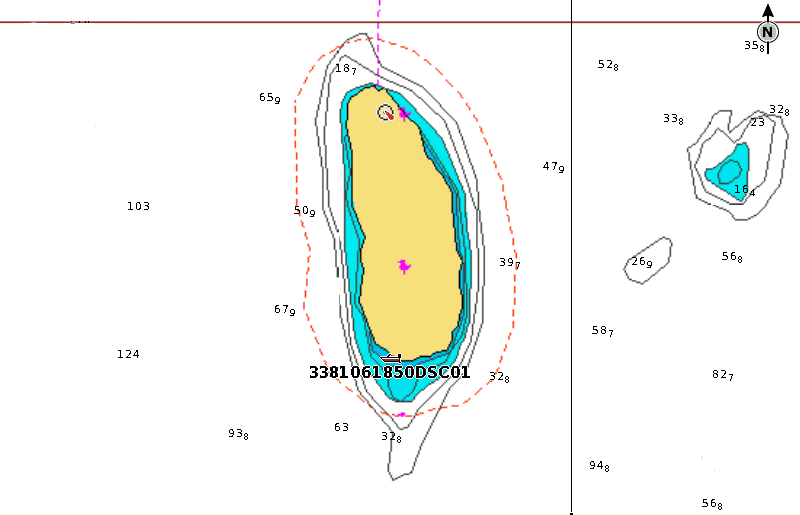
This screen capture from my chart plotter shows a plot of the position of the HOLLY MARIE that we received via DSC radio. They're at the harbor on Devils Island. All graphics, illustrations, and photographs are by the author unless otherwise noted.
While puttering around the dock this morning I encounter a very pleasant fellow from the United States Coast Guard Auxiliary. He offers to perform a courtesy safety inspection on CONTINUOUSWAVE. The boat passes and gets its 2012 Courtesy Inspection decal. That sticker can save you a lot of time later if you are stopped by the active Coast Guard. They will usually wave you off if you have a USCG-Auxiliary inspection decal on the side window. The inspector recommends I carry a copy of the rules and regulations onboard, along with paper charts. I should also have a checklist for guests in case of emergency.
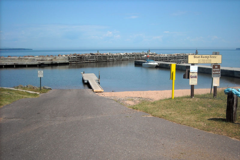
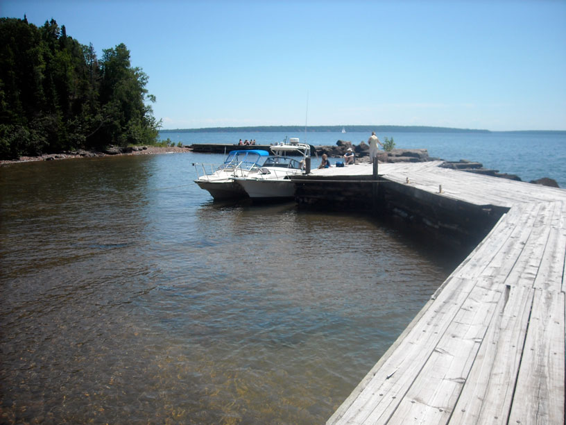
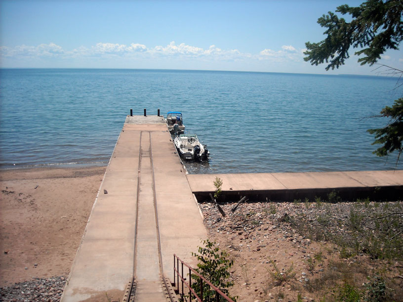
The boat launch ramp at Little Sand Bay, Wisconsin, on a sunny, fair weather day. The harbor opens northeast.
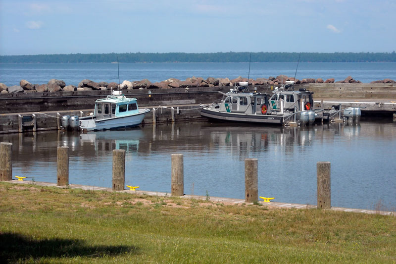
The best protection in the small harbor at Little Sand Bay is at the northwest corner, where the park service has reserved three slips. They also have a boat tied to the seawall. Sand Island is seen about two miles distant.
Finally, after three days of waiting, we get underway about 11 a.m. our time or 10 a.m. local time. We head east and north, passing York Island, Raspberry Island, and Bear Island on the way to Devils Island. At the south end of Devils Island there is a protected harbor and we raft up with HOLLY MARIE, who has a good spot on the west dock there.
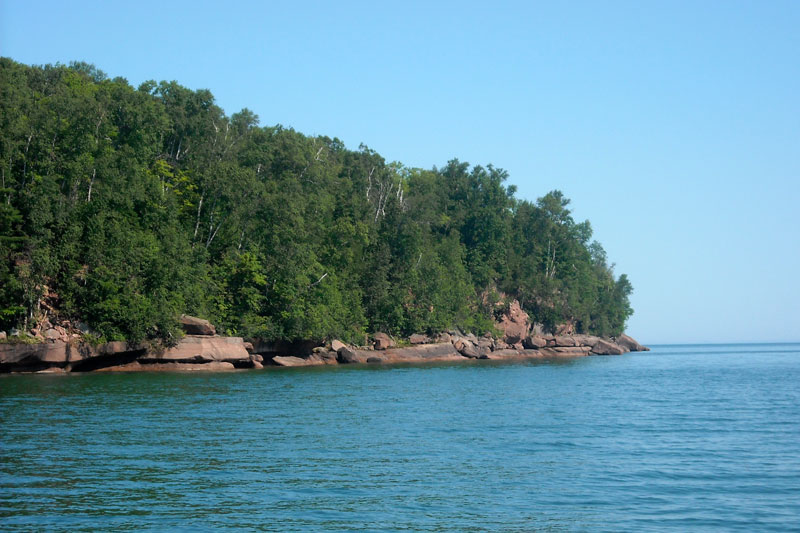
Bear Island, like many of the Apostle Islands, has no natural boat harbor and has a steep-to rocky shoreline all-round. In Summer, Lake Superior can be the calmest of the Great Lakes, as it is here, with beautiful blue water and blue sky.
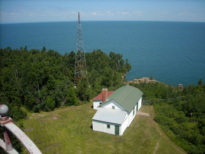
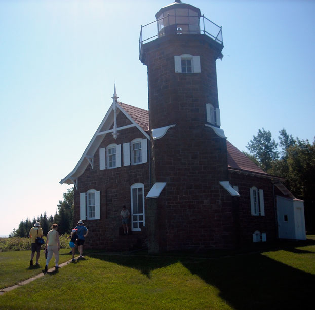
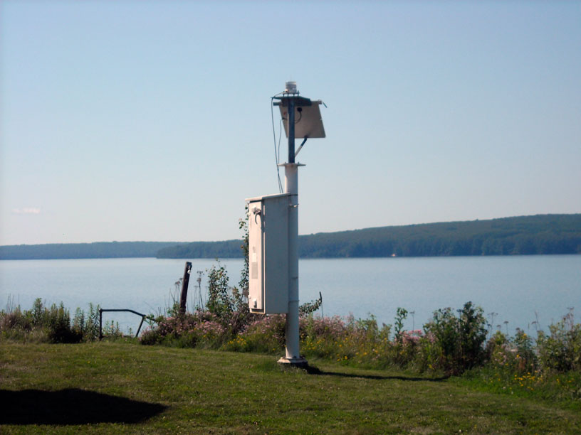
The main attraction on Devils Island is the lighthouse on the northern end. We hike the trail over the center of the island to the lighthouse, a distance of about 1.5-miles. We get a grand tour of the tower from a volunteer docent and see the Fresnel lamp, the only original lens still in place in the Apostle Islands. The light tower now also contains an automatic reporting weather station that sends its meterological data to a NOAA website. One change since our last visit: everyone must wear soft cotton aprons to prevent accidentally damaging the lens.
From the lighthouse grounds, we hike back to the boats for lunch. After lunch we depart the dock and run around to the north end of the island, where we join a small fleet of boats at anchor. Using John's inflatable dingy, we all explore the sea caves. Later in the afternoon Hal and family arrive. They were delayed by having to run to Bayfield for boat gas.
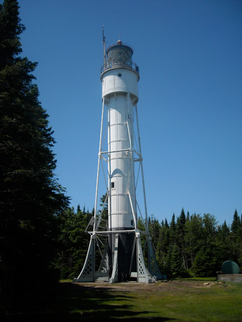
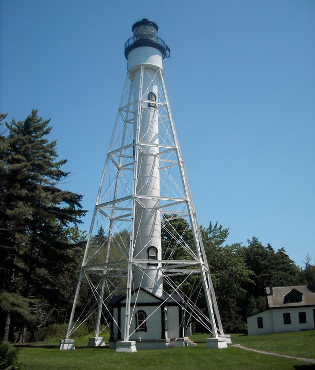
The 80-foot-high Devils Island light was originally constructed in 1898 without
the exterior braces seen here, which were added in 1914 to reduce sway in high winds.
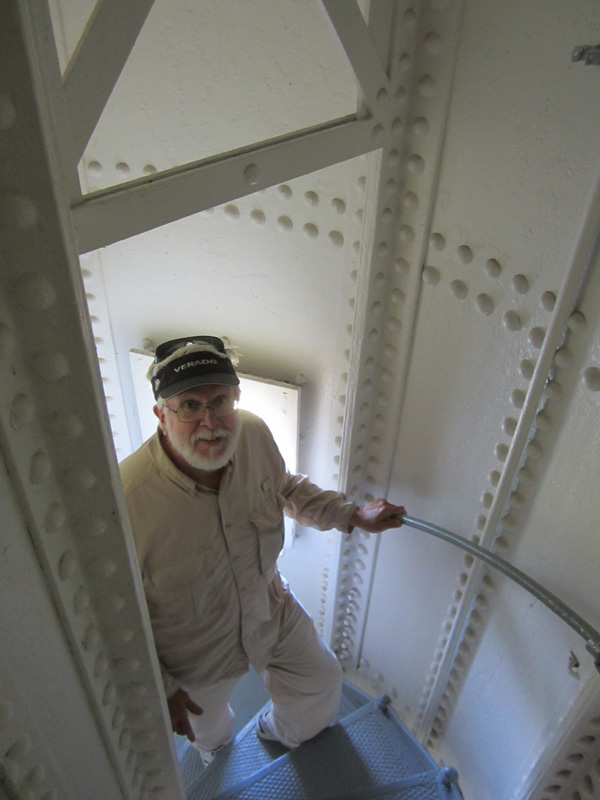
The interior of the tower is in perfect condition. Its riveted construction should last at least another century.
Your author climbs the circular stairs to the lamp level. Photo by John Raby.
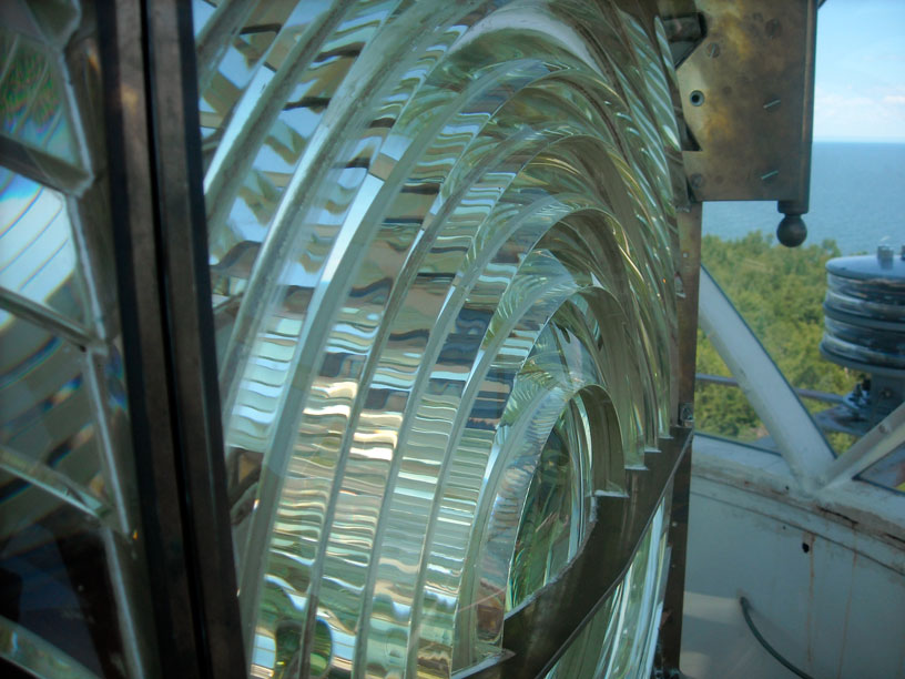
The original third-order Fresnel lens of the Devils Island lamp has been restored to the top of the tower after a local group sued the United States Coast Guard for its return.
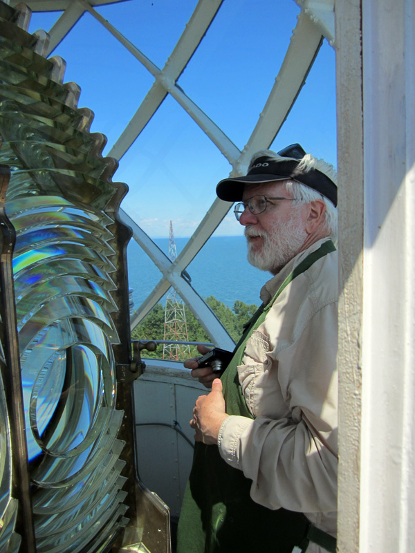
This view gives a good impression of the size of the lamp. During the re-installation a large
base section of the lamp was omitted, and as a result the focus of the lens is now sitting too low.
In the original setting the light beam would have pierced the windows about 18-inches higher.
Photo by John Raby.
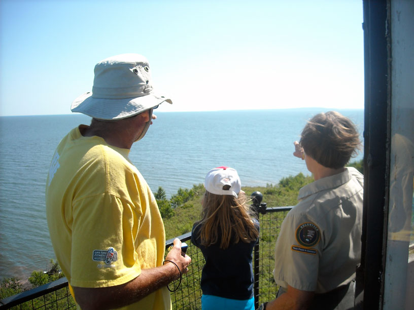
The view from the light tower looking to the Northwest on a clear day takes in the far shoreline of Lake Superior,
about 30-miles away.
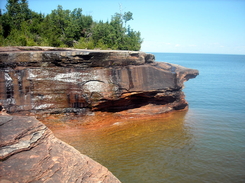
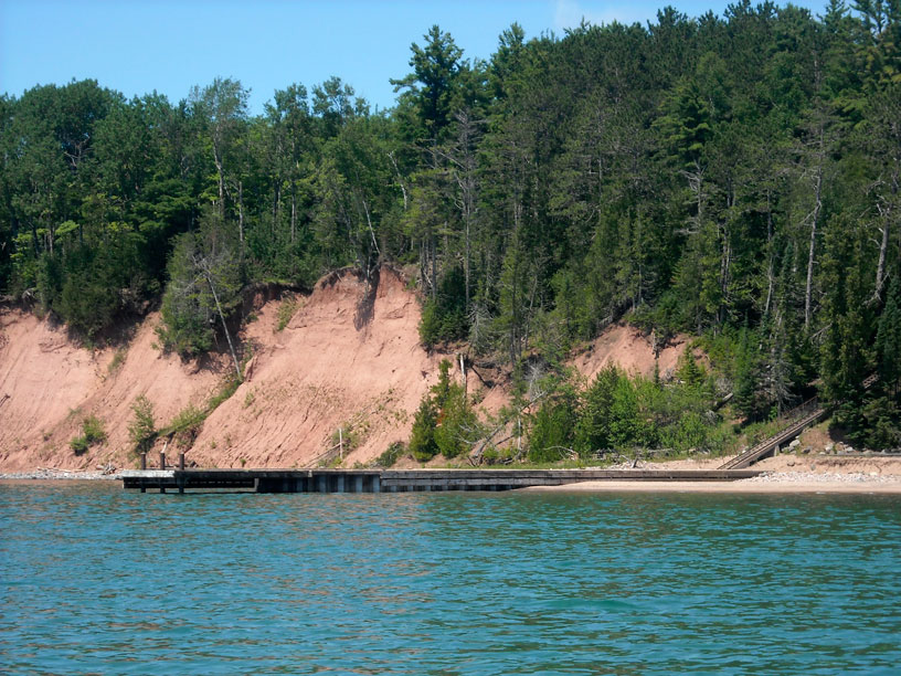
The northeast point of Devils Island is a red sandstone cliff with deep undercuts from erosion by waves.
At Devils Island boat harbor the stone cribs are old, and the water they enclose is now rather shallow due to low lake levels, which is why we raft with the HOLLY MARIE. When we return from our hike to the lighthouse we have lunch before departing.
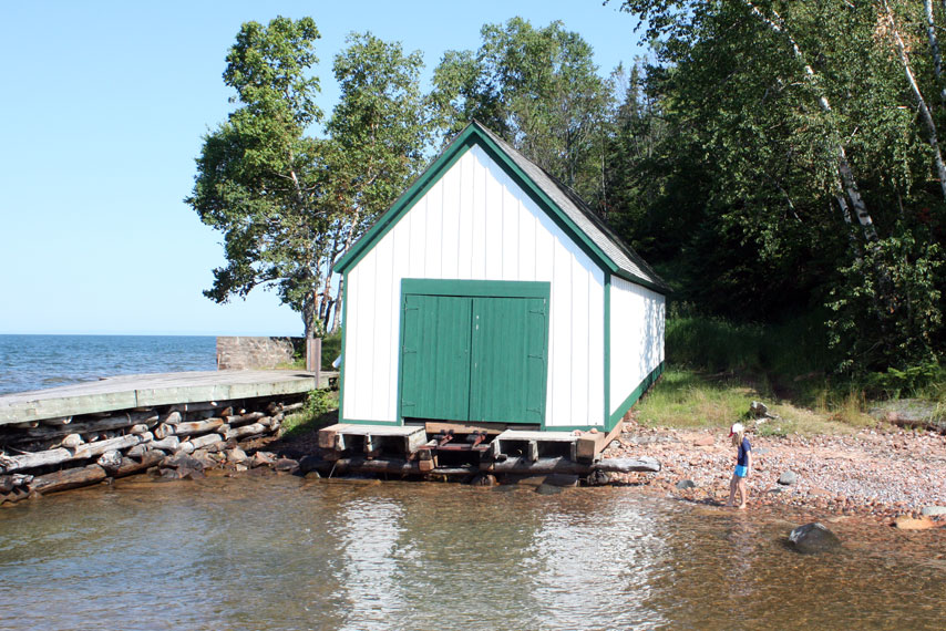
The original boat house has been restored. At the present water level in Lake Superior is will be difficult to launch
the lightkeeper's boat. Photo by John Raby.
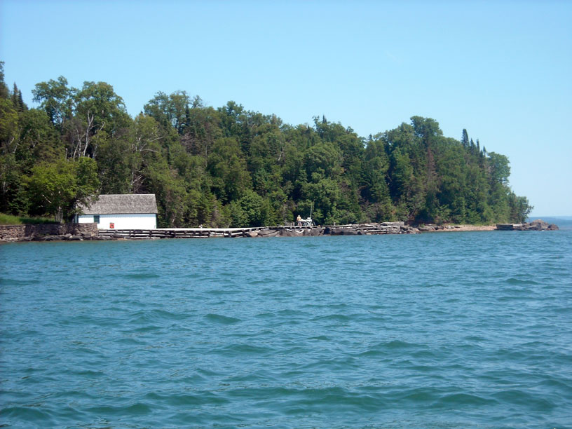
Devils Island boat harbor seen from seaward.
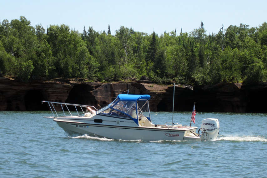
CONTINUOUSWAVE cruises slowly along the western shore of Devils Island in calm conditions. Photo by John Raby.
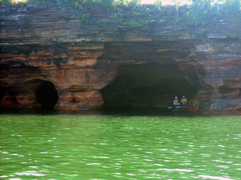
John and Holly row into a sea cave in a small dingy on the northeast shore of Devils Island.
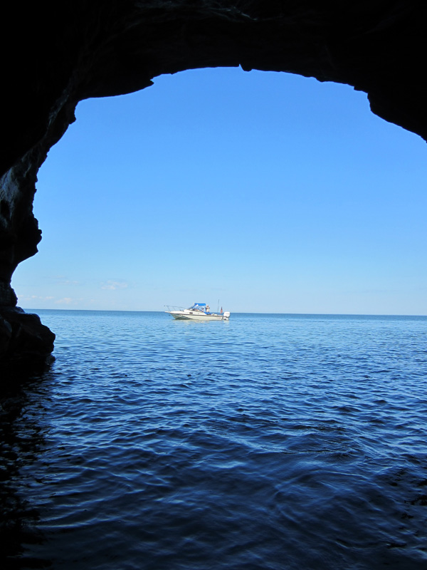
This view reverses the perspection of the scene above, framing CONTINUOUSWAVE
in the arch of the sea cave. Photo by John Raby.
The sea caves are very interesting to explore by small boat. When we were here in 2000 we did not venture very close to the caves, but in an inflatable dingy with oars you can row right into them. Of course, you need a very calm day, and fortunately we have one. The wind is from the southeast, so the north end of the island is nicely protected from the 1-foot seas.
By late afternoon we are done at Devils Island, and we make a run with HOLLY MARIE over to Sand Island, going to the park service dock on the east bay. The water is very shoal here, and we approach the pier very slowly. There is only about two-feet of water at the very end of the pier, and we tie up with our sterns to seaward and the outboard engines raised. With the engine down there is only a few inches under the skeg. This shallow water has kept other boats away, and we have the long dock to ourselves. Adjacent to the dock is a campground, and there is a large group of kayakers staying there.
We have been out in the sun all day, and we been hiking and rowing. We can't resist taking a swim in Lake Superior. The water in this bay is 65°F, and for Lake Superior that is warm. We cool off quickly by swimming off the boats at the dock. The water is a bit cool, but very refreshing.
The park regulations are rather severe about using a grill on a boat at the dock. The park ranger stops by for a visit. He's staying at a cabin about an hour's hike away. Once he leaves the campground, we fire up the grill. Holly has brought a giant steak, butchered from a cow her family raised, and it is big enough to feed everyone. We have a delicious steak dinner, then promptly stow the grill. "Best steak I ever had," says Chris. There is no electricity at the dock, but there are some extremely deluxe vault toilets a short hike away in the campground.
At the east park service dock on Sand Island we still have daylight at 10 p.m.—but we're still on Michigan time.
Our anchorage is open to the east, but the wind is forecast to be light overnight and switch to the west. We go to sleep in a completely calm anchorage without a wisp of wind. About 3 a.m. I awake and find the boat is rocking. I go up on deck to investigate. There is a bit of wave action coming in from the southeast, across the three-mile gap from the mainland. This looks bad. If these waves maintain or build, it will be a rocky night at the dock. To my relief, after about five minutes, the waves stop as suddenly as they appeared. The anchorage returns to a dead calm state. I go back to sleep and enjoy no further interruptions that evening.
| Date: | Sunday, July 8, 2012 |
| Weather: | Still fair weather |
| Winds: | Calm, but will build from the west |
| Waves: | 1-foot or less |
| Departure: | Government dock, Sand Island, Wisconsin |
| Position: | 46° 59.909' N 090° 56.060' W |
| Destination: | Manitou Island, thence to Bayfield, Wisconsin |
| Distance: | 23-miles by boat |
This morning early there is rain to our east, but we escape. The forecast is for more fair weather, light winds, and very small waves. At the dock we are completely in the lee of Sand Island and the wind. We have our usual slow morning wake up and breakfast. A hike is organized to visit the Sand Island Lighthouse.
This small shower to the East does not come our way, and we have a relaxing morning at the dock without rain.
Your author enjoys a cup of coffee freshly brewed with water heated by the Jet-boil propane heater. Photo by John Raby.
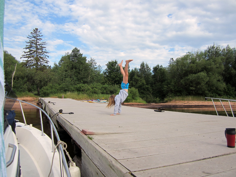
The younger members of our cruising crew employ other methods of awakening themselves for the day. Photo by John Raby.
The trail to the lighthouse from the dock is about two miles through the woods. A portion of it is on a wooden walkway above the boggy soil, and the rest on a path either near the shore or through the woods. It is good exercise, and we arrive at the lighthouse about 11 a.m. There is a volunteer ranger who gives us a guided tour. By the time our tour is complete there is quite a large group arriving from the trail. We relax at the lighthouse for a few minutes, then hike back to the boats.
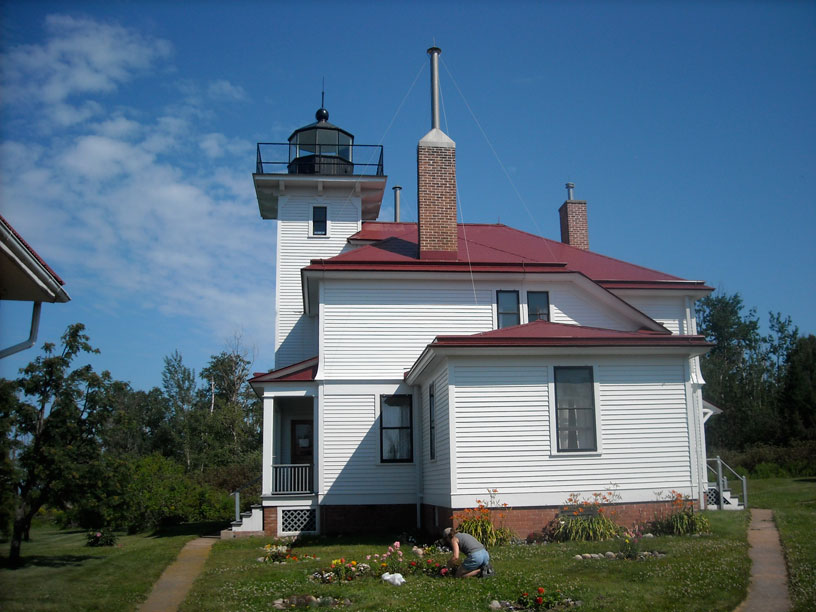
Sand Island lighthouse was built in 1881 using sandstone quarried on the island. The tower is integral with the keeper's house.
Our volunteer docent points to seaward where the 372-foot steamer SEVONA sank in a storm in September, 1905, when she grounded on the Sand Island Shoals about 1.7-miles from the light. John and Emmarie look for the buoy near the wreck.
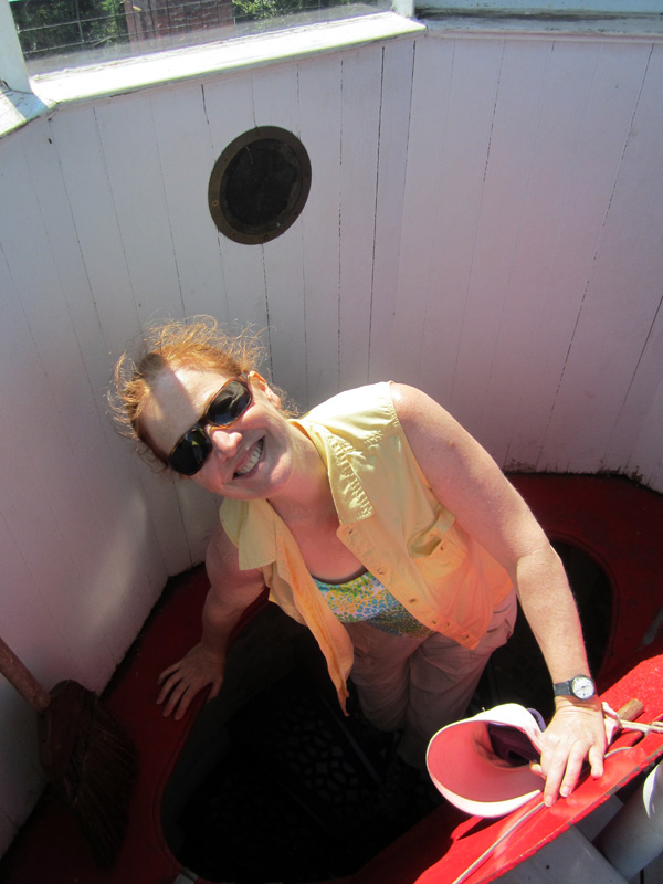
Chris prepares to descend from the light room on the top of the Sand Island Light tower. Photo by John Raby.
About three miles into our four-mile hike to the lighthouse and back to the dock, Chris stops for a rest in the shade of the forest along a nice stretch of sandy beach.
The dock is located at the outlet of a small stream. The water near the strand looks like iced-tea. Photo by Emmarie Raby.
As it is past noon, we have a small lunch at the dock, then we get underway. We head east for Manitou Island. There is a park service dock there, too, and ashore there is a restored fishing camp. The run over takes less than an hour. The dock is empty as we arrive, and we tie up to the lee side, our boats safely out of the wind and waves which have come up in the early afternoon.
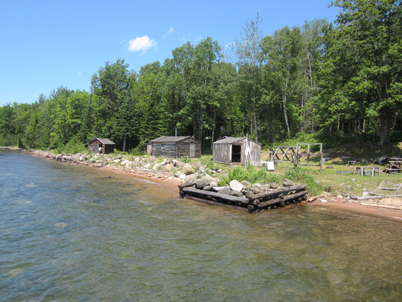
On the south end of Manitou Island the Park Service maintains this historical fish camp in its c.1930 condition. Photo by John Raby.
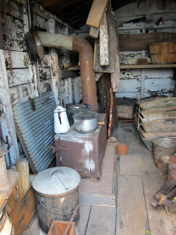
Imagine spending a few months living in this cabin—it defines rustic. It was used only by men, and most of them single men. Photo by John Raby.
This trail and the modern vault toilet it leads to are about the only improvements to the camp. Otherwise it is in its original condition. Photo by John Raby.
The park service ranger gives us a nice tour of the fishing camp. It is an interesting exhibit, still in its decades old condition, and shows how primitively people lived on these islands in the past.
After the tour is complete, we have to part company with our friends. They're just here for the weekend, and they are heading back to the ramp to haul out and drive home. We have more time to spend, and we cast off for Bayfield.
We make a slow passage to the south to Bayfield, where we get a transient slip at the local marina. For dinner we walk around town checking out some restaurants, but we decide that Maggie's was so good we'd rather eat there for a second time. We have another good meal, and walk again after dinner, checking out the local boat ramp and harbor to the south.
| Date: | Monday, July 9, 2012 |
| Weather: | Fair |
| Winds: | Light |
| Waves: | Calm |
| Departure: | Bayfield Marina, Bayfield, Wisconsin |
| Position: | 46° 48.507' N 090° 48.764' W |
| Destination: | Michigan Island, Stockton Island, and Madeline Island |
| Distance: | 46 miles by boat |
The sky is very clear overnight. This morning I am up early, before dawn, and I observe an unusual grouping of three stars low in the eastern sky. It is quite a celestial treat. Later I learn it is the planets Jupiter and Venus very close to the star Aldebaran. It is an impressive and easily seen conjunction. I suspect that it might have meant something to earlier star gazers.
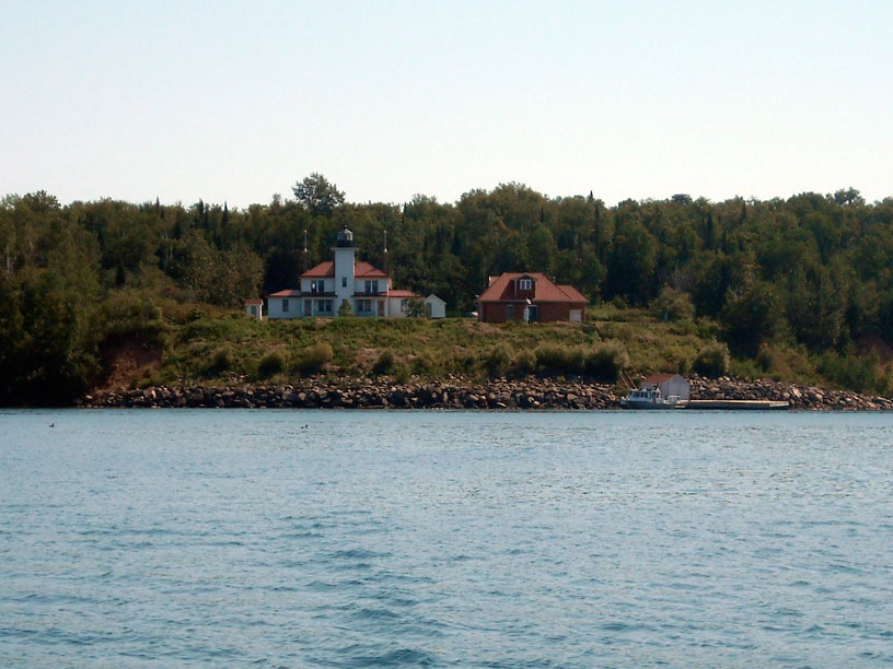
There is a nice fuel dock at the marina in Bayfield, but we have not burned much fuel on this trip, so we pass on fueling here. After breakfast we head out for a boat ride. We first go south, passing over the sand bar at the southern end of Madeline Island, and then we cruise up the coast line along the eastern shore. We jump across to Michigan Island, which has a park service dock on its eastern shore. There is no break wall here, but today the seas are small. We approach the dock and tie up on its southern face, which has been improved a bit for small boats compared to the other side. There is only one other boat at the dock, and, curiously, it is another Boston Whaler boat.
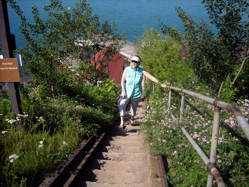
Michigan Island has a very steep shoreline, and we climb a long stairs to reach the bluff where the lighthouses are located. There are two lights here, an older tower and its more recent replacement. There is no ranger or volunteer here, and everything is locked up, limiting our access to ground level and just peering in a few windows. The view is very nice, and the grounds are attractive. After hiking around for half an hour, we return to the dock and take a quick dip in Lake Superior to cool off.
At Michigan Island's east shore the park service dock juts out into open water with no protection.
A flight of stairs—about 100 steps—climbs from lake level to the bluff at Michigan Island.
The new 112-foot-high light tower was originally built in 1880 for use on the Delaware River
near Philadelphia, but it was later removed from service and transported to Wisconsin in 1919.
The tower was not erected on Michigan Island until 1929. The light is 170-feet above the water.
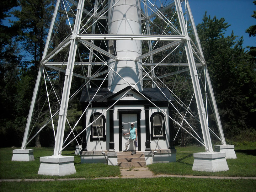
Without an on–site park ranger or volunteer, all the buildings were locked, and we could not climb the light tower. The external brace structure is elaborately constructed.
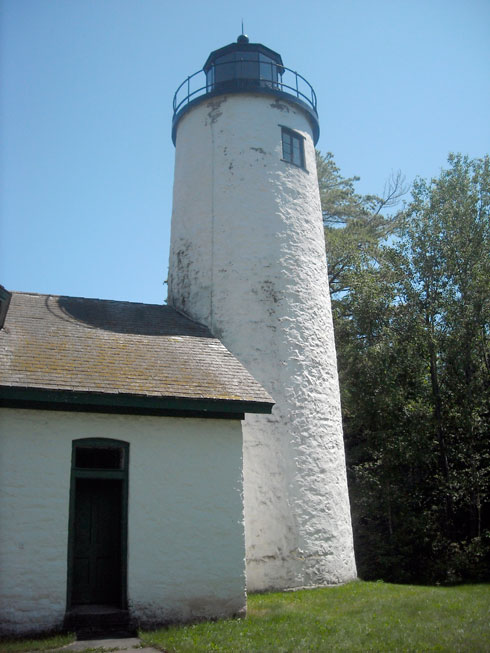
The original stone tower light was erected in 1856. The light was lighted in 1857,
then extinguished one year later. In 1869 the light was refurbished and re-lighted.
The original three-and-one-half order Fresnel lens is now on display in Bayfield.
The light was in service for 60 years, and extinguished on October 29, 1929.
The north face of the dock at Michigan Island lacks the board fendering and is not a good mooring for small boats. The steep bluff of the island shore is evident in this view.
From the dock at Michigan Island we cast off and head northeast, carrying on past the northern end of the island and passing north of Gull Island, a small bit of rock inhabited only by cormorants and gulls. From there we turn west and run across to the northern side of Presque Isle Point on Stockton Island. There is a magnificent mile-long sand beach there at Julian Bay, and we coast along for a few minutes from a few hundred yards offshore. Then we loop around the point and enter the small boat harbor at the campgrounds at Presque Isle Bay. We had heard that there was shoaling at the entrance, but it is very visible. We carry 6-feet of water through the entrance channel and all the way to the dock. We tie up to the park service dock, which has quite a crowd of boats moored to it.
We visit the Stockton Island ranger station. They have a nice exhibit of plants and animals, including a small bear. Unfortunately the young bear became too comfortable around humans had had to be killed. At least he still serves a purpose, stuffed and in a display case. From the ranger station we hike the trail back to the beach at Julian Bay we had been admiring from the boat. There is a self-guided tour for the trail, and we take a brochure and watch for the trail markers.
From the harbor we depart and cruise west three miles to Quarry Bay. There is another dock there, and campgrounds ashore. Instead of going to the dock, we anchor off the beach in about 25-feet of water. The water temperature here is just amazing for Lake Superior. It is 73-degrees! We rig the swim ladder and take a rare dip in Lake Superior in very comfortable conditions. This water temperature is very unusual.
From Quarry Bay we haul anchor and head south, following the western shore of Madeline Island down to La Pointe, Wisconsin. There we enter the Madeline Island Marina and get a transient slip. We get to the marina just as they are closing shop for the day—but in time to get the key for the bathrooms and showers.
For dinner we hike to town to see what we can find. We are not in the mood for a big dinner—we had a feast at Maggie's last night. We settle on a very informal tavern at the ferry dock, where we have some cold beer and fried fish. Then a hike back to the marina and a quiet evening follow.
| Date: | Tuesday, July 10, 2012 |
| Weather: | Fair |
| Winds: | Light |
| Waves: | Calm |
| Departure: | Madeline Island Marina, La Pointe, Wisconsin |
| Position: | 46° 46.360' N 090° 46.860' W |
| Destination: | Raspberry Island, thence to Little Sand Bay thence to St. Ignace, Michigan. |
| Distance: | 20 miles by boat, 380 miles by car |
The weather continues to be fair. We depart the marina around ten o'clock and head west and north. We stop at the park service dock at Raspberry Island to visit the lighthouse. The Raspberry Lighthouse has been carefully preserved and restored. A volunteer is at work in the gardens. Park rangers are on duty at the light keeper's house and tower and give tours. The staff is not quite ready to open, and we decide to forego the formal tour. We visited here and climbed the light tower in 2000, so we have seen the best parts already. We cast off for Little Sand Bay.
Raspberry Island light is a popular destination for park visitors. It is only a mile or two from the mainland shore. Work began on the construction in 1861. In recent years a great deal of work has been done to stop erosion of the bluff, and you can see the very prominent stone bolders that now protect the shoreline below the lighthouse.
If you are going to visit lighthouses in the Apostle Islands, you will be doing a lot of stair climbing. Chris hikes up from dock at Raspberry Island.
The light tower and light keeper's home have been extensively restored. A volunteer tends to the garden. The facility is known as "The Showplace of the Apostle Islands." The original fifth-order Fresnel lens is now on display at the State Historical Society of Wisconsin museum.
The modern aid to navigation at Raspberry Island is not much of a tourist attraction.
This building was constructed in 1903 to house a powerful whistle diaphone (fog horn). The diaphone has since been removed. Note the croquet wickets, a popular pastime for the light keeper and family.
Modern vault toilets have replaced all the old outhouses at popular destinations in the Apostle Islands National Lakeshore.
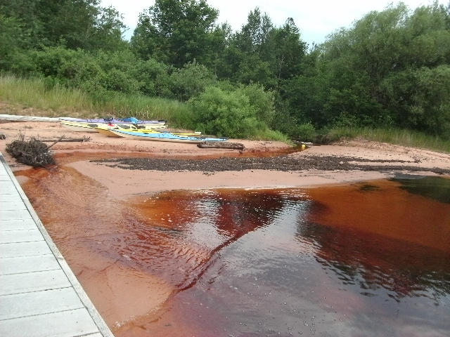
Approaching Little Sand Bay we see a fog bank enveloping Sand Island and coming in from the west. Perhaps some cold lake water has finally come into the shore area, creating conditions for fog. We are able to pilot ourselves to the ramp without getting into the fog bank. We do notice that the water clarity in this western end of the Apostles is not very good. Later we learn the turbid water is from a very unusual rain and flooding in the Duluth area. An enormous amount of silt and mud was washed into western Lake Superior, creating this unusually brown water. (For a view from space, see this amazing image from NOAA for July 5, 2012 showing the plume of brown water from Duluth entering Lake Superior. Also see this newspaper article on the flood.)
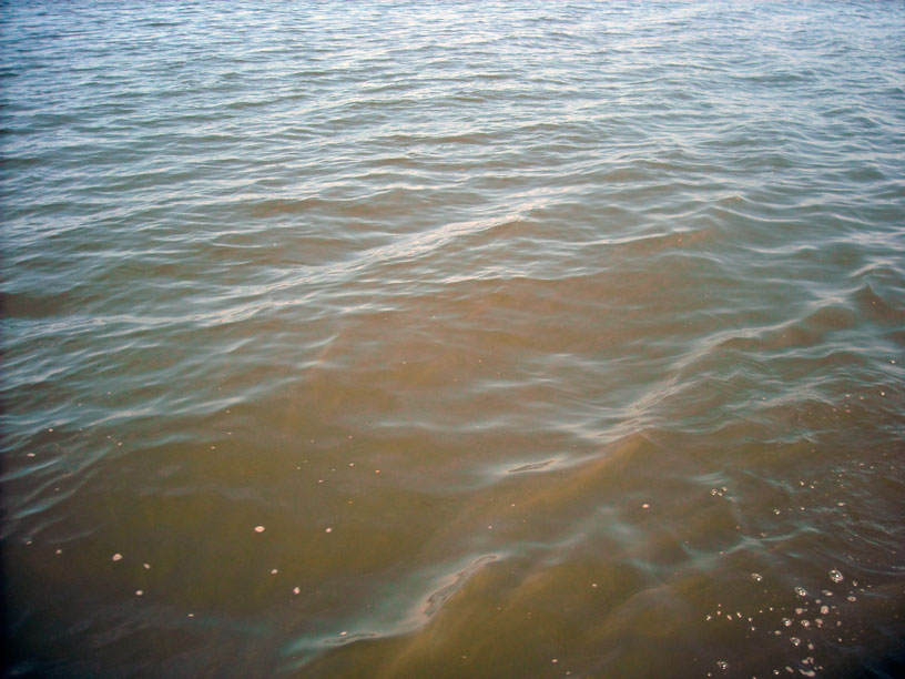
We observed this very unusual brown water in Lake Superior, the result of run off from a 100-year-flood in Duluth.
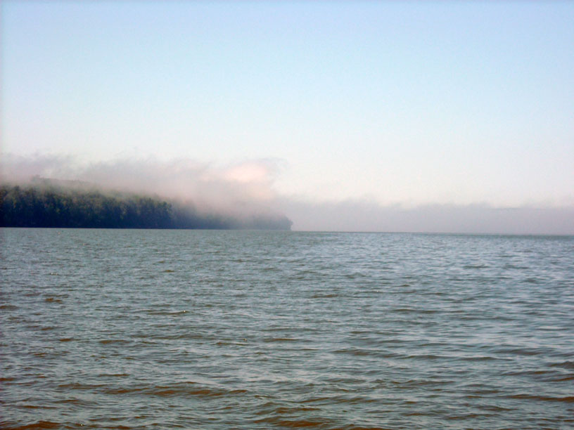
A bank of fog is coming into Sand Bay from the main lake. Many of the local boaters have RADAR on their boats, probably due to days like this on the big lake.
Once at the ramp we soon have the trailer backed down and the boat loaded. We have decided that we have spent enough time in the Apostle Islands and will head back toward home. We are on the highway by early afternoon. Since it took us two days to drive here, we will be splitting the drive home into two legs. We decide to drive as far as St. Ignace, and stop there, where we can enjoy a bit of further boating in that area.
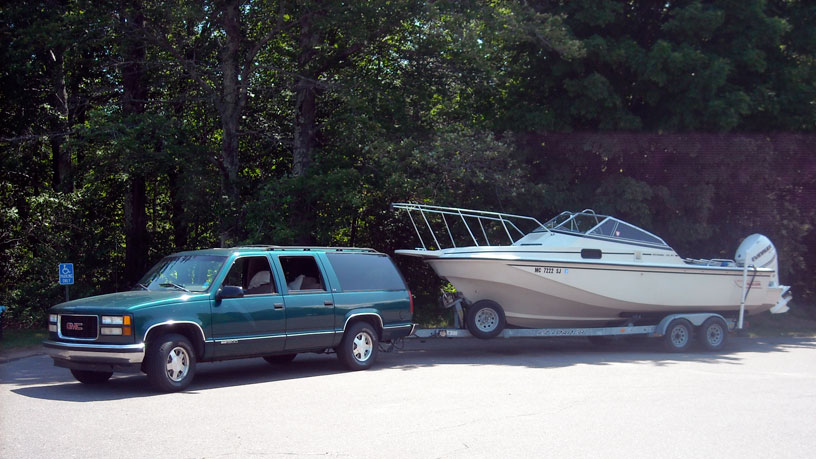
We have CONTINUOUSWAVE ready for highway travel. The canvas has been stowed to reduce wind resistance and wear and tear. With fair weather expected, we are towing without any cover in place.
The 380-miles drive from Little Sand Bay, across the upper peninsula of Michigan, to the Straits of Mackinac and St. Ignace takes an incredible amount of time. We don't arrive in St. Ignace until after 9:30 p.m. We get to the boat launch ramp much too late, and we are very tired. By the time we have the boat launched, the car and trailer parked, and are underway for the one-mile trip across the harbor to the marina, it is midnight. This has been a very long day for us, and we have a deep sleep once we are at the dock.
| Date: | Wednesday, July 11, 2012 |
| Weather: | Fair |
| Winds: | Light |
| Departure: | St. Ignace Marina |
| Position: | 45° 51.951' N 084° 43.115' W |
| Destination: | Cedarville, Les Cheneaux Islands, and return |
| Distance: | 60 miles by boat |
This morning I am up early and see an unusual site. There is a small cruise ship, the YORKTOWN, coming into the harbor. The little cruise ship, about a 250-footer, comes over to a dock just north of the marina. I suspect the passengers will be spending the day in port, and most of them visiting Mackinac Island by taking one of the many ferries that run from here over.
We depart the St. Ignace marina around ten o'clock and run across Lake Huron to Cedarville. We have been in contact with our friend Dave via cellular telephone, and we are going to meet him at the dock in the Cedarville harbor. He's has recently restored an older Boston Whaler boat and has it for sale, and he is leaving it at the shopper dock for the afternoon with a sign on it. We rendezvous with him on schedule. We pick up Dave and take our boat over to the cottage he is renting, which is in Mismer Bay, just to the west. Because of the low water, we have to anchor offshore, and we transfer to Dave's inflatable that he has left on a mooring. We take the inflatable to shore to the dock at the cottage. With Lake Huron water level at just about its historic low level, most of the docks on the shore don't have much water under them this year. We have a pleasant lunch with Dave and his family.
After lunch we go for a boat ride, exploring the Les Chenenaux Islands. Dave has been visiting these islands all his life on family vacations, and he gives us a guided tour. He knows the background of many of the distinguished cottages we see. We get as far as Hill Island, where we drop Dave off at his grandfather's cottage. We start our return trip, pausing for a while to anchor in the south end of Government Bay for a swim.
About 5:30 p.m. we are on the way back to St. Ignace, leaving the Les Cheneaux Islands via the West Entrance, and running upwind into the afternoon southwest breeze, which has brought up some 2-foot waves. The low sun angle gives a silvery reflection off every wave. Just as we pass Les Cheneaux Islands West Entrance Lighted Buoy 1 and get into open water, the propeller ventilates. I yank the throttle back to idle, and go to the stern to investigate. We have snagged a polypropylene line attached to a small white bleach bottle, which was marking the end of a fish net. The little white bottle was impossible to see in the sunlight and wave reflections. To our good fortune, however, the line has not wrapped around the propeller shaft. I use the boat hook it remove the snagged line from the outboard gear case. The net was set right across the course line for St. Ignace from the entrance, probably the most popular heading for boat traffic. Free of the floating line, we continue to St. Ignace and the marina.
We reach the marina without further problems, although we have to pound upwind into the late afternoon breeze. Once we have the boat secured in the slip, we walk over for dinner at the nearby restaurant, the Mackinac Grille. We have eaten there several times and always had a good meal at reasonable prices.
| Date: | Thursday, July 12, 2012 |
| Weather: | Fair |
| Winds: | Light |
| Departure: | St. Ignace Marina |
| Position: | 45° 51.951' N 084° 43.115' W |
| Destination: | Home |
| Distance: | 16-miles by boat, 275 miles by car |
Although we have a day or two of vacation left, we have been on the road now for over a week, and we are ready to head home. We take a short cruise this morning over to the Straits of Mackinac, heading first for the wreck site of the CEDARVILLE. I have a good waypoint on the wreck that I set several years ago when we were here, and that is our target. When we get close to the wreck we see it has been very well marked this summer with three floats and mooring buoys. We spend about half an hour traversing the site getting some very good echoes on our SONAR from the hull, which is in 100-feet of water but comes up to within 30-feet of the surface.
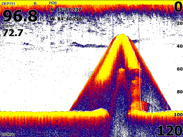
We are not scuba-divers; we can visit the wreck of the CEDARVILLE by echo-sounding it.
After echo-sounding the wreck, we head toward the Mackinac Bridge. This beautiful dark green and ivory structure is always a delight to see. After admiring the bridge, we head north and return to St. Ignace, taking a route that puts us close to shore and weaves among several shoals. We head for the boat ramp, and haul CONTINUOUSWAVE onto the trailer. After some clean up and preparation for the road, we are off on the highway for home.
As we drive across the Mackinac Bridge there is a large freighter passing below. This is always a treat to have such a close encounter with a big laker. After the bridge we have about 275-miles of interstate highway ahead. The drive is smooth, in light traffic, and we are home about 7:30 p.m.
While in the Apostle Islands we put 130-miles on the boat. In the Les Cheneaux Islands we added 76-miles, giving us a total of 206-miles by boat. The total highway travel added up to about 1,400-miles or more. This is an unfavorable ratio, but the long drive to western Lake Superior is worth it.
Visiting the Apostle Islands National Lakeshore is an economical vacation. The trailer parking at Little Sand Bay is free. Overnight stays in the National Lakeshore marina or at a park dock are only $10. If you are a senior citizen and have the U.S. Park Service Golden Age Access Pass, you get a 50-percent discount on those fees. For more details, visit the Apostle Islands National Lakeshore website.
With all the driving in the rather remote parts of Michigan and Wisconsin we have seen a lot of wildlife along the highway. The current totals are
The best road side sign we've seen was in Wisconsin in the northeastern portion, in a mining region. It read:
STOP THE WHINING AND START THE MINING
This newspaper article gives the back story.
We loved the Wisconsin consumer labeling regulations for gasoline. All gasoline containing ethanol is clearly marked as such. And we could buy ethanol-free gasoline on the highway, although we had to pre-plan those stops; not every station sells it.
Copyright © 2012 by James W. Hebert. Unauthorized reproduction prohibited!
This is a verified HTML 4.0 document served to you from continuousWave
URI: http://continuouswave.com
Last modified:
Author: James W. Hebert
This article first appeared November 30, 2012.