continuousWave--> Sail-Logs --> Isle Royale 2013
Isle Royale National Park 2013 Cruise
by Jim Hebert
A illustrated narrative of our 2013 trip to Isle Royale National Park in Western Lake Superior; photographs by the author and his companions; detailed accounts of boat movement and travel.
This is an account of my second trip to Isle Royale. Readers may also find more information about cruising Isle Royale in general and more than one hundred additional photographs in my earlier cruise narrative of our trip there in 2010.
DAY ONE
| Date: | Friday, August 23, 2013 |
| Weather: | Fair |
| Winds: | Southerly |
| Traffic: | Light |
| Departure: | Beverly Hills, Michigan |
| Destination: | Iron Mountain, Michigan |
| Distance: | 470 miles by highway |
Getting Ready
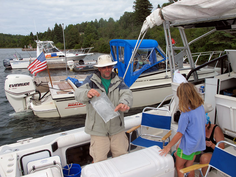
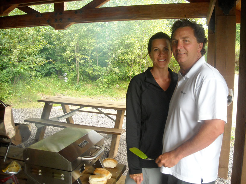
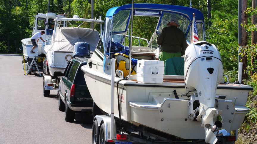
We are towing our 22-foot cuddy-cabin outboard-powered 1990 Boston Whaler boat, CONTINUOUSWAVE, on its 1992 tandem-axle trailer with our 1995 GMC Suburban. Although all three are getting a bit old, they are still quite reliable. The truck has just had the cooling system overhauled, with new radiator hoses and new coolant. A problem with its air conditioner was also found and repaired. The trailer has also been further refurbished: all the existing rollers have been replaced, and a new set of tandem rollers added in the bow area. The boat has a new SONAR transducer, three new gauges, and a new relay for powering the NMEA-2000 network. Its outboard is a 2010 E-TEC, and the electronics and navigation gear is less than two-years old. We've already made three long trips this year with this boat, trailer, and truck, and they have all been working well. Chris has been gathering the cruising gear, food, and supplies. Since we will be cooking our own meals during this trip, we bring along a small Weber grill. A bunch of frozen meat is keeping cold in a cooler with dry ice inside another cooler with ice, and we'll be grilling it for dinner all week on the island.
We have also pre-registered with the National Park Service, given them our boating itinerary, pre-paid, and pre-printed our park documents, and we don't have to actually visit or check-in with the Ranger station. We can just arrive at the park and begin our cruise.
Timing
Like our last visit, we have planned the cruise to take place in the last week of August, concluding on the Labor Day weekend. We chose this time period for several reasons:
- the three-day weekend at the end gives an extra day to travel home or to unwind at home before going back to work;
- the late Summer visit reduces the black fly nuisance to a minimum. Based on an account we received from an extremely experienced Isle Royale visitor—they've been living on the island in the summer for decades—the black flies are so bad in early Summer you have to wear meshed hoods when outdoors to keep them at bay;
- the cooler evening temperatures make for great sleeping;
- the number of other boats visiting at this time seems to be low. We won't encounter another private boat cruising the park until the last day of our trip, and, at every campsite and dock, we'll have the docks to ourselves;
- a later Summer visit makes the chance of being able to swim much better. We will enjoy two or three swims in Lake Superior, with a water temperature in the mid-60's. I don't think the water would be quite that warm in the early days of Summer; and
- a later Summer visit gives everyone a chance to work out the kinks in their boats. In our case, the IRNP cruise is the fourth long cruise of the season for us. In the three prior cruises we have already overcome the usual problems of things we forgot to bring or problems on the boat we forgot to fix.
The only concern about cruising at this time of the summer is for the winds to be higher than in July or early August. Once we reach Isle Royale, the winds and waves should not be much concern, but for making the long open-water crossing to Isle Royale from Copper Harbor, we will need light winds.
Also, speaking of time, we keep our watch on EDST during the trip, which is the official time for the island.
The Way North
Although we probably could make the drive to Copper Harbor in one very long day, we are splitting that journey into two segments, and heading first to Iron Mountain. We have some business to conduct there, apart from the boating trip, and stopping there splits the long drive into two more manageable segments. We leave home about 9:30 a.m., and we cross the Mackinaw Bridge about 3 p.m. We stop for dinner in Escanaba at Buck's Bar, and we arrive at a motel in Iron Mountain about 8:30 p.m.
DAY TWO
| Date: | Saturday, August 24, 2010 |
| Weather: | Fair and warm |
| Winds: | Southerly |
| Traffic: | Light |
| Departure: | Iron Mountain, Michigan |
| Destination: | Copper Harbor, Michigan |
| Distance: | 160 miles by highway |
Road Trip
The weather on Day Two could not be more agreeable. It is a beautiful day for a drive, and we are traversing south-to-north a portion of our state that we've never visited before. We are traveling two-lane highways through mostly undeveloped forest land, with plenty of up and down terrain. Before leaving Iron Mountain we stop at an ice house called City Sales to buy $15 of dry ice. On the highway in the little town of Crystal Falls we get fuel for the car and some take-out for lunch. Once we are within about an hour's drive of Copper Harbor, we stop at The Pines, an Indian-run filling station north of Baraga, where the price of gasoline is always the lowest in the region, and we fill the boat fuel tank to near capacity with 91-Octane pure gasoline for $3.80-per-gallon. From there it's non-stop to the launch ramp at Copper Harbor, where we arrive in the mid-afternoon after about 630-miles of highway travel since leaving home yesterday.
At Copper Harbor we will be rallying with three other boats. We'll be in the company of:
- Craig and Karen, aboard DEFIANCE, a 30-foot Boston Whaler with twin E-TEC 300-HP engines;
- David and Kathy, aboard MANIC MOMENT, a 23-foot Boston Whaler with twin Yamaha 150-HP four-stroke engines;
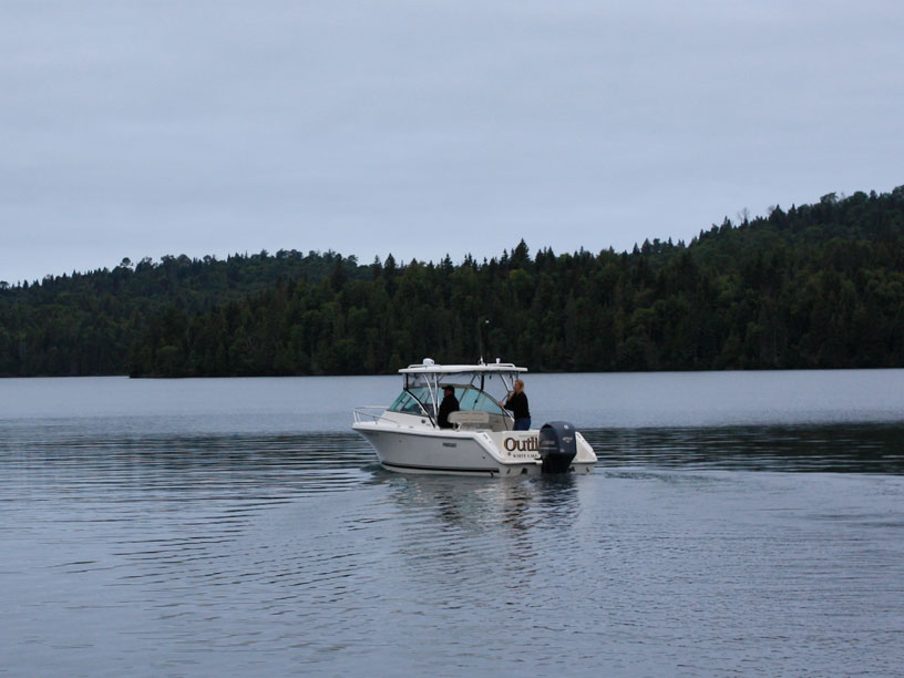
- Kevin and Debbie, aboard OUTLIER, a 23-foot Pursuit with a single 250-HP four-stroke engine.
When we get to Isle Royale we expect to meet one more boat. They'll be coming over from Grand Portage on the Minnesota shore, which is actually much closer to Isle Royale, only about a 25-mile jump for them. We'll be joined by:
- John, Holly and Emmarie, aboard HOLLY MARIE, a 25-foot Boston Whaler with twin Yamaha 200-HP engines;
At Copper Harbor there is no contention for access to the launch ramp, a boat slip, or parking for the truck and trailer. The marina is not very busy, and they have plenty of transient boat slips. The harbormaster is an easy-going fellow and is pleasant to deal with.
By 6:30 p.m. all the boats are in the water and at their slips in the marina. We head for dinner at the Harbor Haus restaurant, a very good and very crowded dinning room. If staying in Copper Harbor, you will want to eat there. Apparently everyone in Copper Harbor eats there on Saturday evening. We have a long wait for a table, but the food is excellent and the service equally good.
DAY THREE
| Date: | Sunday, August 25, 2010 |
| Weather: | Windy |
| Winds: | Westerly at 15 to 20 |
| Waves: | Three-foot or more near shore |
| Departure: | Copper Harbor State Marina |
| Position: | 47° 28.31' N; 087° 54.06' W |
| Destination: | Malone Bay, Isle Royale, Michigan |
| Distance: | 70 miles by boat |
Note that the geographic positions are hyperlinks (which will direct a browser to Google Maps in a separate window) and can be used to locate the position of each day's departure.
Weather
Every morning I listen to the VHF Marine Band radio to get weather information. From my notes, I will try to replicate as closely as possible the actual broadcasts. This one is from WXK-73, a NOAA station in Houghton, on 162.400 or Wx Channel-2 on most radios.
Lake Superior, Open Lake Forecast
TODAY
Winds southwest at 15 to 25-knots.
Chance of showers and thunderstorms.
Waves 2 to 4-feet
Wind decreasing to southwest 10 to 20-knots
Fog, chance of showers and thunderstorms.
Waves subsiding to 1 to 3-feet
Wind decreasing southwest 5 to 15-knots and veering to West
Mist and fog patches
Winds becoming calm
Waves 2-feet or less

MONDAY
Wind west at 10, backing to southwest in the afternoon.

TUESDAY
Wind east and light, veering to southwest by midday, becoming calm
Waves 2-feet of less

SYNOPSIS:
A High pressure system moving east
A Low pressure trough from southern Canada moving in.
Showers building overnight.

Isle Royale Forecast
TODAY
Warm, partly sunny becoming mostly sunny
Temperature 80 to 85-degrees
Chance of thunderstorms
Waves 3 to 5-feet, subsiding
MONDAY
Partly cloudy becoming mostly sunny
Wind northwest 5 to 10 knots becoming northeast
then veering to southeast and south.
The weather is very breezy. The wind did not die overnight, but rather blew at 15 to 20-knots from the West. We cannot see the waves on the open lake, but we anticipate they'll be larger than we'd like.
Departure
About 10 a.m. we get all the boats away from the marina and head for the harbor exit. We venture into the open lake water only a mile or so before we all agree the conditions are unfavorable for the long passage to Isle Royale. We are able to work the boats upwind, but at only modest speeds, about 8 to 10-MPH, and the ride is very unpleasant. The wind is right on our nose and the waves are three to five feet. I am thinking, "I could do this if my life depended on it," but it would be a very ugly day on the water. By 11 a.m. we are all back at the marina docks.
Return
We are not sure if we will be stuck here all day, or if conditions will improve later in the day. We turn our attention to the weather forecasts from the radio and internet. The weather reports present a different picture than what we are experiencing. A weather buoy in Western Lake Superior reports winds are southwest 10 and gusting to 12, with waves of 2-feet. That sounds good, but it is not what we have on our shore. We are stuck in Copper Harbor for a day. Mid–afternoon weather reports begin to reflect what we saw this morning. The wind at Rock of Ages lighthouse is reported as southwest at 23-knots and gusting to 29-knots. That's about what we had this morning.
Resigned to spending the day at the dock, the boat crews go their separate ways. We take a short car ride to explore the immediate area around Copper Harbor. It is also a good way to escape the heat. The temperature on land is approaching 90-degrees, and it feels very good to get in the car and run the air conditioning for an hour or so. About 5 p.m. is the latest we could depart for Isle Royale, but at that hour it is still blowing and the waves are still rolling in. We will be staying here tonight. We reconvene with the rest of the boat crews for another dinner at Harbor Haus.
Overnight a tremendous series of thunderstorms blows through from the West. There is so much lightning activity it is quite amazing. For about one hour there is practically continuous cloud-to-cloud lightning. The sound of the thunder rolling in from the open lake is also impressive. Accompanying the thunderstorm is rain, which at times becomes a downpour. It is a good night to be securely tied to the dock.
Today's Sailings
Copper Harbor to Lake Superior and return
MILES = 7.3
GALS = 2.6

MPG = 2.80
Photographs
To illustrate this cruise I have borrowed heavily from my cruising mates, who often took photographs at times I forgot to record, or from angles better than mine. A notation in the caption gives credit for each photograph.
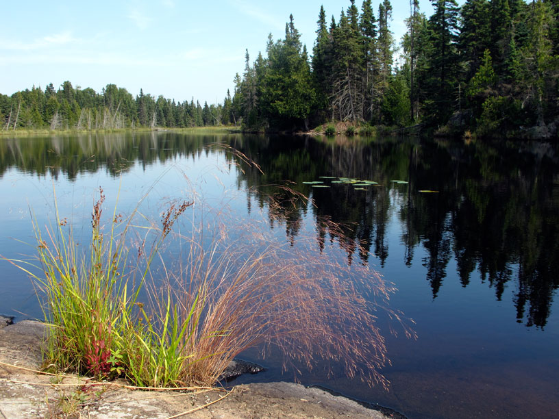
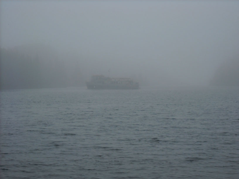
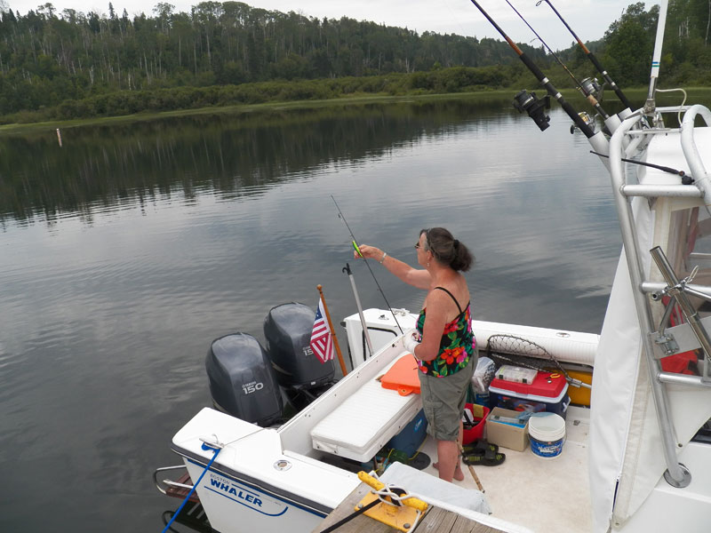
Taken about 9:30 a.m., this view shows the gentle breeze in the harbor and the small ripples on the water we found on Sunday morning. Outside the harbor in thirty minutes from now we will find a much different situation, leading to the decision to abort the passage to Isle Royale for the day. Photo by Kevin Albus.
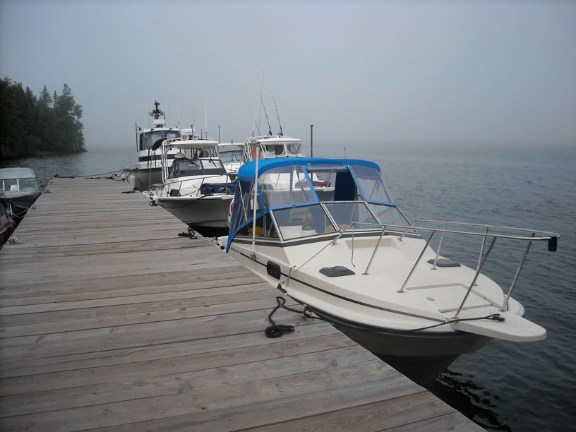
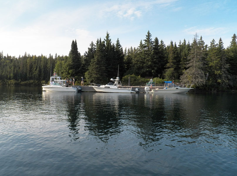
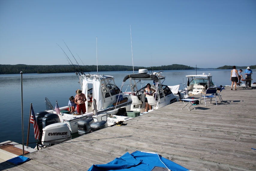
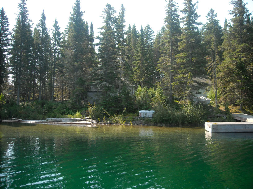
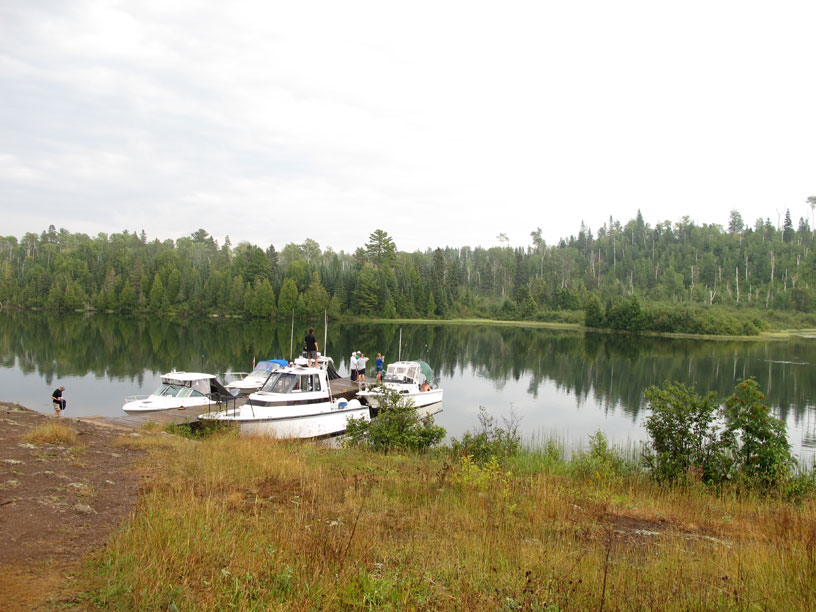
This late afternoon overview captures all four boats at the dock in Copper Harbor, the only boats in the marina. We are whiling away a warm day stuck in the harbor by high winds. Photo by Kathy Hart.
Craig and Karen get into some shade, have a refreshment, and chat with the harbormaster at the Copper Harbor State Marina. Photo by Kathy Hart.
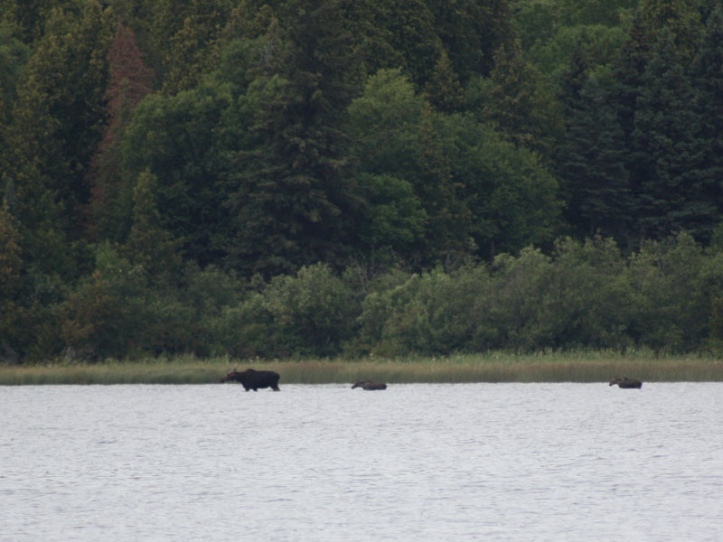
While we were stuck in Copper Harbor by the wind and waves, John Raby and family were already on Isle Royale, where they enjoyed the remote natural surroundings and wildlife. Here an adult moose and two calves wade in the water at Hay Bay. Photo by John Raby.
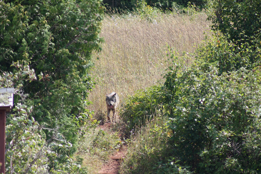
Seeing a moose is quite routine. Seeing a Gray Wolf is very unusual. John caught this young wolf coming down the trail. Photo by John Raby.
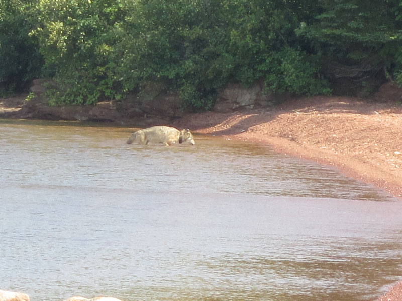
It was a warm day, so the wolf did what any canine would: cooled off in the lake. He has a radio collar. Photo by John Raby.
DAY FOUR
| Date: | Monday, August 26, 2010 |
| Weather: | Party Sunny, warm |
| Winds: | West at 10-knots |
| Waves: | Three-foot, decreasing |
| Departure: | Copper Harbor, Michigan |
| Position: | 47° 28.31' N; 087° 54.06' W |
| Destination: | Chippewa Harbor, Isle Royale |
| Distance: | 55-miles by boat |
Weather
Temperatures: high from 80 to 90-degrees; low from 60 to 70-degrees
Mostly dry the rest of the week.
Today, fog, partly sunny, temperature 73-degrees
Wind west 5 to 10-knots veering to north
Second Departure
Early this morning the wind is down to calm in the harbor, but around 8 a.m. the wind comes up from the West at 5-knots gusting to 10-knots. We push up our departure time to 9:30 a.m. to take advantage of the lack of wind. Near shore we encounter some waves of 2 to 3-feet, but as we work our way into the open water and leave the shore zone, both the wind and waves subside. We can run on plane at a comfortable speed around 22-MPH without pounding too much. We set off for Chippewa Harbor, which would have been our second-day destination. We are figuring the other boat in our fleet, coming from Minnesota, will have already reached our first day destination, and they'll probably be heading toward Chippewa Harbor, too. We make an occasional radio call for them as we are crossing over, but we cannot raise them.
About 10:30 a.m. we run into a large fog bank offshore. It becomes very difficult to maintain visual contact with other boats. We have about a quarter mile separation between boats, so we can continue on plane, in the fog. We keep in touch with frequent radio calls. DEFIANCE has a RADAR set, and they can usually see the other boat positions, although not 100-percent of the time. Small fiberglass boats are not much of a RADAR return target. After an hour or more in the fog, we break out into clear air about ten miles from Isle Royale. It is a very pleasant sight to see the remote island just ahead in clear skies and strong sunlight.
Chippewa Harbor
Around noon we are arriving at Chippewa Harbor, and we have its dock to ourselves. Our four boats fill up all the space along the pier. We enjoy a swim and then a lunch. Shortly after that, our fifth boat in the fleet, the 25-foot Boston Whaler boat HOLLY MARIE powered by twin 200-HP outboards, arrives and rafts up with us at the dock. She has come over from Grand Portage on the Minnesota shore, and arrived, on schedule, a day earlier. The strong Westerlies were a tail-wind for her trip. Figuring that we were not coming across due to the winds and waves on Sunday, she anticipated we'd be heading for Chippewa Harbor when we finally did depart. We pick up her radio call about 30-minutes prior to her arrival. Aboard are John and Holly, and their delightful nine-year-old daughter Emmarie, the only youngster on the cruise.
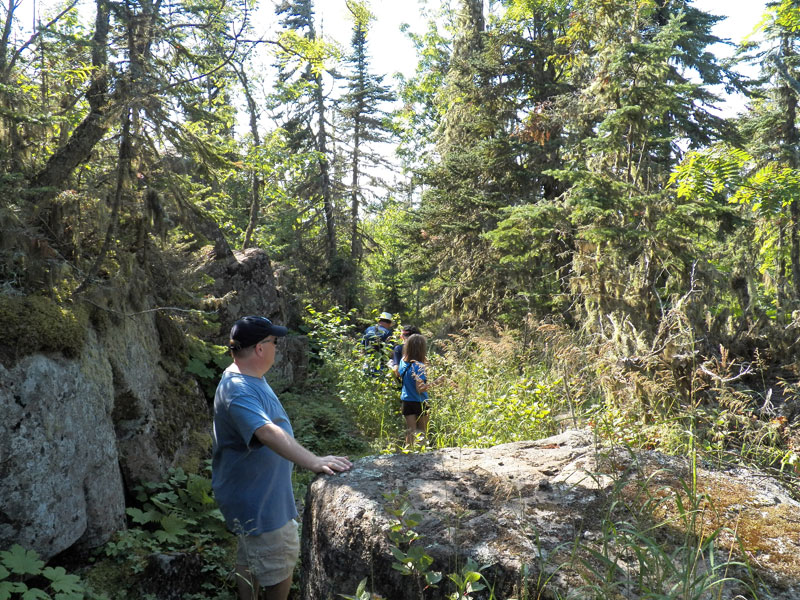
One of our main daytime activities, besides boating, will be hiking. In this regard Isle Royale offers the following attributes:
- no poison ivy;
- no bears, raccoons, porcupines, deer, or skunks;
- only a few wolves, and you are very unlikely to see one (even though the crew of HOLLY MARIE did see a wolf);
- plenty of moose, but they typically do not represent any sort of problem or threat to a hiker and are interesting to watch; and,
- no poisonous snakes; I think there are only two snake species on the island, the garter snake, and the less commonly seen northern red-bellied snake.
Isle Royale is a good place for the novice hiker. The trails are rugged and require a lot of care in foot placement, but you are not going to come face-to-face with a bear or wander into a patch of poison ivy. Hiking is an important part of our daily activities on Isle Royale.
Today we take a group hike inland about a mile to see Mason Lake. Back at the boat, we take a swim, relax, and follow up with a good dinner, cooked on grills and eaten on a picnic table. We then enjoy a beautiful evening and a few drinks before turning in.
We left Copper Harbor with 63.3-gallons (as recorded) in the fuel tank. We have burned 26.3-gallons so far, giving us 37-gallons remaining. We'll want to add fuel at Rock Harbor, when we pass by there tomorrow.
Today's Sailings
Copper Harbor to Chippewa Harbor
MILES = 55.6
GALS = 23.7

MPG = 2.35 (a long run on plane but below optimum speeds)
Photographs
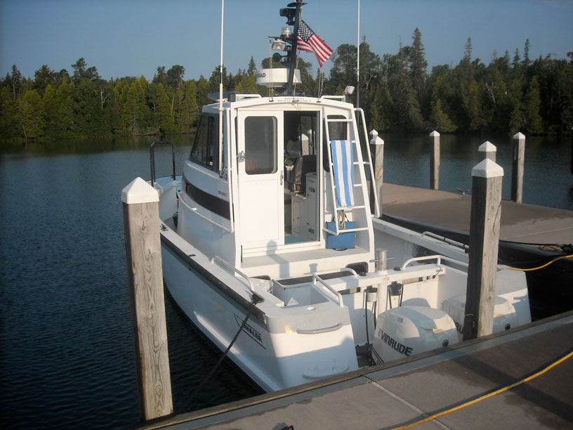
DEFIANCE is an unusual aluminum hull Boston Whaler. The scale of this boat can be appreciated by the relative size of the two V6 Evinrude E-TEC 300-HP outboard engines; they are below the gunwales! The RADAR set will come in handy all week. And what is not to like about a power boat with a mast that has three flag halyards? Photo by the author.
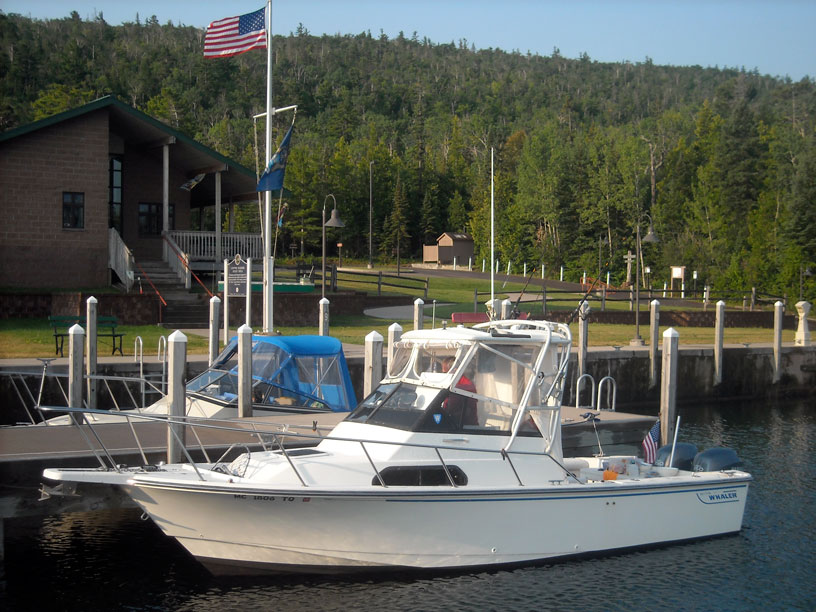
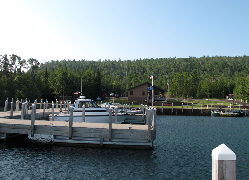
MANIC MOMENT is the Hart's new Boston Whaler 23-foot mini-cruiser, and it is ready to head out. As the flags show, at 9:30 a.m. a breeze has just come up on what is otherwise a very calm and windless morning. This wonderful harbor is the closest point of approach to Isle Royale from Michigan. Photo by the author.
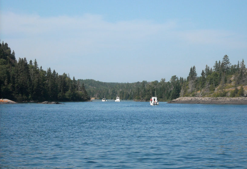
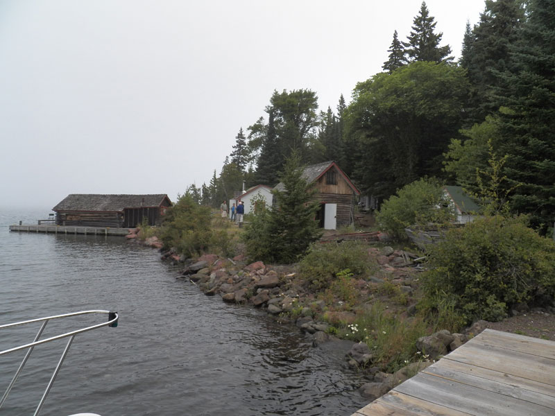
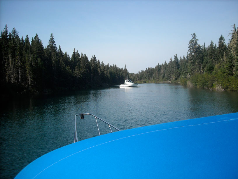
Three hours later, about 12:30 p.m., we are entering Chippewa Harbor, a deep and natural inlet on the east coast of Isle Royale, after a 55-mile run across a foggy Lake Superior. Photo by the author.
This white beacon marks the entrance to Chippewa Harbor. Aids to navigation are scarce around the island, but really dangerous shoals are well marked. Photo by the author.
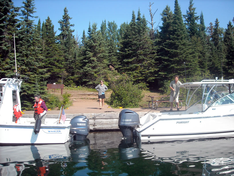
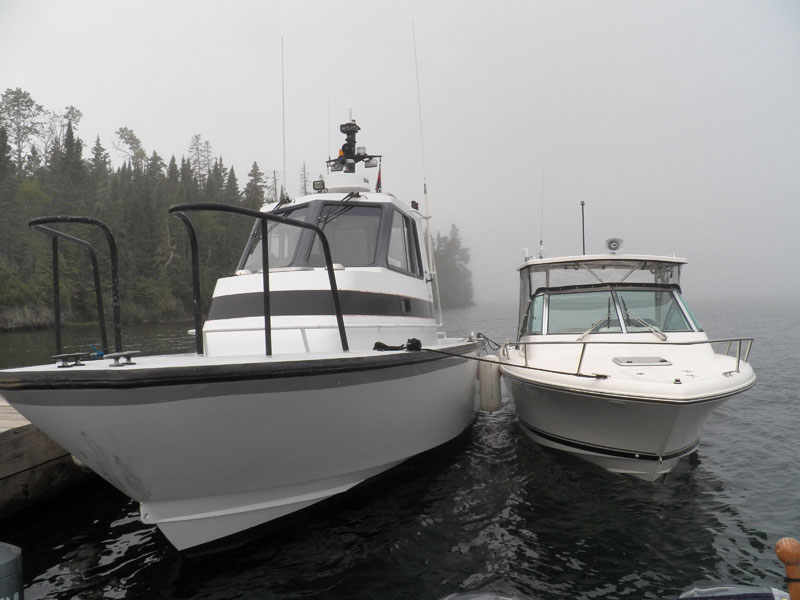
Craig moves OUTLIER to make more room on the T-shaped dock, while Kathy deploys a fender. Her left forearm is in a cast following a recent surgery. We can say that she will be single-handedly responsible for much of the success of MANIC MOMENT's cruise. Photo by the author.
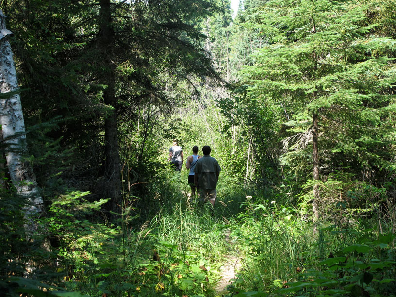
Debbie, Karen, and Craig on the trail to Lake Mason. Every day at Isle Royale there is an opportunity for a hike on an established trail or path. It's a good alternative to sitting on the boat. Photo credit: Kevin Albus.
Lake Mason is perhaps better known for lending its name to a much longer hiking trail across the island to McCargoe Cove. The lake itself is not particularly remarkable. We did not bring any angling gear, so its fish population remains without survey. Its water is a bit dark, suggesting tanin content. Photo credit: Debbie Kearney.
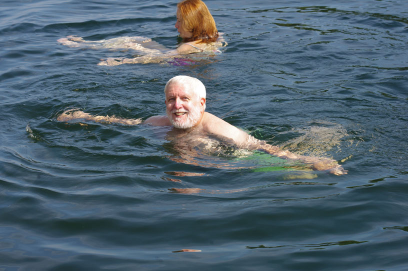
After hiking back a mile or so to the boats, Chris and your author enjoy a brief dip in Lake Superior, but in the warmer water of Chippewa Harbor. The surface temperature was about 65°F, but much colder a foot or two down. Photo credit: David or Kathy Hart.
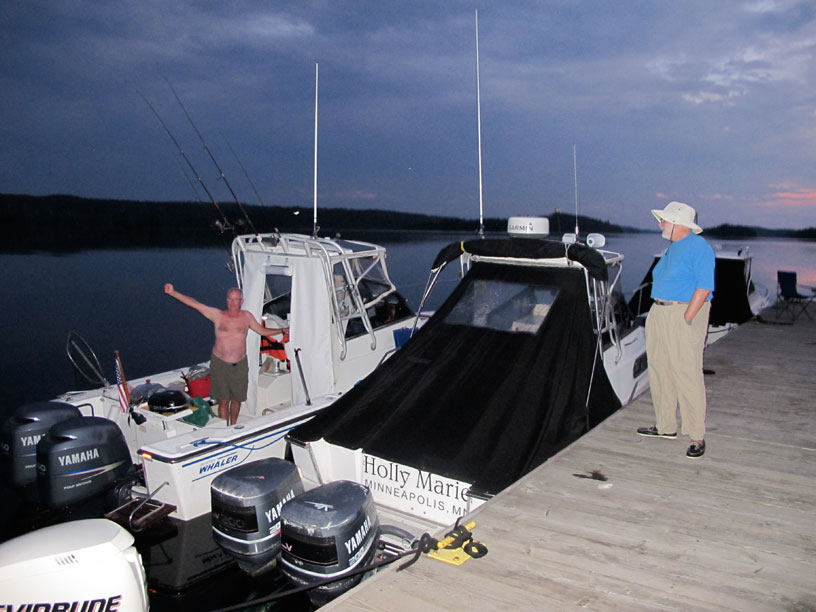
The welcoming party for HOLLY MARIE at the dock at Chippewa Harbor. Photo credit: John Raby.
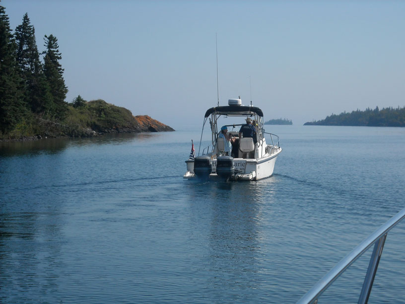
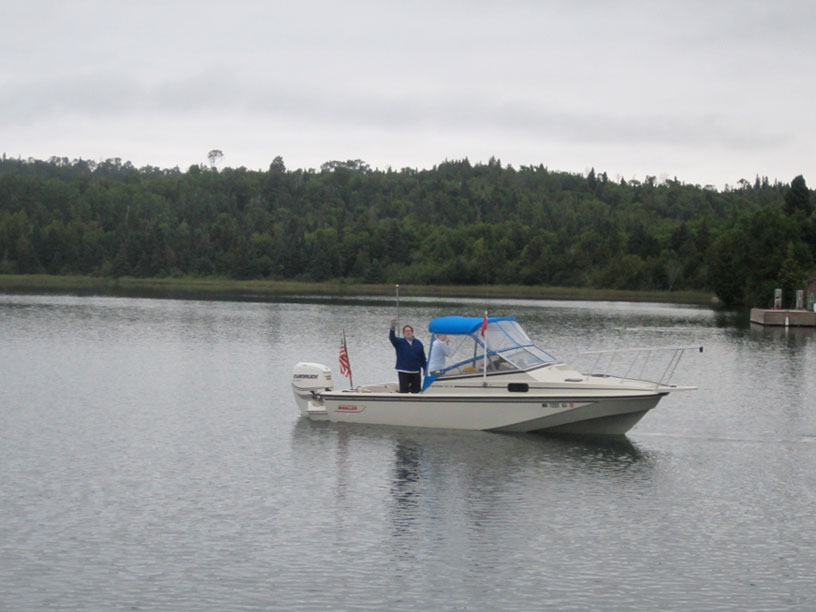
The gang's all here, as HOLLY MARIE arrives about 4 p.m., having come up the coastline from the South at Hay Bay. She appears to have dragged in some of that fog on the lake along with her. Photo by the author.
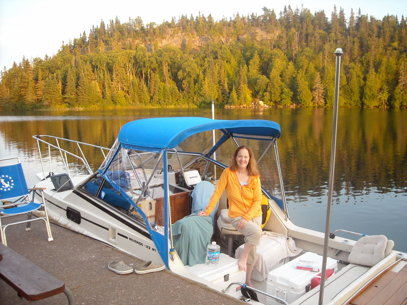
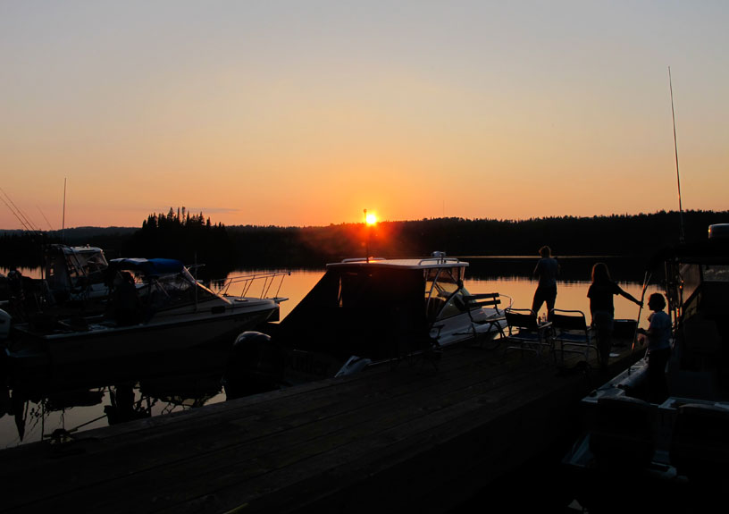
Chris relaxes after a long day of boating, hiking, swimming, and cooking. We are in latitude 48-North, and even in late August there is daylight to almost 9 p.m.—if you are keeping Eastern time. Photo by the author.
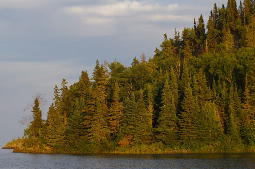
At sunset the light takes on a golden hue, turning the shoreline into artwork. Photo credit: David or Kathy Hart.
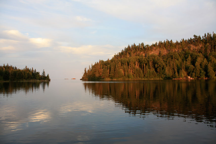
More of Nature's artwork. Photo credit: John Raby.
DAY FIVE
| Date: | Tuesday, August 27, 2013 |
| Weather: | Cooler and very foggy |
| Winds: | Calm |
| Waves: | Calm |
| Departure: | Chippewa Harbor, Isle Royale |
| Position: | 40° 01.733' N; 088° 39.0236' W |
| Destination: | Tobin Harbor, Isle Royale |
| Distance: | 20-miles by boat |
Weather
The signal from WZ-2513 on 162.500-MHz (WX Ch-6) from Copper Harbor is very strong this morning, exceeding its predicted coverage by many miles.
NOAA Land Forecast
TODAY
Patchy fog, temperature 70-degrees, wind East at 5-knots
SYNOPSIS
Moisture will linger over the area, with scattered showers
Clearing tonight, then fog and dry conditions.
Fogged In
Awakening at the dock we are enveloped in fog. Visibility is very limited. The island ferry boat, VOYAGEUR II, is due to arrive at the dock this morning at 10 a.m. EDST, so we need to depart before her arrival. Considering the very thick fog, we decide to cast off and loiter near the dock until the ferry comes into the harbor. In that way we will avoid the uncertainty of perhaps meeting her somewhere along our passage, as we are on opposite courses.
The dock at Chippewa Harbor, like many docks at campgrounds in the park, serves two purposes. The dock is large enough and in water deep enough to permit the ferry boat to come alongside for embarking or disembarking passengers. The Park Service (or its concessionaires) provides hikers and campers with a ferry service on a regular schedule around the island. This makes it possible for hikers to get to more remote areas without having to hike all the way from the ranger stations at Rock Harbor or Washington Harbor. When the docks are not employed in this service, they usually (but not always) offer overnight docking for visiting boaters. If staying at park docks on Isle Royale, you need to be aware of the schedule of the ferries and tour boats, as they are given priority for docking. At every dock there will be a different time and day when a ferry boat or tour boat may arrive, and visiting boats have to keep clear. Check the park literature for details.
The fog is due to the warmer wind blowing across the cold lake from the East. Moisture condensing out of the warm air over the cold water is creating an endless supply of fog. It will take quite a while for this to clear off. By 11 a.m. VOYAGEUR II has come in from lake out of the fog, dropped off and picked up her passengers from the dock, and we are following her out of Chippewa Harbor. She turns to the southwest to continue her packet route, and our fleet turns to the northeast, to head for Middle Islands Passage. We wobble along at low speed in the fog, trying to stay in visual contact by maintaining close spacing and going slowly. As is the normal technique around Isle Royale for small boats underway in reduced visibility, we make a radio SECURITY call on Channel 16 periodically to announce our position and heading.
Edisen Fishery
We are able to transit the Middle Islands Passage, and we turn to Port to visit the Edisen Fishery site. The dock there is completely unoccupied, and our five boat fleet fills it up. We visit the park exhibits in the old buildings of the preserved fishing camp site, then we hike about three-quarters of a mile to the Bangsund cottage to see the Moose-museum. We have the good fortune to find that Rolf Petersen and his wife Candy are in residence today. Mrs. Petersen gives us a wonderful tour and lecture of the moose bones and skulls, and Professor Petersen tells us about the impending crisis for the wolves, whose population has declined significantly in the past few years.
Around 2 p.m. we leave the dock at Edisen Fishery in order to make space available there for the tour boat coming down from Rock Harbor with passengers. When the tour boat appears out of the fog, we cast off and leave the dock. We continue our passage at slow speed in the fog, heading northeast toward Rock Harbor. The fog finally is starting to thin out.
Rock Harbor
At Rock Harbor we make a temporary stop. Several boats go to the fuel dock to take on more gasoline. I buy 25-gallons of fuel, which is selling for $5.61-per-gallon from the concessionaire. You can also buy ice and some groceries here, along with the usually necessary tee-shirts and other memorabilia. There are also showers and washing machines available. After a stay of less than two hours, we depart, heading just a few miles further to the northeast, before making a U-turn at Scoville Point, and coming back to the southwest, down Tobin Harbor to the park docks. The fog has finally burned off by 4 p.m.
Tobin Harbor
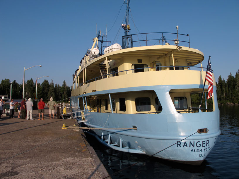
We take over most of the Tobin Harbor docks, with our five boats all moored stern-to at the main pier, bows pointing West. There is a trail from here across the narrow island and back to Rock Harbor, giving us access to all the facilities over there. Craig makes a deal with the Master of the vessel RANGER III, the large ferry that runs from Houghton to Isle Royale every day, and we are offered a special tour of the boat at 5 p.m.. We're all in for this chance to see the workings of this elegant old ship.
After the tour, we are back at the dock for cocktails and then dinner. We have a very nice evening at the dock, and retire to bed around 10 p.m. About two in the morning I am awakened by the sound of waves slapping against the bow and traveling under the sponsons. This noise is typical of a classic Boston Whaler boat hull when moored with the bow into the wind. Even small waves will create a loud hull slap sound. It was my idea to moor with the bows to the West, primarily because I though it would make a great picture. A little breeze has come up, and, even though the distance across the harbor is only about a half mile, there is enough fetch for the west wind to make waves; their sound is keeping me awake all night. Mercifully, about 4 a.m. the wind dies down, and I get back to sleep.
With the fuel added at Rock Harbor, I now have 57.8-gallons remaining. The trip, so far, has covered 82.8-miles, and we have been underway for 6-hours 50-minutes, for an average speed of 12-MPH. We've burned a total of 30.5-gallons, averaging 2.7-MPG.
Today's Sailings
Chippewa Harbor to Tobin Harbor, with stops at Edisen Fishery and Rock Harbor
MILES = 19.9
GALLONS = 4.2

MPG = 4.74 (almost all the trip at idle speeds due to fog)
Photographs
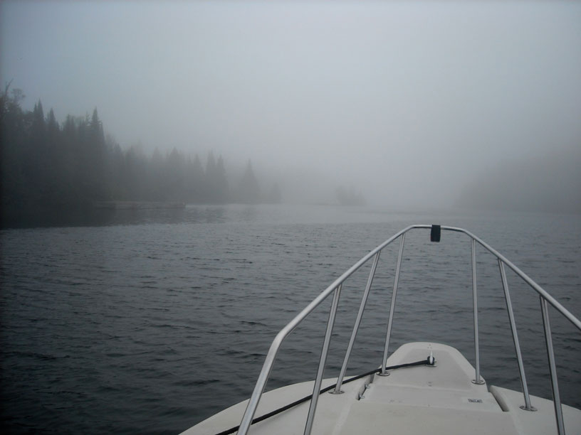
We departed the dock at Chippewa Harbor in a thick morning fog, awaiting the arrival of the ferry VOYAGER II inbound from the lake. Photo by the author.
The ferry VOYAGER II arrived about 10:45 a.m. We stood by while she disembarked passengers at the dock, then followed her out to the lake in the fog. Photo by the author.
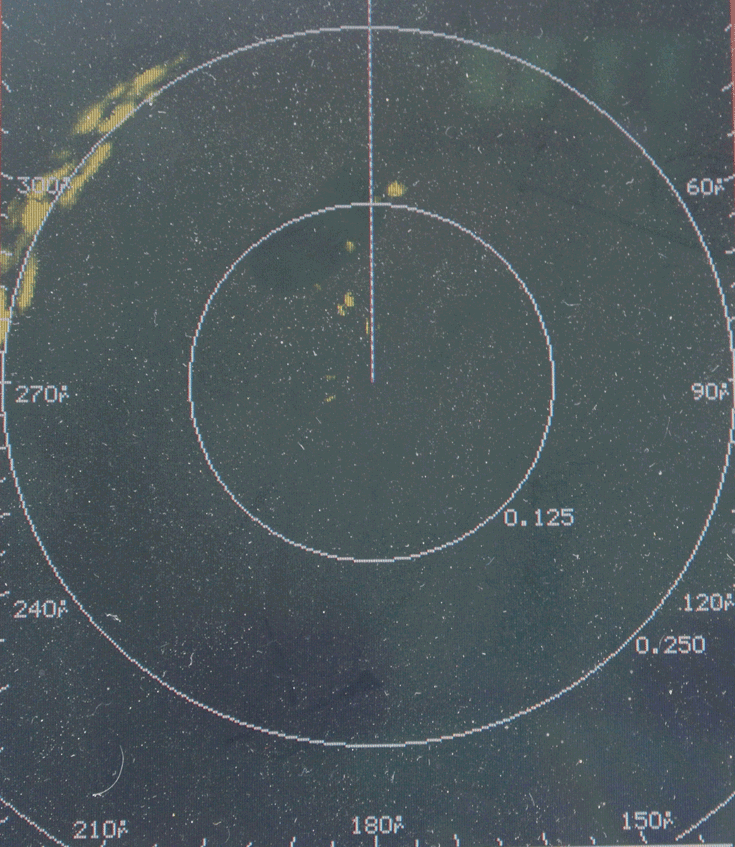
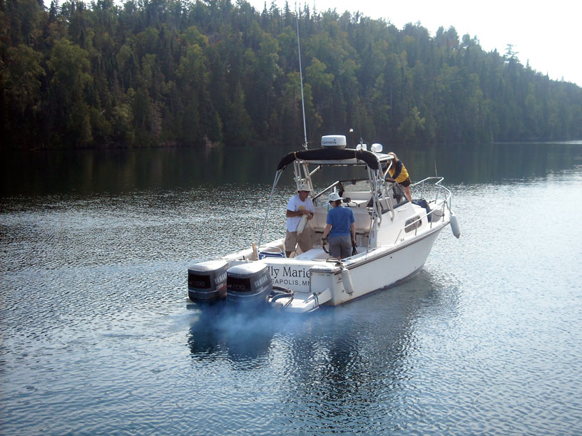
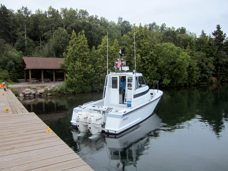
DEFIANCE was at the back of the fleet on the fog-bound course. Her RADAR set shows the position of the four other boats. Photo by Craig Reinders.
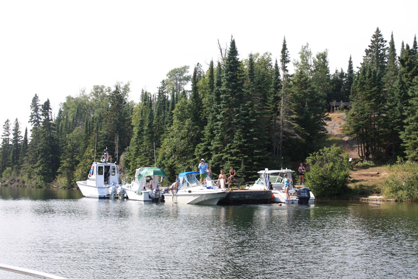
We made our way slowly in the fog to Edisen Fishery, arriving at the dock about 12:30 p.m. Our five boats fill up most of the available space. Photo by the author.
Size matters when determining which boat will raft off which other boat. Photo credit: David Hart.
The Edisen fishing camp is quite nicely preserved as an exhibit. Photo credit: David Hart.
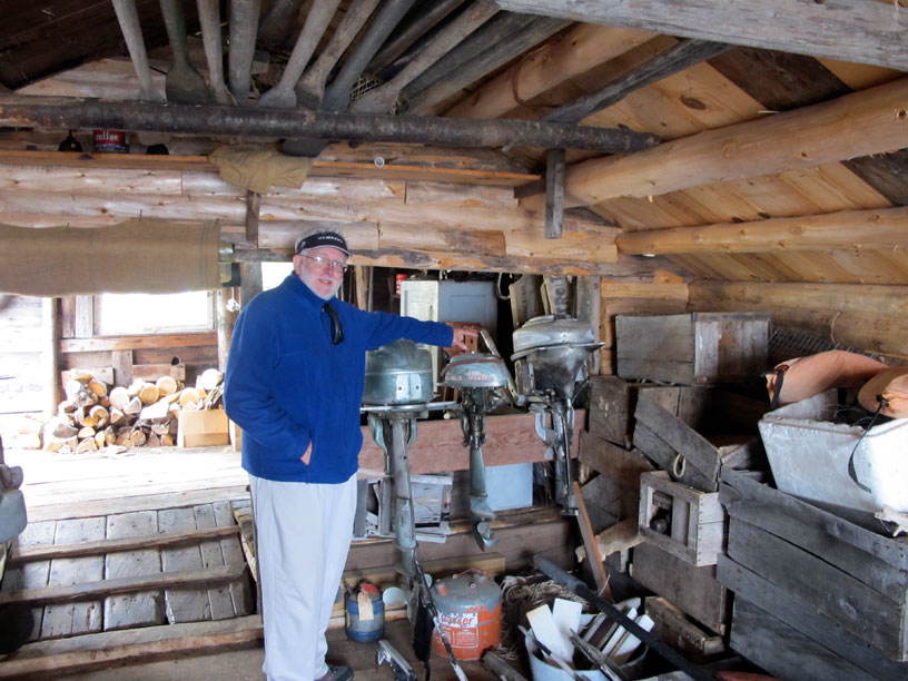
The Edisen Fishery buildings were open, and we could conduct a self-guided tour. These old Evinrude outboard engines caught your author's attention. Photo credit: Kevin Albus.
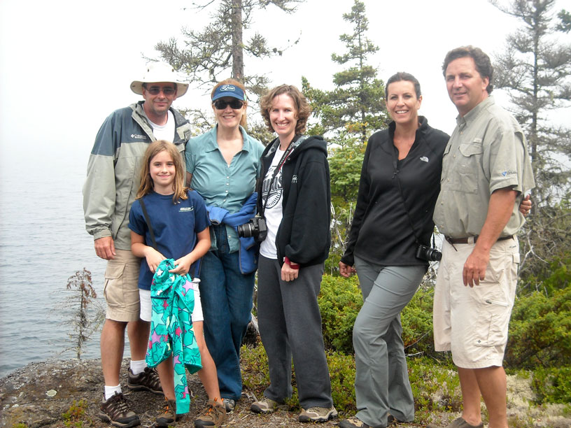
John, Emmarie, Chris, Holly, Karen, and Craig on the trail. Photo by the author.
Even by 1 p.m., fog and mist still hung in the air along the trail to the Bangsund cottage from the dock.
Photo credit: David or Kathy Hart.
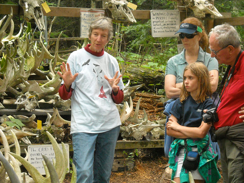
At the Moose-seum we received a wonderful impromptu tour from Candy Petersen. Photo by the author.
Another point of interest close by is the lighthouse, which overlooks Middle Island Passage.
Photo credit: Debbie Kearney.
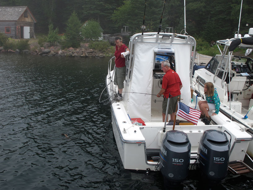
David Hart reels in a nice fish caught on a cast while at the dock. Photo credit: Kevin Albus.
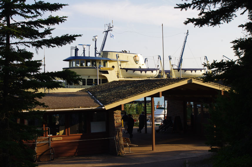
When the ferry ship RANGER III is at the dock at Rock Harbor, it takes over the skyline. Photo credit: Kathy or David Hart.
The Master of the RANGER III kindly offered to give us a tour of this fine old vessel. Photo credit: Kevin Albus.
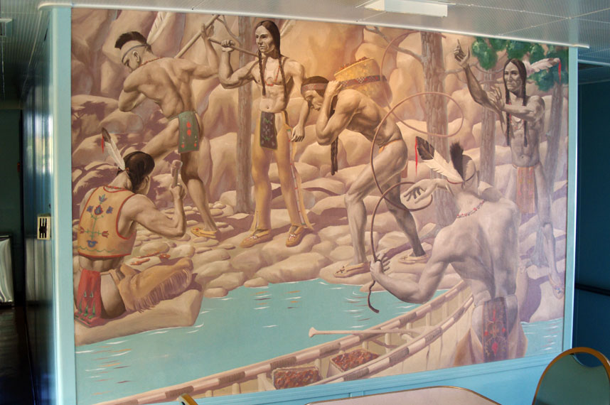
During the construction of the RANGER III in 1958, artist Robert Bushnell painted several beautiful murals on the ship's cabin partitions. As you can see in this example, the artwork has held up very well after 55-years on a working ship. Photo credit: David or Kathy Hart.
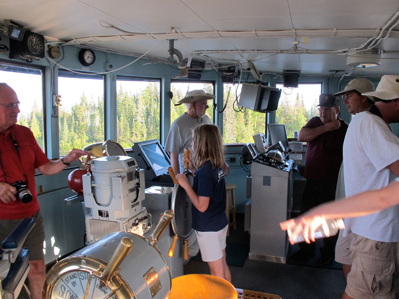
The highlight of any ship tour is a visit to the bridge, which is enjoyed by young and old alike. Photo credit: Kevin Albus.
Five boats at Tobin Harbor on a dead calm evening: this is the picture I had in mind when I suggested we all moor stern-to the dock. Thanks to David Hart for taking it.
The sun sets in a clear western sky. Photo credit: Kevin Albus.
DAY SIX
| Date: | Wednesday, August 28 1, 2013 |
| Weather: | Fair |
| Winds: | Light |
| Waves: | Calm |
| Departure: | Tobin Harbor, Isle Royale |
| Position: | 48° 8.867' N; 088° 28.149' W |
| Destination: | Belle Isle, Isle Royale National Park |
| Distance: | 20-miles by boat |
Weather
There is light fog this morning, but it rapidly dissipates. Winds are light. Waves are calm. It is a beautiful summer day for boating, just the kind we like when on an island in Lake Superior.
Today's Adventure
With the interrupted slumber last night, we catch up by sleeping in until 9 a.m., unusually late for me when cruising. After breakfast at the dock, we formulate the plans for the day. The first mission is to move over to a dock a mile away that accesses the trail to the summit at Lookout Louise. Then a break for lunch. A second hike is planned for Passage Island. Then we will rally at Belle Isle for our next overnight stay.
Lookout Louise
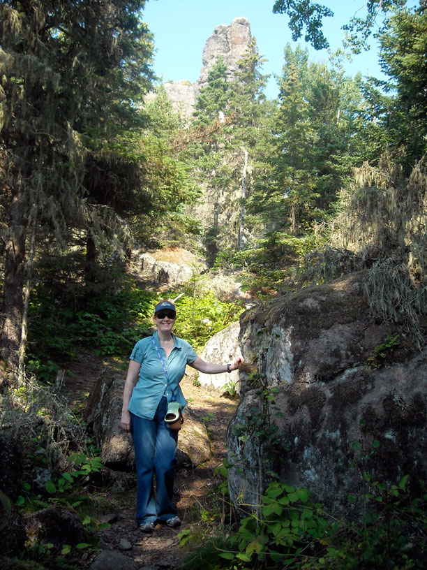
Two hikes in one day are too much for the older set in the fleet. Chris and I will go on the Lookout Louise hike, and skip the Passage Island adventure; Dave and Kathy will opt for the opposite choices. The younger set—the 30-and- 40-year-olds—will take on both hikes. About 11 a.m. we move the boat a mile or so up the harbor and tie at the park dock at the head of the trail to Lookout Louise. The climb to the overlook is about 1.1-mile with an elevation gain of 280-feet, from the 601-feet above sea level of the lake to the 880-foot ridge. That is an uphill grade of five-percent over rocky terrain. The youngsters go in a second boat. They arrive after us, then overtake us on the way up to the top. My 62-year-old legs are getting tired, but I make it to the lookout. The view is very nice.
After the climb to Lookout Louise, we hike back to the dock, and move the boat back to the Tobin Harbor docks. There we have lunch, and afterwords hike across to Rock Harbor. In Rock Harbor we buy tokens for the shower, and enjoy some warm water for a change. Before heading back, we buy more ice for the coolers.
Passage Island
The rest of the fleet is heading to Passage Island, where they will enter the small boat harbor near the island's center, moor at the old boathouse dock, and hike about a mile to the southwest point to visit the lighthouse. We made that hike in 2010, and won't repeat it today. The entrance to the harbor is narrow and unmarked, and has rock shoals. The guys report later that one boat found the bottom on the way out, but was undamaged. The trail to the lighthouse was also very overgrown, and they were often hiking in high grass. Apparently not too many people have been on the trail this summer, or perhaps it has not received any grooming from the Park Service. (Note that the Park Service is operating at a reduced budget due to the government policy of sequestration of funds this summer.)
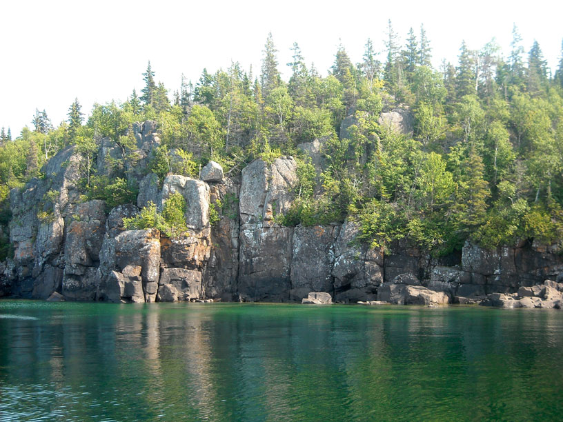
The Palisades
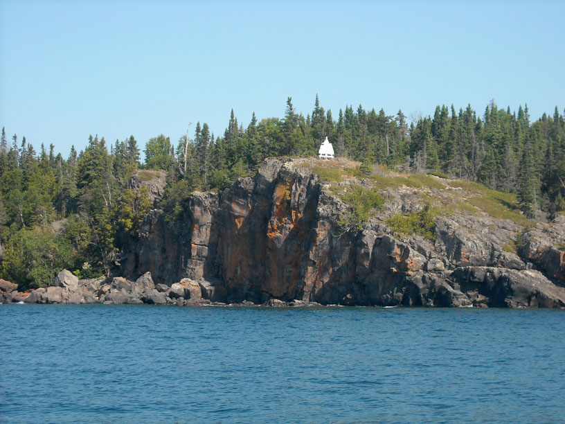
While our mates are off to Passage Island, we depart Tobin Harbor around 3 p.m. and head northeast, rounding Blake Point, and coasting down the island's western shore, stopping first at The Palisades, a tall and nearly vertical stretch of rock shoreline. The 259-foot wooden passenger and package steamer MONARCH out of Thunder Bay, Ontario, was running at full speed in a blinding snow storm in December of 1906, when, due to an error in navigation, she planted her bow on The Palisades. Amazingly, only one life was lost, despite the temperature being minus-20-degrees. The wreck is marked today with a buoy for divers. We make a few passes over it, looking for signs of the hull on the return echoes of our SONAR.
Canoe Rocks
From The Palisades we head farther offshore to visit Canoe Rocks, the site of two significant ship wrecks. We were able to glide over the 4-foot shoal at the northeast end without damage, but the EMPEROR sank after grounding here in June of 1947, which seems unusual for both the year and the season. Poor navigation at 4 a.m. put the 525-foot steel freight onto Canoe Rocks. Two buoys mark the bow and stern of the hull, which is still intact.
Not far away to the southwest we visit Congdon Shoal, named after the vessel CHESTER A. CONGDON, which grounded there in the fog in November of 1918. The 532-feet steel freighter was broken in two by a storm two days later, but before then all crew had been rescued.
Although we do not dive on these wrecks, we find it interesting to locate them and to echo–sound the bottom for signs of the hull. One can also better appreciate the circumstances of the sinking by visiting the actual site, and it helps us learn the history of these wrecks.
Belle Isle
After the tour of the three prominent ship wreck sites, we now head for Belle Isle, where there is a park service dock and campgrounds. It is a pleasant ride on a warm summer afternoon with calm seas. Arriving at Belle Isle, we find the dock completely unoccupied. Rather than tie up right away, we just cut the engine and let the boat drift in Robinson Bay, while we relax, read, and await the arrival of the rest of the fleet.
About an hour later we hear the other boats on radio, heading our way, so we motor over to the dock at Belle Isle and tie up. A short time later a small Park Service outboard boat approaches. It is carrying four or five fellows, one of whom is a volunteer helping out the Park Rangers, and they'll all be staying here tonight at the Ranger station. The volunteer begins to give me a recital of all the park regulations that will affect us during our visit, but I interrupt him to assure him we are quite aware of the regulations and expect to be very low impact visitors to Belle Isle. A while later the rest of the fleet arrives, and we fill the remaining space on the dock, with one boat rafted out.
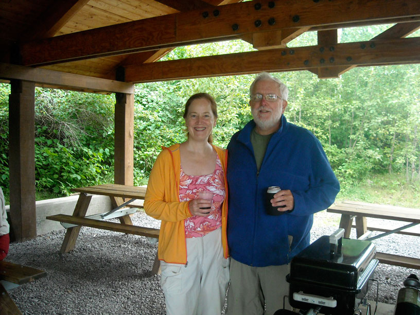
We have another delightful evening of cooking some great meals over the various grills available, passing around some appetizers and side dishes, and enjoying a few adult beverages. A long card game takes over the picnic table. The evening weather is fair and the sun is slow to set. More good times at Isle Royale.
With the boat at Belle Isle, I compute my fuel resources. We have come 102.6-miles from Copper Harbor, having burned 36.9-gallons of fuel. That is an average of 2.78-MPG. Projecting forward, with 51.4-gallons remaining, I should have a range of 138-miles with the fuel onboard.
Today's Sailings
Tobin Harbor to Belle Isle
MILES = 19.8
GALS = 6.4

MPG = 3.1
Photographs
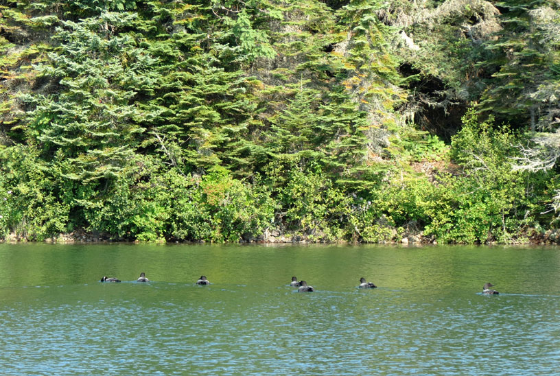
One often sees (and hears) a Common Loon on a northern lake, but to see seven together is unusual. Photo credit: Debbie Kearney
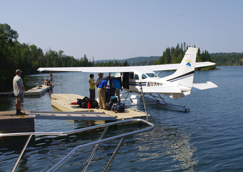
For the park visitor in a hurry (and with a big budget) Tobin Harbor provides a seaplane dock and service to the mainland. Photo credit: David or Kathy Hart
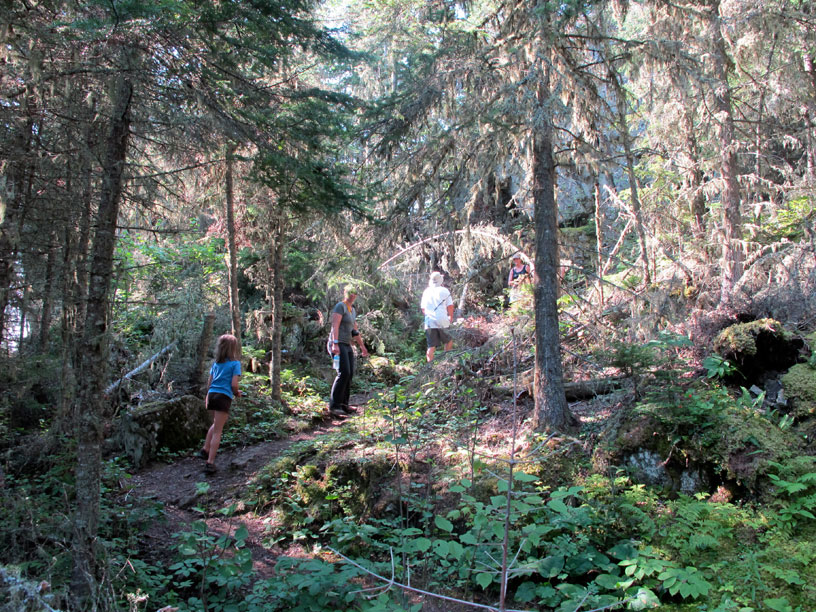
The trail ascending to Lookout Louise has a lot of up and down terrain. Photo credit: Kevin Albus
Monument Rock is a waypoint on the trail to Lookout Louise. Photo by the author.
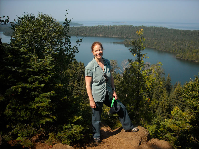
After a long climb across the ridge of the island, we are rewarded with a fine view from Lookout Louise. Photo by the author.
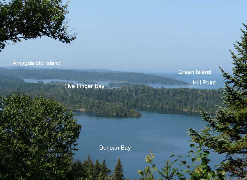
This annotated view identifies the several bays and islands seen from the Lookout.
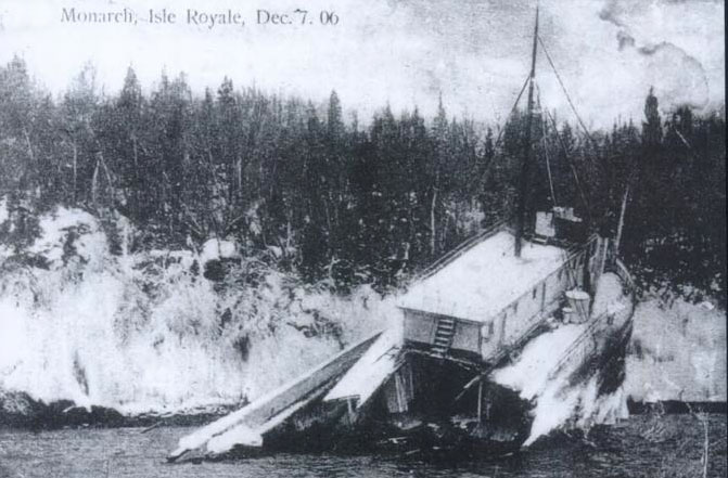
The passenger steamer MONARCH was wrecked on The Palisades during a snow storm in 1906. All but one person was able to scramble ashore to safety. Photo credit: Jim Dan Hill Library, University of Wisconsin–Superior.
The Palisades, in summer on a calm afternoon. Photo by the author.
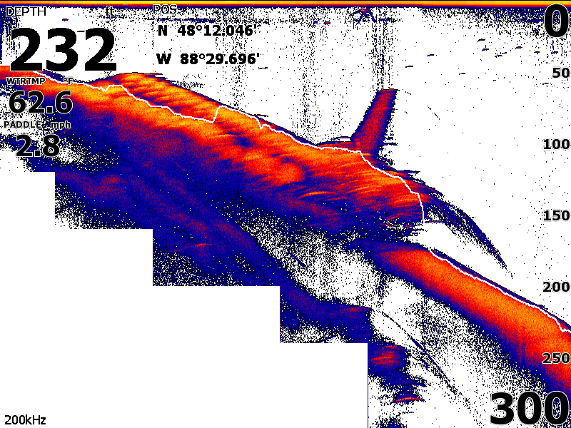
Our SONAR gave us this echogram view of the lake bottom. I believe it shows the wreck of the EMPORER laying on the slope of the rock face to the north of Canoe Rock, where she sank in June of 1947. Considering the depth and the water temperature, this is as close as I will get to seeing the wreck.
The cove at Passage Island has an old boathouse. Three boats raft up for a temporary mooring. Photo credit: Debbie Kearney.
The trail to the lighthouse from the cove on Passage Island has a few difficult sections. Photo credit: Kathy Hart.
Sections of the trail were overgrown. Perhaps not enough hikers made the trek this year. Photo credit: Kathy Hart.
The passage between Passage Island and Isle Royale looks calm and wide today. Photo credit: Kathy Hart.
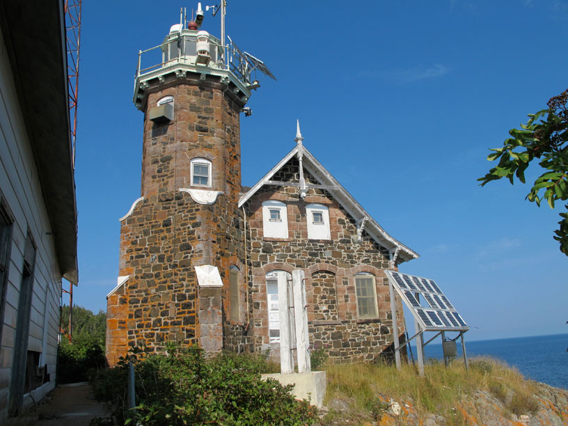
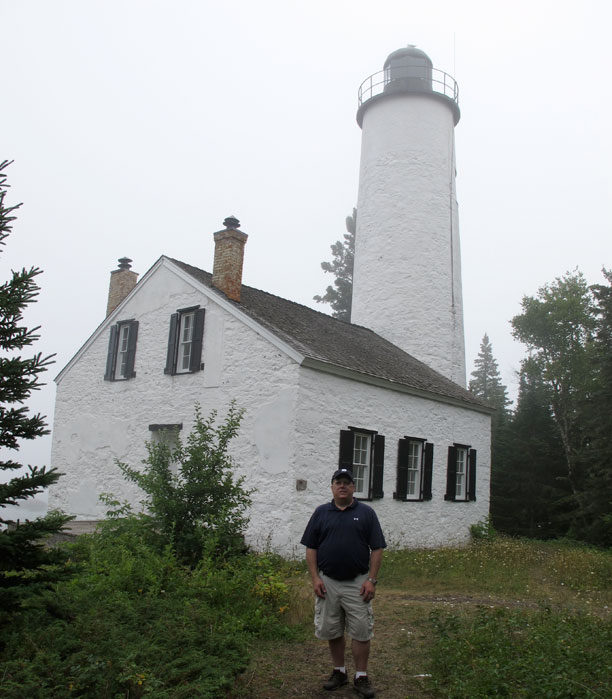
The lighthouse on Passages Island was built in 1881, and has survived many brutal winter storms on Lake Superior. The photo-voltaic panel does not seem to be doing as well. Note its low angle to the sun. Photo credit: Kevin Albus.
From Passage Island it was a fast-paced run to Belle Isle in a very calm Lake Superoir. Photo credit: Debbie Kearney.
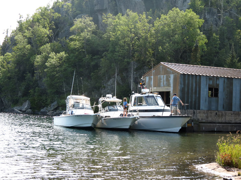
The dock at Belle Isle. Last boat to arrive has to raft off. Photo credit: Kathy Hart.
David stretches after dinner. The hike across Passage Island gave him a few sore muscles, but proper application of medicinal alcohol was able to manage the pain. Your author looks on. Photo credit: Kevin Albus.
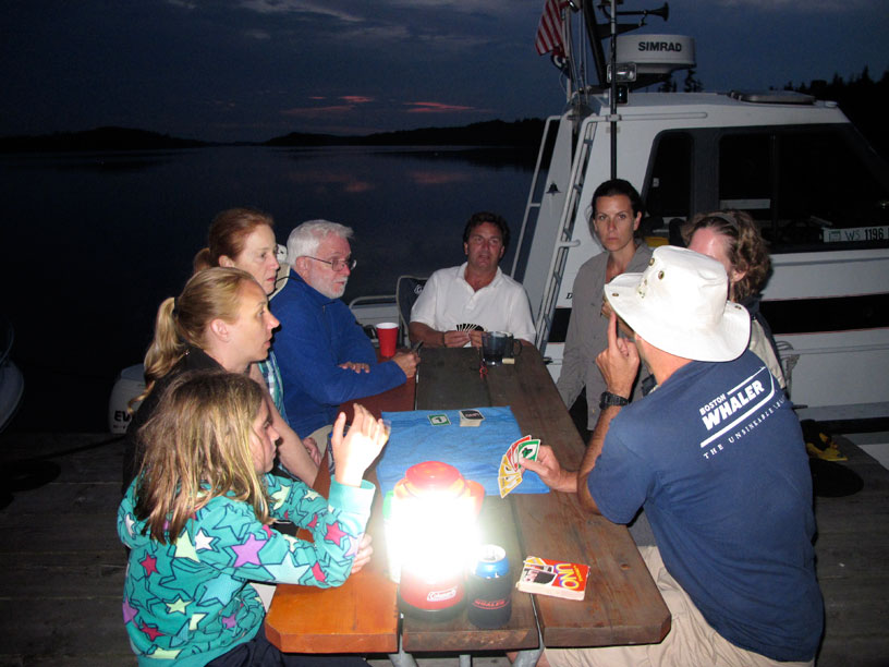
After a good dinner, the crews enjoy a game of UNO on the dock, which went long after sunset. Photo credit: Kevin Albus.
DAY SEVEN
| Date: | Thursday, August 29, 2013 |
| Weather: | Morning fog, then clearing and sunny |
| Winds: | Light |
| Waves: | Calm |
| Departure: | Belle Isle, Isle Royale National Park |
| Position: | 48° 5.23' N; 088° 42.49' W |
| Destination: | McCargoe Cove, Isle Royale |
| Distance: | 11-miles by boat |
Weather
We have another morning with fog and mist. We are only making a short passage, and we'll be underway for less than an hour, so we are not overly concerned about the weather. It continues to be fair, but there are some storms coming in later from the West.
To break up the trip a bit, this morning I hop aboard David's new boat, MANIC MOMENT, and leave the dock with them. I pilot the boat on plane for about a mile to the northeast, then we shut down and wait for the rest of the fleet. Chris pilots CONTINUOUSWAVE away from the dock and comes over to pick me up. The test run over, we head for Crystal Cove for a cruise-by inspection.
Crystal Cove
Crystal Cove is an interesting spot, but the dock there has a sign that prohibits overnight mooring. The Park Service refers to it as an historic property. It was originally a private summer retreat built in the 1920's, and later became a commercial fishing camp. It has been fairly well preserved and is planned to become an overnight campground in the park at some later date. There is an excellent cove there where boats could lay at anchor with protection from all but a northeast wind. As we are navigating away from Crystal Cove, our attention is called by radio to our approach toward a rock shoal, which is not appearing on our chart plotter. (This leads much later to a discovery of the influence of certain display options on the presentation of serious hazards on the electronic chart plotter. See Electronic Charts for Isle Royale for more discussion.) For the moment, we are thankful for the good fortune to have not gotten any closer than we did.
McCargoe Cove
We have a nice run on plane through the Amygdaloid Channel. We actually encounter what appears to be the first other recreational boat in these waters. They're heading for the Ranger Station of Amygdaloid Island, and perhaps the boat is actually a Park Service boat. We run on to the entrance to McCargoe Cove, and enjoy a leisurely cruise down the narrow waterway to the campgrounds and dock at the far end. Again, the dock is empty. We tie up four boats to the dock and raft off one boat (ours).
Minong Mine Hike
A main attraction when at McCargoe Cove is the Minong Mine, a very old open-shaft copper mine about 1.5-miles inland. In mid-afternoon we can see the weather is beginning to deteriorate. We decide we should set off on the hike to the mine before the rain arrives. We are lagging behind the main group at the start, and we take a wrong turn near the campgrounds, putting us even farther behind. But we do manage to get back on the right trail, and we arrive at the mine a few minutes behind our mates. The mine site is a must see. Since we visited three years ago the Park Service has improved some of the wooden railings that prevent you from falling in. I must be getting older, as the hike seems to have more up and down over the terrain than I remember. I am glad to get back to the boat and off the rocky trail, before the rain arrives.
Clouds roll in and the temperature drops, but the rain holds off for most of the early evening. We have another good dock cook-out, with the food getting off the grills just in time before a thunderstorm arrives and sends us under cover of the boat cockpits.
A Dark and Stormy Night
Overnight there are dark clouds and no moonlight. Without any sort of electric light illumination for at least 25-miles, and surrounded by high hills that block out any other light, it is literally so dark you cannot see your hand in front of your face--except when a lightning bolt lights up the sky. Around midnight the front must have blown through, because the wind switches to the southeast, putting it on the stern of the boats. Around 3 a.m. I am awakened by the motion on the boat, as the wind has now shifted to northeast at 15-knots, and is coming right down the two miles of the cove and hitting us broadsides. Fortunately, sometime after 5 a.m. the wind dies down, and I am able to get back to sleeping. Unfortunately, I am awake at 7:30 a.m. the next morning, probably from being anxious about the trip ahead.
Today's Sailings
MILES = 10.5
GALS = (no good data due to a glitch, but at least 3-gallons consumed)
MPG = unknown
Photographs
Even though it is August, mornings on Isle Royale are cool, and the boat is usually covered in condensation. This morning a thick fog is added for good measure. It is about 8 a.m. Photo credit: John Raby.
Two hours later, the fog is gone and we have a beautifully sunny morning. Canvas is out to dry, and everyone is up and preparing for some more great boating. Photo credit: John Raby.
The sun is slowly burning away the morning fog at the dock on Belle Isle. The crew of DEFIANCE gets things shipshape. Photo credit: John Raby.
For the late-riser, a quick dip in a cold lake is a good way to wake up in a hurry. Photo credit: John Raby.
Thanks to the metadata in the digital image file, I can tell you with some precision that twenty-nine seconds later the morning swim is finished. Photo credit: John Raby.
Crystal Cove is on the Northeast tip of Amygdaloid Island. It was privately owned and was originally a summer retreat. The Park Service plans to develop this site for overnight camping in the future. The dock can only accomodate one or two boats. Photo by the author.
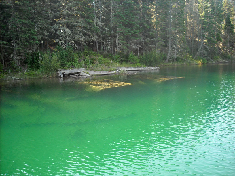
The stone and timber cribs of this old dock have survived many winters, but the ice has torn away the deck they supported. Photo by the author.
DEFIANCE explores the limit of Crystal Cove. Photo by the author.
HOLLY MARIE motors slowly out of Crystal Cove. Photo by the author.
The dock at McCargoe Cove has room for four boats alongside, and a fifth rafted out. Photo credit: Kevin Albus.
The cove is beautifully protected in all directions except for this long fetch to the Northeast. Guess which way the wind shifted overnight. Note to self: next time raft up on the other side. Photo credit: Kevin Albus.
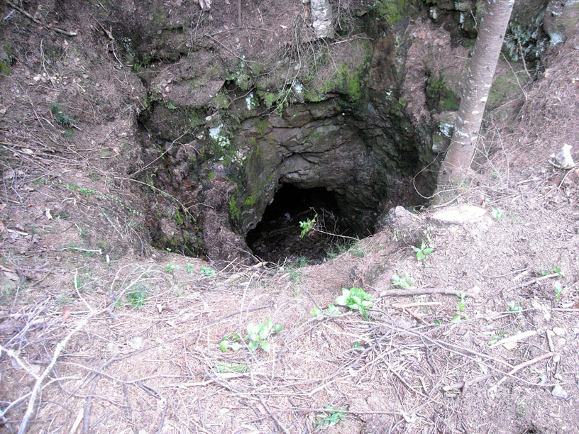
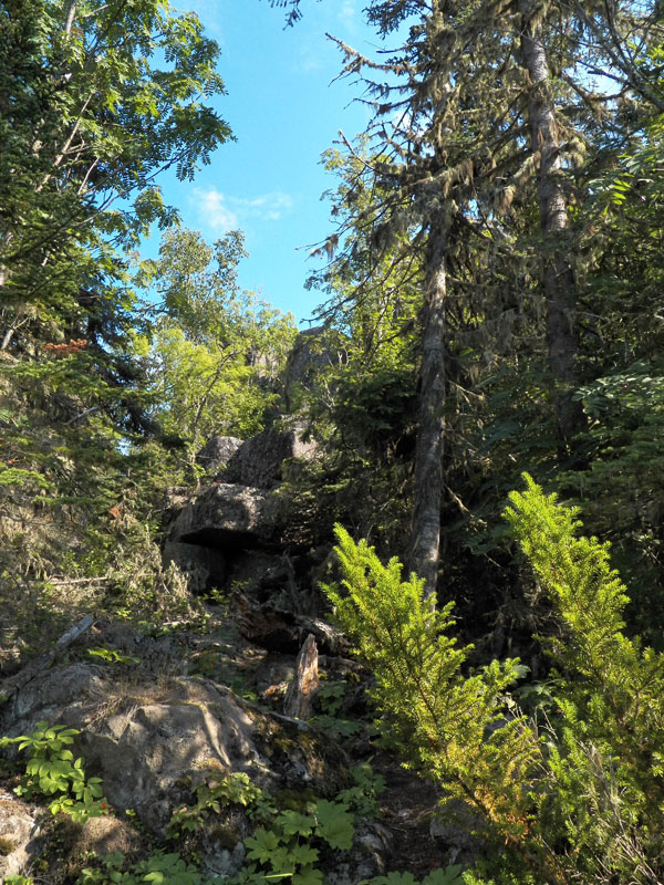
This open shaft to an ancient copper mine is one of many on the island. Photo by the author.
The Park Service has installed a new and very sturdy railing to keep hikers from falling into the open shaft. Photo by the author.
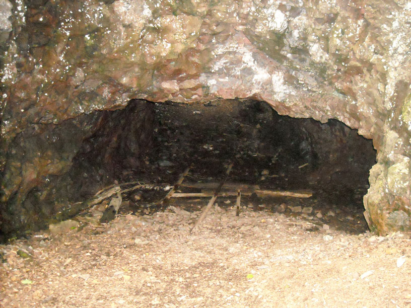
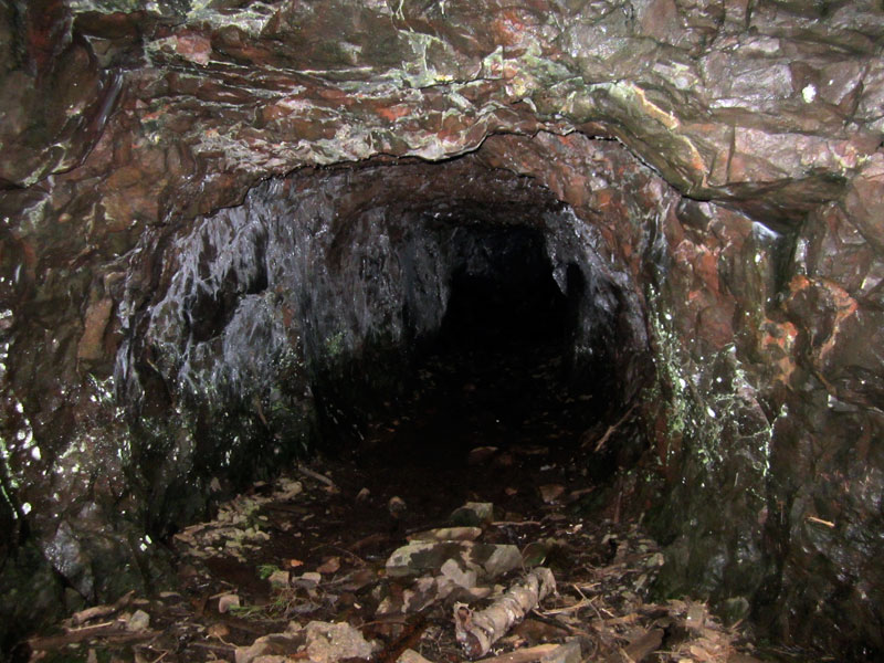
You can enter the mine shaft via this horizontal opening—but keep your head down. Photo by the author.
Adjacent to the mine shafts are fields of mine tailings. Photo credit: John Raby.
A second mind adit and interior view of the old workings. Photo credit: John Raby.
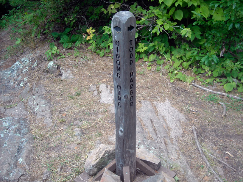
The trails are usually well marked with sign posts like this to guide the hiker. Photo by the author.
Kathy prepares to fish for dinner in McCargoe Cove. Photo by David Hart.
DAY EIGHT
| Date: | Friday, August 30, 2013 |
| Weather: | Cold, cloudy, windy |
| Winds: | Light in the cove, but much stronger offshore |
| Waves: | Three-foot |
| Departure: | McCargoe Cove, Isle Royale |
| Position: | 48° 5.23' N; 088° 42.49' W |
| Destination: | Washington Harbor, Isle Royale |
| Distance: | 37-miles by boat |
Weather
From NOAA via KXI43 at Grand Marais on 162.450-MHz (WX-5):
TODAY
Wind northwest 10 to 15-knots
becoming east 5 to 10-knots in the afternoon
Mostly Cloudy
Waves 2-feet
TONIGHT
Wind east 5-knots
increasing to east 5 to 10-knots overnight
Partly Cloudy
Waves 2-feet
SATURDAY
Wind southeast 5-knots
Chance of Thunderstorms
Waves 2-feet or less
From Canadian Marine Forecast 161.775-MHz (WX-9 or VHF 83B):
Western Lake Superior
STRONG WIND WARNING
Winds variable at 15-knots increasing to north at 20-knots in the morning,
then becoming northeast at 20-knots in the evening, and
decreasing to East 15 by Midnight

Saturday morning, winds southeast 10-knots

Wave heights for offshore: waves less than 0.5-meters,
building to 2-meters
then decreasing to 1-meter around Midnight,
and decreasing to 0.5-meters on Saturday
There is quite a difference between the two forecasts. It will turn out the Canadian forecast is much more accurate. This is not too surprising as they are primarily forecasting for the mariner, while the NOAA forecasts are often more appropriate on land.
The Decision
Up to this point in the cruise we have been proceeding in a counter-clockwise direction and anticipating continuing in that manner, making a circumnavigation of the island. This track will take us to Washington Harbor, on the island's southwest tip. From there we can return across Lake Superior to Copper Harbor on the following day. But there is another option. We could back track, and return to Rock Harbor today, spend the night there, and jump across Lake Superior to Copper Harbor the next day. Each course has its merits.
Cutting short the circumnavigation and heading back the way we came will save at least 40-miles overall travel. We'd gain 15-miles in going to Rock Harbor instead of Washington Harbor. And we gain 25-miles more when crossing Lake Superior, as the distance is shorter from Rock Harbor to Copper Harbor. However, all of our mates seem quite keen to continue on the counter-clockwise track, as several want to complete a circumnavigation of the island. For us, we've already done that in 2010, so it is not something we need to check off. I give a lot of serious thought to which way to go. In the end, everyone in the group wants to continue as we have been, and I decide the camaraderie of our four companion boats is more appealing than saving two hours of boat travel on the return trip. (Plus, we'd apparently be on our own the whole way.) We'll all go on to Washington Harbor.
Washington Harbor Bound
Getting to Washington Harbor is quite a jaunt for today. It is a 37-mile run, and we will be in open water most of the way, as we run down the northern shore of Isle Royale, which is protected only by a few small barrier islands along the way. And the wind has definitely come up. To our good fortune, the wind will be from astern as we head for Washington Harbor, but we will still have to run in its waves, which are 3-feet and building.
We depart McCargoe Cove dock around 10 a.m., motor slowly out of the cove, and reach the open lake water before 11 a.m. The course from here is just to run along the shoreline, ducking behind a few barrier islands along the way for a respite from the following seas. There are shoals to avoid, but they are generally well known and indicated clearly on our chart plotters.
The conditions seem to be different for each boat, as we have quite a variation in size and hull configuration. So we each run at different speeds as best suits our boats. We don't try to maintain a tight formation. We are running about 20 to 23-MPH, as any faster seems to produce too much pounding in the seas. Some of the longer boats are running about 5-MPH faster; either they have a smoother-riding hull or they don't mind the rough landings. We all work our way down the shoreline of Isle Royale, and stay within a half-mile of it for most of the way.
The wave are rolling down from the northwest and striking the shore, where they rebound and come back into the lake. The conditions seem rougher nearer to shore, a situation known as clapotis gaufré (or waffled waves). Some boats move farther out into the lake to escape the mixed seas reflecting from the shore. Around noon, we cut between Thompson Island and Isle Royale, get off the open lake, and are back in the protected water of Washington Harbor. We arrive around 1 p.m.
Crowd at the Docks
There is quite a crowd of boats at the recreational boat docks, and it takes a while for our fleet of five boats to all find a place to tie up. The bigger boats go alongside the high pier used by the ferry boats. The smaller boats seek a place on the floating docks more suited to their size. Eventually, we all find a tie-up, although there is a bit of hubris and some contention with other boaters in getting this done. I have not been very fond of Washington Harbor, and the behavior of some of the other boaters confirms my dislike for the place. They all seem to be acting extremely oddly. I think they are upset because the big seas and north wind have them pinned in Washington Harbor all day; they can't head north from here to their preferred destinations because of the sea state on the open lake. It was a bit rough coming with the waves, and it would be much more difficult to move north against them. Maybe these boaters don't like being here any more than I do, and that is why they are acting rather idiotic at times. Most of these guys are just starting a three-day Labor Day weekend of fishing. They seem a bit too riled up to me. Of course, we have been boating by ourselves for a week and for the most part completely alone and isolated. I may not be very accustomed to dealing with any other boaters at this point, but they seem annoying.
Although Washington Harbor is sheltered from the open lake, it is always windy here. The breeze comes down from the highlands and takes an easy route through this opening. It is blowing rather strongly now, and docking is made complex by the cross winds. Before it gets too late, I want to move over to the fuel dock and add some fuel for tomorrow's long trip.
Fuel Dock
Because there is a scarcity of slips, the boat at the fuel dock loiters there for about 90-minutes after fueling, awaiting some space on the main dock. This keeps me from going over to fuel. Finally, he pulls away. We cast off and head for the fuel dock. But just as we are underway, we are cut off by a newly arriving (and rather large) cruiser, who jumps ahead of us and takes over the fuel dock. Instead of going back to our slip, we idle around in the vicinity. It soon turns out the big cruiser needs diesel fuel, which is not available here. But he, too, loiters at the fuel dock for 30-minutes while his crew runs off to the bathrooms and he plans his next move. Finally, after about two hours of waiting, we get to the fuel dock ourselves. I just add 13.7-gallons, giving me an indicated 50-gallons on board. We are on and off the fuel dock in less than ten minutes, and back to our slip. That will be enough boat movement for today. The boat now has 50-gallons of fuel and is facing a 77-mile trip tomorrow. If we average 2.5-MPG, we should have a range of 125-miles, giving us a comfortable margin on fuel for the long passage across the lake.
The trip is catching up on my stamina. We take it easy the rest of the day. I think I will be ready to head back tomorrow. Some of the other boat crews take hikes on the several trails radiating from the Ranger Station.
Last Night Supper
We take advantage of a covered picnic area adjacent to the main dock for our last night cook out as a group. We have another good meal. A real bathroom, with toilets, running water, soap, mirrors, and even a shower is just a short walk from the dock. By evening the wind has calmed down, and we have a very deep, peaceful, and uninterrupted sleep at the dock.
Today's Sailings
MILES = 36.7
GALS = 15.1

MPG = 2.4
Photographs
John looks on as his daughter Emmarie pilots HOLLY MARIE out of McCargoe Cove. Photo credit: Holly Raby.
After a 35-mile run in open water, we were very glad to get into the lee of Isle Royale's southwest shore. The wind from the North was quite fresh, as can be seen in the stern ensign. Photo credit: John Raby.
At Washington Harbor, the Ranger Station main pier was better suited for DEFIANCE to use. Her gunwale height and the dock height were just about a match. Once the ferry departs for the day there is plenty of room here. Photo credit: Kevin Albus.
The floating docks were better suited for the smaller boats. Here John shows off a still solid block of ice, maintained in the cooler for a week. In the far background you can see the fuel dock. Note the wind in the flag. Photo credit: Kevin Albus.
The montage of crew photographs below shows a generally very happy bunch. Our trip to Isle Royale has been a success!
The crew of HOLLY MARIE: John, Emmarie, and Holly.
The crew of MANIC MOMENT: Kathy and David.
The crew of OUTLIER: Debbie and Kevin.
The crew of DEFIANCE: Karen and Craig.
The crew of CONTINUOUSWAVE: Chris and your author.
DAY NINE
| Date: | Saturday, August 31, 2013 |
| Weather: | usual |
| Winds: | Diminishing, turning southwest |
| Waves: | Variable directions, 2 to 3-feet |
| Departure: | Washington Harbor, Isle Royale |
| Position: | 47° 54' N; 089° 9' W |
| Destination: | Copper Harbor, Michigan, then on to St. Ignace by car. |
| Distance: | 79-miles by boat; several hundred by car. |
Weather
It is almost calm early, then a breeze comes up from the southwest. However, there are still remnant waves from the northeast from yesterday's blow.
Departing Isle Royale
I am anxious to get an early start in order to take advantage of the calm conditions we have this morning for our long passage. One boat is going back to Grand Marias, a much shorter jump to the mainland in Minnesota. The four boats going to Copper Harbor have an unusually long route, about 79-miles, due to being rather farther west here at the southern tip of the island. We will not be leaving simultaneously or traveling in strict formation.
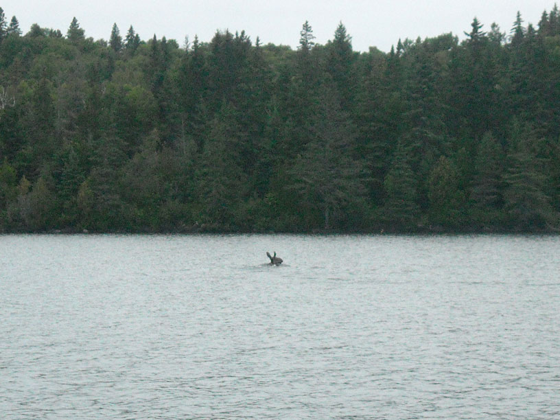
We make our goodbyes, and leave the dock about 7:30 a.m., the first boat to depart. The next few miles are very pleasant running, still in the protection of Washington Harbor. We even have the good fortune to see a moose swimming across the channel in front of our boat. This gives us a very nice feeling, as we hadn't seen any significant wildlife on this cruise until now. At least we saw one moose!
By 8 a.m. we are clear of Washington Harbor and upon Lake Superior, but in the lee of of the island and protected from the northeast swell still running from yesterday. A breeze is coming up from the southwest, but it has yet to generate any significant waves. We can get up on plane and head directly for Copper Harbor at a speed of 27.5-MPH. By 9 a.m. we are in more open water and are faced with some 2-foot to 3-foot swell from the northeast. Our speed is cut to 21-MPH. By 10 a.m. we are finding the seas more mixed, with some waves now from the southwest meeting the remnant swell, which has become more easterly and swinging to be on our bow. Our speed is about 23-MPH at best. By 11 a.m. we have the entrance to Copper Harbor in sight, but the waves are bigger than ever. We are back to about 20-MPH.
During the passage we are overtaken first by DEFIANCE, a larger boat that can run faster in these conditions than we, and then by OUTLIER, a boat of about the same size as ours but with a more aggressive V-hull. MANIC MOMENT is still astern of us, as we make the harbor entrance.
Return to Copper Harbor
The staggered arrivals are Copper Harbor are actually very efficient. The ramp is a one-lane affair. It would have made no sense for all four boats to arrive simultaneously, as we'd just have to wait in turn at the ramp. Our timing is good, as OUTLIER is just hauling out as we arrive. But we do have to wait about 15 minutes while two other boats use the ramp to launch. By noon we are out of the water and on our trailer. The boating portion of the cruise is over.
When we arrive at Copper Harbor, our fuel remaining is 18.6-gallons. If I had not purchased fuel at Washington Harbor, I would have arrived with only 4.9-gallons remaining. (That would be as indicated on my gauges, but I probably would have a further reserve of about five more gallons that are not accounted for on the fuel monitor.) Seeing less than five gallons on the gauges would have been too close to empty for comfort. The purchase of fuel at Washington Harbor, although tedious, was prudent.
The Drive Home
It takes me a few minutes to get the truck and trailer hitched up and moved to the ramp, and then we await our turn, as two other boaters are launching. Fortunately, they are skilled trailer boaters and it takes them only moments to get their boats off the trailer and clear the ramp. Our boat loads nicely onto the trailer, the new keel rollers working very well. We haul the boat out and park on the side of the access road leading out of the marina, which is on a long slope uphill. It takes about an hour to make the boat ready for the road. We have to lower and stow all the canvas, shift some gear to the truck, and give the boat a fast clean up. We have a quick lunch, then we are ready for the road.
Just as I pull out of the marina road onto the highway, an alarm light comes on; it warns of a problem with the brakes. The pedal suddenly seems very soft. I pull over. I hope it is just a warning of low brake fluid. The fluid reservoir is lower than usual. I top it off. But the problem is not solved. There is a leak somewhere in the hydraulic system, as the pedal is still very soft. This puts us in a real dilemma.
We are sitting on the side of the road, in Copper Harbor, about 50-miles from any place with an auto repair shop, on the Saturday of Labor Day weekend, and we have a serious problem with the truck's brakes. It's about 1:30 p.m., and if there were any auto repair shop open, it won't be open for long. We also have a motel reservation in St. Ignace tonight, which is about 310-miles away.
It is possible to stop the truck with the brakes, but they are not as effective as normal, and fluid has to be added after each stop. However, the trailer brakes are working, and we can use the transmission on the truck to downshift, slowing the truck and applying the trailer brakes. I also use the truck emergency brake—heck, this is precisely what it was designed for—to bring us to a complete stop. We decide there is not much upside to sitting in Copper Harbor. We will try to creep into Houghton, about 50-miles away, and look for a repair shop. There will be very little traffic on the two-lane road into Houghton, and we will go slowly.
We manage to get to Houghton, where we find that all the auto shops we see on the roadside are closed for the holiday weekend. Nothing is open in the way of car repair. The drive was not too bad, so we decide to push on. The biggest grades of the entire drive are in Houghton, a steep descent to cross the canal bridge. We manage to make it through that segment by running very slowly with the transmission in low gear. If we can handle that downhill, we can manage the rest. We set off, driving very carefully and at reduced speed, for St. Ignace. There are almost no stops on the route other than a few traffic lights in Marquette and Munising. We do a lot of coasting and timing of the lights, so we actually never have to come to a stop, except once for fuel at a little plaza in the middle of nowhere along the highway.
The 310-mile drive at an average of perhaps 40-MPH takes us about eight hours, and we arrive at the motel in St. Ignace around 10 p.m. Parking the trailer in the motel parking lot becomes the first real application of the truck's normal brakes. It has been a stressful drive. The motel room is quite nice. I have a couple of beers to relax.
Today's Sailings
Washington Harbor to Copper Harbor by boat
MILES = 78.9
GALS = 31.4

MPG = 2.57

TOTAL BOAT TRIP
MILES = 228.6
GALS = 83.4
TIME = 16-hours 3.6-minutes

Averages
MPH = 14.2
MPG = 2.74
GPH = 5.19

Copper Harbor to St. Ignace by car
MILES = 310
Pictures
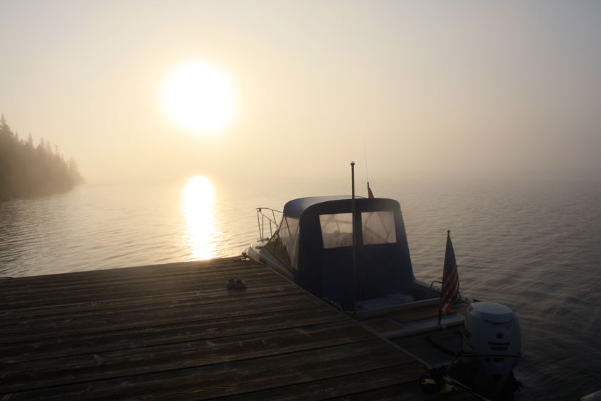
With the wind very calm, we take an early morning departure from Washington Harbor, leaving about 7:35 a.m. EDST. It is a cool morning, and we're wearing hats and gloves. We have 79-miles to go to reach Copper Harbor. Photo credit: John Raby.
DEFIANCE follows about six minutes later. Photo credit: John Raby.
OUTLIER gets away from the dock about 7:45 a.m. Photo credit: John Raby.
MANIC MOMENT heads out a few minutes before 8 a.m., leaving HOLLY MARIE alone at the dock. Photo credit: John Raby.
Having gone a week without a moose sighting, we were very pleased to come across this one, swimming across our path as we departed Washington Harbor. Photo by the author.
HOLLY MARIE arrives at the boat ramp in Grand Portage before noon. The jump across from Isle Royale is only about 20-miles of open water. Photo credit: John Raby.
DEFIANCE, OUTLIER, and CONTINUOUSWAVE are on their trailers and being prepared for highway travel. Photo by Karen Reinders.
DAY TEN
| Date: | Sunday, September 1, 2013 |
| Weather: | Warm |
| Traffic: | |
| Departure: | St. Ignace, Michigan |
| Destination: | Beverly Hills Michigan |
| Distance: | 275-miles by car |
Home Stretch
In the morning light I can see the problem with the truck brakes. There is a leak at the left rear wheel. There is a trail of drips of hydraulic fluid on the pavement of the parking lot, leading to the present position of the truck.
Not much has changed with our situation, except it is Sunday of the Labor Day weekend, and we are 275-miles from home. The next leg of the trip will be almost all Interstate highway, and in our direction of travel there will be very little traffic. We decide to continue driving, as it seems unlikely we could get this problem resolved at 9 a.m. on a Sunday in St. Ignace on Labor Day weekend.
The drive home is actually not much of a problem. Before leaving St. Ignace, we get enough gasoline to make the drive home without stopping. We maintain just the minimum speed, 55-MPH (or less, sometimes). We coast off the interstate at rest areas, decelerate with down shifting, and use the emergency brake to stop. There is practically no traffic going in our direction of travel, and for the first several hours of the trip we are often the only vehicle on the road. The emergency brake does get a work out once we get off the interstate and have to drive about eight miles to our home on surface roads, but somehow we manage. We are back home without incident, after a 600-mile drive without fully working brakes. I don't recommend it, but at the time it seemed like our only option. (Later, I developed an idea for a temporary fix. I also learned that the design of the dual master cylinder braking system on the GM vehicle would have automatically shut off the leaking circuit and reverted to using one of the two circuits. GM had already designed into the braking system as a temporary remedy, and I had more braking power than I realized.)
Today's Sailings
St. Ignace to Beverly Hills
MILES = 275 by car
Summary Data
The total of miles run, engine hours, and fuel used are shown below, along with an accounting of some expenses for the trip.
Boat Fuel Consumption
         MILES  HOURS GALS  MPG  GPH   MPH
TOTAL    231    16.1  83.4
AVERAGE                    2.77  5.19  14.3
Boat Fuel Purchase
Gasoline
LOCATION       GALS   PRICE   COST
The Pines      45.0   $3.80  $171.00
Rock Harbor    25.0    5.61   140.25
Wash. Harbor   13.7    5.61    78.86
------------------------------------
TOTALS         83.7          $388.11
AVERAGES              $4.64

Oil
LOCATION       GALS   PRICE   COST
Lockeman's      2.0   $30     $60

TOTAL (Gasoline and Oil)     $448.11
Dockage and Park Fees
Copper Harbor    66 (two nights)
Isle Royale      64
TOTAL          $130

(The Isle Royale cost is $4/day/person x 8-days x 2-people.
We prepaid for more days than we actually used.)
Highway Expenses
1,200-miles at approximately 11-MPG = 109-gallons
109-gallons at approximately $3.80
Gas   = $414
Tolls =   14
TOTAL = $428
Copyright © 2013 by James W. Hebert. Unauthorized reproduction prohibited!
This is a verified HTML 4.0 document served to you from continuousWave
URI: http://continuouswave.com
Last modified:
Author: James W. Hebert
This article first appeared January 2014.