continuousWave--> Sail-Logs --> North Channel 2012
North Channel 2012
A Week of Following Seas
by Jim Hebert
A narrative with detailed accounts of boat movement and of expenses for fuel, docking, dining, and travel, profusely illustrated with 80 photographs by the author and his cruising companions, of a week of cruising of the North Channel in which a most fortunate weather pattern gives us nothing but following seas.
DAY ONE
| Date: | Saturday, August 4, 2012 |
| Weather: | Warm and sunny |
| Winds: | Light |
| Traffic: | An initial delay, then smooth sailing |
| Departure: | Beverly Hills, Michigan |
| Destination: | Detour Village, eastern Upper Peninsula of Michigan |
| Distance: | 330 miles by highway |
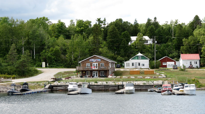
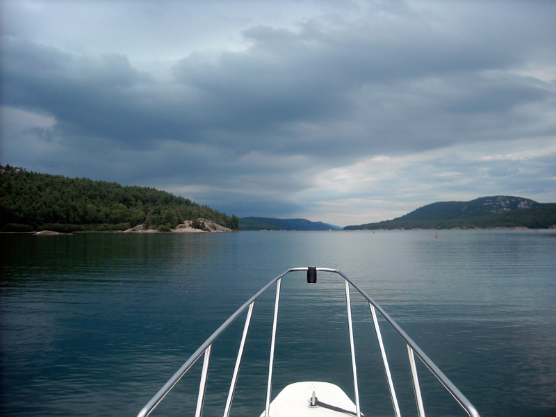
For our 2012 mid-Summer cruise we are returning to the North Channel of Lake Huron, an area we have been cruising almost every summer since 1986, or over a quarter-century. We love the region and have never tired of exploring it. The most unusual aspect of this trip will be our point of departure. Instead of towing our boat to the Canadian side of the Lake, we will begin from Michigan's Upper Peninsula, launching at Detour Village. In the past we have hauled the boat on the highway across the border at Sault Ste. Marie and driven along Lake Huron's North shore to Blind River, an additional 130-miles of driving. This trip we will stop in Michigan, avoid any border crossing delays in the Soo, and cross the border by water in our own boat.
Our one-week cruise circumnavigated the North Channel, visiting each destination only once, except for the inevitable second pass through Little Current. This map was developed from a base map generated by woodshole.er.usgs.gov. All graphics, illustrations, and photographs are by the author unless otherwise noted.
The itinerary for this trip was worked out over the winter in discussion with our fellow cruisers. The goal was to shorten the driving time, particularly for our friends coming a long distance from Minnesota, and to increase our time and distance traveled on the water. I have been a bit reluctant to start from Detour Village because of the long stretch of open water to be crossed to reach Manitoulin Island, but I've agreed to the rally point of Detour Village.
This cruise is our third one-week-long trip of the season, and we have worked out most of the problems with the trailer, the boat, and the cruising gear by this time. As a result, our preparations are more relaxed, but there is always plenty to do before jumping into a week of living aboard a small boat.
The first leg is to haul the boat on the highway to Detour Village, at the extreme eastern end of Michigan's Upper Peninsula. We are on the road by 10 a.m., and the drive up North is routine—for about five miles. We are soon stuck in a rather significant delay as the three-lane Interstate-75 highway is reduced to one-lane for some local road repairs. At noon we make a few cell-phone calls to report our position and see how far ahead our mates might be. It looks like we'll be the last to arrive in Detour Village.
We reach the Straits of Mackinaw around 3:00 p.m., cross the five miles of the straits on the beautiful Mackinaw Bridge, and continue northward. The exit from the Interstate for Detour is ten miles past the bridge, and from there we are on a two-lane highway heading east, often right on the coastline. A State Police cruiser pulls onto the road behind us; we'll be obeying the posted speed limit all the way to Detour.
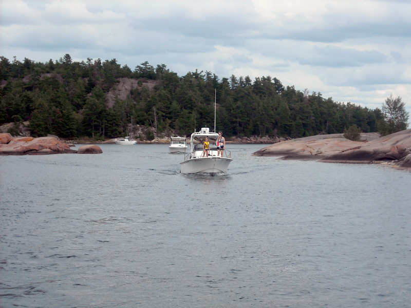
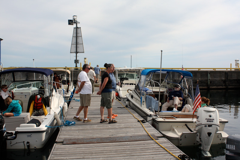
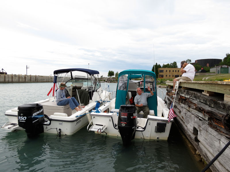
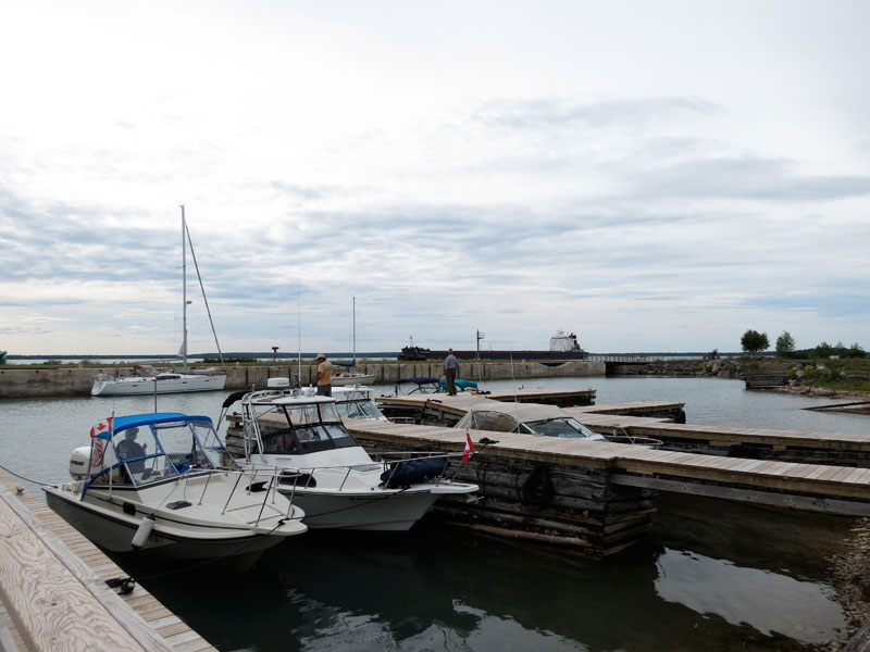
We're the fourth boat to arrive at the rally point. Kevin on OUTLIER, a new 23-footer on its maiden week of cruising, has also driven up from the Detroit area. Elsa and Don with LITTLE ZEPHYR, a 22-footer very similar to our boat, have arrived from Mullet Lake, Michigan. This will also be their initial week of cruising on their new boat. And John, Holly, and Emmarie, despite starting from Minnesota, have also beaten us to the ramp, and have already launched the 23-foot HOLLY MARIE. Our other companions for the cruise are nearby. Dave and Kathy live just ten miles away, and they will be launching their 21-footer WALKABOUT tomorrow. Hal and Margaret are staying at their place, and will also launch their 20-footer, EASTPORT, tomorrow.
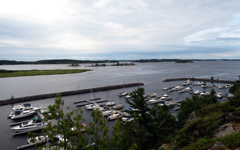
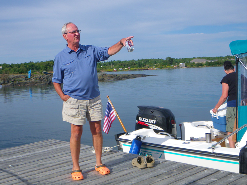
The launching ramp at Detour is adjacent to the marina, but not part of it. To the marina from the ramp by water is a distance of 200-feet, but on foot it is a half-mile walk. We carefully prepare for launch, being certain we are not leaving anything in the car that we'll need to come back to retrieve later. The ramp has a steady stream of boat launching and loading, perhaps more than usual because there is a fishing tournament in progress this weekend. We wave several boats past us in the line to launch, as we are taking our time getting prepared. Converting our boat to water-ready from highway-ready involves setting up the canvas and its frame, installing some electronics, and moving some gear to the boat from the car. We take our time.
In trailer boating there are three phases. When the boat is on the trailer and being towed, it is in highway mode. When the boat is in the water and ready to cruise, it is in cruising mode. But at the beginning and end of a cruise the boat must transition from the trailer to the water and then back again. This is an amphibious mode where the boat is changing from being on the land to being in the water, or vice-versa. It is often during this transition that problems can occur.
OUTLIER is the first boat and crew to arrive. Kevin makes arrangements with the marina for our slips. The Pursuit 235 Offshore is on its first big cruise. Photo credit: Kevin Albus.
HOLLY MARIE, a Boston Whaler 23 Walkaround with Whaler Drive, is next to arrive, towed from Minneapolis on a long highway journey by John, Holly, and Emmarie. Photo credit: Kevin Albus.
Don and Elsa on LITTLE ZEPHYR, a Boston Whaler REVENGE 22 Walk-Through join the fleet. Photo credit: Kevin Albus.
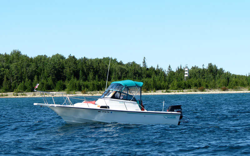
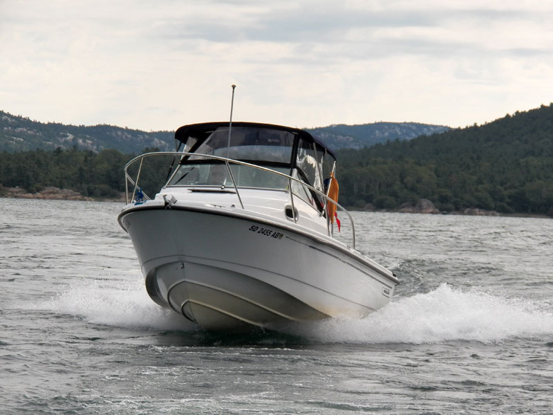
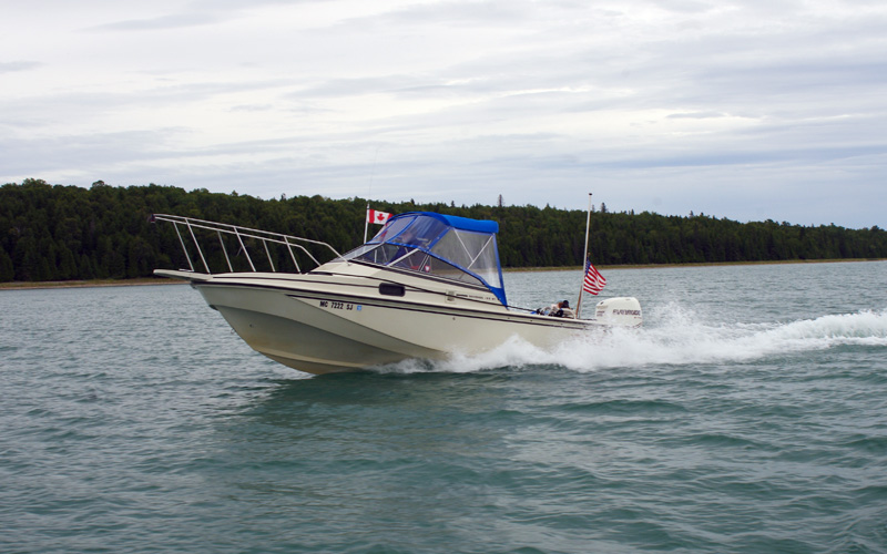
Fourth to arrive, CONTINUOUSWAVE takes to the water. Chris makes the lines secure, and your author comes over to go aboard the Boston Whaler REVENGE 22 Walk-Through with Whaler Drive. Photo credit: Kevin Albus.
In our boating travels we seldom use the same boat launch ramp twice. Each launch or load is typically our first at a particular ramp site. And every ramp is different. Ramps have different approaches, different parking, different slopes to the ramp itself, different lengths of the ramp underwater, different depths of water, and different lengths and heights of docks. Before we use a ramp we generally take a survey of the ramp length under water to identify how far we can back in the trailer. And we give a careful look to the dock and how far it extends. In the transition from land to water there is opportunity for errors and problems. You are moving a large object that weighs over 4,500-lbs, using only your own strength, perhaps assisted by a small winch. On the incline of a launching ramp, gravity tugs at the boat to come off the trailer, and this force is restrained only by the most modest of rigging. Each launch or loading is an opportunity for big problems to occur if all steps are not done properly. There is always some apprehension when we reach this amphibious transition. To avoid problems, we try to be slow, careful, methodical, and thorough in our preparations.
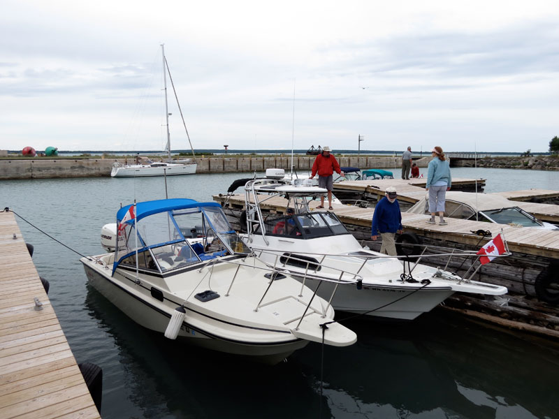
After a successful launch, I move the truck and trailer to the parking lot. The ramp's lot is full, but an enterprising neighbor has set up a large overflow trailer parking lot on his property. Due to the fishing tournament, even the overflow lot is crammed with trucks and trailers, and I squeeze into one of the only remaining spaces. Then it's back to the boat, and the very short cruise over to the marina, where we tie-up in Slip 87, joining our friends at the end of the long pier. This will be it for boating today. We spend the rest of the afternoon puttering with the boat gear at the dock, getting everything prepared for tomorrow's cast off.
The fleet's crews take a walk to town for dinner We have a nice meal at the local tavern, THE MAINSAIL. They serve up delicious whitefish ($16), some cold beer, and provide a break from the warm summer sun. After dinner we hike over to the truck for some last minute changes in equipment, and also to leave a check for the week of parking. It's $5-per-day, a fair price for the convenient location adjoining the ramp. It is only on this second trip that I realize I have parked next to John's truck and trailer, an impressive rig with its dual-wheel-rear-axle one-ton truck and big float-on trailer. I didn't notice the Minnesota plates when I pulled in a few hours ago. It is always surprising how big boats and their trailers can look on land and how small they can seem in the water.
After dinner I do more cruise planning. I listen to the weather forecast, which has been a topic of conversation all afternoon. The predicted wind for tomorrow is from the west and northwest with wind strength rising to 40-knots by afternoon. I connect to the internet so I can transfer the latest GRIB model data to my laptop and see for myself what might be coming. Using the versatile computer-based navigation program POLARVIEW NS, I can display wind vectors on my NOAA chart and move ahead in time in three hour increments for six days in advance. I see the same discouraging news I heard on the radio. The GRIB model shows that by 4 p.m. tomorrow the North Channel will have a very strong northwest wind with speeds to 40-knots. That is not small-boat weather. But for now, we have a very calm evening, and we get a good rest.
I like to summarize fuel and distance information each day. On the highway trip we stop near Graying, Michigan, at Charlie's Corners to purchase boat fuel. They are selling RECREATION-90 grade no-ethanol fuel there. We add 40-gallons at $4.15/gallon, bringing our tank level on the boat to 61-gallons. Prior to leaving home, I also added 35-gallons of ethanol-gasoline blended fuel to the truck, taking advantage of a substantial discount being offered, and paying only $1.97-per-gallon. That fuel has brought us to Detour in the truck without refueling.
DAY TWO
| Date: | Sunday, August 5, 2012 |
| Weather: | Changing |
| Winds: | West 20 and building westerly |
| Waves: | Two-footers |
| Departure: | Detour Marina, Detour Village, Michigan |
| Position: | 45° 59.785' N 083° 53.977' W |
| Destination: | To be determined, somewhere on Manitoulin Island, Ontario |
| Distance: | 45 to 85 miles by boat |
Weather
We awake to a beautiful clear blue sky and only a light and gentle breeze off the land to the west making just small ripples in the water of the marina. We have set our departure for the usual ten o'clock. The four boats and crews in the marina will be ready to go by then, but we have to wait for the last two boats to arrive and launch. As the morning wears on, the wind picks up, and clouds begin to form. This is one day that leaving earlier would be a big advantage. I get more updates on the weather via a GRIB download. It shows the present wind to be about 20-knots, but the speed will be increasing all day. The sooner we go, the better.
At 8 a.m. the weather looks very benign, with clear skies and only a moderate breeze. The crews are just awakening. Photo credit: Kevin Albus.
Our two other boats arrive at the ramp just before ten o'clock. We signal to them that we are ready to go, and to not come over to the marina—we can't afford to wait any longer. As the final boat hits the water at the ramp, we are pulling away from the dock and heading out for open water. By this time the skies are filled with gray clouds, and the wind, even in the relatively protected area of the marina, has picked up to 15-knots.
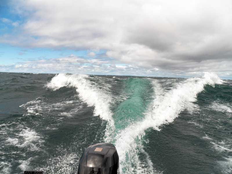
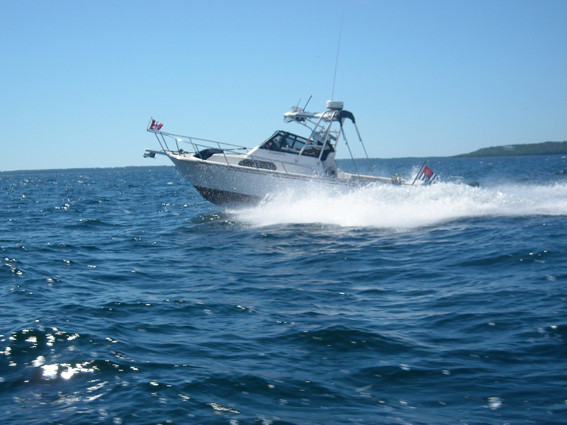
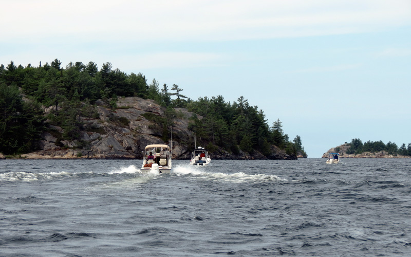
From the marina we turn north and head upstream on the St. Marys River, then northeast into Potaganissing Bay. Although in the lee of St. Joseph Island, the bay is filled with white capped waves. We pause for a few minutes to let the tail-enders in our fleet close up ranks. Conversation on the radio is discussing a stay-or-go decision. I have some experience in going downwind in the North Channel in big waves, and I know that once you get about a mile downwind you will be very unlikely to turn around. To go upwind into big waves is much more difficult than to go downwind, and our boats, mostly Boston Whaler boats, are renown for their excellent handling when going downwind and with the waves. They are not known for being great at crashing into big head seas. In this weather, going upwind is not much of an option. Going downwind will be much easier. I propose we give the North Channel a look. Although I expect to find the wave height to be rather impressive, I feel that the boats can handle what is out there now.
Just before 11:00 a.m. we leave the protection of Potagannissing Bay at Chippewa Point, heading a bit to the north to clear Chippewa Bank, and then we turn east. At this point the waves are running three-feet or more, and they're on our stern. We can get the boat on plane and run comfortably on plane at about 24- to 25-MPH. This leg will be the farthest north on our trip today, and once clear of Drummond we can continue east but allow some drift to the south.
Ahead of us are three options for a destination. Closest is the ghost town port of Tolsmaville on very sparsely populated Cockburn Island. There is not much there but a break wall and a dock, although I can't say for certain as I have never visited. Next is the small town of Meldrum Bay on Manitoulin Island. The marina there has been recently improved, and that is a good thing—it needed it. On our last visit, twenty years before, the docks were leaning and the harbor was not well protected. Images on GOGGLE EARTH don't show much improvement, but there has been some mentions of new docks and break walls. Exactly what we might find in Meldrum Bay remains a bit of a mystery at this point. Beyond Meldrum Bay and past Cape Roberts is Gore Bay, perhaps the biggest town on Manitoulin and home to the best marina facility. In my mind, this is the real goal for this leg of the cruise. Although it will be a long run of 85-miles, it would be my choice if conditions permit.
With Gore Bay as a possible destination, I try to keep our course as far to the north as we can manage in the seas. I don't want to drift too far south and then have to fight upwind to regain lost ground to clear Cape Roberts. But once past Drummond Island, the course line begins inevitably to ease to the south, putting us dead downwind and heading about 135-degrees. We cross the gap between Drummond and Cockburn, and more seas roll in from the south, coming up the False Detour Channel. We approach Cockburn Island's northernmost point, but we leave it two-miles to our Starboard. I turn more to Port, and we begin to make good a course over ground of about 100-degrees. I can see Cape Roberts, some 25-miles ahead and bearing 095-degrees-True, and I try to aim for it. Later our track will show we would have missed it badly, as we continued to make good a course of about 102-degrees, being continually set to the south by the sea conditions.
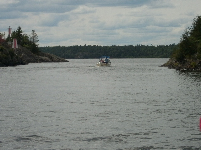
This is the view astern as WALKABOUT, a Boston Whaler 21 Walkaround, is coming over a wave around Noon, just north of Cockburn Island. There are clouds everywhere, but we are still in sunshine. Waves never seem to photograph well, usually looking much smaller than they really were. Photometric analysis shows this wave to be a 7-footer. Photo credit: Kathy Hart.
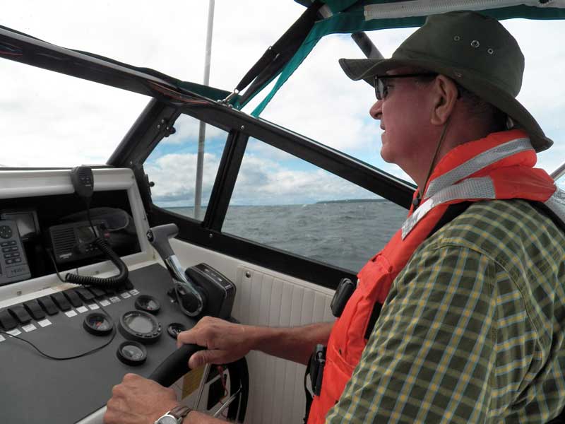
Although David has two hands on the wheel in this image, for most of this leg it will be one hand for the wheel and one hand for the throttle. Running in these big following seas requires a lot of adjustment of engine power. Wearing a PFD is a good idea anytime but especially today when the boat can be tossed around in the seas. Cockburn Island is seen about two miles to the south through the side window, and Manitoulin's shores can also be seen to the left. Photo credit: Kathy Hart.
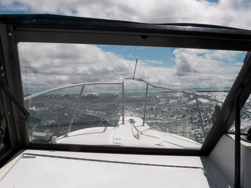
The windshield serves as a frame for the seas and land. Do we go to Meldrum Bay, the closer darker headland to the right or continue on to Cape Roberts seen grayer and in the distance dead ahead? And do you see the four boats just ahead? No, they're lost in the big seas. Photo credit: Kathy Hart.
So far we have been lucky in several respects. The wind, while strong and getting stronger, is at our backs, and we are able to make good progress downwind. We have had to reduce speed as the waves have grown, and we are now running about 16 to 18-MPH in order to stay most comfortable in the big seas. All six boats are still running and have not reported any major problems. On LITTLE ZEPHYR the main radio has lost power, but they're communicating with a handheld radio without difficulty. On WALKABOUT there has been a problem with the GPS receiver, but it is not affecting their progress. The six boats have become stretched out in a long line, and with the high seas it is hard to see more than a few hundred feet astern. I depend on the radio to confirm that there are still five boats behind me and still following. I have not actually seen any of them in a while, other than HOLLY MARIE, who was not far behind us up to now.
The weather has been most remarkable. All around are dark clouds that threaten rain, but by very good fortune we seem to be staying in a window of open sky and strong sunshine. This makes the experience much more pleasant and tolerable. If it were raining and dark, we would likely have never left the marina.
Next we cross the gap between Cockburn Island and Manitoulin Island, the famed Mississagi Strait, often the home of rough seas and very odd compass indications due to magnetic anomalies in the area. Again we encounter waves rolling in from the south, indicative of big seas on the open water of Lake Huron. Once past this gap we approach Manitoulin Island, now about 2.8-miles to our Starboard.
Just after Noon (12:30 p.m.), I slow the boat down to about 10-MPH, keeping station in the waves more or less, and letting some of them run through us, while I get on the radio. I inform the fleet I am going to try to raise Meldrum Bay marina to see what the conditions are like there, and I switch to Channel-68, where I call them several times without answer. I report back that I could not raise the marina on the radio, and we don't have any idea what conditions are like there. With my experience that the harbor is not well protected, I am not too enthused about spending the day and evening there being tossed about at a dock. I'd rather keep pressing on if we can't confirm what awaits us in Meldrum Bay. I'd rather not waste time going down there to look for myself, and fighting our way back out and to the north would be difficult. I am inclined to want to continue on, heading for Gore Bay.
At this moment two events occur almost simultaneously. First, a set of three really big waves, perhaps eight-to-ten footers, roll past, and awaken in me a sense of just how bad conditions are already in the open water. The harbor at Gore Bay is still some 43-miles ahead. We have only come 42-miles at this point, not even half way. I am already getting tired of running the boat in these conditions. There is no possibility of taking a break in these seas, and Gore Bay is probably three-hours away. Next, from the back of the fleet there is a bit of revolt. Don calls in from LITTLE ZEPHYR to say he is going to head for Meldrum Bay, as he thinks it to be the best option for him, his crew, and his boat at this point. The radio call comes at the same instant as the third wave, and as I watch that big wall of water plow eastward, I make a decision, too. "Let's go to Meldrum Bay and see what we find," I call to the fleet on the radio, and I turn right, get back on plane, and head for Meldrum Bay.
Our course line is now about 165-degrees, causing the boat to run across the face of the big seas. Traveling like this is akin to surfing. I soon find I have to jam on more speed to keep my position on the face of a big wave approaching from astern, and the boat is surfing across it like a surfboard at Molokai. We ride that big wave for a long time before finally getting out of its grip. About two miles out from the marina we find calmer water, and my radio call gets through to the harbormaster. They report a beautiful day in their harbor—no waves, no wind, and just what we want to hear. It is full-speed-ahead for the marina.
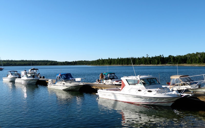
In the two decades since my last visit, but only very recently, the harbor at Meldrum Bay has been significantly upgraded by the construction of a very substantial curved break wall, finally giving the marina and its dock protection from all seas from the north and northeast. And to our great surprise and substantial benefit, all the docks at the marina have just been rebuilt and replaced only a few days prior to our arrival. On the radio I inform the harbormaster we have a group of six boats approaching and seeking overnight dockage. I think at first they are worried, as the normal size of a boat cruising the North Channel is typically 40-feet or longer, and they express some concern if they'll have room for us. I explain that our fleet is all outboard boats, from 20 to 25-feet in length, and their apprehension is removed. Yes, they'll have room for us all, and can even fit us on one dock, all together.
I don't think there have ever been six Boston Whaler boats and crews more happy to call it a day and tie up at a dock by 1:30 p.m. than we are. The docks are wonderful new floating docks, the harbor is a mill pond, and there isn't even a strong breeze in the marina. We are done with ten-foot waves for the day.
Upon arriving at the dock at Meldrum Bay, we must first clear our entry into this foreign country with the Canadian Customs and Immigration authority. The marina office has a dedicated telephone for making a call. Each boat captain must call in and report their entry into Canada. We each in turn make the call, describe our vessel and crew, and receive the necessary clearance, including a clearance number which must be recorded in the ship log and displayed when in Canadian ports.
We all enjoy lunch at the dock, and then we take stock of the boats. HOLLY MARIE needs a bit of repair. Running in the big seas she buried the bow, putting green water on the foredeck which ran up the windshield and busted out the plastic extrusion that retained the windshield canvas. Most of the extrusion is still intact, and it just needs to be reinstalled. John borrows a cordless drill from a well-equipped cruising vessel on our dock, and makes repairs. Don sorts out the problem with the loss of power to his main radio. Dave investigates the lost connection to the GPS. Kevin explores Meldrum Bay. Hal takes his dog Gracie for a walk. Since I don't plan any further boating today, I have a beer for lunch and enjoy the afternoon.
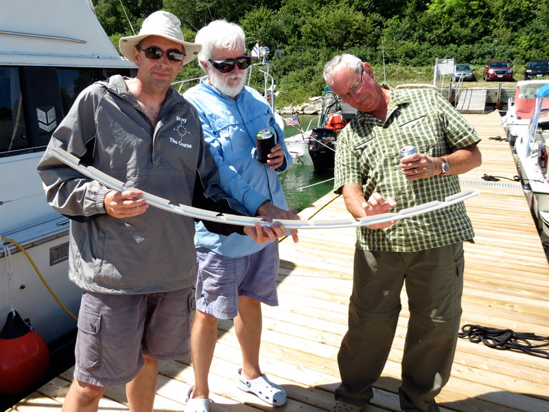
John (left) holds the only damage from our rough trip: a plastic extrusion that retains the upper part of the windshield canvas that was pulled out of the hardtop by green water coming on deck. Your author and David (right) look on. The extrusion was reinstalled by making new mounting holes for it to replace the ones that had broken out. Take note of the just-installed new docks and their unweathered new wood; they are a great improvement to the harbor. Photo credit: Kevin Albus.
John makes repair to the windshield canvas system on HOLLY MARIE while Kevin and Chris watch. Photo credit: Kathy Hart.
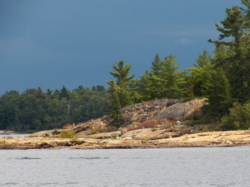
The new break wall at Meldrum Bay, with the Inn in the distance. Photo by Kevin Albus.
This view shows all of downtown Meldrum Bay. The marina office is on the left. These local-boat docks are tucked in behind the break wall and are better protected than the transient docks to the south. Photo credit: Kevin Albus.
By late afternoon the forecasted 40-knot winds must be arriving because even in the marina the wind has increased noticeably and a there is a bit of surge rolling in from across the bay. On the eastern side of Meldrum Bay a lot of water is being blown in, with big waves crashing ashore. Some of that wave action comes back across and rolls into the harbor.
Only two other boats arrive at Meldrum Bay this afternoon, both rather large sailboats and both with shorthanded crews. KOKOMO, a Schock 55-foot, 10-foot-draft racing sailboat with the owner and his wife aboard, arrives first. Next TOTALLY BLOWED, a 47-foot Hunter-466 cruising sailboat arrives, again with just husband and wife for crew. They look extremely glad to be in the harbor and out of the North Channel's big seas.
For only the second time in 25-years of cruising the North Channel, we get a visit from a law enforcement agent who wants to see our entry clearance numbers. It seems that the Royal Canadian Mounted Police just happen to be visiting Meldrum Bay this weekend. They have trailered two boats from Sault Ste. Marie, launched them here, and are operating in this area for a few days. As usual, the demeanor of the Canadian officer is friendly and informative. Compliance with his request for our clearance number is simple and results in no complications.
Around 4 p.m. we conclude that there is now too much wind to cook out on our grills. The best option will be for us all to go to dinner together at the MELDRUM BAY INN, just a short walk up the road. We make dinner reservations for the entire group of 12. Around 6 p.m. we enjoy a dockside gathering for cocktails and appetizers. Later we move to the Inn and have an excellent meal. The fish-and-chips ($17) are highly recommended, and look perhaps better than the whitefish dinner ($19).
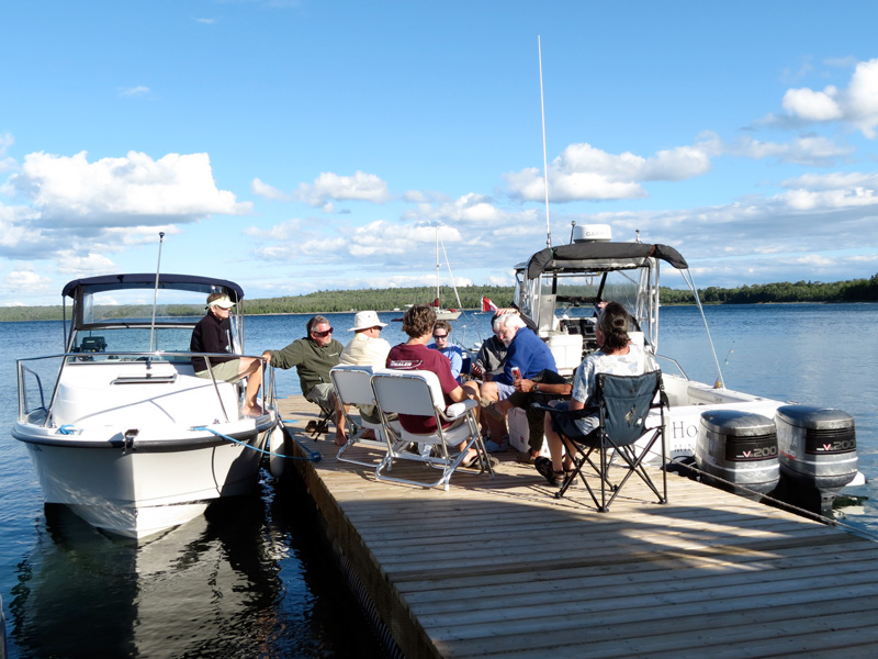
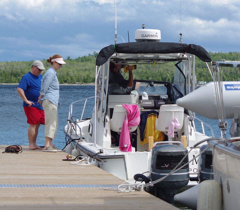
The boat crews enjoy late-afternoon cocktails on the dock. Although it is mid-Summer, the cool breeze has a chill in the air. That's EASTPORT, a Boston Whaler 205 CONQUEST on the left, with Margaret on deck and Hal on the dock. Photo credit: Kevin Albus.
Whether to cook-out or go to a restaurant for dinner during the cruise has been a topic of discussion. Some boats have planned for cooking a lot of meals, and others, like ours, plan to enjoy some restaurant meals during the week. We are leaving it up to each boat to suit their own preferences.
As the evening comes on the winds drop. The surge in the harbor goes away, and we have a perfectly fine sleep aboard. It has been quite a first day of the cruise, but all boats and crews have come through the rough weather in fine shape and without any lasting effects.
It is an odd thing, but it often happens that the first day or first part of a passage turns out to give the worst seas and the best test of the boats and crews. For everyone involved today, I think these conditions are probably the biggest waves these boats have seen. We were fortunate to be going downwind, otherwise I suspect we'd be back in Detour Village for the night. But all crews are probably now more confident in the abilities of their boat to handle rough conditions.
Today's Sailings
Today's sailings are summarized below
TRIP = 47.1-miles
TIME = 02:56:38
FUEL = 21-gallons
MPG = 2.2-MPG
MPH = 16.0
DAY THREE
| Date: | Monday, August 6, 2012 |
| Weather: | A beautiful morning |
| Winds: | Southwest 15 |
| Waves: | 1-meter or less |
| Departure: | Meldrum Bay Marina, Manitoulin Island, Ontario |
| Position: | 45° 55.523' N 083° 6.850' W |
| Destination: | Little Current, Ontario |
| Distance: | 70 miles by boat |
Weather
Each morning we generally begin by listening to the continuous marine broadcast from the Canadian Coast Guard. I usually take careful notes, but on this cruise I am becoming very lax in my journal. The big wind of yesterday has gone, but there is still a fresh breeze from the southwest. Fortunately today we will be in the lee of Manitoulin Island for the entire run, and we won't face any significant wave conditions. What wind we do have will again be on our stern. The morning sky is cloudless.
All six boats at the transient dock at Meldrum Bay—the day begins with another cloudless sky, but a fresh breeze from the southwest. The gap along the dock was occupied by a trawler. Like many slower-moving boats, they have left early. Photo credit: Kevin Albus.
The docks are new, but the electrical distribution is still somewhat rustic. A single 30-Ampere outlet serves the entire dock from the head of the pier. Kathy plugs in the coffee-maker to make the morning brew. Photo credit: Kevin Albus.
There is agreement among all boats that a ten o'clock departure is the norm, and on this fine day we are all ready as that hour arrives. We depart Meldrum and head east. Instead of going directly to the open water, I take a diversion to cruise south of Vidal Island. From there we run on plane about nine miles to Cape Roberts. We stop in the lee of the cape to let the group reform, then we head on to Clapperton Island Channel, a run of 25-miles due east and right on the 46th parallel of latitude.
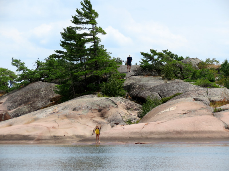
WALKABOUT idles along in the lee of Cape Roberts, whose lighted tower is seen in the background. Photo credit: Kevin Albus.
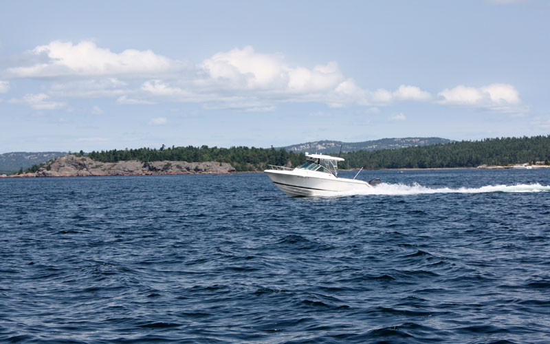
HOLLY MARIE enjoys some blue water boating. It's a 25-mile straight run to Clapperton Island passage. Photo by the author.
After safely passing through the narrow channel on the western approach, we divert into Clapperton Harbour to anchor for lunch. In the lee of Harbour Island we raft up six-boats-abreast, and break out our lunch stock. It is a very pleasant day, and most everyone jumps in for a swim. The water temperature is about 73-degrees, and that is about as warm as it ever gets in this area.
In the lee of Harbour Island we raft up for lunch and a swim. Photo by the author, while treading water.
The Harbour Island Yacht Club's most famous member, patron, and eventual owner was Benson Ford. Things have been going downhill since its heyday in the 1960's when membership peaked at 2,000 in 1962 (according to Majorie Cahn Brazer's cruising guide). Photo Credit: John Raby.
After lunch our next destination becomes the topic of discussion. Some boats wish to anchor out for the evening, and some wish to go to the dock in Little Current. One proposal for an anchorage is Bears Back Island, so we head in that direction. LITTLE ZEPHYR is certain they want to stay at Little Current, so they break away and head there.
As we leave the protection of the lee of Manitoulin, the fresh southwest breeze becomes more apparent, and upon reaching Bears Back Island we see its anchorage is not well protected. We continue on to the northeast, rounding the north shore of Bedford Island, and turning into Bedford Harbour. In the recess of Cutknife Cove there is calm water, but the afternoon breeze is very strong. Several attempts to anchor there are not successful. Although the water is shallow, less than ten-feet deep, the anchors do not get much holding in the mucky bottom. After about 45-minutes of exploration, we abandon the plan. We then exit via the passage south of Schreiber Island, and head south down the Waubuno Channel. For the 2.5-miles of this leg we actually encounter head seas for the first time in the cruise. By late afternoon we finally arrive at Little Current.
On approach to the downtown harbor area, I head for WALLY'S GAS DOCK for fuel. The dock is open, and we tie up without a moment of delay. Fueling in Canada is always a bit of a mystery due to the measurement of fuel volume in liters and the pricing in Canadian currency. We spend about $200 on gasoline, giving us about 3/4-FULL tank. Then it is on to the marina docks for the night.
There is sufficient room on the east docks of the town marina for the latecomers to join LITTLE ZEPHYR, and soon we are all tied up in close proximity on E-DOCK. The big westerly winds have pushed a lot of water down this way, so docking requires a bit of allowance for the strong current running to the east through the marina.
From WALKABOUT comes an announcement; they have a very recently caught Lake Trout that is sufficiently large to provide dinner for all 12 of us, and Kathy plans to cook it for us tonight. A large dockside gathering quickly forms, and we pass appetizers and enjoy a few cocktails while Kathy prepares dinner. Cruising cannot get much finer! The weather is perfect, the company is great, and the fish is wonderful.
Kathy cooks dinner for twelve in the cockpit with this modest grill. Photo credit: Chris Wilson.
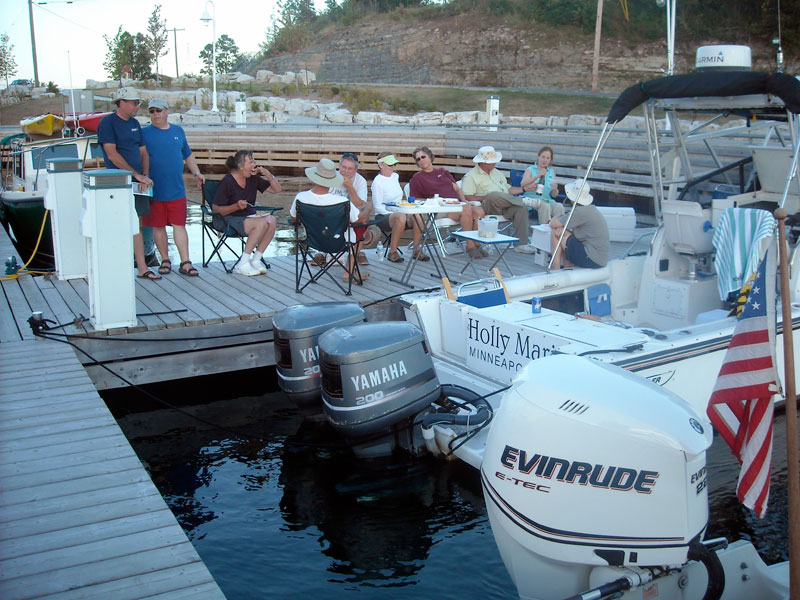
Our dinner party takes over E-Dock in Little Current. Left to right are John, Kevin, Kathy (last to eat), David (back to camera), Hal, Margaret, Elsa, Don, Chris, and Holly. Not pictured: Emmarie (napping) and your author, taking the picture.
Today's Sailings
Cumulative
TRIP = 117.7-miles
TIME = 6:43:40
FUEL = 47.8-gallons
MPG = 2.46
MPH = 17.5

This leg
TRIP = 70.6-miles
TIME = 3:47:02
FUEL = 26.8-gallons
MPG = 2.63
MPH = 18.7

Fuel Tank
REMAIN = 13.3-gallons
ADDED  = 39.3-gallons at Wally's Gas Dock
REMAIN = 52.6-gallons
DAY FOUR
| Date: | Tuesday, August 7, 2012 |
| Weather: | Warm |
| Winds: | Light and variable |
| Waves: | Calm |
| Departure: | Little Current Docks, Manitoulin Island |
| Position: | 45° 58.842' N 081° 55.451' W |
| Destination: | Baie Fine and The Pool |
| Distance: | 25-miles very leisurely by boat |
Weather
I have again neglected to transcribe the forecast. This morning has brought some clouds and a threat of rain, but the afternoon should be sunny, although thunderstorms are possible. The wind is light, perhaps still from the southwest, but it is backing to south and perhaps southeast tomorrow. Some dark clouds roll in about 9 a.m.
The weather has changed to an overcast and cloudy sky this morning. This view is from the hilltop at the eastern end of the docks looking to the northwest and across Little Current's municipal docks. Photo credit: Kevin Albus.
In a morning caucus of captains we decide that our destination will be The Pool, the beautiful but weedy anchorage at the eastern end of Baie Fine (pronounced "bay fin"). Most plan to stay there overnight, and dinner will be cooked on the boats. Chris walks up the hill to the grocery store to buy two steaks for our dinner. With our destination close at hand, we delay departure until about 10:45 a.m., giving everyone a few extra minutes to enjoy Little Current, a wonderful town to visit as a cruising yachtsman. Next, the fleet heads east, past Strawberry Island, across Frasier Bay, and into Baie Fine.
LITTLE ZEPHYR runs on-plane past the Strawberry Island Light on the way to Baie Fine. Photo by the author.
Ahead lays Baie Fine, with Casson Peak on the right. We are again fortunate to be just out of the rain sector of this weather system. Photo by the author.
This view gives a good sense of the vertical scale to be found in Baie Fine. Photo credit: Hal Watkins
Here's the view of the entrance to Baie Fine from the top of Casson Peak. Photo by the author, taken on August 11, 1997, on a previous cruise.
The sun occasionally peaks through the dark sky making for interesting pictures of contrast, like this scene on the shoreline of Baie Fine. Photo credit: Kathy Hart.
CONTINUOUSWAVE and HOLLY MARIE stop for a gam along the steep north shoreline of Baie Fine. Photo credit: Kathy Hart.
At the end of the 10.5-miles of Baie Fine, another even narrower inlet carries you the last two miles to The Pool. Photo credit: Kathy Hart.
From our anchorage in The Pool this is our view to the northwest. Atop all that white quartzite is Topaz Lake. Photo by the author.
For most of the crews, this is their initial visit. For those of us who have been here before, the passage is just as enjoyable. The white quartzite hills are still as beautiful as ever, and the long trip up the narrow bay is a delight. By early afternoon we have arrived. Due to the poor holding in the very weedy bottom, we anchor in two rafts of three boats each. We have lunch, and on HOLLY MARIE the inflatable dingy is launched.
In the afternoon an expedition to Topaz Lake is begun. Five explorers row to the northern shore while I stay with our three-boat raft to keep an eye on the anchor. Topaz Lake is a hidden gem. It is not indicated on most navigation charts but is just to the north. Created by the accumulation of rain water, there is no inflow or outflow. The water of the lake has an elevated pH due to the acidity of the rain, and there is very little aquatic plant growth in the water. This gives the water a startling clarity and a beautiful aquamarine color. It is a challenging hike to climb up the 400-feet to reach it, but Topaz Lake rewards the climbers with the chance for a refreshing swim.
There is a trail from The Pool up to Topaz Lake, and it is a good climb. Photo credit: Emmarie Raby.
Topaz Lake. Photo credit: Emmarie Raby.
Holly, Emmarie, and John at Topaz Lake.
The shore party returns from their expedition to Topaz Lake. The cottage in the background belongs to the Evinrude family and is built on two small islets in The Pool. Photo by the author.
LITTLE ZEPHYR departs in the late afternoon to head for Killarney, another great town to visit. Don has spent many years as a boy cruising this area with his father, and he wants to revisit Killarney for the first time in several decades. When the Topaz Lake expedition returns, we row a line between the two rafts of boats, pay out our anchor rodes, and haul the two rafts together for a dinner cookout. The setting is beautiful, the just-bought steaks are delicious, and the evening is most pleasant. As night comes, we separate back to two rafts and button-up for the night. The sky is clear and the star gazing is excellent. After midnight a red-green twinkling CAPELLA rises in the northeast.
To join the two separate rafts for dinner, we row a long line between them so we can haul the boats together. Photo credit: Kathy Hart
With the five boats rafted together, preparation are made for dinner and for some fishing. Photo credit: Kathy Hart
Emmarie catches some panfish. Photo by the author
Today's Sailings
Cumulative
TRIP = 142.5-miles
TIME = 8:55:30
FUEL = 55.1-gallons
MPG = 2.59
MPH= 16.0

This leg
TRIP = 24.8-miles
TIME = 2:11:50
FUEL = 7.3-gallons
MPG = 3.4
MPH = 11.3

Fuel Tank
REMAIN = 45.3-gallons
DAY FIVE
| Date: | Wednesday, August 8, 2012 |
| Weather: | Cool, but still fair weather |
| Winds: | Calm, but building to strong southeast |
| Waves: | 1- to 2-foot |
| Departure: | The Pool, north Shore of Lake Huron, Ontario |
| Position: | 46° 2.864' N 081° 28.643' W |
| Destination: | Little Current and thence
to Spanish River, Ontario |
| Distance: | 60-miles by boat |
We awake to a calm morning with clear skies. The wind has flipped around to the east. That is usually a sign of disturbed weather, but so far we have no rain and the wind is light. The sun has to rise quite a bit to penetrate into this high-walled anchorage, and for a while it only illuminates the surrounding hills.
At 6 a.m. we awake in a quiet anchorage and enjoy a cup of coffee in beautiful surroundings. Photo credit: John Raby.
Our three-boat raft was securely anchored all night, but the rode has picked up an incredible collection of aquatic plants. The ones seen here are just the beginning of 70-feet of vegetation that had to be pulled off. Photo credit: Kathy Hart.
To make our scheduled 10 a.m. departure I begin to haul the anchor about 9:30 a.m. The rode is covered with weeds, which must be stripped off by hand and cast overboard. Finally the anchor comes up, with 30-lbs of mud and weed attached. It is a laborious process to clean the gear and get it stowed. Now we are off to the west and Little Current. We have been in touch by radio with LITTLE ZEPHYR and will rendezvous with them there.
After a slow exit from The Pool, we increase speed in Baie Fine. Here is EASTPORT on plane. Where did all those blue skies go? Photo credit: Kathy Hart.
By the time we reach Frasier Bay the blue skies return. OUTLIER runs on-plane for Little Current with the La Cloche Mountains in the background. Photo credit: John Raby.
Traffic approaching Little Current from the east is regulated by the opening of the Swing Bridge for 15-minutes on the hour, unless your boat is small enough to pass under. We arrive at 10:40 a.m. and have unencumbered access to the open dock spaces while the larger boats wait. Photo credit: Kathy Hart.
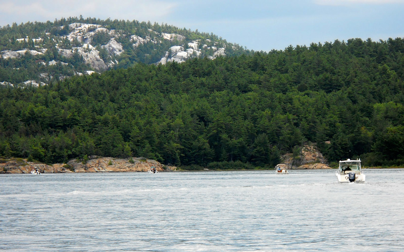
We arrive at Little Current in the late morning and grab some empty slips on E-Dock to tie up for a pit stop. Boat crews scramble for the bathrooms, and then on to more grocery shopping and re-provisioning. The fuel dock is extremely busy, and I abandon my plan to top off here. It is hard to pry all six boats off the docks, but well past noon we are finally underway again. We cruise at speed for about an hour to the anchorage at South Benjamin Island. With the wind light and from the east, we have a good spot for lunch just off the east shore of the harbor near its entrance. We form a six boat raft with two anchors out at the bows. The pink granites of the Benjamin Islands make a nice backdrop.
After lunch we go ashore by various methods. Some take a dingy, some swim, and Gracie the dog floats in on a throwable cushion. The close-by rocks and coves are explored. Not all are ashore, and good thing, as the wind shifts a bit, blowing our raft around and putting the boats in very shallow water. We make a quick retreat to the boats, start the engines, and motor the raft back to deeper water. It is time to continue the cruise.
We anchor for lunch, but not as close to shore as this telephoto shot makes it appear. Photo credit: Kevin Albus.
After lunch it is time for a swim ashore. Getting out of the water and onto the smooth rocks is more difficult than you might think—below the water they're covered with a slippery slime, and footing is very tentative. Photo credit: Kevin Albus.
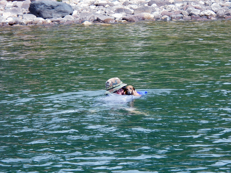
Hal performs his daily ritual: swimming Gracie ashore on a floatation cushion. Photo credit: Margaret Watkins.
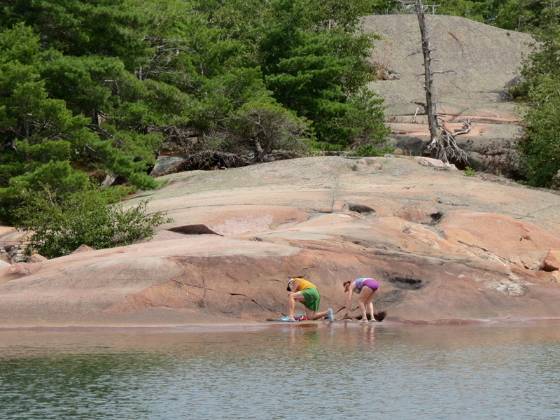
Emmarie and her Dad explore the pink granite shores of South Benjamin Island. At age 62 I find it fun to explore these unihabited islands; I think at age 8 it must be a total blast. Photo credit: Kevin Albus.
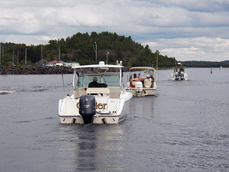
From South Benjamin Island we loop back to the east, cruise along the shore, and enter the anchorage between South Benjamin Island and North Benjamin Island. There are many cruisers at anchor here, but we are just passing through. We take a narrow but deep unmarked passage out of the anchorage at its northwest end, and continue westward. We cruise on plane at speed to Little Detroit, where we pass through the 75-foot wide gap blasted into the rocks. From there we turn north to visit the Spanish River and the town of Spanish, which has a nice marina facility.
We leave the Benjamins via this narrow passage. It is quarter to four in the afternoon and the weather is going sour. Photo by the author.
We transit Little Detroit going east to west. The range guides you through a narrow gap in an underwater rock wall which otherwise would completely obstruct the passage. Photo credit: Emmarie Raby.
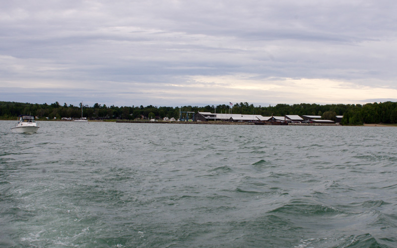
With the low water level, the trip up the Spanish River is undertaken carefully. Our SONAR indicates less than two-feet of water below our keel. The Spanish marina is a nice facility. We tie up at the fuel dock and take on some gasoline. It's almost a dollar-per-gallon more expensive than at Wally's in Little Current, but I want a comfortable reserve for the run tomorrow to Thessalon. The dockmaster works out dock assignments for the fleet. We end up on the dock farthest from the showers and bathrooms but in a close group. It is a five minute walk from the boat to the bathhouse.
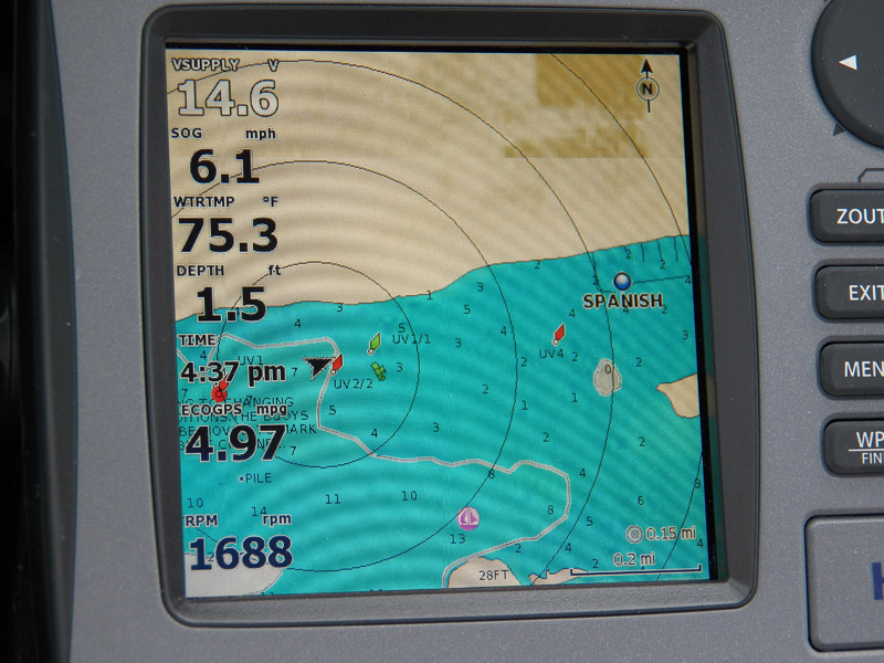
The chart says there should be 6-feet. The depth sounder says the bottom is only 1.5-feet below the keel. We proceed with caution. Photo credit: Kathy Hart.
The fleet idles into Spanish Municipal Marina. Photo credit: Kathy Hart.
Dinner plans again are split. Don and Elsa are going to hike into the small town of Spanish, about 1.5-miles down the road, and look for a restaurant. The rest of us will have another dockside cookout. Chris pulls up some sausages from the cooler, and all crews share various nutritious side dishes. It is another fun evening on the docks.
The water in the marina at Spanish is dark from the tanin in the river. We had an evening dinner on the dock in extremely calm conditions—literally not a ripple on the water. Photo credit: Kevin Albus.
Today's Sailings
Cumulative
TRIP = 201.8-miles
TIME = 13:04:48
FUEL = 74.3-gallons
MPG = 2.7
MPH = 15.4-MPH

This leg
TRIP = 59.3-miles
TIME = 4:09:18
FUEL = 19.2-gallons
MPG = 3.1
MPH = 14.3

Fuel Tank
REMAIN = 26.0-gallons
ADDED =  18.5-gallons at Spanish Marina fuel dock
REMAIN = 44.5-gallons
DAY SIX
| Date: | Thursday, August 9, 2012 |
| Weather: | Fair, some clouds |
| Winds: | East-10 and becoming stronger |
| Waves: | Building to 2-foot |
| Departure: | Spanish Marina |
| Position: | 46° 11.017' N 082° 21.676' W |
| Destination: | Long Point Cove,
thence to Thessalon, Ontario |
| Distance: | 63 miles by boat |
Weather
Recreational Boating Forecast for the North Channel
issued at 0500 9 August 2012.

Strong Wind Warning in effect. Wind northeast 15 increasing to
northeast 20 by mid-day and then increasing to
northeast 25 by Friday morning. Chance of rain.

Great Lakes Forecast, northern Lake Huron: Wind northeast 15
increasing to northeast 25 later today and then to
northeast 30 on Friday.

Wave height forecast for northern Lake Huron: Waves 0.5-meter
increasing to 1-meter, then increasing to 2-meter by midnight
and to 3 to 4-meter on Friday.
Our good fortune with the winds and waves continues to hold. The forecast has some scary predictions, but we will be heading west and be on the north shore of the North Channel. Winds from the northeast will be on our stern and not have much fetch to raise big waves for us.
Everyone seems to visit the showers this morning, as it is cool and cloudy outside. The Spanish marina facility is large and has a big shower room with about ten showers. I don't think we will be swimming today unless it gets a lot warmer.
Kevin hiked to the top of the hill at Spanish Municipal Marina to get this nice view of the many islands to the southwest. Our boats are at the extreme right; the marina facilities are out of frame to the left. Photo credit: Kevin Albus.
We depart Spanish about ten o'clock and motor slowly down the river channel in the very shallow water. The locals apparently have more faith in the depths, and one of them overtakes us while he is pushing a large wake. With my SONAR showing 1.7-feet below the keel, the last thing I want to see is a two-foot wake rolling under the boat; it's a good way to put the outboard skeg on the bottom. I guess the locals are in more of a hurry than we are.
Once out of the shallow channel, we still continue rather leisurely and join up with the Whalesback Channel, although we make our own path among the many rocky islands to give us a different view. As noon approaches we have cleared the Whalesback and are coming to Long Point. We turn inland and enter a nice anchorage. Although not named on the charts, it is known among cruising boats as Long Point Cove. There are already three boats at anchor here. The cove has calm water but there is a strong breeze from the northeast. We set anchors from two boats and raft up six-abreast for lunch.
Instead of following the marked route, we work our own way among the islands of the Whalesback Channel, but on watch for the many shoals and rocks, fortunately all well-charted. Photo credit: Kevin Albus.
This rock leviathan is Whalesback Island, which gave the channel its name. In 1822 Lt. Bayfield set up his initial survey campsite here, choosing the barren island to escape the black flies on shore. Photo credit: Kathy Hart.
EASTPORT arrives at our picturesque lunch anchorage, Long Point Cove. Photo credit: Kevin Albus.
After doing this all week we are getting rather good at rafting up for lunch. Photo credit: John Raby.
Long Point Cove is a great anchorage, but today there is a 20-knot northeasterly blowing through it, as evidenced by the flags. Even in the lee of the cockpit canvas they are stretched out. Photo credit: Kevin Albus.
Lunch is pleasant and peaceful. There are some clouds but the weather is fair and the sun is out. The wind is building. After about an hour or so we get a really big gust. The strain is too much for one of the anchors and it breaks out. We motor the raft ahead about 100-feet and reset the anchor. It holds for a while, but another big gust breaks it out. The strain of six boats is too much for it. It's 2:30 p.m. and it is time to go.
From Long Point we continue west running about a mile offshore along the coast. We pass Blind River without stopping; we are bound for Thessalon, another coastal harbor and one we have never visited. Thanks to the lee of the mainland, our 45-mile run to the west is on plane with following seas. Normally I don't like to leave this much boating for the late afternoon, but this time it works out well. It is amazing how the wind has shifted this week to stay at our back. If this breeze were from the southwest, the usually prevailing wind, we would be fighting head seas and cursing our luck. Instead we lope along at 27-MPH with an easy ride and great fuel economy, getting to Thessalon in just over two hours. To battle upwind for 45-miles late in the afternoon can feel like an eternity and make for a very miserable day of boating.
During our cruise along the north coast to Thessalon we encountered only one other vessel, this fishing tug making her way east against the wind and waves. When a displacement hull boat has this much white water at the bow the old timers say she has a bone in her teeth. Photo credit: John Raby.
By late afternoon we are approaching Thessalon, and glad to be there. When it is four o'clock it is great to be at the dock and done with the boating. The wind is really starting to build. We get all six boats on one dock, again the farthest from the showers and also the most exposed. It is too windy to cook and eat on the boats, but we find that the marina has a wonderful large lounge with a kitchen, so we decide to cook dinner indoors. Chris borrows a bicycle and rides to town to buy some more provisions. We did not bring with us much food for grilling out, but we have been able to buy things as we go along. We set up shop in the lounge, and get out of the wind.
Our six-boat fleet takes over the last dock at Thessalon Marina. The two-storey blue-roofed building is the marina bathhouse and lounge. The sailboat TOTALLY BLOWED is on the next dock. The stern flag shows the breeze. It is so windy that I have already stowed my ensign. Photo credit: Kevin Albus.
About 6 p.m. there is a lull in the wind, which seems to have blown itself out for the evening. David Hart offers some direction as Kathy makes plans for dinner. Photo credit: John Raby.
What better place to be at 6:30 p.m. than on your boat, having a beer, and having a gam with your fellow cruisers. Photo credit: Holly Raby.
Dinner is another fine cookout (although indoors), and we are all glad to be indoors for the first time in four days. These group meals are very fun. They build group camaraderie and cohesiveness, cost a lot less than a restaurant, and are generally more relaxing and enjoyable.
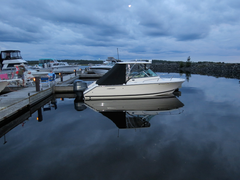
After dinner we put the clubhouse back to the way we found it, and retire to the boats for the night. The dock we are on is exposed to the northeast, but the fetch from the land is so short that only very small waves can build up. Sleeping on the boat will be very comfortable.
Today's Sailings
TRIP = 264.8-miles
TIME = 17:25:42
FUEL = 94.7-gallons
MPG = 2.8
MPH = 15.2

This leg
TRIP = 63.0-miles
TIME = 4:20:54
FUEL = 20.4-gallons
MPG = 3.1
MPH = 14.5

Fuel Tank
REMAIN = 24.1-gallons
DAY SEVEN
| Date: | Friday, August 10, 2012 |
| Weather: | Cloudy |
| Winds: | Northeast 20 |
| Waves: | 2-foot and building |
| Departure: | Thessalon Marina, Thessalon, Ontario |
| Position: | 46° 15.246' N 083° 33.070' W |
| Destination: | Drummond Island Yacht Basin, USA,
thence to Lime Island State Park. |
| Distance: | 45 miles by boat |
The wind continues to be from the northeast and by 10 a.m. it is blowing a steady 20-knots.
Recreational Boating Forecast:
Strong Wind Warning in effect. Wind northeast 20-knots backing to north 20,
then becoming northwest 15 by Saturday afternoon. Showers. Rain after midnight.
Today we are going to be heading south, crossing the North Channel at its western end, and re-entering the USA at Drummond Island. We will have to report to Customs and Immigration. At the marina a 47-foot sailboat departs about 9 a.m. It's TOTALLY BLOWED, the same boat we saw come into Meldrum Bay on Sunday. We have a chat with the skipper and agree that we'll call them on the radio in about 45 minutes to get a report on conditions in the open water. When we call, they report as we expected: seas about three-feet and wind from the north to northeast. We depart Thessalon about ten o'clock.
The farther south we go in the open water the more the waves are building, and the more they're coming from an easterly direction. We round Chippewa Point and are glad to be in the lee of Drummond Island. From here via cellphone we call USA Customs to report entry. Because everyone on board has a NEXUS card, we can report by telephone. Without NEXUS, you must report to the Customs station at Drummond Island Yacht Basin. The rest of the fleet heads that way to clear entry into the USA.
We also go to the Yacht Basin, just to rejoin our mates and get a break from the wind. Dock space is at a premium, so I tie to the fuel dock. We are not sure exactly what our next destination will be, so I add some fuel. Buying fuel also legitimizes staying at the fuel dock for a while while we stretch our legs ashore. We have barely set a foot on the dock when a Customs agent approaches. Chris walks past him on the way to the bathroom.
"Where is she going," the agent asks me in a somewhat agitated manner, "you need to report before you leave the boat."
"We already checked in by telephone with the Soo," I explain.
"Do you have a log number," he asks.
"Yes, I do," I reply, and I give him our just-acquired customs log number. This seems to settle the matter of our entry into the USA. When you get one of these numbers, be sure to write it in the log!
We depart Drummond Island Yacht Basin just as TOTALLY BLOWED arrives. Photo credit: Kathy Hart.
After about an hour of fiddling around at the docks, we get the fleet organized for our next leg: we are going to the anchorage at Harbor Island to have lunch, except for LITTLE ZEPHYR; they're heading directly to Detour Marina. The northeast wind is still steady at 20-knots, but it's a short trip to the anchorage. I slowly motor to the extreme northeast corner of the large harbor, stopping only as the water depth shallows to about four feet. We set our anchor in the muddy bottom and pay out about 100-feet of rode. This 25:1 scope should hold us in the strong winds. Over the next fifteen minutes the other boats arrive and raft up. Eventually all five boats are riding on the single anchor, and we have our lunch.
We discuss our final destination for the day. We decide we will explore the State Park docks at Lime Island. The island is an old coaling station and is right off the shipping channel in the Saint Marys River, about 15-miles away. We can stay there tonight and still be close to Detour for hauling out tomorrow. As lunch is wrapping up we notice that we are now dragging the anchor. Again the load of five boats was too much for the single 15-lbs Danforth. I retrieve the anchor, clean off the weeds and mud, while the rest of the fleet heads for Lime Island.
We leave our lunch anchorage at Harbor Island. The harbor is now rather shallow with the present water level in Lake Huron. Photo credit: Kathy Hart.
In the lee of Lime Island we have some smooth water and can run on plane. Photo credit: Kathy Hart.
The route to Lime Island is nicely protected, and we do not have any head seas to battle. About an hour later we are inside the enclosed harbor and tied up to the docks. The docks are old relics made of stone cribs and timbers, but they have been given a new top surface. Unfortunately the added top layer just makes the docks that much higher. From a small boat they are impossibly tall to climb up. The low water level aggravates the problem.
CONTINUOUSWAVE and HOLLY MARIE raft up at Lime Island State Park docks. The dock to the left is much too high for us to reach, so we climb over HOLLY MARIE to get ashore. Photo credit: Kevin Albus.
EASTPORT and WALKABOUT also raft up at Lime Island State Park docks. David rigged his own swim ladder to be able to climb up to the tall deck height. Photo credit: Kevin Albus.
If you can get yourself to Lime Island State Park by boat, you can rent one of several rustic cabins for the night. The three-storey Victorian home on the left was originally transported to the island by being hauled over on the Winter ice. It is open for tours. Photo credit: Kevin Albus.
Lime Island's harbor and docks are nicely situated. We face west, looking right at the shipping channel and large freighter pass by at close range. We can even watch the water being sucked out of the harbor as they go by. The island was originally a coaling station, and around 1910 freighters would stop here to take on coal that was stockpiled.
There is a picnic table area adjacent to the docks, and some high-end vault toilets (or outhouses as we used to call them) close by. Dinner is another cook out, but this time a real cook out and eaten at a picnic table. The breeze is still strong, but the grill masters manage to keep their propane flame going long enough to roast hot dogs and sausages. Hal gathers driftwood and fallen limbs and makes a big bonfire in the fire pit. He uses a signal flare to get the wood ablaze. The sun sinks low in the west and brings with it a deep red-orange sky. It is a nice end of the day for this leg of the trip. With a stiff after dinner drink, sleep will come easily tonight.
When a freighter goes by Lime Island they're not far away. Photo credit: Kevin Albus.
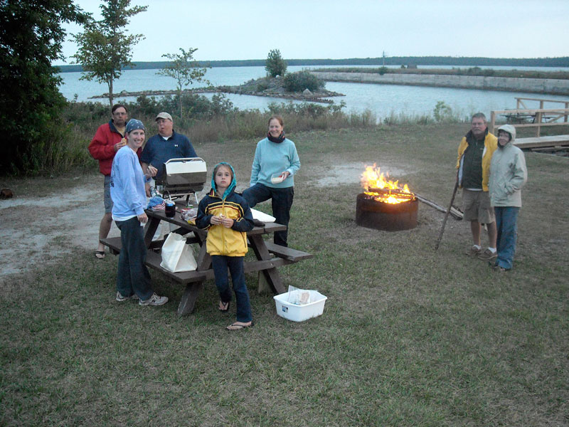
We find this picnic table close to the dock and set up for dinner. Kevin has his grill lit, and Hal has a nice bonfire going. Photo by the author.
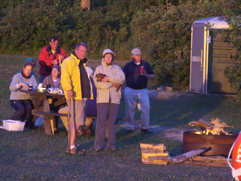
After dinner we await the sunset. Photo credit: Kathy Hart.
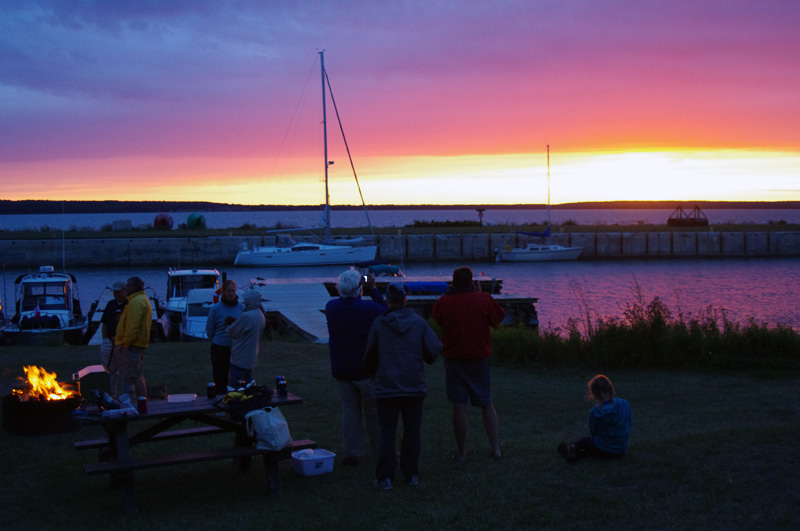
A truly memorable sunset closed our week of cruising the North Channel. Photo credit: Kathy Hart.
The arrival of darkness also brings some light rain. Weather RADAR via satellite on HOLLY MARIE warns us of the approaching drizzle. The night is made more exciting by a down bound freighter. We see its navigation lights approaching for what appears to be a very close pass by our dock. We are even more surprised when the vessel actually comes along side our dock, tying up for the night on the outer face of the big break wall. This is worthy of a closer look, even if we have to put on rain gear to make the hike over there. The vessel is a 150-foot tug, an old timer rigged for towing and looking like she has earned her keep. It is definitely not in Bristol yacht condition. The crew seems rather rough around the edges and not inclined to talk or answer questions.
Today's Sailings
Cumulative
TRIP = 303.4-miles
TIME = 20:02:45
FUEL = 108.9-gallons
Overall Averages
MPG = 2.8
MPH = 15.1

This leg
TRIP  = 38.6-miles
TIME = 2:37:03
FUEL = 14.2-gallons
MPG = 2.7
MPH = 14.7

Fuel Tank
REMAIN = 19.9-gallons
DAY EIGHT
| Date: | Saturday, August 11, 2012 |
| Weather: | Cool and cloudy |
| Winds: | Northwest 15 to 20 |
| Departure: | Lime Island State Park |
| Position: | 46° 05.252' N 084° 00.725' W |
| Destination: | Detour Village boat launch ramp,
thence by car to home |
| Distance: | 15 miles by boat, 330 by highway |
| Highway Traffic: | No delays |
Saturday is another blustery day for boating. The morning is most odd. We look to the northwest and see the shoreline in strong sunlight, but here on Lime Island we are under dark clouds. The clouds refuse to budge. An hour later we are still overcast while the mainland a few miles to the west is in sunlight. The first order of business this morning is walk around the big pier and take a look at the tug that arrived last night.
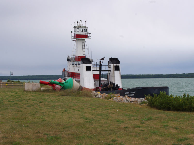
The 150-foot GREGORY J. BUSCH from Cleveland has decided to lay-up for a day at Lime Island while they wait for the weather to improve. I guess there aren't too many other places around where a ship of this size can tie up for the night at no charge. Photo credit: Kathy Hart.
A hike is organized. First we visit the island's old school house, now nicely preserved. Then we follow a trail to the northeast end of the island, and on the return take a second trail to the old kilns where lime was baked from limestone, a proces which gave the island its name. The hike takes up most of the morning.
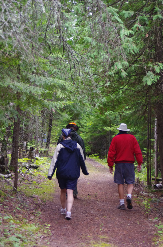
We hike this nicely groomed trail on Lime Island. Photo credit: Kathy Hart.
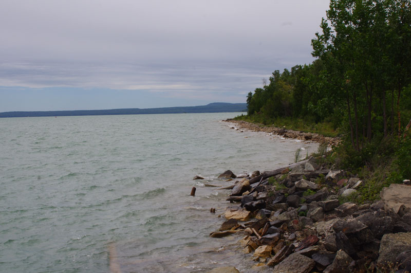
The northeast point of Lime Island is a very rugged shoreline and rather shallow—no place to try to land in a small boat, especially one with a fiberglass hull. Photo credit: Kathy Hart.
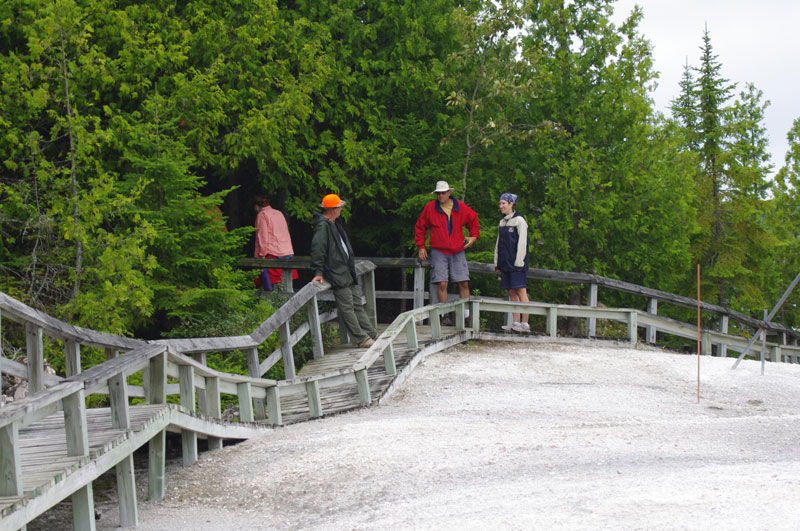
The trail near the lime kilns is a boardwalk. Photo credit: Kathy Hart.
Lime Island is more or less made of limestone, which was quarried and baked in these kilns to produce lime. The kilns date back to 1790. Photo credit: Kathy Hart.
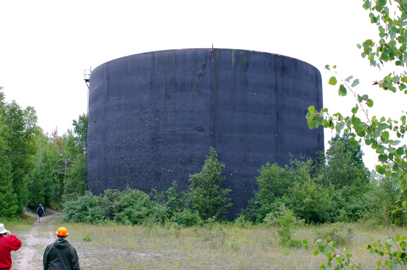
When freighters switched to oil from coal, Lime Island built two huge oil storage tanks. They once each held 1.75-million gallons of fuel oil. Heaven knows what is in them now. Photo credit: Kathy Hart.
We depart Lime Island about ten-minutes after Noon, heading downstream in the St. Marys River with following winds and waves. At Detour we go directly to the launching ramp to haul out, arriving at 12:45 p.m. We stagger the arrival of the five boats so we aren't all circling the ramp. Soon we have CONTINUOUSWAVE back on the trailer. An hour of preparation readies her for the road trip home.
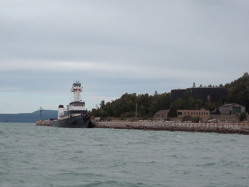
This large tug stopped late last night and moored on the pier at Lime Island. They are destined for Bay City, and the forecast for very high winds and 20-foot seas on Saginaw Bay caused them to decide to wait here for the weather to clear. Photo by the author.
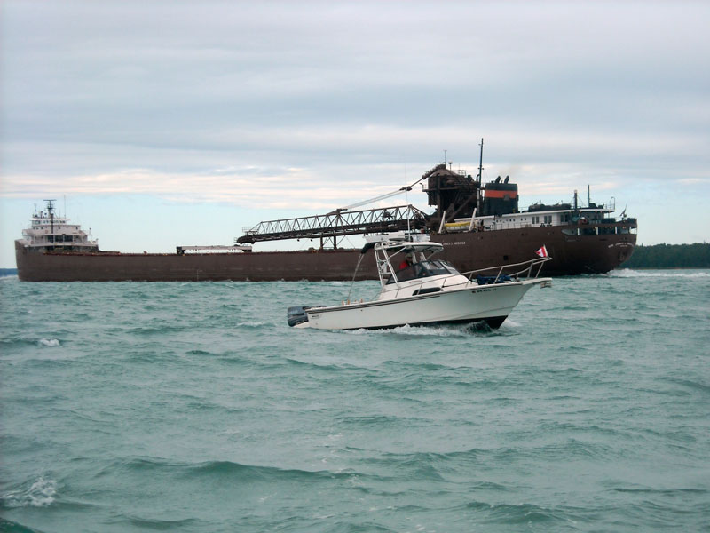
Shipping traffic is concentrated in the St. Marys River. HOLLY MARIE and the HON. JAMES L. OBERSTAR have a one-whistle pass. This picture also shows how the overcast skies end about a mile or two to the west of our position. Photo by the author.
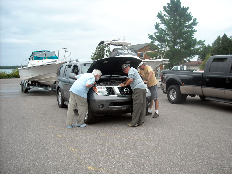
The boats are back on their trailers, but David's truck is making an odd noise. We investigate. Photo credit: Chris Wilson.
In the parking lot at the ramp we make our farewells to our cruising companions, and get on the road. It is already after 2 p.m. On the drive home we take it easy and keep the pace relaxed. We arrive home about 9 p.m., having enjoyed another week of cruising in the North Channel of Lake Huron.
Today's Sailings
Cumulative
TRIP = 312.7-miles
TIME = 20:35:07
FUEL = 112.6-gallons
MPG = 2.8
MPH = 15.2

This leg
TRIP = 9.3-miles
TIME = 0:32:22
FUEL = 3.7-gallons
MPG = 2.5
MPH = 17.2

Fuel Tank
REMAIN = 16.3-gallons
Reflections
In reflecting on the trip, I can say that it was a grand week of boating, but I have some reservations about the choice of a starting point. By starting at Detour Village we did avoid the risk of a border crossing delay at Sault Ste. Marie, but in turn we obligated ourselves to having to make a long run to reach Little Current. I think Little Current is the center of the North Channel for cruising boats, particularly small boats like ours that do not have a lot of endurance to be out in the wild, away from marina services, for very long. I think it is wiser to just haul the boat on the trailer to Little Current or to somewhere closer to Little Current than Detour Village, even if that means crossing the border on the highway and the risk of a delay. We were very fortunate in this particular week that the wind was always blowing in the same direction we wanted to go. If the wind direction had been opposing us, we would have been weathered in at Detour Village for two days on the outbound trip, and likely stuck in Little Current for two more days on the return trip. You really do not want to try to go upwind in the open water of the North Channel against even 20-knot headwinds, let alone 40-knot headwinds.
If you draw a 30-mile radius from Little Current you will encircle the best of the North Channel's anchorages, so it makes more sense to make your base of operation from Little Current, not from Detour, which is over 100-miles by water away. In starting at Detour Village you are committed to about 200-miles of travel by water to just get to Little Current and return. With a fuel economy of about 2.8-MPG this means burning over 70-gallons of fuel. With fuel typically at least $5-per-gallon, that means at least $350 in extra fuel expense. While driving to Little Current will mean more truck fuel, it will not mean $350 more truck fuel, unless your truck only gets 5-MPG.
The most attractive advantage of driving to Little Current will be the increased amount of time you will have to explore the beautiful country around Little Current. If your time to cruise is limited, say limited to a one-week vacation, it is best to get the maximum out of it by starting in the best place.
Summary Data
The total of miles run, engine hours, and fuel used are shown below, along with an accounting of most expenses for the trip. Excluding the intentionally short leg on the last day, the average day's travel on this week-long cruise was 50.5-miles. The longest leg was 70.6-miles to Little Current from Meldrum Bay, which included quite a detour around Bedford Island. The shortest leg was to The Pool from Little Current, only 24.8-miles. Fuel economy began miserably with only 2.2-MPG the first day out, due to the 47-miles run in very challenging conditions at less than optimum speed, but the average climbed back throughout the week and finished at 2.77-MPG, which is lower than our usual 3-MPG economy. We did not keep a precise accounting of the marina dockage charges, but they are typically $1.50-per-foot in most municipal marinas. With the Canadian dollar at par or more valuable than the USA dollar, we have not converted the currencies. Most expenses are charged, and the exchange rate is usually reasonable. We typically charge almost all expenses, and we don't carry much Canadian currency with us.
Fuel Consumption
        MILES  GALS   MPG
TOTAL   312.7  112.6
AVERAGE               2.77

OIL Used = 2 gallons (approximate)
GAS:OIL ratio = 112/2= 56:1
Boat Fuel Purchase
LOCATION  PRICE   GALS  COST
Highway   $4.14   40.0  $166
Wally's    5.50   39.3   215 (CA$1.45-per-liter)
Spanish    6.25   18.5   115 (CA$1.65-per-liter)
Drummond   5.00   10.0    50
TOTAL            107.8  $546
AVERAGE   $5.06

Oil 2 x $30 = $60
TOTAL Gasoline and Oil = $598
Boat Dockage
Detour        38.00 (all figures are approximations
Meldrum Bay   33.00  as a precise ledger was not kept)
Lit. Current  33.00
Spanish       33.00
Thessalon     33.00
Lime Island   20.00

DOCKAGE     $190.00
Meals
THE MAINSAIL              $50
MELDRUM BAY INN            55
TOTAL                    $105

We cooked out the remaining five nights, grilling steaks,
sausages, and hot dogs.
Highway Expenses
660-miles at approx. 11-MPG = 60-gallons
60-gallons at approx. $3.00/gallon (influenced by 35-gallons
Gas   = $180                        purchased at a big discount)
Tolls =   16
TOTAL = $196
Cruising Companions
Boat            Captain and Crew        Homeport

CONTINUOUSWAVE  Jim, Chris              Beverly Hills, Michigan
EASTPORT        Hal, Margaret           South Dakota
HOLLY MARIE     John, Holly, Emmarie    Minneapolis, Minnesota
LITTLE ZEPHYR   Don, Elsa               Mullet Lake, Michigan
OUTLIER         Kevin                   Union Lake, Michigan
WALKABOUT       David, Kathy            Detour Village, Michigan
Boat Details
CONTINUOUSWAVE  Boston Whaler REVENGE 22 Walk-Through Whaler Drive, 24-feet LOA
EASTPORT        Boston Whaler CONQUEST 205, 20-feet LOA
HOLLY MARIE     Boston Whaler 23 WALKAROUND Whaler Drive, 26-feet LOA
LITTLE ZEPHYR   Boston Whaler REVENGE 22 Walk-Through w/bracket, 24-feet LOA
OUTLIER         Pursuit OFFSHORE 235, 24-feet LOA
WALKABOUT       Boston Whaler 21 WALKAROUND, 21-feet LOA
Addendums
I invite my fellow cruisers to comment on the trip.
Copyright © 2012 by James W. Hebert. Unauthorized reproduction prohibited!
This is a verified HTML 4.0 document served to you from continuousWave
URI: http://continuouswave.com
Last modified:
Author: James W. Hebert
This article first appeared November 13, 2012.