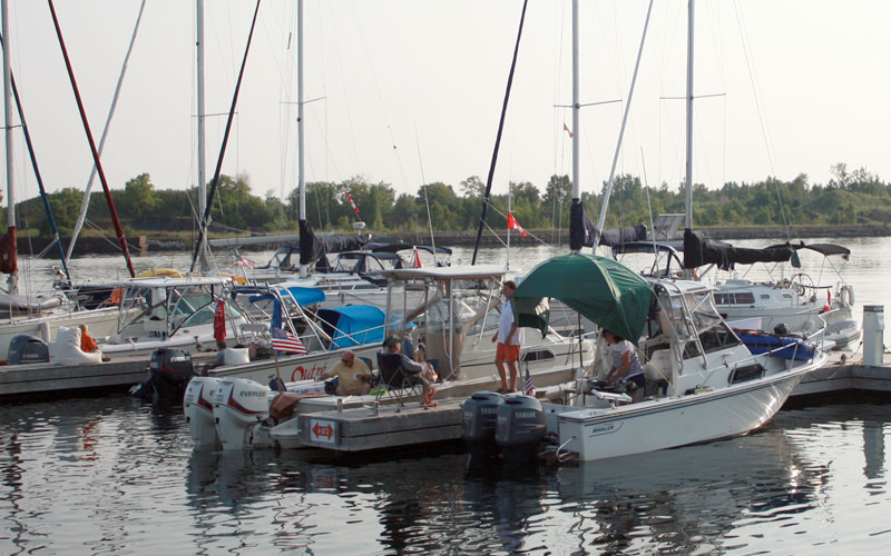
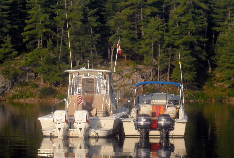
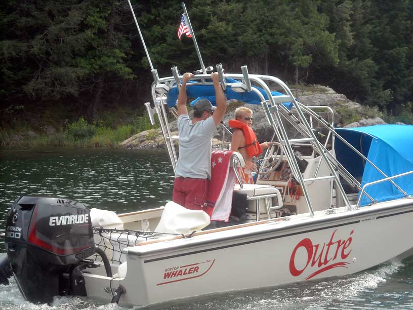
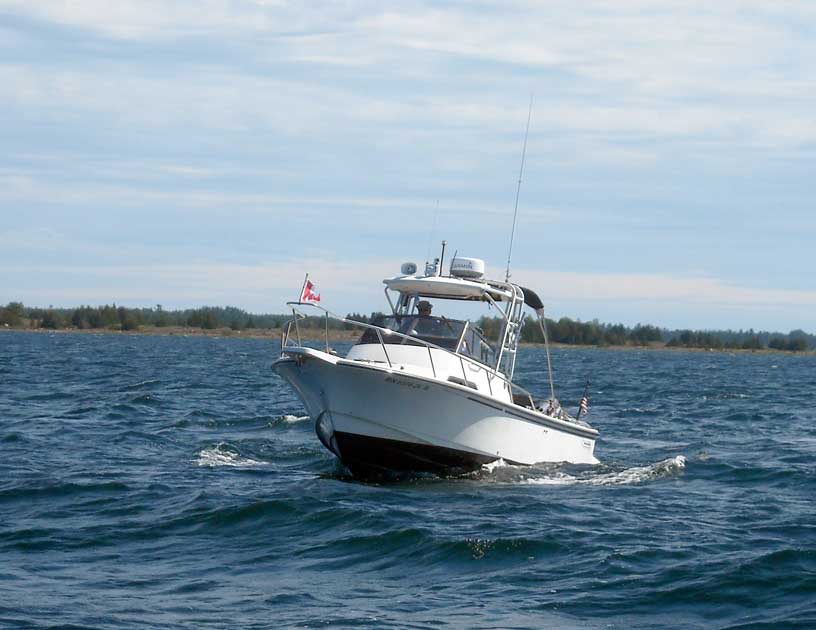
Our boating day begins at D Dock in Little Current with some coffee and dock talk. Here are OUTLIER, OUTRÉ,
LUCKY TWO, and MANIC MOMENT.
Photo by John Raby.
A illustrated narrative of our 2014 trip to the North Channel of Lake Huron and Georgian Bay; photographs by the author and his companions; detailed accounts of boat movement and travel.
This is an account of one of my many trips to the North Channel of Lake Huron and nearby Georgian Bay. You can find other accounts in my other sail logs.
| Date: | Friday, August 8, 2014 |
| Departure: | Beverly Hills, Michigan |
| Destination: | Carolyn Beach Inn, Thessalon, Ontario, Canada |
| Distance: | 386 miles by highway |
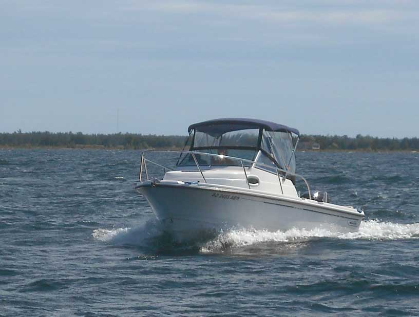
As usual, we are towing our 22-foot cuddy-cabin outboard-powered 1990 Boston Whaler boat, CONTINUOUSWAVE, on its 1992 tandem-axle trailer with our 1995 GMC Suburban. The 24-year-old boat has been holding up very well, but our 19-year-old truck has needed some repairs. We think we have everything ship-shape. The most recent problem, a bad power steering hose, has been fixed. Owning an old truck is a continual repair process.
We are coordinating our summer vacation with several of our close boating friends, and we all plan to rendezvous in Little Current, Ontario, on Saturday, August 9, 2014. A total of nine boats will be meeting there. Also, speaking of time, we keep our watch on EDST (GMT -4) during the trip, which is the official time for the island.
Driving directly to Little Current is a very long haul for a one-day drive, and since both my wife Chris and I are semi-retired, we can afford to take a more leisurely pace. Instead of 515 miles on the highway or 345-miles by highway and ferry, we will split the drive into two days. The first day we traverse the hardest segment, the 386-miles from SE Michigan to Thessalon, Ontario via a busy border crossing at Sault Ste. Marie. Although MapQuest says you can do this in 6.5-hours, it takes us much longer, due to a slower highway speed while towing, several stops, and the delay at the border. We get to Thessalon in time to check into a motel and have dinner. From Thessalon to Little Current on the second day will be an easy 125-miles and three-hour drive.
| Date: | Saturday, August 9, 2014 |
| Departure: | Thessalon, Ontario, Canada |
| Destination: | Little Current, Ontario, Canada, on Manitoulin Island |
| Distance: | 125 miles by highway |
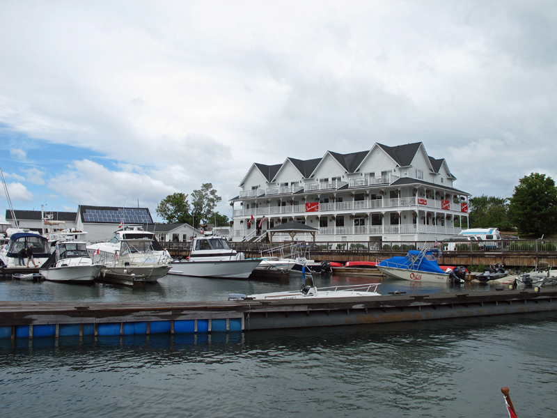
The weather is perfect for highway travel. There is no rain, and no construction delays. We get a late morning start from our motel, and reach Little Current at 1 p.m. Our destination is Spider Bay Marina, operated by the town of Little Current. It has a good launching ramp and affordable parking for our truck and boat trailer for the week we'll be cruising. We have been there many times. The facilities are very good and the staff is always friendly and helpful.
At Little Current we will be rallying with eight other boats. Coming to Little Current by water are:
From Meldrum Bay on the western end of Manitoulin Island, these three boats will be heading east to Little Current on Saturday, arriving about 4 p.m. after a lunch stop at Kagawong, a small town west of Little Current, where they also explored Bridal Veil Falls.
And coming to Little Current on the highway are:
These three boats met by chance at the border crossing at Sault Ste. Marie, where, unfortunately, the Canadian immigration officials decided to make an unusually thorough inquiry into the immigration status of one of the participants, postponing for about 40-minutes what otherwise should have been a completely normal and uneventful entry into Canada by a fine citizen of the USA. The three boats and crew were all in Little Current by 7 p.m.
As often happens when many boats are hauled many miles by trailer, a problem or two arises, and this instance was no different: the brake on the left front trailer axle of the HOLLY MARIE trailer malfunctioned, but since the trailer was being towed by a 1-Ton dually truck, the lost of brakes on the trailer was not an impediment to further highway travel.
One boat would arrive by a combination of highway and ferry travel. Don and Gail brought WHITE WATER, a 25-foot Boston Whaler cuddy cabin boat with twin 150-HP outboard to Little Current by taking the MS CHICHEEMAUN ferry to South Baymouth from Tobermory. They left Port Huron on Saturday, but did not get on the ferry until early Sunday morning, delaying their arrival at Little Current until 10 a.m.
With eight boats gathered on Saturday evening, "dock-tails" and hors d'oeurves are consumed on the fine floating docks of the Port of Little Current, to such an extent that dinner cooking is cancelled. The weather is fair, and all the boats were in close proximity on D-Dock. With taxes added, dock fees come to about $2-per-foot. At the east docks, showers and bathrooms are scarce and under heavy use. An impressive rendezvous of Ranger Tug boats fills A-Dock with about twenty nearly matching blue-hulled vessels at the western end of the port.
| Date: | Sunday, August 10, 2014 |
| Weather: | Fair |
| Winds: | Light and variable |
| Waves: | Calm |
| Departure: | Port of Little Current |
| Position: | 45° 58.839' N; 081° 55.436' W |
| Destination: | Marianne Cove, Baie Fine, Ontario |
| Distance: | 18 miles by boat |
The weather continues to be fair, the winds are light, and the seas are very small. The summer temperatures are moderate here, but very enjoyable, and are almost "hot" today.
To accommodate the late arrival of WHITE WATER, departure is delayed until about 11 a.m. We head east, passing under the highway swing bridge, then across the small bay to pass north of Raspberry Island, and then into Fraiser Bay and the entrance to Baie Fine. As we pass Marianne Cove we note only a few boats at anchor, so we turn into this delightful anchorage.
As our fleet has nine boats, we anchor in three rafts in Marianne Cove, followed by a relaxing lunch. Some of us undertake a climb to the top of Casson Peak. Ascending Casson Peak on a hot summer day will be quite a workout, particularly for those of our group, like me, who are old, out of shape, and overweight. It has been many years since my one prior ascent of Casson Peak, and I am extremely keen to repeat the climb. By the time we reach the summit everyone has worked up a sweat. The top of Casson Peak offers a marvelous view, but today some haze obscures the distant features of this interesting mix of islands, hills, and bays. The descent is less taxing than the climb, but in some spots more difficult due to the steep downward slope. Fortunately, all climbers make it back to the boats without any injury.
For dinner that eventing we increase the anchor rodes of two of the rafts and pull the boats together to make a seven-boat dinner party. The two other boat crews come over via dinghy. We have a delightful cookout and dinner on the boats, and enjoy the group gathering until late into the evening, when we split up the raft for overnight anchoring.
As it turns out, the night is extremely calm and the cove is like glass. Also quite by coincidence this is the night of a super-moon, a full moon with the moon at perigee, and by even more happenstance, the closest perigee of the year so thus a supper super-moon. When I awake at 3 a.m. and come on deck, the sky is completely clear, and I look out on a scene of boats in a wilderness anchorage completely still and wonderfully illuminated by an extremely bright and large full moon. It is a memorable evening.
To illustrate this cruise I have borrowed heavily from my cruising mates, who often took photographs at times I forgot to record, or from angles better than mine. A notation in the caption gives credit for each photograph.
Our boating day begins at D Dock in Little Current with some coffee and dock talk. Here are OUTLIER, OUTRÉ,
LUCKY TWO, and MANIC MOMENT.
Photo by John Raby.
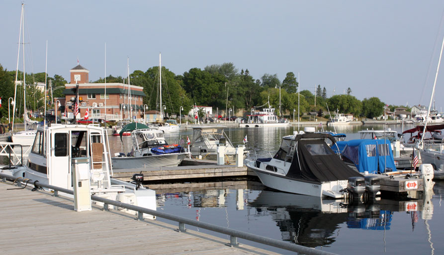
Also at D Dock are DEFIANCE, HOLLY MARIE, and CONTINUOUSWAVE. Little Current is a wonderful boating center.
Photo by John Raby.
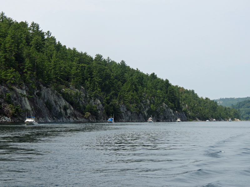
After clearing the narrow entrance, the fleet hugs the south shore of Baie Fine.
Photo by Kevin Albus.
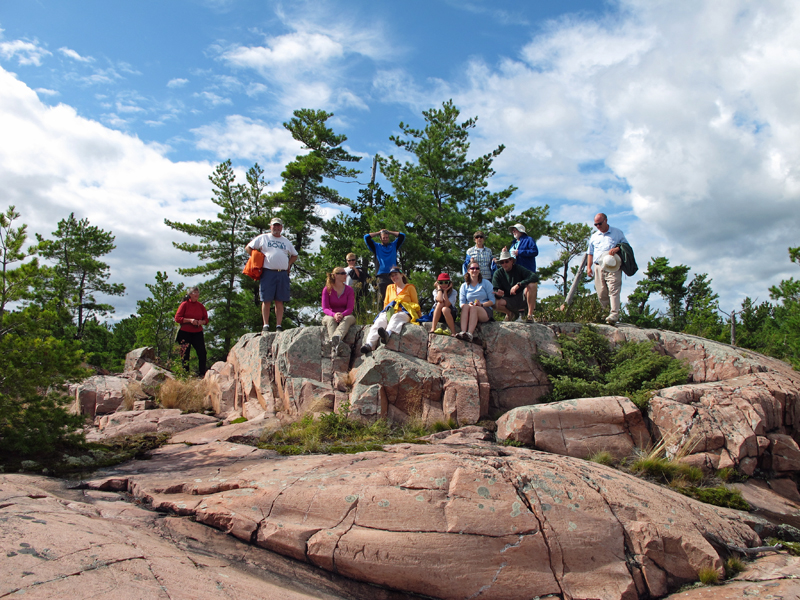
Our goal today is to ascend Casson Peak, named after Group of Seven artist A. J. Casson, who painted from its heights.
Photo by John Raby.
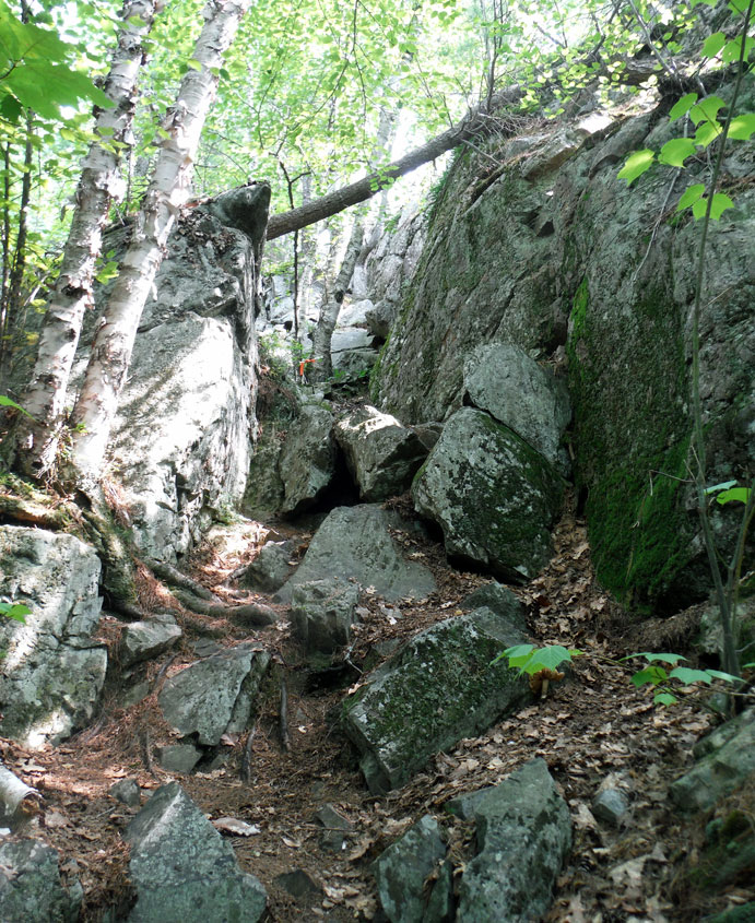
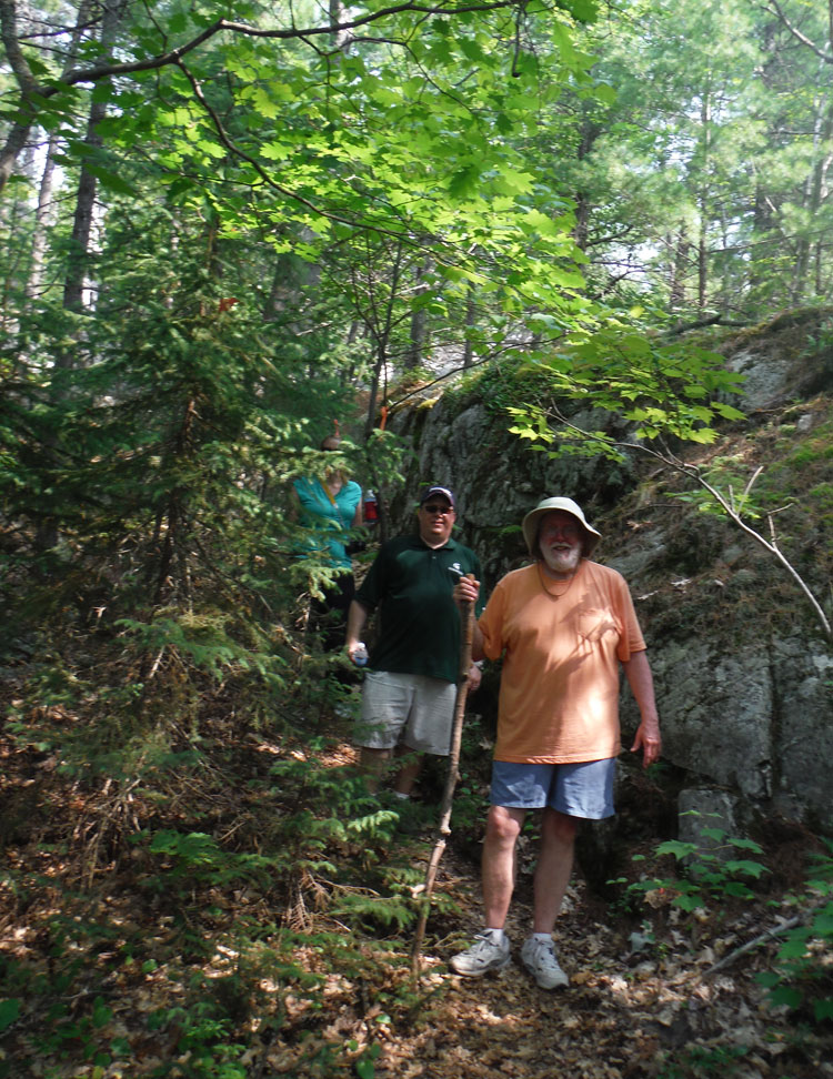
This rock passage is one of many obstacles to be overcome on the climb to the top of Casson Peak.
The trail is marked by orange ribbons along the way.
Photo by John Raby.
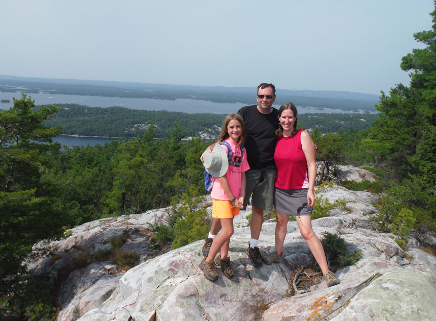
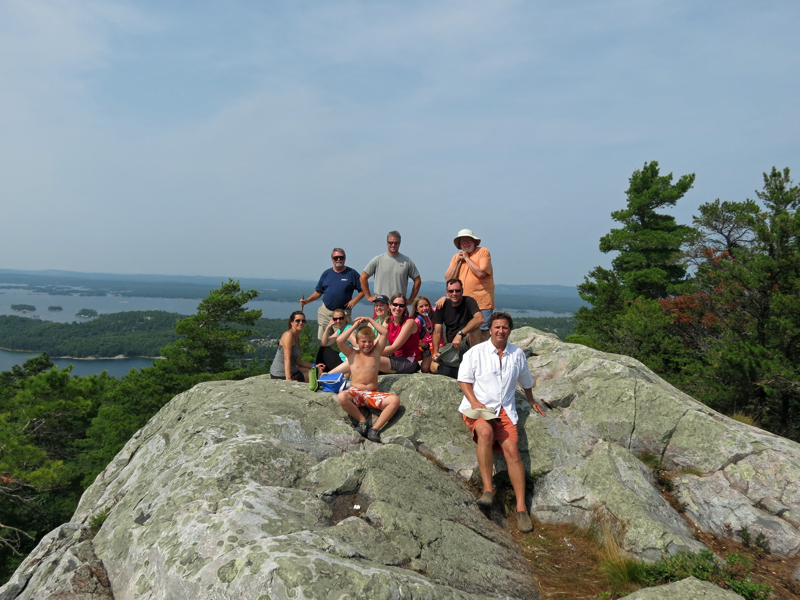
At last, the Summit! Note the excellent footwear, highly recommended for this rocky climb.
Photo from John Raby.
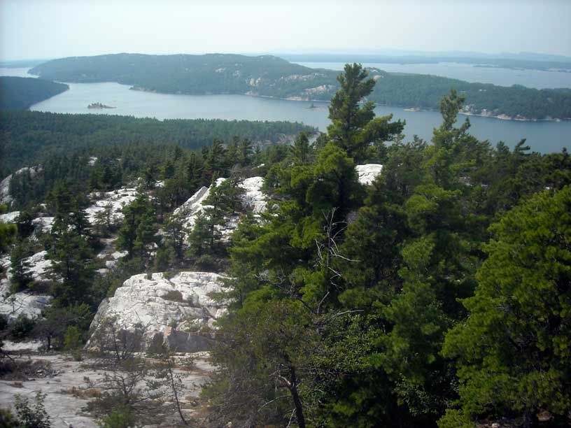
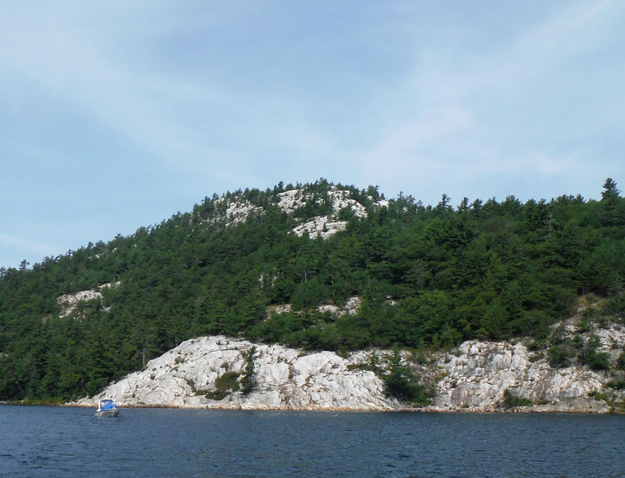
View from Casson Peak looking to the northwest. Marianne Cove is just visible, mostly concealed by the trees on the next ridge.
It was a hot and hazy day, and visibility was limited. We are standing about 575-feet above Lake Huron. Baie Fine and
McGregor Bay are seen, and the LaCloche range is on the horizon.
Photo by your author.
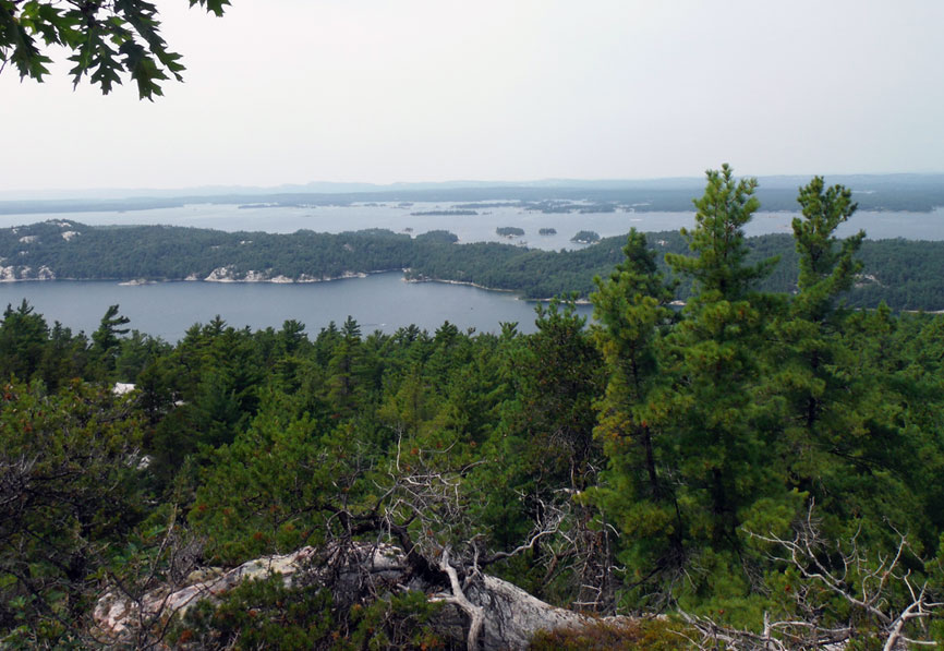
To the North are Baie Fine, McGregor Bay, and the LaCloche Range.
Photo by John Raby.
After a long climb on a hot day, we relaxed for a few minutes on the top of Casson Peak.
Photo by Kevin Albus.
The weary climbers descend; particularly weary was your author. Kevin and Debbie are about to pass me.
Photo by John Raby.
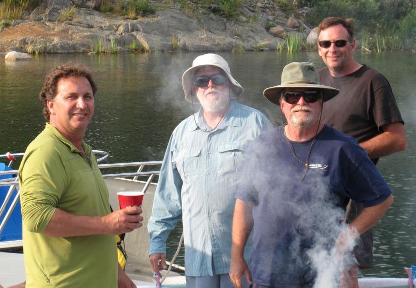
Craig, your author, Hal, and John carefully supervise the grill as dinner is being prepared; we are at anchor in Marianne Cove.
Photo by Don McIntyre.
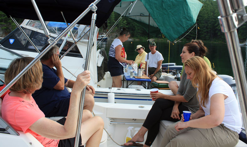
The dinner raft at Marianne Cove. Foreground: Margaret, Hal, Karen, Debbie. Background: Kathy, Don, David.
Photo by John Raby.
| Date: | Monday, August 11, 2014 |
| Weather: | Hazy and hot |
| Winds: | Light |
| Waves: | Calm |
| Departure: | Marianne Cove |
| Position: | 46° 0.80' N; 081° 37.93' W |
| Destination: | The Pool and thence to Killarney |
| Distance: | 36-miles by boat |
The remarkable five day streak of warm fair weather with light winds and very small seas continues. This long stretch of favorable weather has been great, but the weather forecasts indicate that it is about to end.
We haul anchor at Marianne Cove at the usual ten o'clock departure time, and begin a leisurely cruise up the picturesque Baie Fine, toward The Pool, some nine miles away.
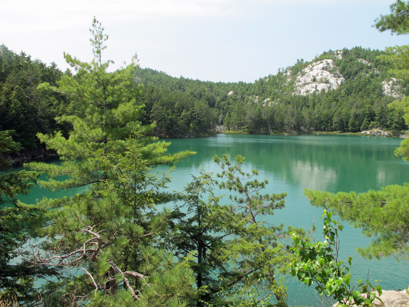
At the very farthest reach of Baie Fine one enters The Pool, a marvelous anchorage surrounded by tall white hills of quartzite rock. The water at The Pool is not very deep, about ten-feet in most places, and to the dismay of visiting boaters there is a very substantial growth of marine plants on the bottom, which makes anchoring difficult. Setting an anchor among the thick weeds requires some technique and lots of luck, and retrieval of a well-set anchor usually brings with it a bundle of marine plants that weighs several times more than the anchor itself. In spite of this impediment, we get at least two anchors to take hold of the bottom, and we form into a very large single raft of nine boats, intending just to stay for the day, not overnight in that configuration.
After lunch at anchor, an expedition is organized to hike to nearby Topaz Lake, a rain-fed lake atop one of the quartzite hills to the north. Since I am a bit sore from the big climb to Casson Peak yesterday, as well as being apprehensive about leaving all nine boats rafted up and unattended on marginally set anchors, I volunteer to skip the climb to Topaz Lake and remain with the boats for the afternoon. Having spent many days and nights at anchor in The Pool, I know the winds are very changeable, and they could easily switch direction and speed, possibly fouling the raft's three anchors.
The Topaz Lake expedition party set off in a flotilla of three inflatable dinghies, towed by one of them with outboard engine power to a beach on the north shore of the cove where a trail to the lake can be joined. Since Topaz Lake is a rain-fed body of water, for several decades it has been getting its water from acid-rain, that is, water with a pH that was slightly acidic. As a result, very little vegetation could grow in the lake, and its water was unusually clear. One could see into the lake more than 30-feet in the totally transparent water. But the days of acid rain have ended, and in this summer of very warm weather and lots of rain, the water of Topaz Lake has apparently returned to more normal pH, accompanied by an significant increase in algae and vegetation. Topaz Lake's water color is more greenish than bluish for this visit. But the cool water is still inviting for a quick swim after the climb to reach it.
When the shore party returns to the boats, it is decided that we ought to depart for a better overnight destination. Eight boats head for Killarney, while WHITE WATER choses to return to Little Current. We bid adieu to Don and Gail, and set out for Killarney in the late afternoon.
From The Pool to Killarney is about 25-miles, and once we exit from the narrow passage in the upper reaches of Baie Fine, we can run on plane almost all the way. In the later afternoon we reach Killarney and are heading down its Venice-like main canal, looking for overnight accommodations. The marina at the recently remodeled Sportsman's Inn has room for all eight boat, although not exactly right next to each other. The fleet works its way into the marina and into assigned slips, often nestled between much larger boats staying there. The docks are very nice and only priced at about $2-per-foot, after adding the usual taxes. The bath and shower facilities for visiting boaters are excellent and plentiful, a nice change from the crowded facilities at the Little Current town docks.
For dinner we hike down main street to HERBERT'S FISH AND CHIPS. Their famous red school bus is gone, a victim of modernization. A new three-storey building is being constructed to house their fishing business and an expanded restaurant, and in the interim a temporary van serves as a take-out-only source of their fine fresh fish and chips. It seems that almost everyone in town is in line, and to get a wonderful cardboard box of hot-from-the fryer locally caught whitefish and deep-fried potatoes takes about 45-minutes. The fish is the same delicious treat we have enjoyed so many times before, but a new delight for some of our companions. Part of the fun of these trips is introducing new friends to our favorite places.
Marianne Cove is perfectly still this morning, and a low eastern sun illuminates two of our companion boats,
LUCKY TWO (left) and WHITE WATER.
Photo by your author.
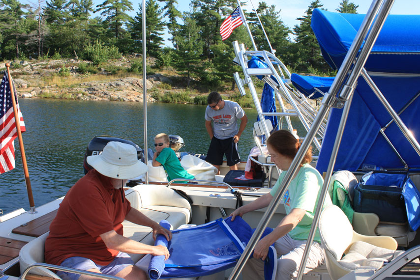
Morning boat work includes carefully rolling and storing weather curtains. We roll our blue canvas in blue towels.
The delightful shoreline of Marianne Cove provides a nice backdrop.
Photo by John Raby.
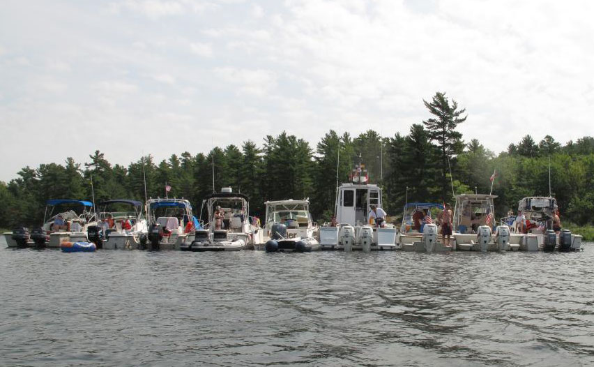
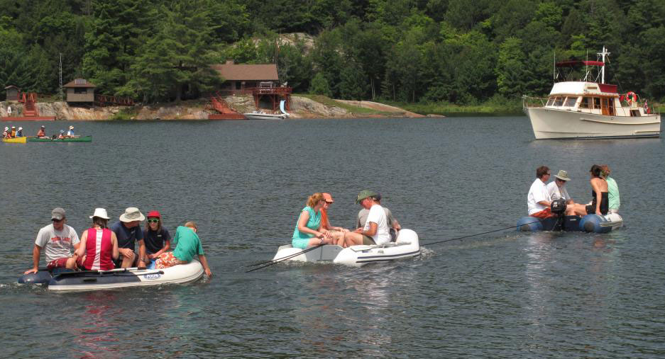
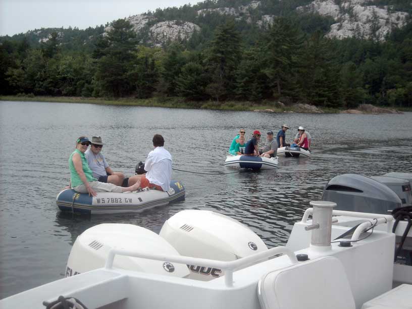
For a lunch stop, we rafted all nine boats together in The Pool.
Photo by Don McIntyre.
The raft at The Pool with a white quartzite hill in the background. All nine boats are in this view, but some are partially obscured.
Three anchors hold the fleet in very light winds.
Photo by Don McIntyre.
After a late lunch, a fleet of three dinghies heads for the north shore of The Pool and a climb to Topaz Lake. The cottage on the islet
in the background is owned by the Evinrude family.
Photo by Don McIntyre.
Topaz Lake has lost some of its usual blue color, probably a result of some algae beginning to grow in the now less-acidic water. The lake is rain fed, and for decades acid rain kept its water free from any algae, giving it a wonderful blue hue.
Photo by Kevin Albus.
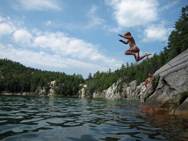
After a long climb uphill to reach Topaz Lake, everyone takes a dip. Sam jumps in from a rock outcrop.
Photo by Kevin Albus.
The Topaz Lake climbers and swimmers return. Skies are turning gray.
Photo by your author.
Departing The Pool we motor slowly down the narrow channel back to Baie Fine. Sam takes the helm of OUTRÉ.
Photo by your author.
After a 25-mile run we arrive at Killarney in the late afternoon and take slips at the Sportsman's Inn marina.
Photo by Kevin Albus.
Some of the other cruising boats are a bit larger than CONTINUOUSWAVE. Darker clouds are accumulating.
Photo by Kevin Albus.
The marina at Sportsman's Inn accommodates a wide size range of visiting boats. MANIC MOMENT and OUTLIER
snuggle into some open space on the ends of docks.
Photo by Kevin Albus.
| Date: | Tuesday, August 12, 2014 |
| Weather: | Heavy Rain |
| Winds: | Strong south-westerlies |
| Waves: | Six-footers forecasted |
| Departure: | None; we stay put |
| Position: | 45° 58.25' N; 081° 31.00' W |
| Destination: | None |
| Distance: | 0-miles by boat |
An enormous and deep low pressure weather system has moved into the region, bringing very heavy rain and high winds overnight and all morning. The low is just about centered on our location, and spins counterclockwise around us for days. It is miserable weather for travel in small boats.
To get out of the rain we find refuge in a basement utility room at Sportsman's Inn Resort and Marina. We sit around most of morning, commiserating about the weather and glad to be able to get off our small boats and stay dry indoors.
In the afternoon there is a brief interlude of no rain, and LUCKY TWO casts off with several of the crews aboard to take a look at conditions on the open water of Georgian Bay to our south. The boat ride is cut short after only a brief excursion into the big lake; it's just too rough for comfortable boating. We resign ourselves to spending the rest of the day and night remaining in Killarney.
A large group goes to dinner at the Killarney Mountain Lodge. It was once a private company retreat in the 1960's, and has been a public resort for many decades. Located at the end of the channel, it faces Georgian Bay. The dinning room is large and has a classic northern pine motif. A new chef has been hired, and the food is much improved compared to our last visit. Due to the rough weather, none of the local commercial fishers have been able to get out to tend their nets and unfortunately there is no fresh fish on tonight's menu. We enjoy a leisurely dinner at a big table in this fine old resort, and again we are glad to be indoors, out of the rain, and among good company.
| Date: | Wednesday, August 13, 2014 |
| Weather: | Stormy |
| Winds: | Strong |
| Waves: | High |
| Departure: | None |
| Position: | 45° 58.25' N; 081° 31.00' W |
| Destination: | Nowhere |
| Distance: | 0-miles by boat; several miles on foot |
This low pressure system just won't budge. It continues to ruin another day of summer boating with high winds and lots of rain.
The weather is once again so miserable that we can't see much sense in setting out in the boats for a new overnight destination, and, reluctantly, we decide to spend another day in the rain in Killarney. By mid-afternoon there is some let-up, and we organize a hike to the lighthouse via a marked trail that begins from the lodge. The ground is saturated with water, so the trail is quite wet. Our destination, the lighthouse, proves to be too far, and we content ourselves with reaching a tall rocky outlook at Thebo Cove, about three-quarters of a mile short of Red Rock Point and the light.
The rain abates in the early evening, and we have a nice supper dockside for a change. We all resolve, no matter what the weather, we will get out of Killarney tomorrow.
The hikers paused for this group photograph, taken at a nice overlook of pink rocks on the trail to the lighthouse point at
Killarney's south entrance. Pictured (left to right) are Kathy, Hal, Debbie, Sam, Bob, Chris, Emmarie, Holly, Elsa, John,
your author, and Don.
Photo by Kevin Albus.
| Date: | Thursday, August 14, 2014 |
| Weather: | Morning rain, then clearing |
| Winds: | Strong Northwesterlies |
| Waves: | Three-footers |
| Departure: | Killarney, Ontario |
| Position: | 45° 58.25' N; 081° 31.00' W |
| Destination: | Little Current, Ontario |
| Distance: | 30-miles |
We awake to another morning of overcast skies, rain, and wind. The wind has shifted to the northwest, and the temperatures are cooler. The rain continues, but not like the downpour we have had for three days.
The three-days rain has dissolved some of the group's cohesion and dampened our enthusiasm. With the week winding down, each boat has a slightly different agenda for today, but we are united in one thought: time to get out of this harbor. All want to head West, to Little Current, but on different time tables. Eight boats will be leaving Killarney today, but not as a single fleet.
With a return to Wisconsin by boat ahead of them, DEFIANCE plans today to head as far to the West as they can. They leave first, with OUTLIER accompanying them. The big head seas from the West keep the two boats of different size from staying together. After reaching Little Current, OUTLIER's crew decides they've had enough of this week of boating, and they go the ramp to haul out and head home on the highway.
DEFIANCE tarries for a moment in Little Current, then continues Westward. She takes the Wabuno Channel to the north, then runs west through the McBean Channel, Little Detroit, Aird Island, and John Island. From there she turns southwest, crosses the breadth of the North Channel, and continues all the way to Drummond Island, Michigan, concluding a remarkable day's run into large headseas.
MANIC MOMENT also departs early from Killarney, heading for Little Current on her own. OUTRÉ also leaves alone, but instead heads east to explore a bit of Collins Inlet.
Still left in Killarney are EASTPORT, CONTINUOUSWAVE, HOLLY MARIE, and LUCKY TWO, and we depart about 11 a.m., taking a bit of a sight-seeing route and visiting Covered Portage Cove and Snug Harbor, both of them remarkably unfilled with any cruising boats. We then set out in earnest for Little Current, taking a southerly approach, staying in the shelter of the lee of Badgely Point, Centre Island, Partridge Island, and Heywood Island as much as possible. We make our northing in the lee of Strawberry Island, and have only a short run in head seas to Little Current, where we arrived for a late lunch. Approaching the docks is an exercise in boat handling, as there are very strong currents flowing through them from west to east at about five-knots. To find the best protection from the wind and current, tie-ups on B-dock are sought, and, fortunately, we can take open slips in very close proximity.
From here, EASTPORT goes to the ramp and hauls out. That crew will spend the night in the comfort of their motor home ashore, instead of in the wet boat. We also reunite briefly with WHITE WATER; they've spent the last three days here in Little Current and traveling around in their car to see the island sights. They're finished with boating this week, too. Room on the next ferry for their car and trailer helps make the decision: they will haul out and head for home.
Remaining at the very nice marina docks in Little Current are OUTRÉ, CONTINOUSWAVE, MANIC MOMENT, HOLLY MARIE, and LUCKY TWO. The five boat crews are joined by Hal and Margaret from EASTPORT, and we have a very nice last-night gathering under the covered pavilion on the West end of the marina. As might be expected now that the turbulent weather has finally left the region, a wonderful red sunset promises better conditions tomorrow.
By evening's end, the nine boats are scattered. DEFIANCE is in Drummond Island. WHITEWATER is on a ferry and heading home. OUTLIER is on the highway, slowed momentarily by a flat tire on the boat trailer, but also heading home. EASTPORT is on her trailer in the parking lot at Spider Bay Marine, and OUTRÉ, CONTINOUSWAVE, MANIC MOMENT, HOLLY MARIE, and LUCKY TWO spend the night at B-Dock in Little Current.
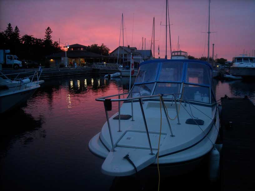
After several days of bad weather, this very red sunset portends fair weather tomorrow. The marina pavillion was the site of our group's last supper. Photo by your author.
| Date: | Friday, August 15, 2014 |
| Weather: | Fair and sunny |
| Winds: | Westerly Near Gale |
| Waves: | Three-footers |
| Departure: | Little Current |
| Position: | 45° 58.84' N; 081° 55.44' W |
| Destination: | The boat ramp, then the highway |
| Distance: | 4-miles by boat; 235-miles by car |
For a very welcome change, we awake to fair weather and beautiful sunshine. Unfortunately, the winds are unchanged, and it's blowing a near gale from the west. The winds funnel into Little Current and seem to be amplified as they pass through the narrows, and making headway into them will be rough.
With four of our original nine boats gone, the fleet breaks up even more. OUTRÉ's crew decides to head for home. They get an early start at 8 a.m. and haul out at the ramp. Momentarily the fleet is down to four boat, then EASTPORT re-launches to get in one more day of boating. About 10 a.m. we depart from Little Current as a group. As the fleet approaches Narrow Island at the western end of the narrows, boats head in several different directions.
LUCKY TWO and MANIC MOMENT stay together, and head due west into the wind and seas, aiming for the Clapperton Island channel and eventually for Gore Bay. EASTPORT and HOLLY MARIE turn north at the Wabuno Channel to gunk-hole in the calmer water and shelter of the Bay of Islands. They explore the many rocky, narrow, and shallow channels and coves. HOLLY MARIE finds a nice spot to anchor-out for the night, and EASTPORT returns to Little Current to again haul-out at the ramp so the crew can sleep in their motor home. On CONTINOUSWAVE we wave farewell and make a U-turn. We head for the ramp at Spider Bay Marina to haul out and prepare for a long drive on the highway to home.
We will learn later that DEFIANCE departs Drummond Island this morning, continues west, and presses on all the way to her homeport of Chambers Island in Green Bay, Wisconsin, completing her 586-nautical-miles cruise to the North Channel. (See addendum for more details of DEFIANCE's boat movements.)
The rough seas in the North Channel cause a lot of fuel sloshing in the fuel tank of LUCKY TWO, stirring up some sediments on the tank bottom and resulting in a clogged a fuel filter on one engine. As a result, she limps into Gore Bay for repairs on one engine with MANIC MOMENT standing by. They spend the night there.
With CONTINUOUSWAVE on her trailer, we depart Little Current around noon and drive around the north shore of Lake Huron. We re-enter the USA at Sault Ste. Marie, and due to fatigue we decide to stop for the night in St. Ignace. We have made some really long drives at the end of a week of boating, but we are getting older and wiser, and we have the luxury of having another day to get home. The weather also has returned to rain, making the prospect of an all-night drive less attractive.
LUCKY TWO heading for Gore Bay. Great LaCloche island and the LaCloche Mountains in the background. Photo by the author.
EASTPORT coming out from Little Current. The cottage in the background is on Little Island. Photo by the author.
HOLLY MARE on her way to The Bay of Islands, here heading west and coming from Little Current. Photo by the author.
| Date: | Saturday, August 16, 2014 |
| Weather: | Fair and sunny |
| Departure: | St. Ignace |
| Position: | 45° 58.84' N; 081° 55.44' W |
| Destination: | Home |
| Distance: | 277-miles by car |
We have an uneventful drive home, with no problems on the road or with or truck and trailer. The crew from the HOLLY MARIE were not as lucky. A trailer tire failed on their drive back to Minnesota, then, close to their destination, their big truck broke down. Fortunately they were able to borrow another large truck to finishing hauling the HOLLY MARIE to their home while their truck was towed to a service shop for repairs.
My usual habit of recording details of the boating distance and fuel consumption has been neglected this trip. My recorded track points show we only put 90-miles under the keel this week, a very modest amount of travel by boat for the over 1,000-miles we travelled by car to get to our launch point. Since the boat averages about 3-MPH for fuel economy, we probably consumed about 30-gallons of gasoline fuel and less than one-gallon of oil.
The biggest boat in our fleet, DEFIANCE, compiled quite a bit more travel. Her captain gives this excellent account of the passage from Wisconsin to the North Channel and return:
August 7th we departed Chambers Island at 10:30 a.m. (all times will be EDST) for a brief stop at the Fish Creek town dock to take on fuel. With a full 250-gallons on board we departed at 11:30 a.m. We traveled northeast, up the Door Peninsula to Rock Island Passage, then east across Lake Michigan to Beaver Island. Conditions were flat calm and we cruised at 32-knots. After a brief stop at St. James on Beaver Island we departed for Cheboygan, Michigan, passing through Grays Reef shoal and then east under the Mackinaw Bridge to the Cheboygan River, where Don met us at the town dock and we were able to refuel. Elsa dropped Don off and returned to their marina further up the river. Don joined us on the boat for the short cruise to their marina where he had arranged a slip for us that night. After securing the boat we drove to a local restaurant on the water for a great dinner. Total distance travel by water was 162.4-nm and we burned 127-gallons of fuel.
August 8th we departed Cheboygan for Meldrum Bay, total distance 66.8-nm.
August 9th Meldrum Bay to Little current with a stop at Kogawong, total distance 58.2-nm.
August 14th Killarney to Drummond Island was 105.4-nm with a crossing of the western half of the North Channel with two to four-foot waves and winds gusting to 25-knots. Cleared customs and spent the night at Drummond Island Yacht Harbor.
August 15th departed Drummond Island at 8 a.m. and headed for Mackinaw Island. The winds were west and forecasted to turn south throughout the day. As we approached the Mackinaw Bridge the waves began to build to 4-feet. As we traveled West of the bridge the conditions worsened and we were slowed to 10 to 12-knot pace with regular water up and over the windshield. We arrived at Beaver Island at 12:30 p.m. after four hours and 38-minutes and 83.6-nm. We were very tired and our initial plan was to stay the night, however, after checking weather and seeing that conditions would likely deteriorate the next day, we opted to push on for Chambers Island that afternoon. Conditions remained the same for the rest of the trip that afternoon until we entered Rock Island Passage into Green Bay and were in the lee of the Door Peninsula. We arrived at the Chambers Island dock at 6:15 p.m. and enjoyed some well deserved beverages with some friends on the dock. Total distance for the day 167.6-nm and 9 hours 25 minutes on the water.
Total distance for the trip 586.3-nm.
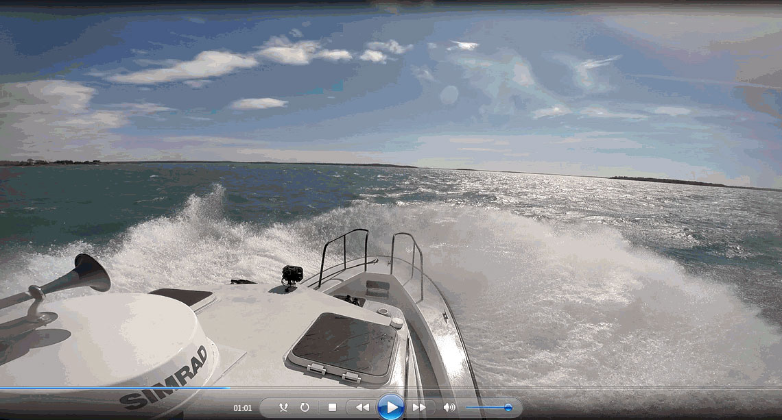
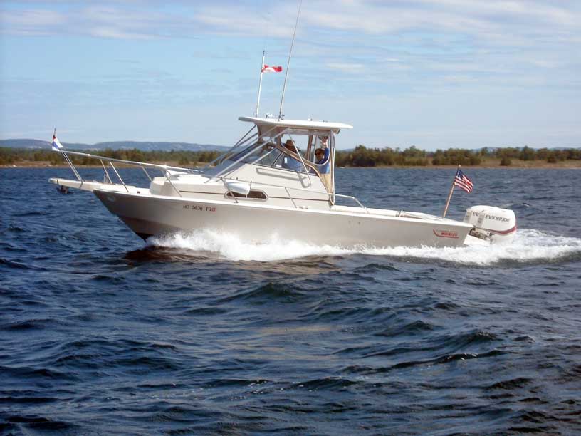
DEFIANCE makes way into the open water of the North Channel of Lake Huron, throwing considerable spray. Frame capture from video recording by Craig Reinders.
Copyright © 2016 by James W. Hebert. Unauthorized reproduction prohibited!
This is a verified HTML 4.0 document served to you from continuousWave
URI: http://continuouswave.com
Last modified:
Author: James W. Hebert
This article first appeared February 2016.