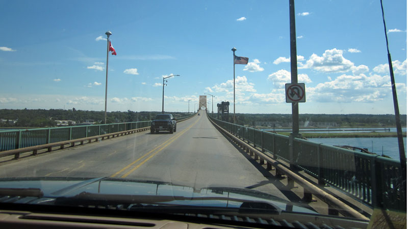
The International Bridge at Saulte Ste. Marie, with very little traffic. Photo by JR.
A illustrated narrative of our 2016 trip to the North Channel of Lake Huron and Georgian Bay; photographs by the author and his companions; detailed accounts of boat movement and travel.
This is an account of one of my many trips to the North Channel of Lake Huron and nearby Georgian Bay with the Boston Whaler Great Lakes Cruising Club (BWGLCC). You can find other accounts in my other sail logs. To locate some of the remote anchorages mentioned in the narrative you can use this Google Earth collection of places we visited (in KML format). The images presented are up to 900-pixels in width, and a large monitor is recommended for best viewing.
| Date: | Saturday, July 23, 2016 |
| Departure: | Northport, Michigan |
| Destination: | Blind River, Ontario, Canada |
| Distance: | 290 miles by highway |
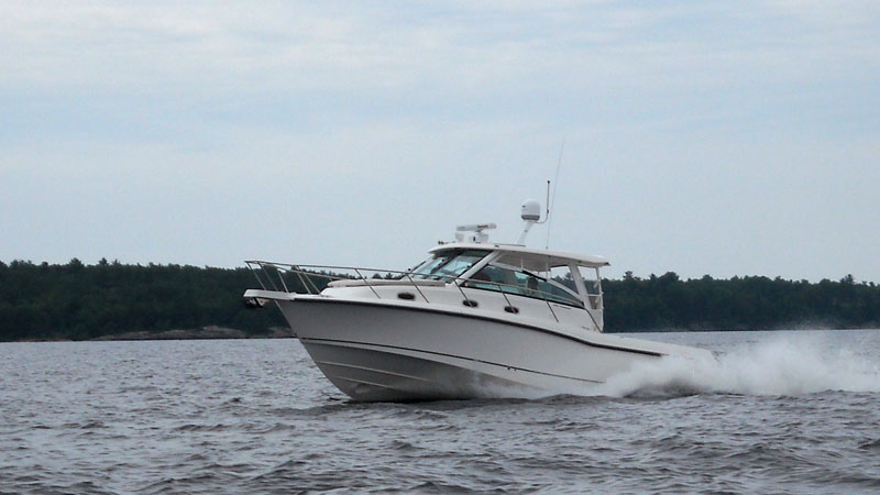
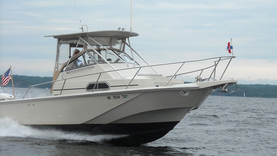
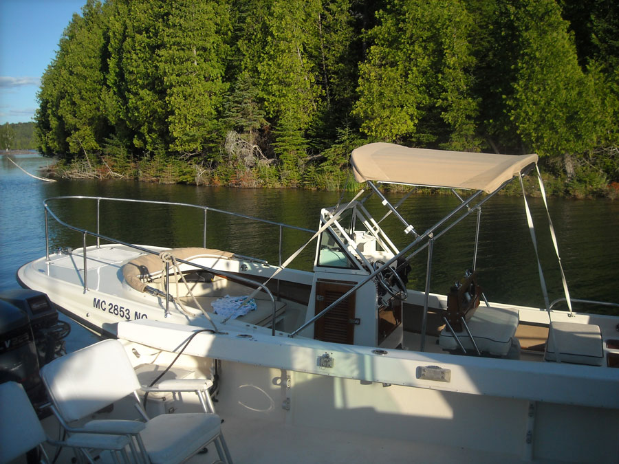
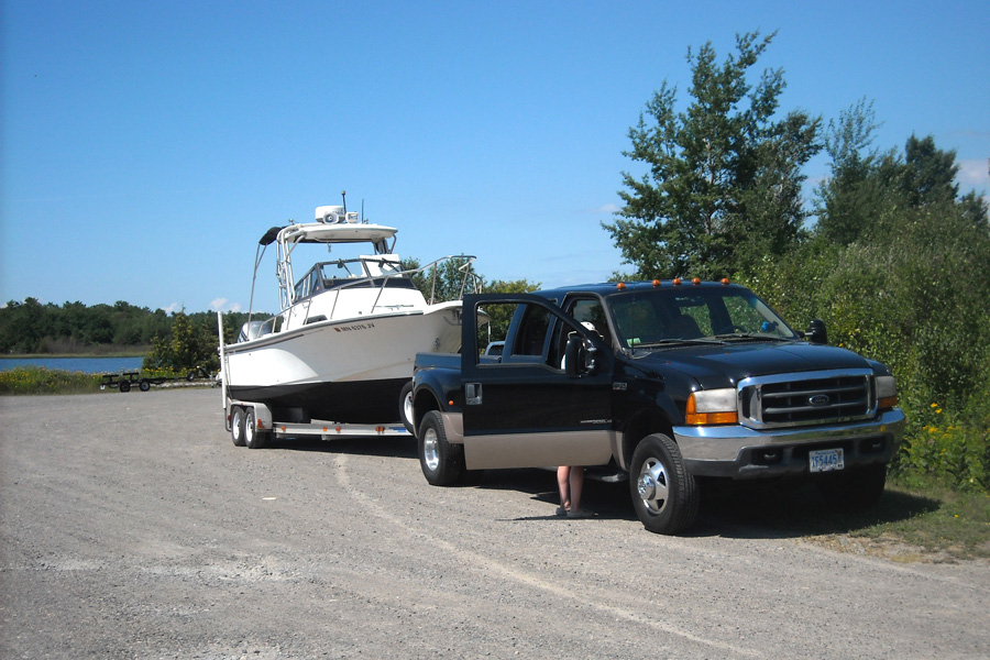
As usual, we are towing our 24-foot cuddy-cabin 1990 Boston Whaler boat, CONTINUOUSWAVE, with its 2010 E-TEC outboard engine, on its 1992 E-Z-LOADER tandem-axle trailer, with our 1995 GMC Suburban. The 26-year-old boat has been holding up very well, as has our 21-year-old truck. We think we have everything ship-shape for this week of cruising in the North Channel of Lake Huron.
We are coordinating our summer vacation with several of our close boating friends, and we all plan to rendezvous in Blind River, Ontario, on Saturday, July 23, 2016. A total of seven boats will be meeting there. We have moved up our vacation week to July in hope of getting the best possible weather. Our last trip to these cruising grounds (in August 2014) was made less than wonderful by three days of heavy rain and an almost stationary low pressure system. We hope for better weather in July. Also, speaking of time, we keep our watch on EDST (GMT -4) during the trip, which is the local time in this region.
We will be driving to Blind River, but we listen for the marine weather forecast because most of our mates will be arriving by boat. The weather radio broadcast for the North Channel (with wind speed in knots and wave heights measured from trough to crest in meters) for today predicts:
Strong Wind Warning in effect. Wind West 10 knots
backing to South 15 around midnight, then
becoming Southwest 10 by noon Sunday,
and increasing to West 20 Sunday night.

Chance of showers and thunderstorms.

Water level: Lake Huron is 0.9-meter above chart datum.
We depart Northport at 9 a.m., which is about the soonest we could after we both slept soundly until 8 a.m. We stop at the Holiday fuel station on M-22 and find it surprisingly unoccupied by other vehicles, allowing the long combination of truck and trailer to both take on fuel. I add 33-gallons of 91-octane premium-grade no-ethanol gasoline to the boat, and I top off the Suburban's tank to full. Between the boat (59-gallons) and the truck (44-gallons), we are carrying more than 100-gallons of fuel. This adds over 625-lbs to the load, which is already very close to the weight limits and ratings for the truck, the trailer, and all the tires. We lose about 0.7-lbs per mile, as the truck burns off fuel at a 10-MPG rate.
Our departure point, Northport, is at the end of a long peninsula, so to head North we first have to drive south for 45-minutes, drive through Traverse City, and then turn north. With the stop for fuel and the city traffic, it takes us almost two hours to just get back to the same latitude we started from. Finally we are making some northing toward the Straits of Mackinaw and crossing into the upper peninsula. The route we have chosen is all two-lane highways. This cuts 20-miles off the distance compared to going east and taking the Interstate. We don't really drive faster than 55-MPH when the boat and truck are this heavy, so a shorter route should be as fast as the longer Interstate highway route at our speeds.
After Noon, we cross the deep blue water of the Straits of Mackinac that connects Lake Michigan to Lake Huron on the stately bridge that has spanned the gap since 1957. We take a break at the rest area and change drivers. I check the temperature of all tires and the wheel bearings on the trailers; they're all consistent and within the usual ranges. Ten minutes later we are back on the road. From St. Ignace to Sault Ste. Marie the highway is Interstate-75, about the only stretch of this trip that will be on really good roads.
Entry into Canada is via the International Bridge at the Soo. This old structure crosses the Soo Locks, maintaining a 150-foot vertical clearance to not interfere with the many passing ships. After paying the toll, we only move about 200-yards before coming to the backed-up traffic at Canadian Immigration and Customs. We creep across the 1.5-miles of bridge in stop-and-go increments of 100-feet. Fifty minutes later we reach the customs booths, just at 2 p.m., which appears to be some sort of shift change. All traffic stops for about three agonizingly slow minutes as the Canadian border agents start a new shift. Three of the five lanes are open. We must have hit this border at a peak in traffic.
When our turn comes to pull up for entry, the verbal interrogatories are brief and perfunctory. We are admitted to Canada. We pull ahead to exchange some currency. The currency exchange is housed in a very dirty and somewhat dilapidated small building, and the customer ahead in the line is changing more than US-$1,000 into Canadian money. A lot of careful and slow counting of bills is going on. The exchange rate is presently about CA-$1.35 for one U.S. dollar, but at this venue there is a ten-percent skim. We exchange just US-$40 so we have some Canadian money for incidentals. The rest of our purchases will go on our credit card and get a better exchange rate. We get about $50 in Canadian bills which are quite colorful, have pictures of Queen Elizabeth or old prime ministers from pre-confederation days whose names begin with "Sir", and are printed onto a mylar plastic.
Exiting the border plaza requires negotiation of an awful curb with chunks of missing pavement. This extremely busy crossing point is showing its age and the wear of thousands of trucks and cars every hour for decades. It is in the process of being renovated, and it really needs an upgrade.
By 2:30 p.m. we resume our eastward travel. Having learned from a prior visit to ignore the large signage pointing to the "truck route," we avoid the extra five miles it adds to getting to the eastbound highway when it takes you on a complete loop around the northern side of town. Instead we follow the quite obscure and preposterously small signage that points us to the much shorter and more direct route available to non-trucks that leads through the city in a series of left and right turns, block by block. Across the street from the border plaza I notice a new welcome center with its own currency exchange. Do they give a more favorable rate?
This Canadian steel mill and border town is showing its age. The buildings have the architecture of the first decades of the last century, the traffic signals appear to be completely uncoordinated or synchronized, and the pavement needs attention. One oddity: there is an absence of otherwise omnipresent Canadian bi-lingual street signage; not a word of French to be found here. There must be no Francophones in Sault Ste. Marie, which, considering the origins of this place and its name, is a bit hard to understand.
About five miles and twenty traffic signals from the border plaza, we finally are on the major road, Highway 17, the Trans-Canada highway. At three miles east of town it turns into a four-lane divided highway, almost like an interstate highway but the crossing roads have no bridges. There are just uncontrolled intersections with the main local roads every few miles. Signs announce the towns and their populations. Municipalities of 400 residents are typical.
By the village of Desbarats—more French heritage—the road reverts to a two-lane with a 90-kilometer-per-hour speed limit (56-MPH). That's good for us, as we seldom go any faster when towing this big boat. Blind River, our destination, is 100-minutes to the East.
We have travelled this route many times, usually without the boat in tow. Chris's aunt and uncle lived east of Blind River on beautiful and large Lake Lauzon for several decades after leaving the USA. We visited them almost every summer.
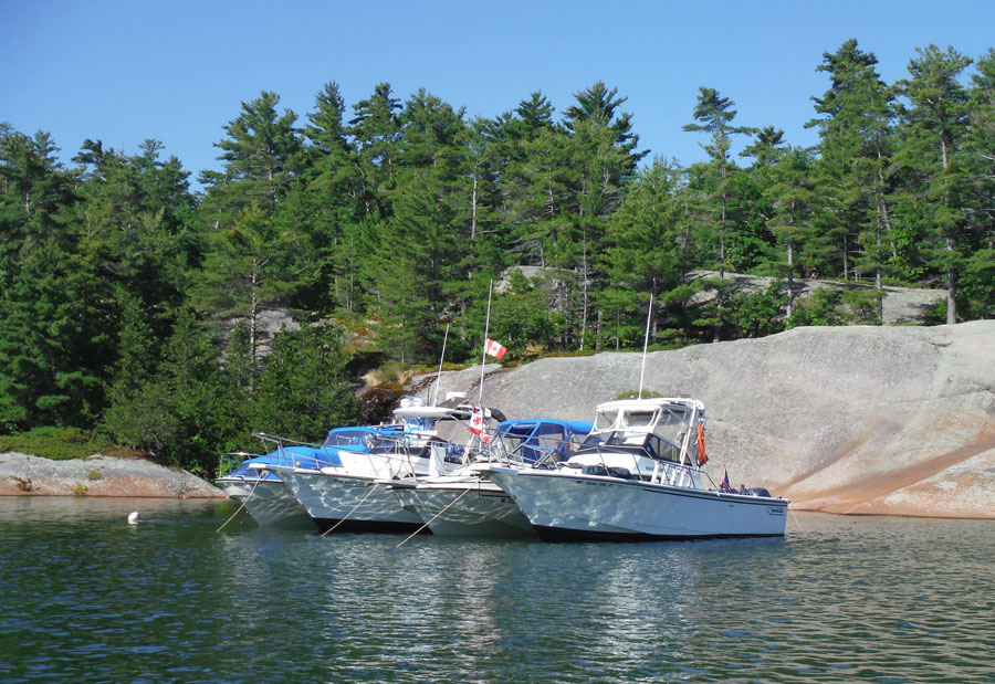
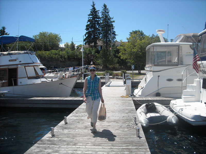
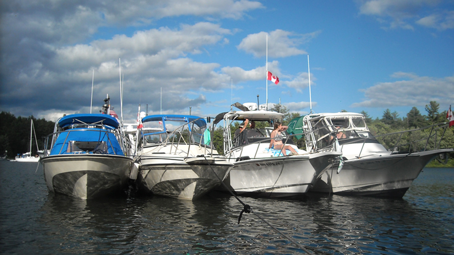
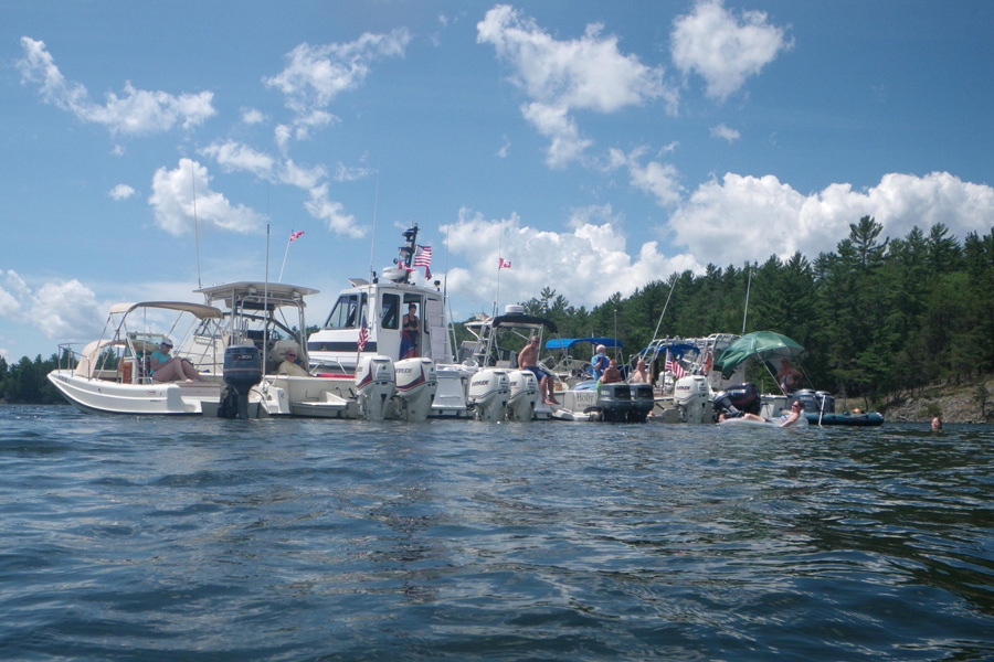
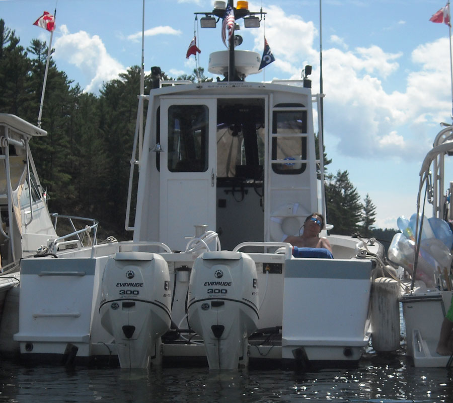
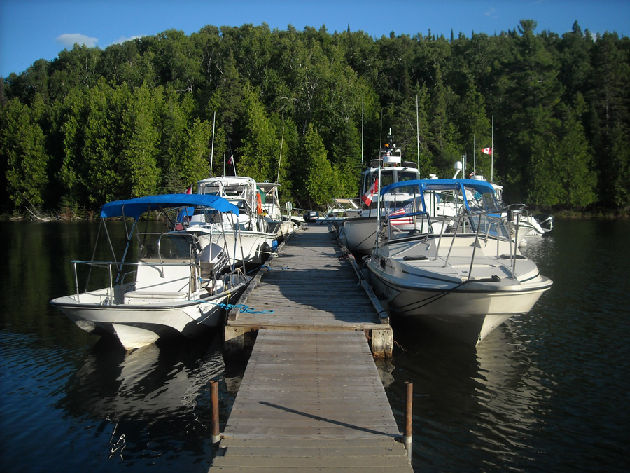
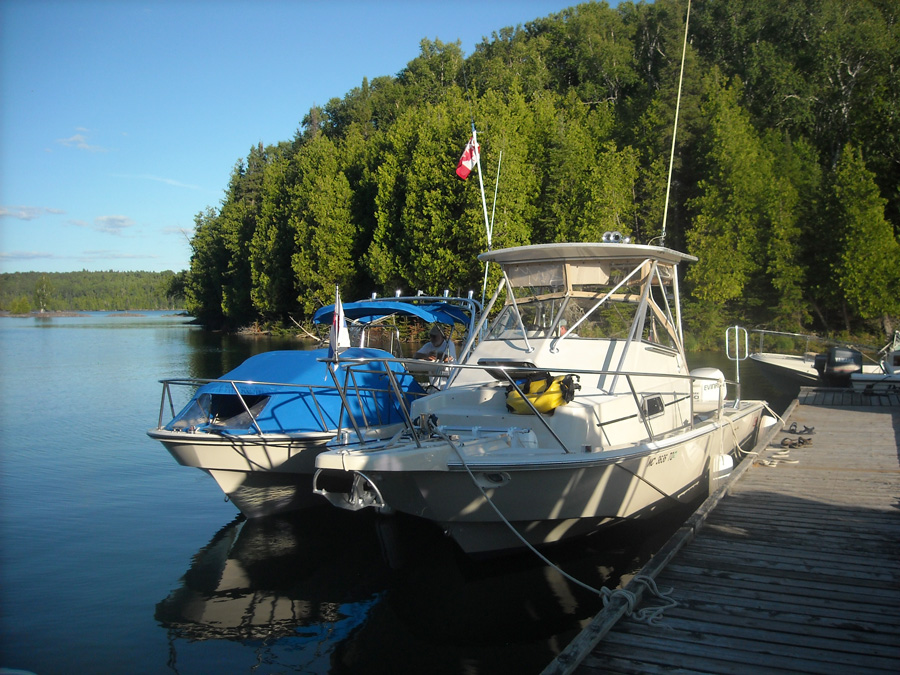
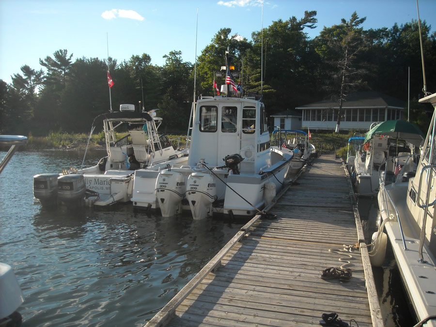
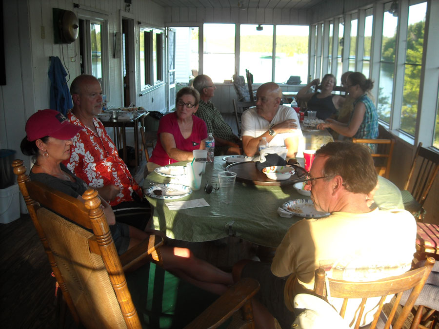
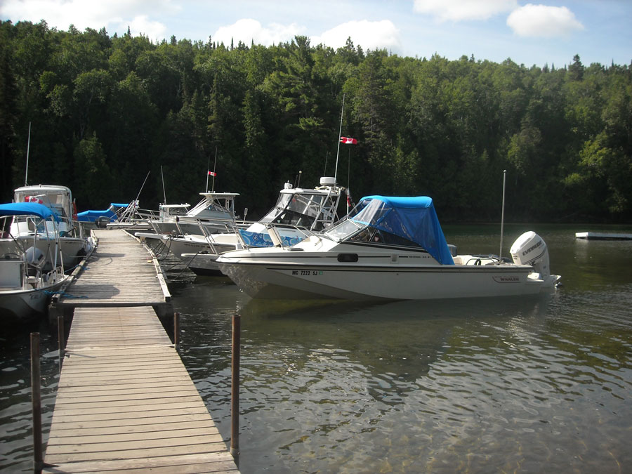
By 4 p.m. almost on-the-dot we turn at the traffic signal—the only one—in Blind River, and head south to the northern shore of Lake Huron and the marina. Launching the boat is easy. The ramp is decent, the water well protected, and there is plenty of depth. The floating dock is long. We are almost the last boat to arrive. Five boats of what will become a seven-boat fleet are already here. We move CONTINUOUSWAVE the short distance from the ramp to a slip on the upwind side of B-dock. The watery portion of our cruise has begun.
Most of fellow Boston Whaler boaters who will be cruising with us are already arrived at Blind River. When the entire fleet assembles we will have:
The winds and wave have been generally favorable for making Easting, and the boats coming across the North Channel from the West have had mostly a downwind passage. All the boats are in close-by slips, so we have a dock cookout for dinner. By six o'clock the presently seven-boat fleet has assembled, and we will be ready to head east tomorrow.
At 5 p.m. Environment Canada issues the following recreational boating forecast for the North Channel:
North Channel: strong wind warning in effect.
Wind West 10 becoming South 15 by midnight;
then becoming Southwest 10 by noon Sunday,
and clocking to West 20 Sunday night.
Chance of rain and thunderstorms.

At 6:30 p.m. Synopsis: a N-S ridge over Lake Ontario;
by Sunday a N-S ridge over New Hampshire,
and a 999-millibar Low over northern Ontario;
a N-S-trough over Manitoba; North Channel:
a cold front moving southwestward.
All photographs are by the author, unless otherwise noted in the captions.
The International Bridge at Saulte Ste. Marie, with very little traffic. Photo by JR.
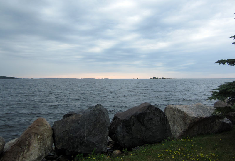
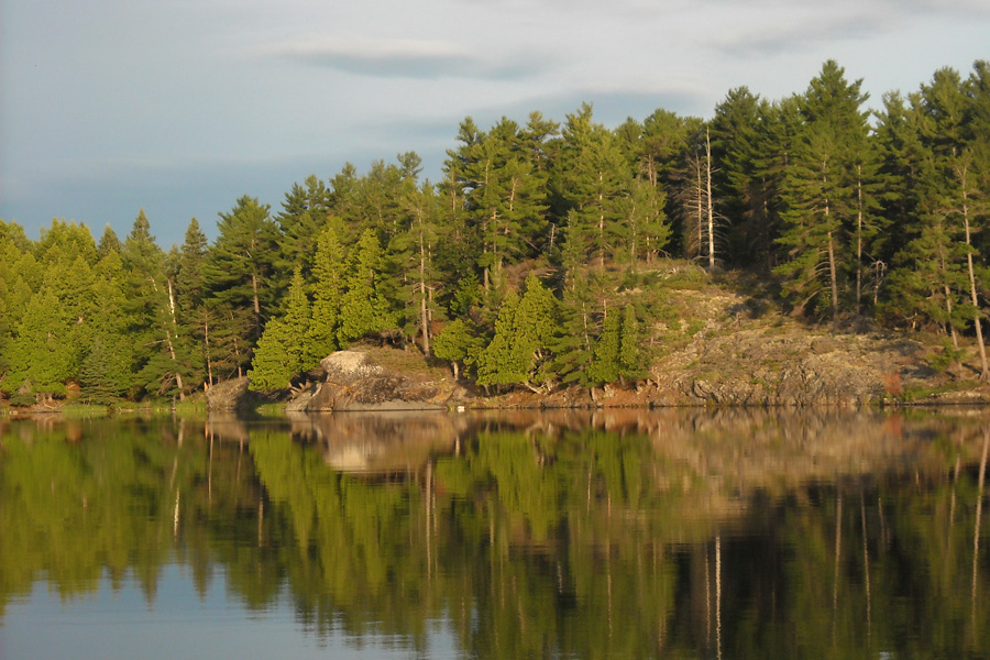
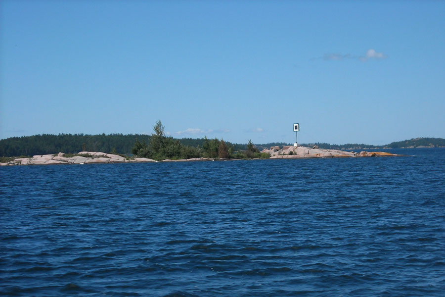
Looking seaward from Blind River Marina on early Saturday evening, the weather begins to deteriorate
as the low pressure system moves in from the West. Photo by JR.
| Date: | Sunday, July 24, 2016 |
| Departure: | Blind River, Ontario, Canada |
| Destination: | South Benjamin Island or Little Current, Ontario, Canada, on Manitoulin Island |
| Distance: | 39 miles by water |
By 6:30 a.m. Sunday morning the western sky has a dark horizon and rain is anticipated. On weather RADAR, a line of showers and thunderstorms is approaching. The marine forecast says "cooler, cloudy, with southeast winds." My local barometer (on the E-TEC engine) reads 996-millibars. We are upon Lake Huron, so our elevation is about 576-feet above sea level. Correction for our altitude is 15.4-millibars. This gives a corrected barometer reading of 1011.4-millibars, which is a bit at odds with the forecast 999-millibar low; maybe the system has already moved through and we are on the back side of it.
We decide to loiter at the docks in Blind River and let this low-pressure system and cold front pass through. Many of the crews gather at the marina cafe and have an excellent extended breakfast. The little place serves up very good eggs, bacon, and homemade bread. We make arrangements for leaving our truck and trailer for the week, buy some ice, and reset all the electronic fuel and distance trackers on the boat's electronics to zero so we can record this cruise in detail. As Noon approaches, the rain has passed, and we embark on our cruise. We grab two Egg McMuffin-equivalents from the cafe for lunch; they're delicious at CA-$4 each.
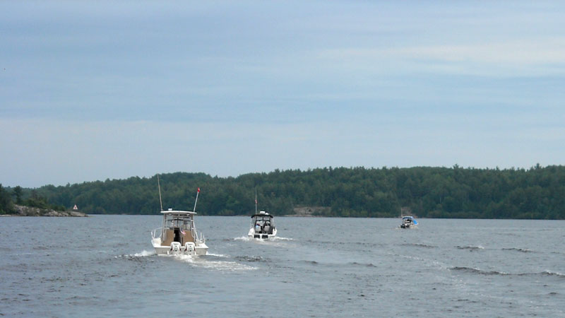
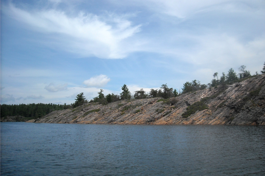
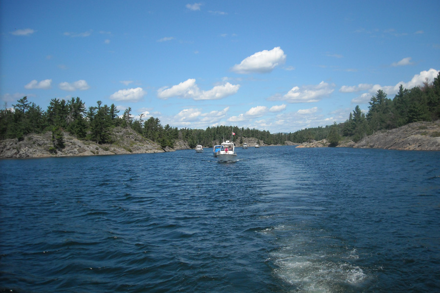
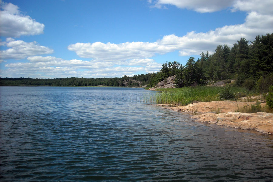
The wind is up from the southeast at about 10 to 15-knots, and our first leg will be upwind and into two foot waves rolling in. The shoreline around Blind River is a shallow bank with depths of ten to fifteen feet, so the waves tend to stack up. We have to make about ten miles to the East before we can gain some shelter in the lee of a long string of offshore islands that forms the Whalesback Channel.
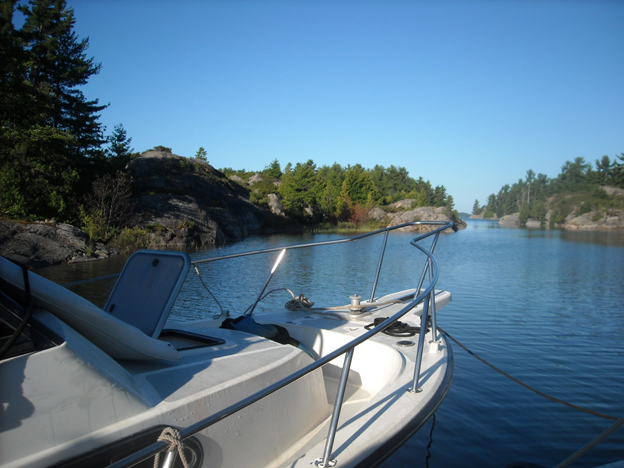
Once in the protection of the Whalesback Channel, the water smoothes and we cruise along in comfort. We transit Little Detroit around 1 p.m., and continue toward the Benjamin Islands. We depart the main channel and take a short cut behind Eagle Island, avoid Phantom Rock (which is just awash with this higher water level), and enter the north harbor at South Benjamin Island through the narrow and unmarked passage from the West.
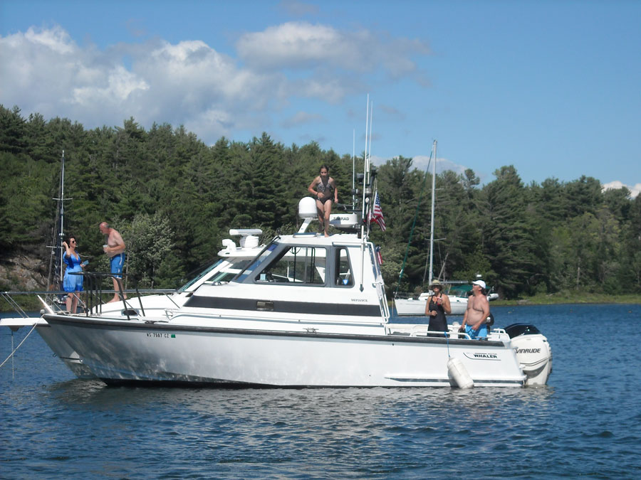
The end of the rain and the appearance of the sun has elicited the departure of several boats from the popular anchorage, and as we look for a good location to drop anchor a rather large blue motor yacht steams out of the best cove in the whole harbor. We immediately replace her in that spot, forming two rafts, one of four boats and another of three boats, to simplify the raft-up and setting of anchors.
The Benjamin Islands are formed from pink granite. There are many boats here: sailboats, trawlers, motor yachts, small cruisers. Our fleet of outboard-powered small cabin boats is unique. We spend the sunny afternoon swimming and exploring the island, and chatting with the crews of passing dinghies coming ashore from boats anchored out in the more-open harbor.
We have such a nice anchorage that four boats decide to stay here for the night. The other three will head to Little Current, where only three slips are left available at the town docks, and stay there tonight. DRIFTWOOOD, DEFIANCE, and LUCKY TWO depart for Little Current. The remaining four boats raft-up for dinner and overnight anchoring.
Marine Weather Forecast from Environment Canada issued at 5 p.m. Sunday.
NORTH CHANNEL - Strong Wind Warning in effect.
Winds South-Southwest 15 knots becoming West 15 by midnight,
then increasing to West 20 by noon Monday.
Chance of showers and thunderstorms.
We will be going East tomorrow, so some strong westerlies won't be a problem for the run to Little Current and beyond.
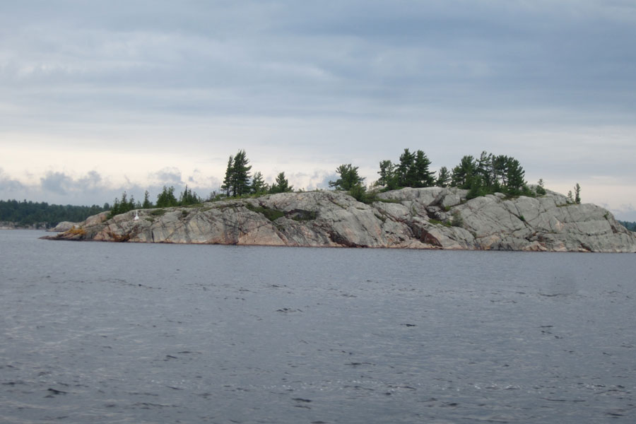
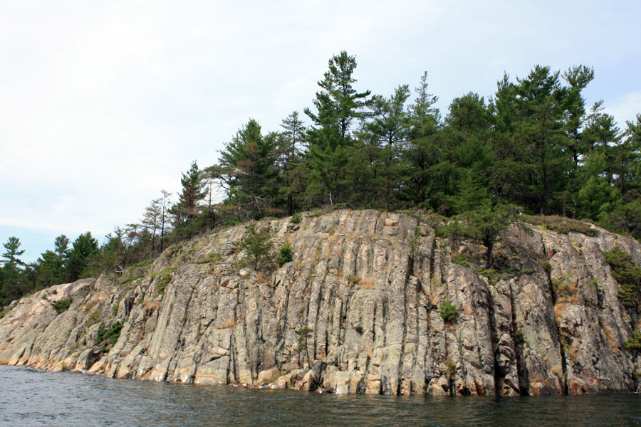
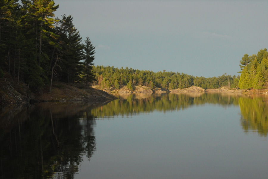
The Whalesback Channel is named after Whalesback Rock. Lt. Bayfield and his small party are said to have encamped here to avoid the mosquitoes during their months of surveying this area in the Summer of 1822. Photo by JR.
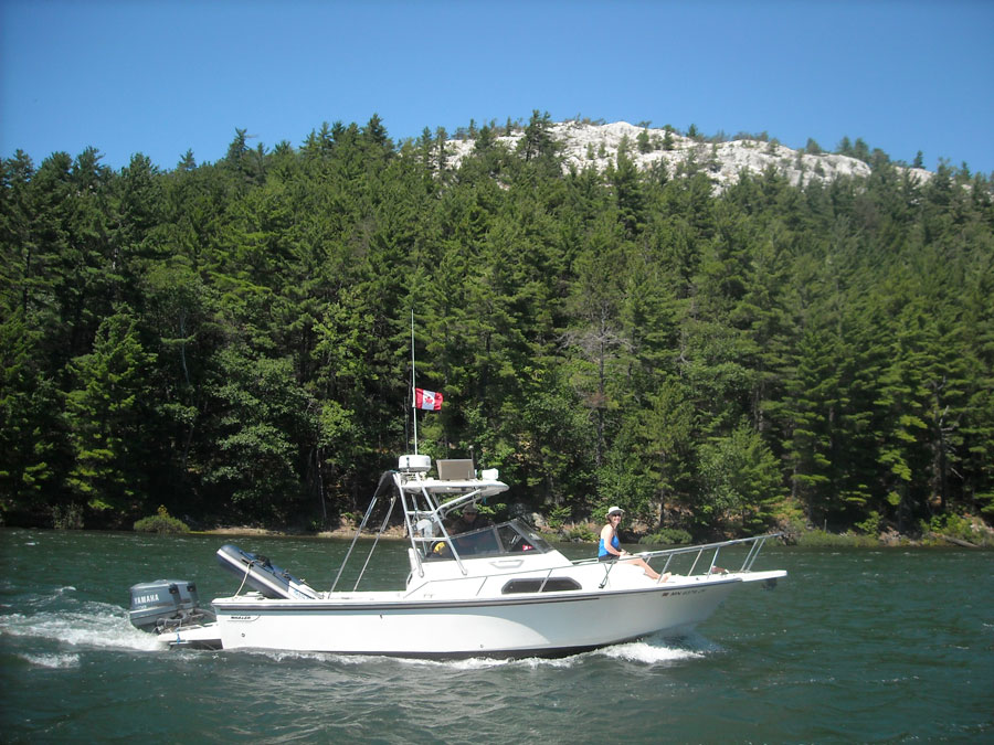
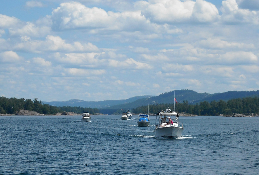
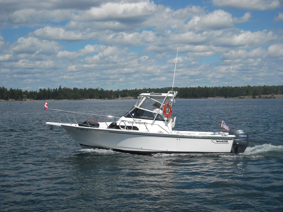
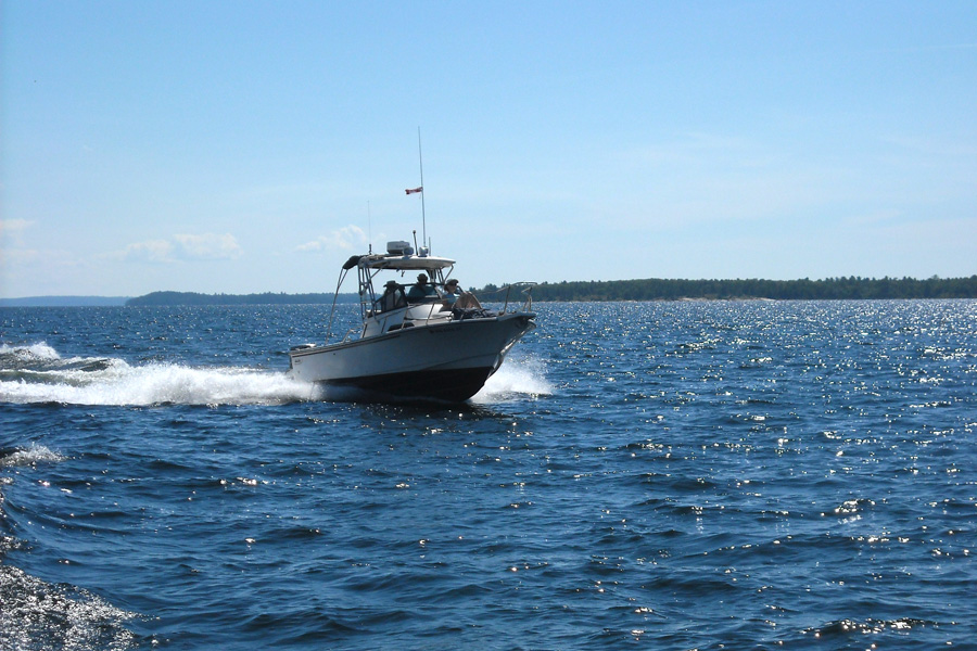
DRIFTWOOD, LUCKY TWO and MANIC MOMENT run under cloudy skies on the first leg of our cruise, here near the eastern end of the Whalesback Channel and north of Aird Island.
DRIFTWOOD, the newest and largest boat in the BWGLCC 2016 Cruise fleet, is on her first visit to the North Channel.
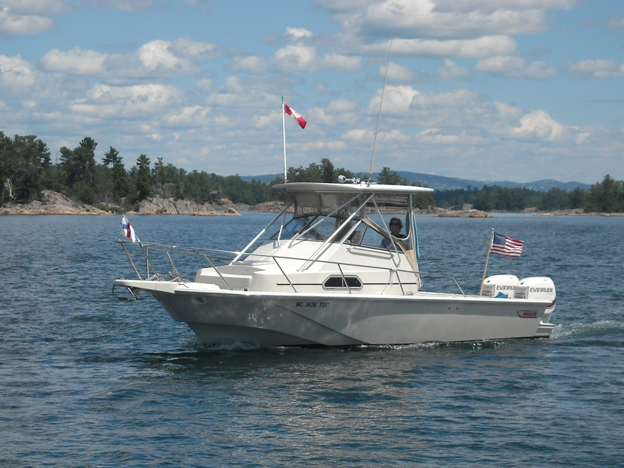
LUCKY TWO passes us close abeam.
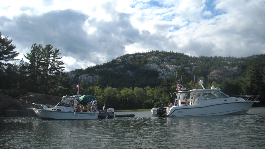
The fleet slows down as we approach the narrow passage called Little Detroit.
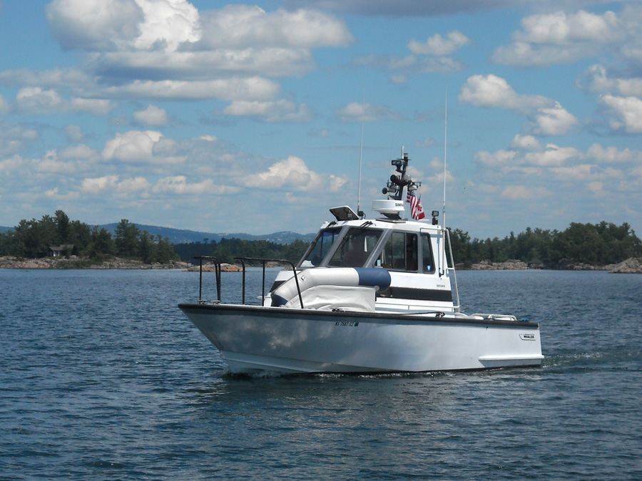
DEFIANCE carefully aligns to the 75-foot wide channel and transits Little Detroit, West to East. Photo by JR.
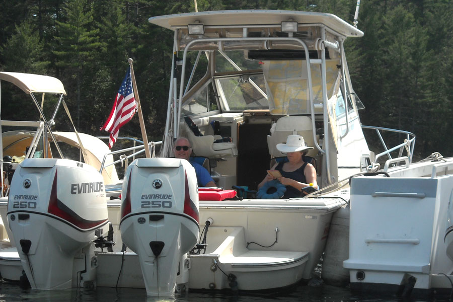
The remnants of the overcast morning are still clearing as we take our lunch stop at a nice cove on the north side of South Benjamin Island. Boats with multiple outboards predominate in our fleet; six of the eight boats have more than one engine.
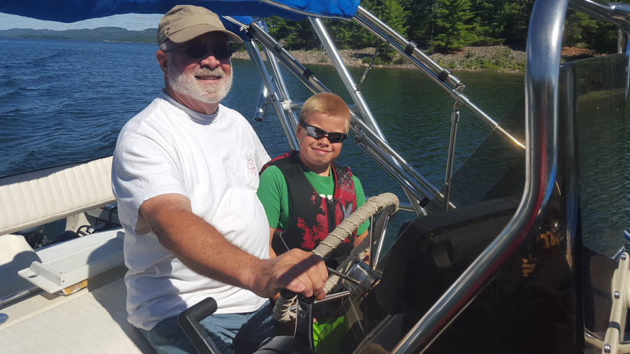
Sometimes the easiest way to get ashore is to swim. Here John returns from shore with his hat, camera, and sunglasses intact.
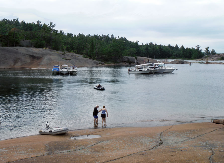
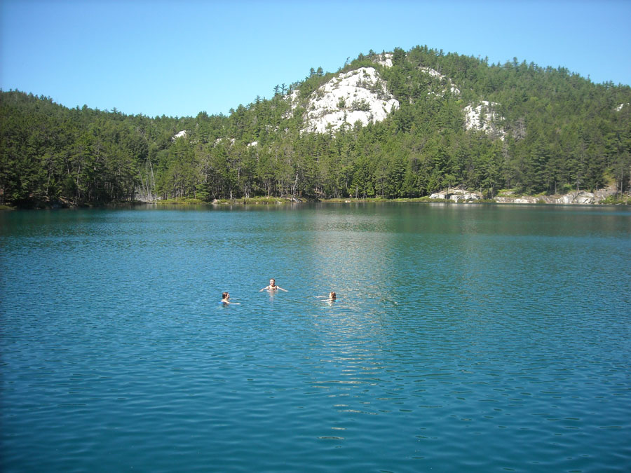
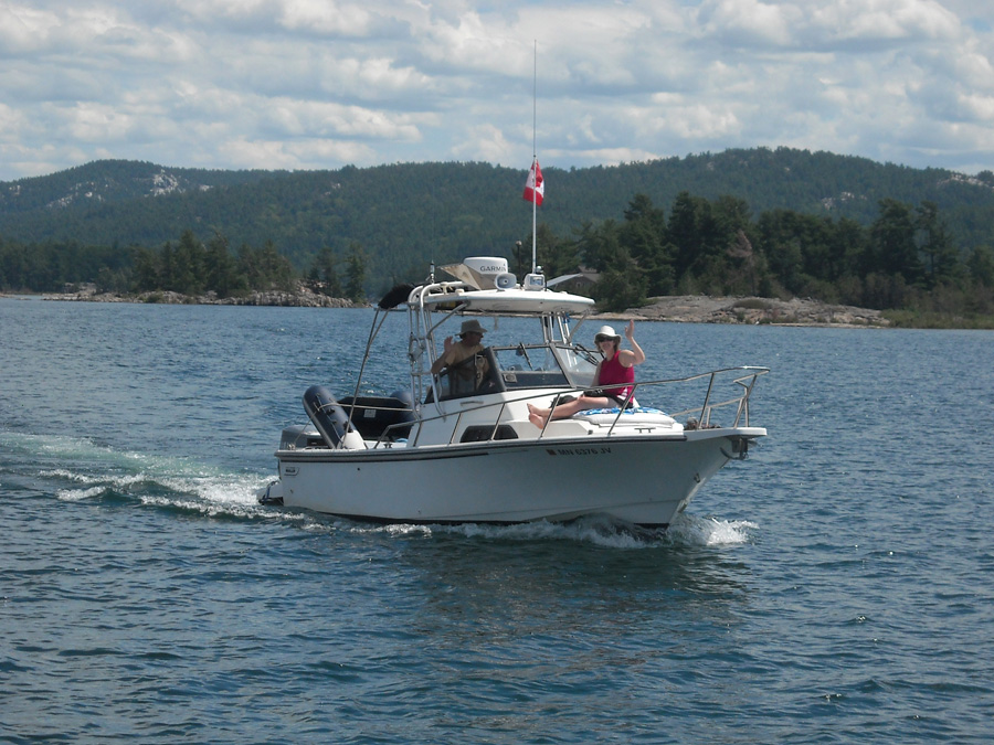
At our anchorage on South Benjamin Island, your author and Chris step carefully down the the wet granite rock into the water for a swim back to the boats. Photo by JR
| Date: | Monday, July 25, 2016 |
| Weather: | Fair |
| Winds: | Light and from the West |
| Waves: | Calm |
| Departure: | Anchorage at South Benjamin Island |
| Position: | 46° 05.09' N; 082° 15.21' W |
| Destination: | Marianne Cove, Baie Fine, Ontario |
| Distance: | 45 miles by boat |
By morning the wind has switched to the west. The air is cooler, the wind variable, and there are low clouds; there is some disturbed weather in the region, but eventually the sky turns a glorious blue. We have a lazy morning, and get underway around 11 a.m. As we cruise downwind on the way to Little Current to the east, we take a detour to pass Bears Back Island, which has a nice natural harbor that we want to inspect. We arrive at Little Current about 45 minutes past the hour. This is a good time because the swing bridge only opens on the hour, and a crowd of larger boats is idling east of the bridge, waiting to transit and come to the fuel dock at Wally's. We can pull right up to the long service dock without waiting, and take on 90-liters (23.3-gallons) of ethanol-free gasoline. The price is CA-$1.20-per-liter. With the exchange rate at a favorable US-$1.00 for CA-$1.25 (or higher), the price is about US-$3.72-per-gallon (or less). Lower gasoline prices in general and a very favorable currency exchange have made fuel costs much lower this year than in the recent past.
We move off the service dock and take a temporary slip in an adjacent town marina docks. Chris goes up the hill to the grocery store for more provisions. And we get the bathroom code from another boater. Our barometer corrected to sea level reads 1006.4-millibars. Alongside in the adjacent slip is a sail-boater, James, from Manitowoc, Wisconsin. We have a bit of conversation about his steel KANTER sailboat, and I discover he is a fan of the CONTINUOUSWAVE.COM website and its sail logs.
All seven boats are ready to depart Little Current in time for the two o'clock bridge opening. The smaller boats, like ours, can easily transit under the bridge, which at this water level has about 16-feet of clearance. Today is another beautiful, fair, warm, and sunny summer day, and it is hot at the dock. We cast off and head east at idle speed, waiting for the larger boats to make the bridge opening on the hour.
Once the fleet reforms, we get on plane and head across Frazer Bay to the entrance of Baie Fine, pronounced "bay fin". Our destination is The Pool, another popular anchorage. LUCKY TWO peels off on the way and goes to Marianne Cove for a lunch stop, planning to go on to Killarney for the night.
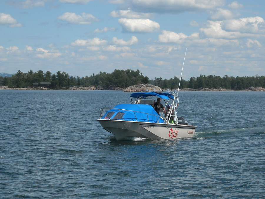
At The Pool, I find a good spot for anchoring, putting down my 15-lbs Danforth astern, and then slowing heading to shore, where a very stout tree is just a few feet above the water and in easy reach. Bob on OUTRE sees my thinking, and he yells over, "Do you want Sam to swim a line ashore to the tree?"
Yes, that is precisely what I was planning. Twelve-year-old Sam jumps in the water. I throw him the end of a 100-foot 3/8-inch line, and he takes it ashore. He ties it to the tree, and now we have a nice fore-and-aft mooring. "That's child labor," someone yells. Perhaps, but it is quite nice to have an enthusiastic young fellow around for chores like his. The bow is pointed west into the wind and tied to shore, and the stern is on about 80-feet of rode on an anchor well set in the lake bottom. The other three smaller boats raft up, with HOLLY MARIE also setting a stern anchor. We quickly have a very good overnight mooring.
The two larger boats, DEFIANCE and DRIFTWOOD, anchor and raft up close-by. They're not going to stay overnight, and will join LUCKY TWO in Killarney after having dinner here. By the time we get all the boats settled-in, it seems too late to embark on our ascent to Topaz Lake. That side trip is postponed until tomorrow. We enjoy the afternoon with some swimming. The water temperature is 78°F, and it is very pleasant to take a dip. The kids, Sam and Emmarie, and some of the big kids, too, go off exploring by motorized dingy.
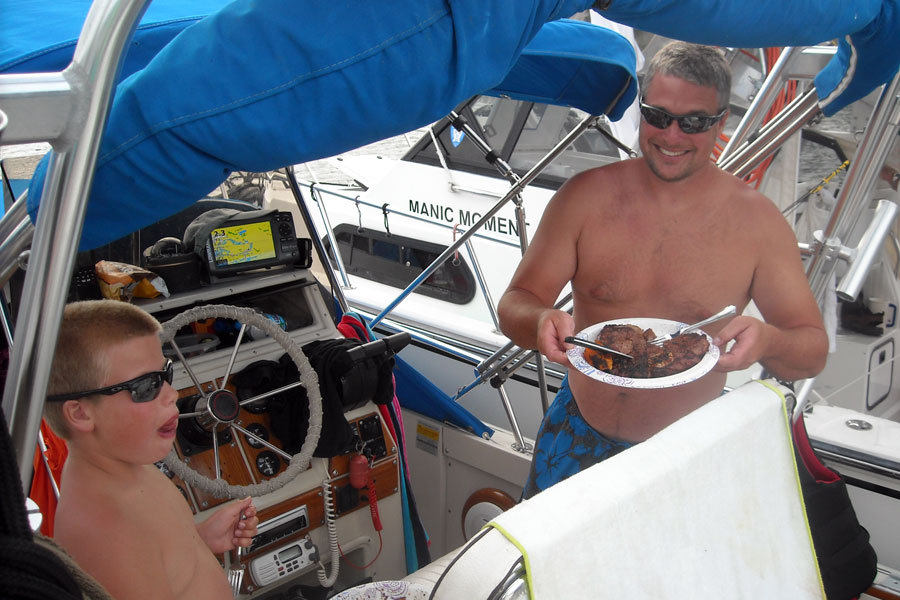
For dinner we grill two steaks that Chris bought in Little Current. Food always tastes better on a boat, and even more so when your boat is anchored in a beautiful and remote cove in the North Channel.
The 8 p.m. marine forecast for the North Channel says:
North Channel:
Strong wind warning in effect.
Wind West 20 decreasing to West 15
and then to West 10 late tonight.
Tuesday winds Southwest increasing to 15-knots
then clocking to West 10 by evening.

Observations:
Killarney, West-Northwest 12 gusting to 17.

Wave height forecast:
Western Lake Superior, 1-meter decreasing to 0.5-meter;
Eastern Lake Superior, 1-meter decreasing to 0.5-meter.

Extended marine forecast issued at 6:30 p.m. Monday:
Lake Huron: Wednesday and Thursday winds light;
Friday wind Northeast 15-knots
We awake to clearing skies, sunshine, and light winds.
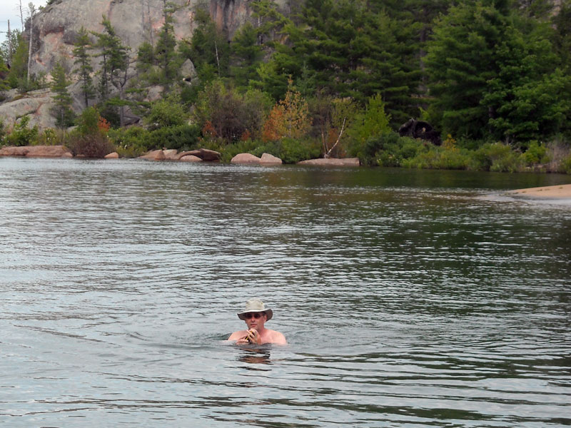
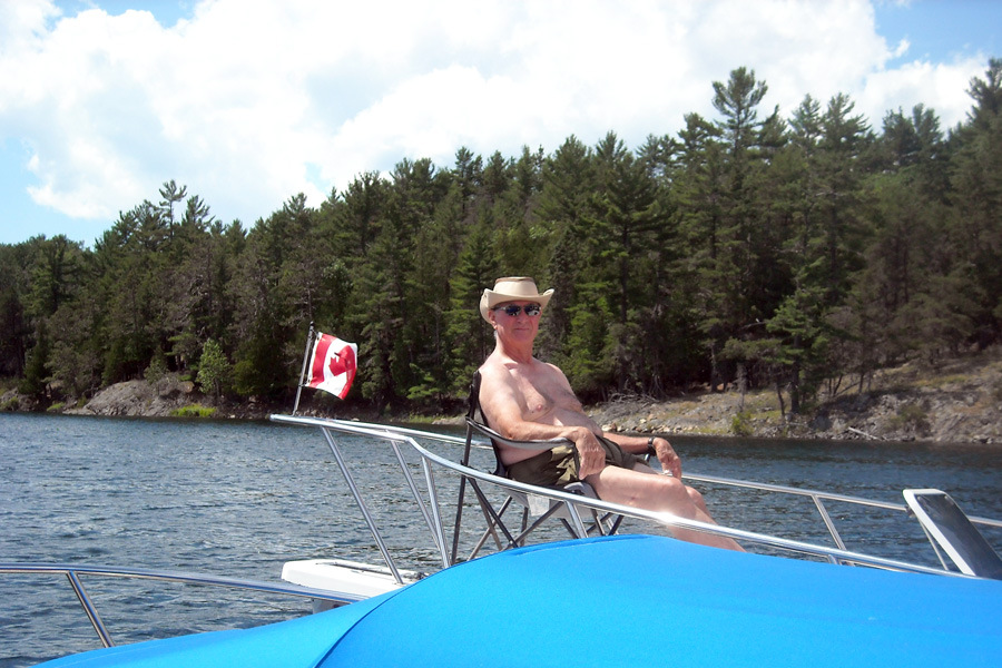
Our four-boat raft rode easily overnight in this protected anchorage. Your author goes for a morning swim (left). Photo by JR
We cruise by Bears Back Island to assess its anchorage for possible future use.
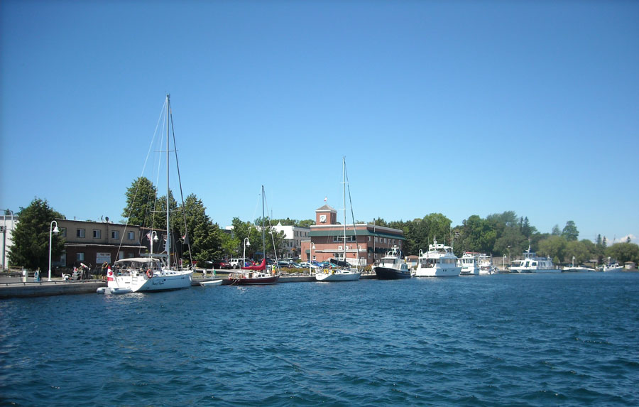
The sea wall at the Port of Little Current is occuppied by boats of all sizes.
We move to an empty slip at the marina docks so we can get ashore for some shopping. Most "cruising" boats here are a bit larger than ours. This marina has first-class docks but could use more bathrooms.
Chris returns with the provisions: steaks for the grill for tonight.
Holly rides the foredeck on the HOLLY MARIE. The white quartzite hills make a delightful backdrop.
The cabin top on DEFIANCE becomes a diving board.
At anchor at The Pool on a beautiful afternoon.
OUTRÉ, CONTINUOUSWAVE, HOLLY MARIE, and MANIC MOMENT will again spend the night at anchor rafted together. We are tied to a stout tree ashore for our bow mooring line.
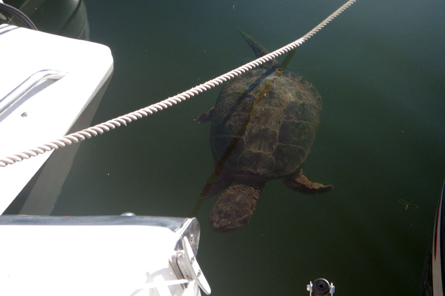
My enthusiasm for swimming waned after I saw this rather large turtle swimming astern of the boats. Photo by DH
| Date: | Tuesday, July 26, 2016 |
| Weather: | Clear, fair, warm, and sunny |
| Winds: | Calm |
| Waves: | Calm |
| Departure: | The Pool |
| Position: | 46° 02.79' N; 081° 28.73' W |
| Destination: | Killarney |
| Distance: | 36-miles by boat |
The warm fair weather with light winds and very small seas continues into our fourth day of the trip. This long stretch of favorable weather has been great. We awake to another clear summer day with no wind or waves in the anchorage.
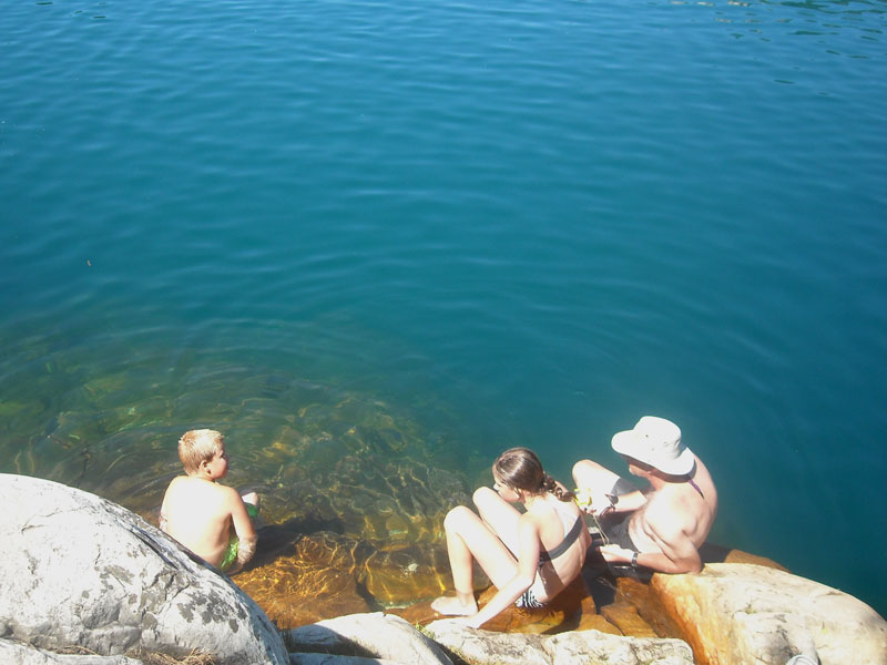
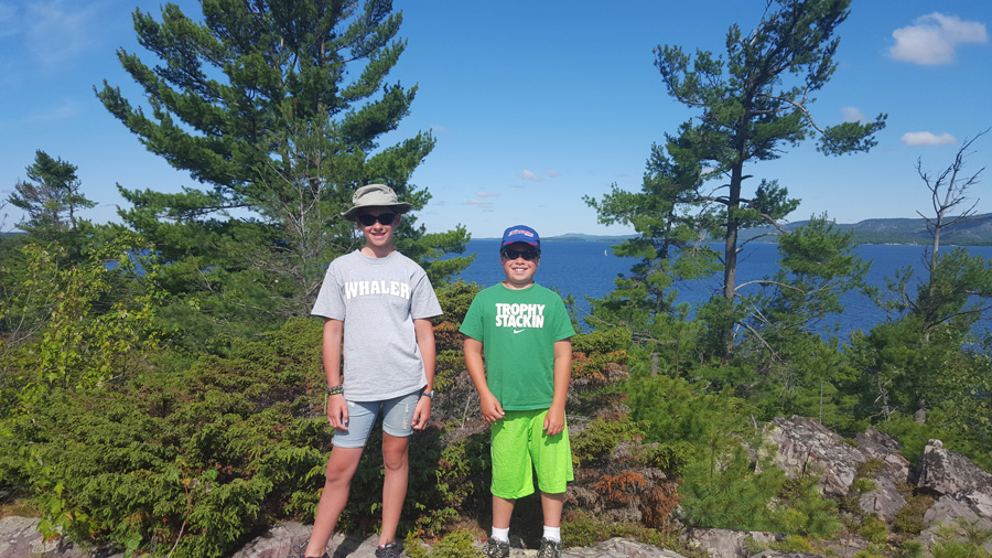
After breakfast, our mission is to climb up to Topaz Lake. About 10:30 a.m. we dinghy to shore and hike up the trail, part of a long series of improved trails in Killarney Provincial Park. There are even signs on this one now, pointing to Topaz Lake. The hike is not too arduous—actually quite easy compared to climbing Casson Peak—and we get to the lake in about thirty minutes. Arriving "at the lake" means you are standing on a granite rock face about 50-feet above the lake. Getting to the water requires a very careful descent. Getting into the water requires finding the one particular spot where you will also be able to get out of the water again.
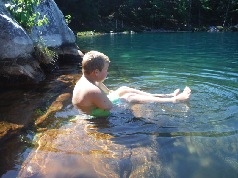
Topaz Lake is not in its crystal clear Bahamian blue color today, perhaps due to the heavy rains that fell on Sunday, but is more blue than green and better compared to last year, remarks John who saw it then. The water is also warm, and it is a delight to jump in. We are the only visitors and have the secluded lake to ourselves. Emmarie and Sam quickly find a spot when they can dive in from a rock ledge about 15-feet or more above the water, and they're having a blast jumping in and climbing out and repeating anew.
After about 30-minutes another small family group arrives with two young boys. The boys immediately want to emulate Emmarie and Sam, and beg their helicopter-parent mother for permission to jump in from the high rocks. She is not buying that, and won't let them, insisting they enter the water more safely. Eventually, she relents, and her kids are doing cannon-ball dives off the high rock, too.
Although I have been to The Pool many times, this is my first visit to Topaz Lake, and I am really enjoying it. The water is wonderfully clear and warm, and the setting is delightful. You're swimming in a rain-fed lake atop a very big hunk of white quartzite rock in a remote section of the north shore of Lake Huron. The surrounding shoreline is a combination of granite and pines. This is heaven.
After about an hour of solitude at Topaz Lake, we fall from grace. New groups of hikers arrive, about 20 or more people. Since there are just a few spots in the rock face where you can actually climb down and get into the water, there is a pedestrian traffic jam developing. We are now in Paradise Lost. I climb out of the lake, and change back to my hiking shoes to ascend the rock face. I don't like this much company. As we hike back downhill to the dinghies, we are passed by about 30 people or more ascending the trail. When they all arrive, Topaz Lake will look like Coney Island on a weekend—too much crowd for me. When we reach the dinghies we are amazed to count more than a dozen tied to shore, augmented by a large pontoon boat.
Back at the big boats we have lunch and remark on our good fortune to have made the climb when we did. Eventually we un-raft the boats, untie from the tree, and haul in the anchors. To my great surprise, our anchor comes up without a giant ball of weeds attached. The bottom of The Pool is remarkably free from the Asian Milfoil weeds that have plagued this spot for the last 20-years. It is a welcome change. Around 2:30 p.m., a rather late start to the day, we exit The Pool and head for Baie Fine.
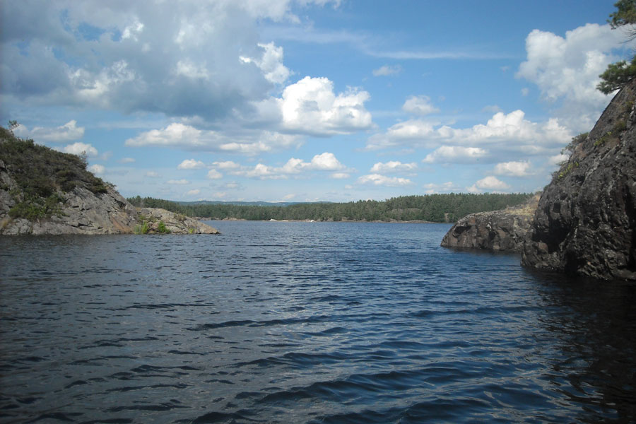
At the exit of Baie Fine we find Frazer Bay is not as rough as expected; the 15-knot southwest wind that was forecast is not quite at that strength. We head for the Lansdowne Channel, able to run on plane with some two-foot waves on our beam. Our destination is Killarney, where we will rejoin the three boats already there. We take a little side trip on the way to visit Snug Harbour, a favorite anchorage of ours. We raft up quickly on one anchor, and relax and swim some more. The 30-foot-deep water here is a bit colder, but it is still above 70°F and quite refreshing. It is just too hot today to get to a marina before about 5 p.m.
Eventually we reach Killarney and take slips at Sportsman's Inn. For dinner we visit the newly remodeled Killarney Mountain Lodge. We have an excellent dinner in the still intact original dinning room, however the food is a bit more modern and more likely to be found in Toronto than in a northern fishing camp.
One of the most pleasant parts of cruising and anchoring out is to awaken to a beautiful setting in a cove with blue skies and calm winds. The large tree on the right is our bow mooring post.
Tranquility Base: The Pool on a quiet summer morning.
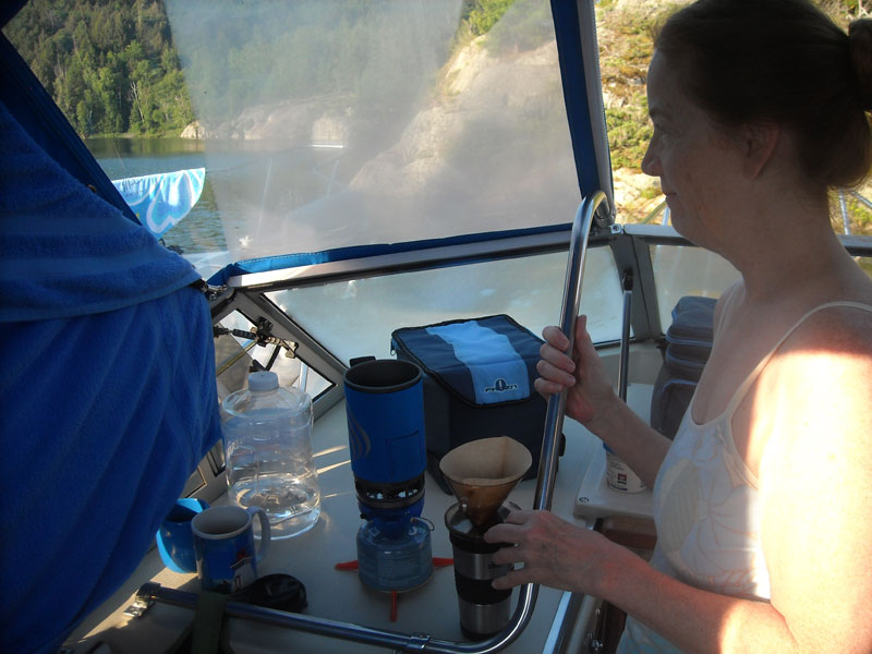
The galley on our small boat is limited to this space. A Jet-Boil heats water for coffee.
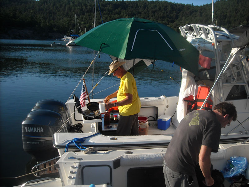
The other boats in our raft awaken and prepare breakfast.
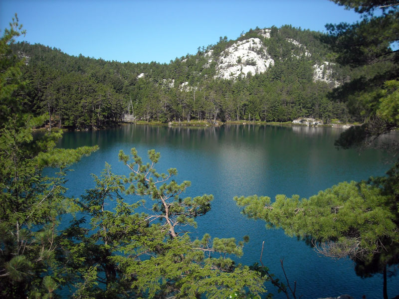
Topaz Lake lies quiet and calm this morning. We just need to climb down the rock bluff to the water level.
There are not many places where a swimmer can easily get out of the water from Topaz Lake.
The ladies really enjoy their morning swim at Topaz Lake.
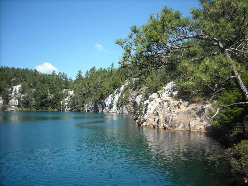
Once stepping off the shoreline rocks, Topaz Lake plummets to unfathomed depths.
Sam takes a rest from high diving. Photo by JR.

Your author pauses on the trail on the (downhill) hike back to The Pool from Topaz Lake. Photo by CEW.
| Date: | Wednesday, July 27, 2016 |
| Weather: | Fair |
| Winds: | Light |
| Waves: | Calm |
| Departure: | Killarney |
| Position: | 45° 58.26' N; 081° 30.92' W |
| Destination: | East Channel, McGregor Bay |
| Distance: | 32-miles by boat |
Fair weather continues. This July week has been perfect for boating, so far, and forecasts indicate it should continue, although the winds may switch to northeast tonight.
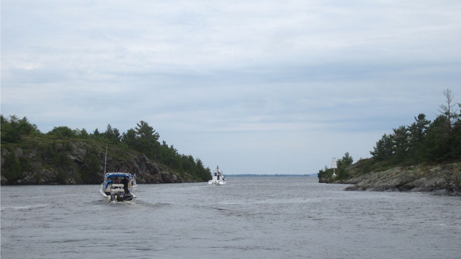
We leave Sportsman's Inn at 10:45 a.m., a six-boat fleet, without DRIFTWOOD, whose crew have been enjoying Killarney so much they decide to stay another day. The rest of the BWGLCC fleet heads west, through the Lansdowne Channel, taking a bit of fun detour through the narrow passage at The Hole in the Wall, running north across Frazer Bay, and turning eastward again into McGregor Bay.
While heading east in McGregor Bay we get a radio call from Don and Gail aboard WHITEWATER. They have launched at the ramp at Birch Island (in the northwest part of McGregor Bay), and they are heading out to join us. We find a path among the many islands on the southern shore of the bay, and work our way east to East Channel. Eventually we anchor in the very farthest east portion of East Channel, in a beautiful cove we have to ourselves. We form a nice raft and set three anchors. We have found our overnight anchorage. The water temperature here is a remarkable 78°F; we enjoy a lot of swimming from the raft of boats.
The boats with inflatable dinghies with small outboard engines get them ready for use, and soon they are exploring the surrounding waterways. There is a passage into the next large bay to the North, but it is very narrow and shallow, about 3-feet, suitable only for small boats. This little arm of the waterway is also subject to some strong currents. When the wind moves the water in the two large but separated systems, the little passage connecting them will try to equalize the water levels and may develop some current. And the passage has a very sharp turn, which might be hard to make in a larger boat, even with no current.
We have a grand cookout and dinner on the boats. We pass hors d'oeuvres among the boats, and Chris and I grill ourselves some hamburgers.
The wind has been southwest all afternoon at about 200-degrees, providing a welcome cooling effect. By 8 p.m. the wind swings to west (270-degrees) and drops. By morning the wind will veer back to 245-degrees, and be very light. The evening is very pleasant, with a red sky after sunset.
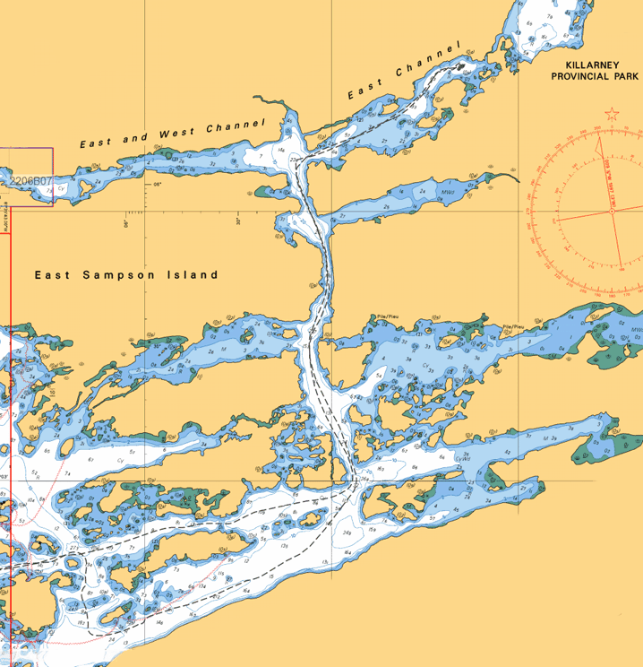
Our track into and out of East Channel in McGregor Bay, North Channel of Lake Huron.
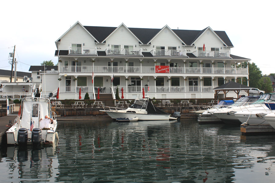
A 6 a.m. view of Sportsman Inn. Photo by JR.
CONTINUOUSWAVE looks for the deeper water entering Hole In The Wall, a shortcut between Frazer Bay and the Lansdowne Channel. Photo by JR.
LUCKY TWO, OUTRÉ, and DEFIANCE on the north side of Hole In The Wall. Photo by JR.
CONTINUOUSWAVE explores the unbouyed East Channel in McGregor Bay. Photo by JR.
This channel was likely gouged out by glacier movement. The tracks remain on the shoreline rocks. Photo by JR.
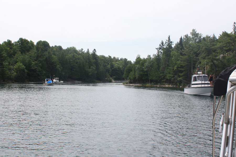
We work our way to the East in McGregor Bay, following a natural and deep channel with rocky shoreline.
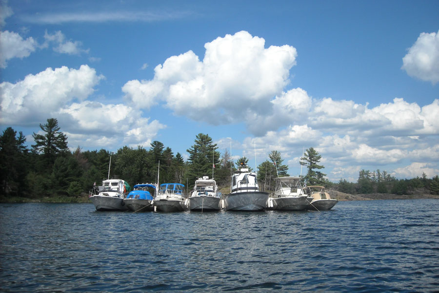
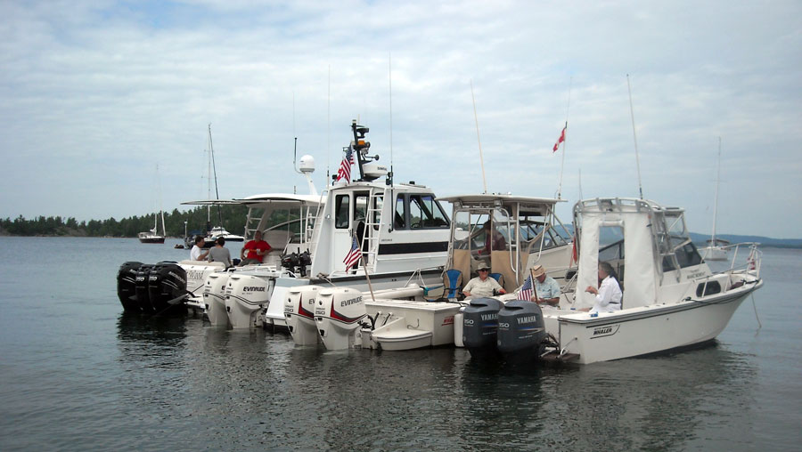
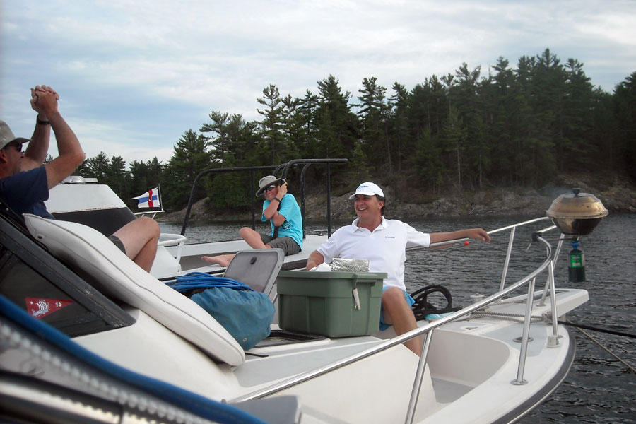
We assemble this raft of seven boats, holding on three strategically arranged anchors, in the farthest East and North cove we can find.
L to R: MANIC MOMENT, OUTRÉ, CONTINUOUSWAVE, HOLLY MARIE, DEFIANCE, LUCKY TWO, WHITE WATER.
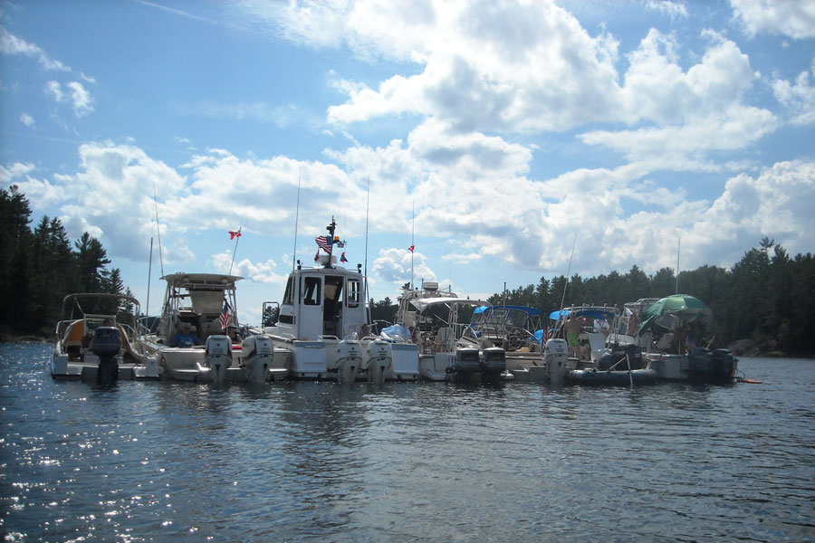
The raft from astern. There are 12 outboard engines: six Evinrude E-TEC and six Yamaha, from 8-HP to 300-HP.
Everyone enjoys a relaxing afternoon on and in the water. Photo by DH.
Dave enjoys the sunshine, the breeze, and the view from the foredeck.
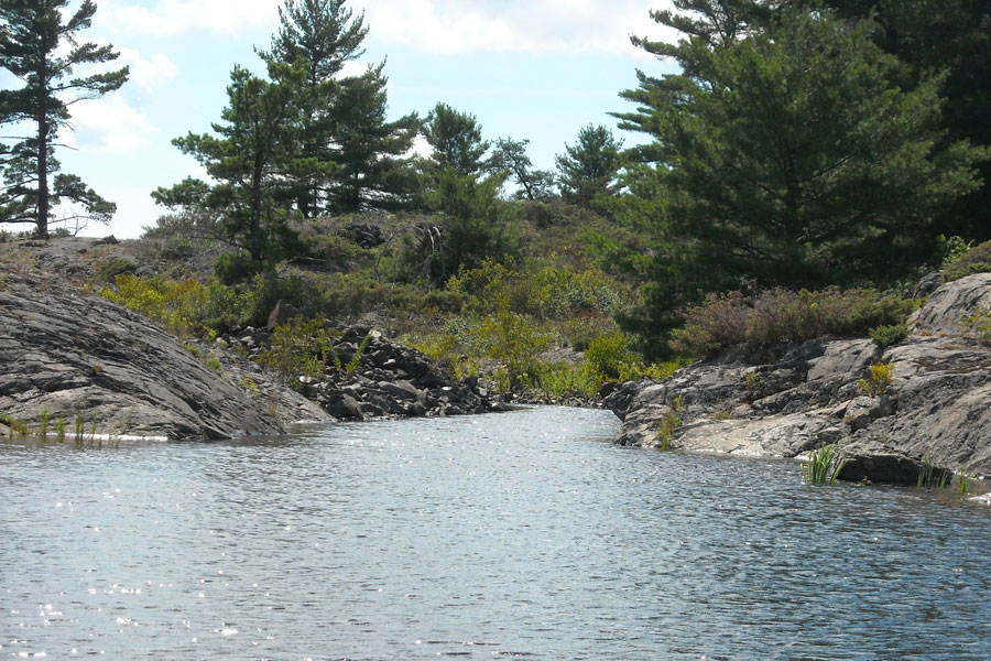
Navigation of the East Channel ends here, execpt for very small boats.
The other end of the passage opens to a new and large bay.
Twin E-TEC outboard engines power a Boston 32 DEFIANCE. Craig takes a nap.
Twin E-TEC outboard engines power a Boston Whaler 25 WALKAROUND. Note independent steering. Don and Elsa relax in cockpit.
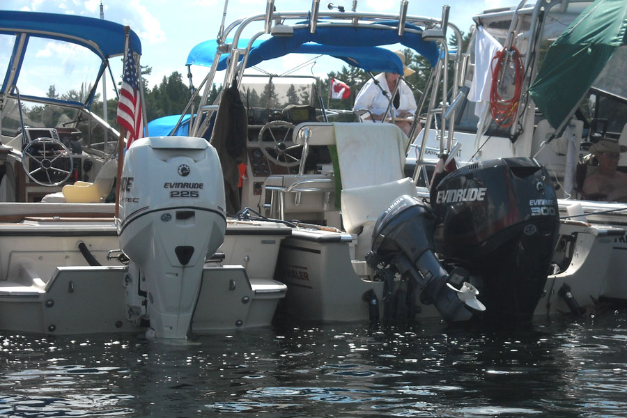
E-TEC outboard engines power Boston Whaler REVENGE 22 W-T Whaler Drive and OUTRAGE 22 boats.
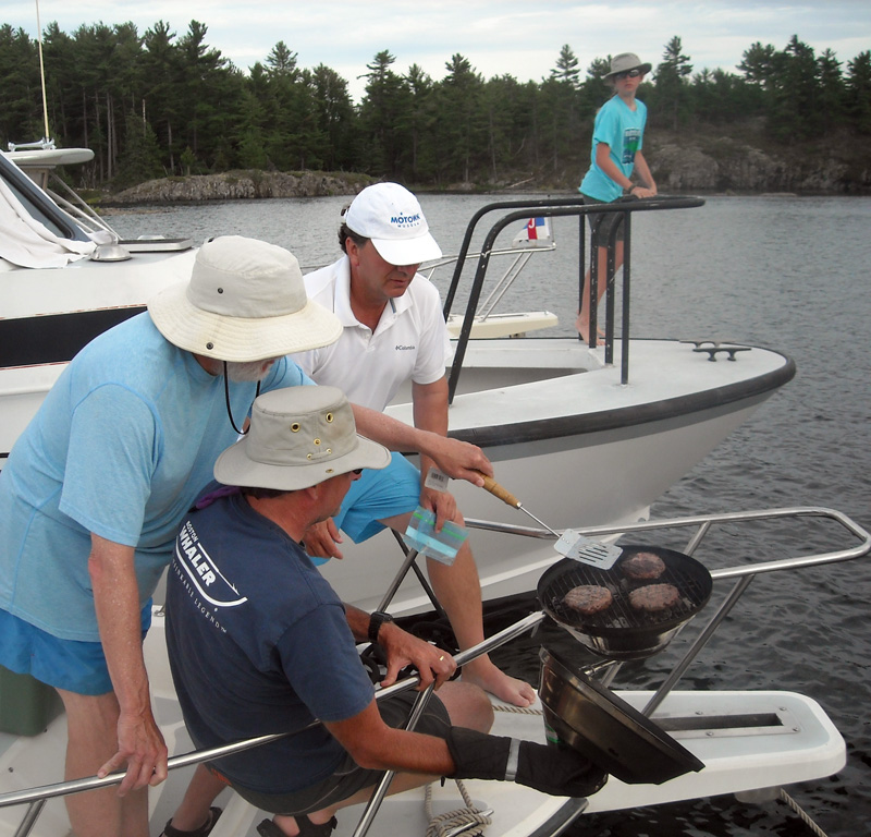
Some of us grill hamburgers. Photo by CEW.
Sam and Bob eat giant steaks.
A GAM on the foredeck.
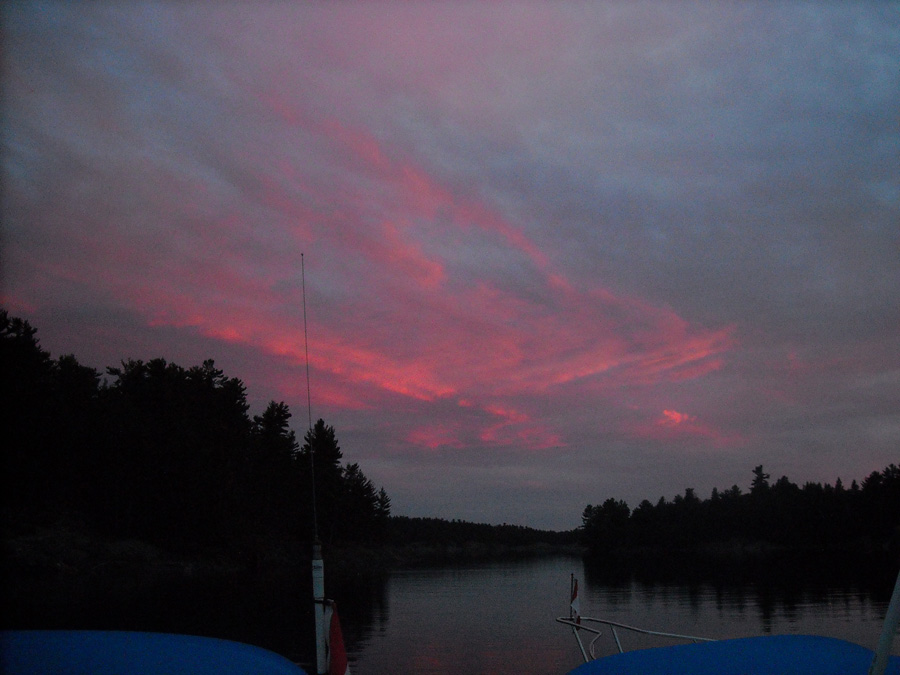
A wonderful day of cruising ends with this evening sky.
| Date: | Thursday, July 28, 2016 |
| Weather: | Fair |
| Winds: | Light but will change to East around 11 a.m. |
| Waves: | Small |
| Departure: | East Channel |
| Position: | 46° 04.54' N; 081° 33.29' W |
| Destination: | Neptune Island |
| Distance: | 31-miles by boat |
This high pressure system just won't budge. It continues to give us fair weather, sunshine, and light winds. Overnight the temperature has been above the dew point, so our canvas and decks are dry. There was a beautiful sunrise in the East, and the western skies are cloudy
We have a leisurely morning in the cove in East Channel, then about 11 a.m.the wind switches to the East, presenting a bit of a challenge to prevent the big raft of boats from swinging 180-degrees and fouling and crossing all the anchor rodes. We break up the raft in an orderly manner and prepare to head for Neptune Island, where we have made arrangements to meet with our old friends John and Katie. They have a cottage there and a nice dock, and we plan to have dinner with them and stay the night.
We pass through Little Current, again, and stop for fuel, ice, and supplies. We also rendezvous there with DRIFTWOOD, whose crew is ashore and about the town, having arrived earlier from Killarney. There is quite a crowd of boats at the fuel dock, a fleet of six or seven from Michigan, so it takes a while to reach the pumps and re-fuel. In conversation with one of the other cruising group, I learn they came from Pot Hole Portage, another nice anchorage in McGregor Bay that we had considered visiting. I am very glad we didn't make that choice, as it would have been a disappointment to make the long and complicated passage up to that remote spot and then find it already filled to the brim with other boats.
Eventually by 3:20 p.m. all boats are re-fueled, their food stores replenished, and we depart again for Neptune Island. The ten-mile run west, then north up the Wabuno Channel, then east to Neptune is very fast, and soon we are at John and Katie's dock, enjoying their hospitality. They first hosted a BWGLCC rendezvous in 2000, and it is wonderful to reprise that event 16 years later. We have a lovely evening with a pot luck dinner and excellent sausages and burgers from the grill. We are in quite a relaxed state by early evening, when the wind decides to finally fulfill its forecast change to the East.
Sometime around 7 p.m. the wind makes an abrupt change and comes up from the East at about 15 to 20-knots. The location of Neptune Island is such that it is only separated from much larger Great LaCloche Island about about 100-feet, and this comes at the end of several miles of open water. The result is that this new East wind is funneled right through that gap, and our boats are all now laying along a north-south dock. It is not going to be a comfortable overnight docking for the boats on the east side of the dock, and some boat rearrangement is necessary before it gets too dark and the winds possibly increase further. WHITE WATER departs for Little Current. LUCKY TWO leaves the dock and anchors in the little cove to the west, called OLD WOMAN BAY. OUTRÉ moves to the end of the T-dock, rafts off the larger Parker camp boat, and faces east into the wind. MANIC MOMENT, the crew apparently impervious to the rocking motion, stays put on the east side of the dock, abeam the east wind.
On the west side of the dock, the boats are crosswise to the wind, and rocking back and but not as much as the boats on the east side. We are moored closest to shore, a favorable position, but the motion on the boat is still too much for comfortable sleeping. I cast off the stern line and let the boat swing downwind, keeping its bow tied to the dock. With a 100-foot-long line I tie-off the stern quarter to some rocks ashore on little spit of land astern to keep the boat from getting too far out of east-west alignment. We'll have a gentler ride being bow-into these winds, which look like they are going to blow all night. The big DEFIANCE remains fairly stable, and make a nice lee for HOLLY MARIE to stay in. Late in the evening the east wind eventually blows out and decreases to 5 to 10-knots, granting all of us a sound sleep aboard.
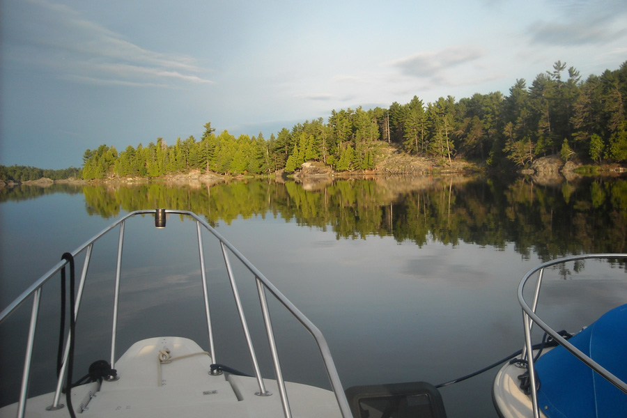
Another beautiful summer day begins in our quiet East Channel anchorage.
The shoreline beauty at morning.
We are surrounded by nature's gifts.
Enthusiasm for twin engines extends to the dinghy power. Photo by DH.
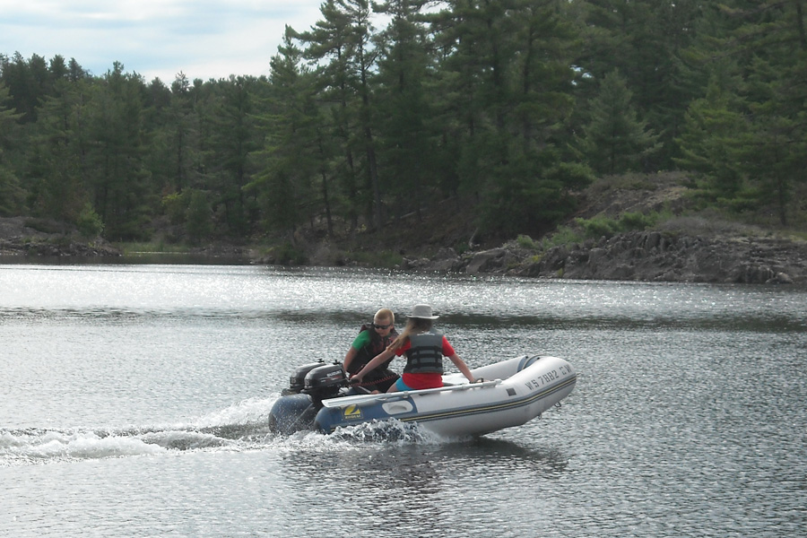
Speed improves with better power-to-weight ratio.
The fleet departing East Channel about Noon.
The fleet departing East McGregor Bay.
HOLLY MARIE and crew.
OUTRÉ and crew.
MANIC MOMENT and crew.
LUCKY TWO and crew.
DEFIANCE and crew.
OUTRÉ at 50-MPH.
The dock at Neptune Island is filled with Boston Whaler boats.
The East side of the dock
The West side of the dock
DRIFTWOOD at the dock.
WHITEWATER at the dock.
Neptune Island dock and cottage.
A Flemished line.
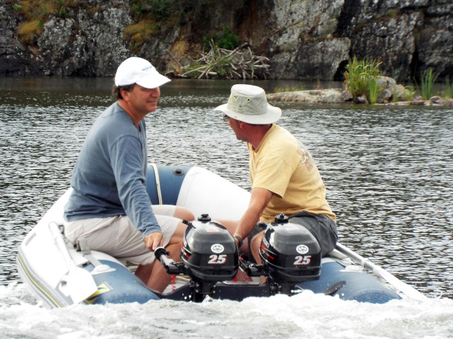
The former and current owners of OUTRÉ discuss some recent changes to her.
After dinner conversation on the porch at Neptune Island.
| Date: | Friday, July 29, 2016 |
| Weather: | Fair |
| Winds: | Light |
| Waves: | Small |
| Departure: | Neptune Island |
| Position: | 43° 02.98' N; 081° 55.96' W |
| Destination: | Long Point Cove, Ontario |
| Distance: | 42-miles |
The east wind continues, but the weather is still very fair, mostly sunny, and warm.
The BWGLCC 2016 fleet is splitting up today. CONTINUOUSWAVE and HOLLY MARIE, whose trailers and trucks are in Blind River, will head toward there for eventual hauling out and highway travel home. The larger group of boats that came to the cruise on their own bottom, will head back toward Michigan by water, aiming for Gore Bay or other ports on the north shore of Manitoulin.
About 8 a.m. DRIFTWOOD and DEFIANCE depart, heading for Drummond Island as a re-entry point for the USA. With some dock space open, LUCKY TWO comes back to the dock from Old Woman Bay about 9:30 a.m. to join the rest of us for a late breakfast and some coffee.
Remaining at the dock at Neptune and not needing to return to Blind River, are the LUCKY TWO, OUTRÉ, and MANIC MOMENT. The three boats will travel together, also toward Drummond Island, for re-entry into the USA.
Our now two-boat fleet heading toward Blind River sets course for Long Point Cove, an excellent harbor along the north shore of the North Channel. We depart Neptune Island, and take a route of exploration to the West. We pass between Kirkpatrick Island and Louisa Island to reacquaint ourselves with the sandy harbor on Louisa Island's east shore. Then we gunk-hole behind Hog Island, and eventually return to the main channel at McTavish Island. We then continue to the northwest, leaving Fox Island to port, and turn in at Oak Point, setting a lunch hook anchor in a little cove at the western end of Hotham Island.
After lunch we explore the narrow passage into Reed Lake, which turns out to no longer have very many reeds growing in it. Reports from long ago described it as quite chocked with large floating masses or reeds; apparently things have changed. We exit from the reed-less lake, leave the Hotham Island/Oak Point area, and head west. We transit Little Detroit, take a twisty passage through the Whalesback Channel, then turn north for Long Point Cove.
The main part of the anchorage at Long Point Cove has a number of larger boats, mostly sailboats, so we explore a shallow and narrow channel on the southwestern end. We make a two-boat raft and anchor on fore-and-aft anchors in about four feet of water, nestled between two rock shore faces, and facing due west. It will be a good spot for the night as the winds are forecast to be gentle.
By evening's end, the fleet is scattered. CONTINOUSWAVE and HOLLY MARIE are anchored-out in Long Point Cove. MANIC MOMENT, LUCKY TWO, and OUTRÉ have gone to the marina at Meldrum Bay. No doubt DEFIANCE has taken advantage of the favorable east wind and is making a long passage toward Wisconsin and Lake Michigan, and DRIFTWOOD is heading for Cheboygan. WHITE WATER is most likely on her trailer and on the highway or already on the ferry at South Baymouth.
Chris and Katie chat after breakfast.
John—our excellent host—perpetually at work.
A relaxing morning on the porch at Neptune Island with the Dinner Bell in background.
John gets a chance to sea trial his old boat with its new 300-HP engine: all smiles here. Photo by BD.
Emmarie and Sam stand on the summit of Neptune Island. In the distance: the McBean Channel and the mainland shore. Photo by BD.
The wind remains from the East at the dock.
Reed Lake, west from Oak Point near Hotham Island, is no longer filled with reeds in July 2016.
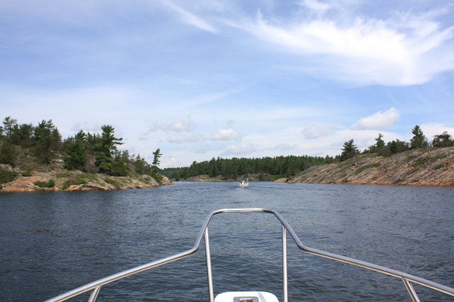
We retrace our outbound leg through the Whalesback Channel on another fabulous summer day.
| Date: | Saturday, July 30, 2016 |
| Weather: | Fair and sunny |
| Winds: | West 10 |
| Waves: | Two-footers |
| Departure: | Long Point Cove |
| Position: | 46° 10.56' N; 082° 41.49' W |
| Destination: | The boat ramp at Blind River, then the highway, then home |
| Distance: | 15-miles by boat; 285-miles by car |
Again we awake to fair weather and beautiful sunshine. There is just a whisper of wind from the northwest. There is a heavy dew on the boats this morning. The sky is beautifully clear with some clouds on the eastern horizon. We have bird song to entertain us. There are just ripples on the water. A cool breeze comes aboard from astern (east).
We break our two-boat raft and haul our anchors, then depart Long Point Cove, where five sailboats and one power cruiser remain. We explore a bit to the northeast, looking at two other coves that might be suitable for small boat anchoring, then we get back on plane and head west, closing to the mainland shore. We run on plane, staying about a half mile off the beach, dodging a few shoals, and soon are entering Blind River's harbor. There is little traffic at the ramp, and we tie up. First a walk to the parking lot to get the truck, then a short drive to where the boat trailer has been parked, and soon we have re-hitched the trailer to the truck. With only the briefest of delay as another boater uses the ramp, we are backing the trailer into Lake Huron for the final movement of the boat by water on this cruise: pulling ahead a few feet onto its trailer.
With CONTINUOUSWAVE on her trailer, we undertake the usual post-cruising hull clean up, removing only the slightest of water marks from a week in these pristine freshwater passages. We depart Blind River around 1 p.m. and head west on Highway-17 (the Trans-Canada Highway, albeit mostly only a two-land blacktop in this part of Ontario). We depart Canada at Sault Ste. Marie, this time with very little delay in crossing the bridge and clearing customs and immigration on the American border at the Michigan Soo. Our highway travel is slowed by having to pass through the rather busy and very much expanded metropolis of Petoskey on a Saturday afternoon, followed by a trek across Traverse City's main drag on a busy Saturday night. Eventually we arrive at our Northport destination, all safe and sound, no highway incidents or problems about 280-miles for this leg. The truck trip odometer reads 573-miles.
We are a bit weary from a week of highway travel, boat travel, and living outdoors, but is is a good weariness, and we feel most fortunate to have had such good weather, good boating, and good companions for this trip.
The three boats at Meldrum Bay depart and take a brief diversion to cruise past Cockburn Island. OUTRÉ then heads for Drummond Island Yacht Basin and the Customs Dock there in order to re-enter the USA, while MANIC MOMENT and LUCKY TWO take the longer southern route around Drummond Island. Dave and Kathy then head for Detour Village, and Don and Elsa for their home port, Cheyboygan, clearing customs via telephone thanks to their NEXUS cards.
DEFIANCE continues on to Chambers Island, Wisconsin; WHITE WATER is on her trailer. DRIFTWOOD is back to her homeport, Cheybogan. With a safe return home for all boats, the Great Lakes Boston Whaler Cruising Club North Channel 2016 Cruise is done.
Our anchorage in a smaller cove at Long Point Cove. Note heavy dew on the deck this morning.
MANIC MOMENT, LUCKY TWO, and OUTRÉ spent their last night at Meldrum Bay. The harbor has recently been much improved
and these floating docks replaced the very old wooden piers once there. Photo by DH.
The small harbor at Cockburn Island serves mainly its island residents. Photo by DH.
HOLLY MARIE jumps our wake in the North Channel, as we run down the mainland coast (left) to Blind River in following seas.
HOLLY MARIE on plane and passing close abeam.
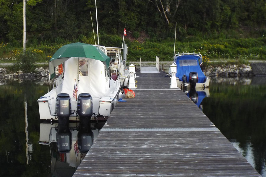
Blind River Marina docks.
Although not paved, the ramp at Blind River is good, and big boats are easily launched here.
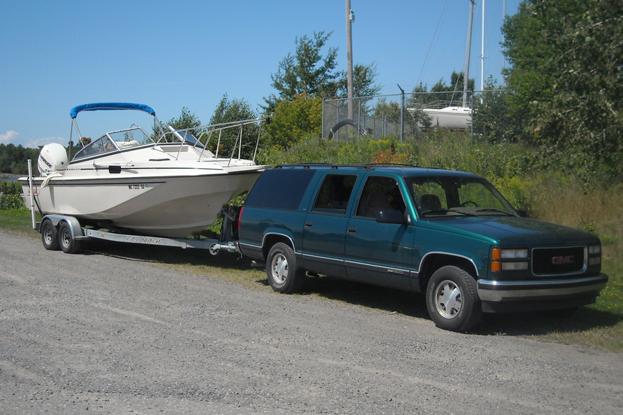
HOLLY MARIE returns to her trailer for the long highway trip home to Minnesota, towed by a hefty F350 with dual wheels on the rear axle.
CONTINUOUSWAVE on her trailer, towed by a GMC 1500 Suburban, has 285-miles of two-lane highway ahead.
My usual habit of recording details of the boating distance and fuel consumption has resumed. Here are some notable figures for fuel, distance, time, and costs.
Harbor          Fuel Remain  Fuel Used  Time   Miles    Max   Avg   E-TEC
                Gallons      Gallons    H:M    Statue   MPH   MPH   Hours
BLIND RIVER     58.8                    00:00    0.0    0.0   0.0   397.9
BENJAMIN ISLAND 43.3          15.6      02:12   38.7   41.7  17.6   400.1
LITTLE CURRENT added 23.2-gallons (90-liters) at CA-$1.20/liter
THE POOL        49.7          31.3      4:51    83.7   41.7  17.0   403.2
KILLARNEY       41.1          40.0      6:52   108.6   41.7  15.8   405.41
EAST CHANNEL    33.1          48.0      8:55   133.9   41.7  15.0   408.0
LITTLE CURRENT added 10.3-gallons (40-liters) at CA-$1.20/liter
NEPTUNE ISLAND  33.8          57.6     11:10   164.5   42.9  14.7
Added 0.9-gallon engine oil; fuel-oil ratio 57.6/0.9 = 64:1
LONG POINT COVE 27.1          64.5     13:28   208.8   42.9  15.5   413.3
BLIND RIVER     22.0          69.6     14:28   223.9   42.9  15.5   414.5
Total distance for the trip was 223.9 statute miles by boat, during which 69.6-gallons of fuel were consumed. The average boat fuel economy was thus 3.2-MPG. The boat fuel cost was a composite of fuel purchased in Canada and the USA. In Canada 33.5-gallons were taken on at CA-$4.54 per gallon, for a total of CA-$152. At the exchange rate of US-$1 = CA-$1.30 that becomes US-$117. The other 36.1-gallons consumed on the trip were purchased in the USA for about $3.50-per-gallon, or a total of $126. The total cost of boat fuel consumed on this trip was thus about US-$243. The fuel-oil ratio was 64:1, suggesting a little over one gallon of oil as consumed at a cost of about $33. Total fuel cost (of gasoline and oil) is then about $276; this gives a cost-per-mile for boat movement of about US-$1.23 per mile.
Total distance for the highway trip was 573-statute miles by truck. Thanks to the 44-gallon fuel capacity, all truck fuel was purchased in the USA; we could drive into and out of Canada without buying any truck gasoline. The truck gets about 10-MPG when towing the boat at highway speed. The estimated fuel consumed by the truck is then about 57-gallons. The price of gasoline was about $2.50, making total truck fuel costs $142, and cost-per-mile about about $0.25.
We spent only a limited amount of time in marinas: the first night we stayed in Blind River. We also stayed one night at Sportsman's Inn. The costs were approximately CA-$2 per foot or CA-$44 per night. With the favorable exchange rate this reduces to US-$34 per night, for a total of about US-$68.
We ate only one evening meal in a restaurant. The total for dining out was then a modest US-$70. Most of the food consumed was purchased in the USA and carried with us when we crossed the border, but we did buy steaks, ground meat for hamburgers, and some fresh produce in Canada; the costs were not recorded.
Copyright © 2017 by James W. Hebert. Unauthorized reproduction prohibited!
This is a verified HTML 4.01 document served to you from continuousWave
Author: James W. Hebert
This article first appeared February 2017.
