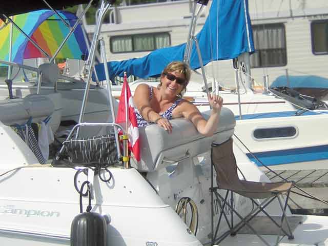
Wendy, our Tim Horton's coffee benefactress, and her husband Nick were staying at the Deep River marina for the week on a work/vacation. Their hospitality renewed our faith in Canadians as the friendliest of people.
Our first portage around the huge dam at Rapides Des Joachim.
| Date: | Monday, July 24, 2006 |
| Weather: | Warm and sunny to start, then rain |
| Winds: | Light |
| Waves: | Calm |
| Departure: | Deep River |
| Destination: | Rapides des Joachim, thence to Mattawa |
| Distance: | 63 miles by boat, with a two mile portage |
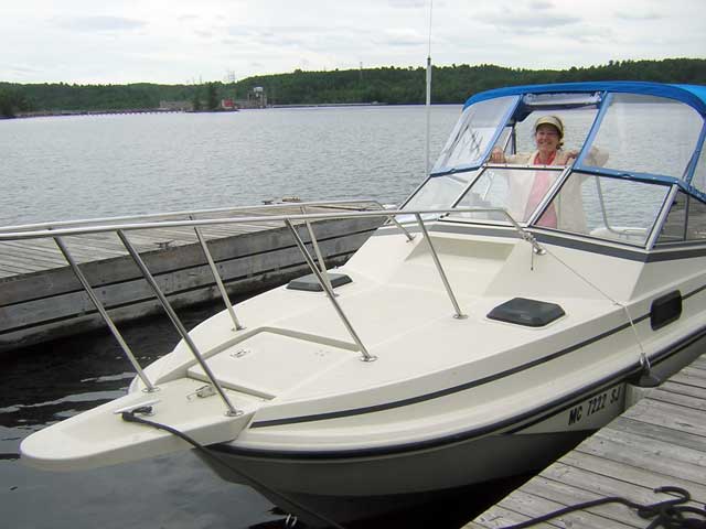
Let me back up a bit in the story and describe more of Deep River Marina and our fellow boaters. After we arrived and the "atomic" boat left, three more transient vessels arrived, filling the marina to capacity overnight.
First to arrive following us, and now in the adjacent slip, is a Tanzier 7.9, a small sailboat. It was motoring up the Ottawa River yesterday and we passed them in the late afternoon. Aboard were two fellows, but they have since been met at the dock by their wives and a daughter. The daughter is enrolled in a sailing school being taught out of the marina all week, and the family is making a boating vacation of it. I think the other fellow and his wife must have sought accommodations ashore over night. I don't see them this morning.
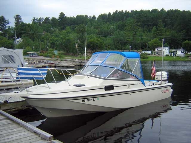
Also in harbour we have TIPPERARY, a very clean 24-foot Campion cruiser powered with a stern drive and hauling an inflatable dingy. Aboard are Nick and Wendy, and they've come up from their home port of Navan, east of Ottawa. Nick is a nuclear physicist who used to work for the government at Chalk River, but now he works for a private firm in the area which produces nuclear radiation detectors. Their best customer is the United States Department of Homeland Security. To make a bad pun, you could say that their business was booming.
Our third companion is another sail boater, NOUVEAU DEPART, a nearly new Hunter 25-footer with a centerboard. He has his mast down and is apparently in transit up the waterway, much like us. He spent the night at the fuel dock, and his crew (perhaps his wife) left early this morning to go back south and to work.
The long drive and the long day yesterday have caught up with us, and both Chris and I have slept past 9 o'clock, which is very unusual, especially for me. When I stumble out of the v-berth and come up on deck, I am greeted by a very nice surprise on the deck of the cockpit.
"Hey," I say to Chris down in the cabin, "you won't believe this but someone has left us two Tim Horton's coffees!"
I pull back the lid to sample the brew. It is still warm, although it could use a re-heat.
Wendy from the Campion comes over to say high and to reveal she is the provider of this gift. "We were up early to get Nick off to work, and we thought you might enjoy a coffee. But that was hours ago. You folks really sleep in!"
"Let me warm that up for you in our microwave," she offers.
I profusely thank her for this kindness, and, wobbly-legged on the tipping docks, I carry my treasure over to her boat for warming. On the railing of the Campion there is a large towel draped which shows the Canadian and American flags and carries a legend remarking about the nations' friendship. Coupled with their coffee kindness, it is a very nice gesture to welcome us to Canada, completely overcoming the hostility of yesterday at the Pembroke launch ramp.
Wendy, our Tim Horton's coffee benefactress, and her husband Nick were staying at the Deep River marina for the week on a work/vacation. Their hospitality renewed our faith in Canadians as the friendliest of people.
Back at the boat, I nudge Chris to get her up and going. We have an 11 o'clock appointment up the river at Rapides des Joachim to portage around the huge hydro-electric dam which impedes any further navigation upstream.
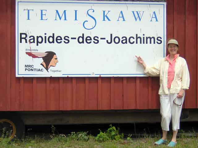
It is about 16 miles from Deep River to "Da Swisha"--which is how all the English speaking locals pronounce Des Joachim. (I am not fluent in French, but I think you'd pronounce it "deh Jwah-scheem.") We called yesterday and left notice of our intent to arrive at 11 o'clock on the voice mail of the Temiskawa (Temiskaming-Ottawa River) Waterway office there. The cruising guide recommends 24-hour notice to get service. So far, we have not actually spoken to anyone, just left messages.
Before ten o'clock the NOUVEAU DEPART casts off heading also for Da Swisha. He is planning to travel upstream all the way to New Liskeard. Our new French friend has a noon appointment at the portage. Although we've just met, he takes his leave of Chris with a two-cheek kiss. I demur and shake hands. "See you up the river," I say. He motors off, making about 7 to 8-MPH with a small outboard auxiliary. With a remote control for the tiller he can steer from the bow.
After a quick breakfast of cereal aboard the boat, we move to the fuel dock and take on some more gasoline. Our plan for today to go all the way to Mattawa, about 63 miles, and we are not sure of the on-the-water fuel situation as we go farther north. Another $50 of fuel brings the tank up to about 7/8-th full. It is a beautiful morning, as we are soon underway and heading upstream.
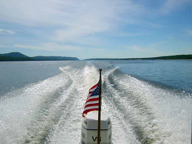
Ottawa River Cruising: We are running along on plane at about 26-MPH on a beautiful Monday morning, heading upstream from Deep River. The Quebec shore is on the left, with generally higher elevations. Those wispy high clouds are a sign of rain coming. In my mind's eye, this is how I pictured most of the trip as I first envisioned it about ten years ago when I saw the river from the highway.
We are about six miles into our journey when we decide to give the folks at the waterway office another call to see if we can actually reach someone in person instead of an answering machine. This brings about the realization that I have left our cellular telephone connected to its charger and sitting in the marina "office" back in Deep River. Its battery was quite low, and without any way to get shore power to the boat, early this morning I had plugged it into the wall outlet in the office to get it re-charged. It is not quite as far back as we went for the swim ladder, and the cellular telephone is more likely to be of use, so back we go, again. Can this cruise ever settle down into a routine?
To add to the "fun" and anxiety, when we haul into Deep River, slowly making our way through the fleet of small day sailors engaged in some sailing lessons just outside the break wall, we discover that the marina office is locked and the dock master has left. This produces more distress, as we are now clearly going to be very late for our scheduled arrival for the portage. Just as I start to head up the road to see if anyone else has a key to the office, the young dock master returns. He had gone to pick up his girlfriend and bring her down to the marina for the morning.
Soon we have rescued our telephone and charger. We say good-bye again, and depart anew. We are planning to cruise back down this portion of the river later in the week, but by the time we return we will have been over some parts of it three or four times!
We run back towards Rapides Des Joachim at top speed, burning a little more extra fuel. It is now about 11:45 a.m. We were figuring we'd pass our sailboat friend on the way, but, like the tortoise to the hare, when we arrive at the dock below the dam, he is already there and in the process of being loaded onto the trailer for the portage.
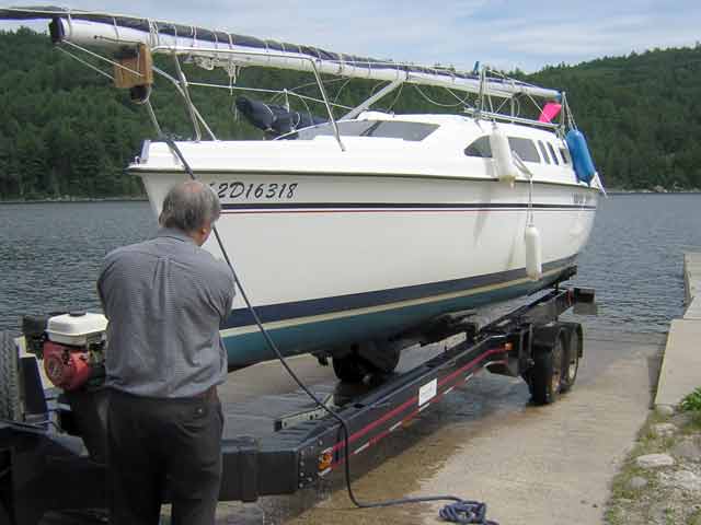
Our French-Canadian sailor beats us to the dock at Rapides Des Joachim. His 25-foot sailboat is being loaded onto a special trailer with hydraulically adjustable bunks for a portage around the large dam. Roger from the Temiskawa Waterway wades into make some adjustments. The two had a long discussion (in French) on how to adjust the trailer bunks. The truck is a GMC Suburban 2500 with heavy-duty towing package. It seemed to have no problem yanking out the heavy boat and trailer combination.
With the boat hauled out of the water, Roger sets the bunks into final position.
A small motor provides hydraulic pressure to operate the many adjustable devices on the trailer.
The final step is a securely tightened bow strap.
After about fifteen minutes of tweaking the trailer to the boat, Roger from the Temiskawa Waterway is ready to start the trip up and over the dam. He drives off with the sailboat. "I'll be back for you in about 40-minutes," he says, "I have to get a different trailer for your boat."
The town of Des Joachim, or at least what we can see of it from the dock, is quite small. There is an inn and bar across the road, a chip wagon at the marina, a gas station up the hill, and a general store nearby. We are getting low on beer, so I visit the general store, which, to my surprise, is a licensed beer, wine, and liquor agent. Laws about alcoholic beverages must be a bit more relaxed in Quebec. In Ontario, you generally can only buy alcoholic beverages from large, government-run brick edifices located miles away from the usual marina dock. Here it is right next door!
The highway at Rapides Des Joachim also connects Ontario and Quebec. It is the first (and only) point of access across the river between Pembroke (70 miles south and east) and Temiscaming (82 miles north and west), yet we hardly see a car or truck go by.
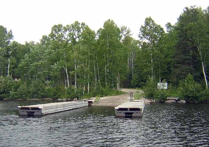
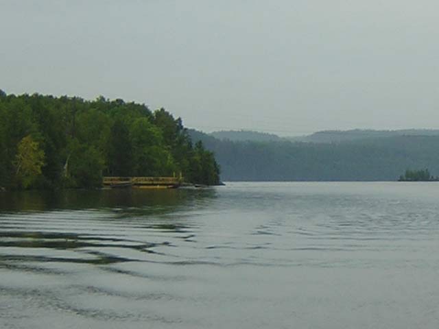
Rapides Des Joachim. These are apparently the marina docks. There was no one around to ask about them. This view is looking downstream. You can see the discharge current from the dam's tail waters flowing in from the right. The dam is about a kilometer upstream from here. The weather is starting to change, too. Where do all those gray skies come from?
The office of the Temiskawa Waterway at Rapides Des Joachim, Quebec. The door was locked. Whenever we called we got a recorded message and a chance to leave voice-mail. I don't think there is as much demand for transportation around the dam as was initially anticipated when the facilities were built.
After we've been idling around the dock for about a half-hour, I notice that Roger and the sailboat aren't very far along in their journey over the dam--they're still parked at the gas station just up the road! "They're probably grabbing lunch," I speculate to Chris. We plan to eat after we make the portage. We can't complain too much, after all, we were the ones who were late for our appointment. Actually, I am a bit amazed that anyone was here to meet us. Leaving messages on an answering machine was not completely convincing that we'd actually find someone here when we arrived.
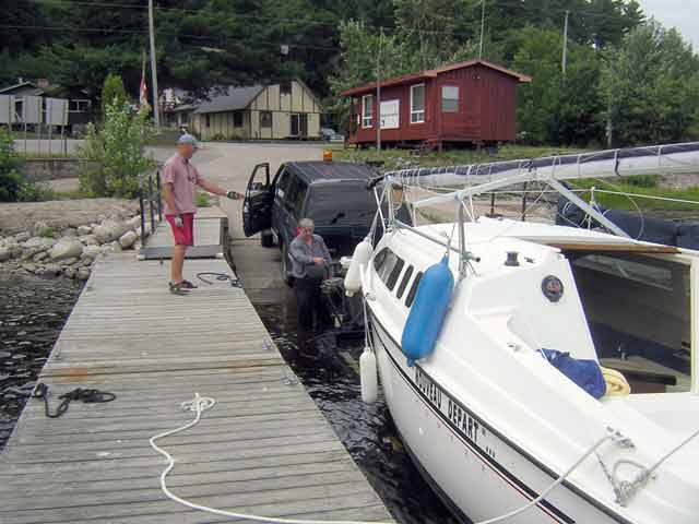
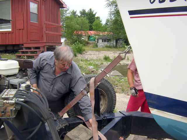
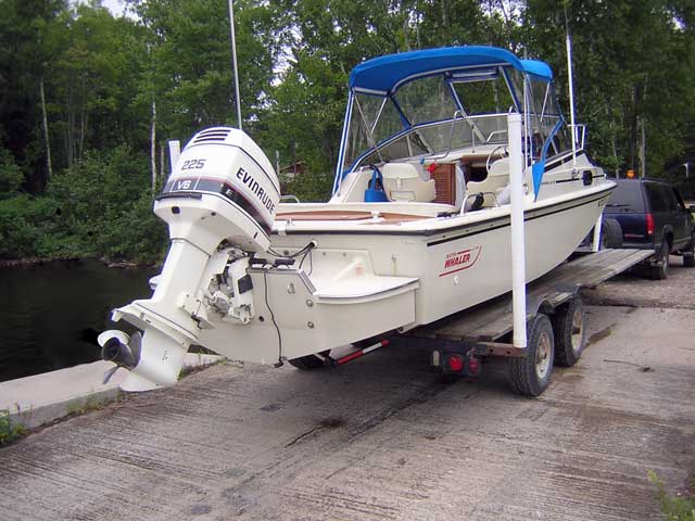
About an hour has elapsed when Roger returns with a different trailer, this one more of a flat bed trailer with a small v-notch in the middle. It looks like a compromise for hauling pontoon boats and smaller v-hulls. Roger left instructions with us to move our boat into the haul-out slip, so we are ready for him. He backs the trailer down the ramp, and we begin loading CONTINUOUSWAVE.
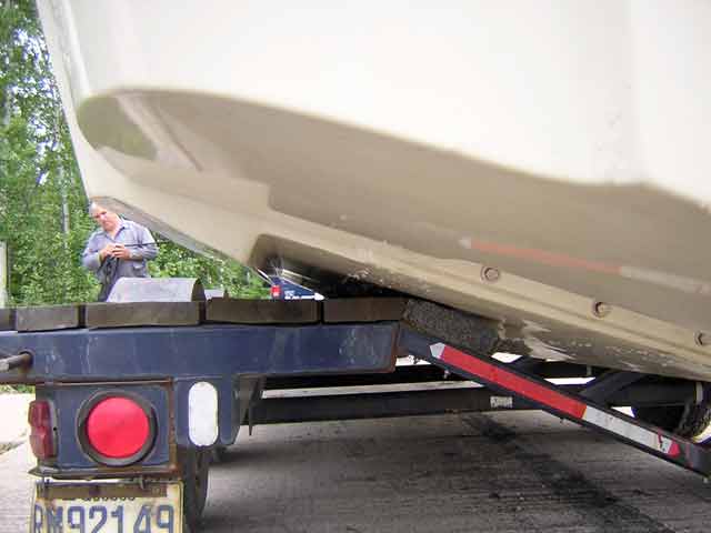
After partially loading the boat, Roger backs the trailer in further, and then winches our Boston Whaler hull completely aboard. He snugs the bow strap down, and we are ready to go. First step is to get into the Suburban and fill out some paperwork. The fee is $50; we pay cash. Roger enters us into a big ledger book. After that, it is up the ramp and up the hill.
The portage is about two miles, but we are traveling at about 10-MPH maximum. Roger keeps an eye on the boat. "She rocks a little," he says to me, gesturing with his hand. I am not sure why the hull is rocking--with the constant-deadrise V, it should be sitting level, but I think the trailer is designed more for boats with some taper in the hull's deadrise. It is not a perfect fit.
The road seems like it is all uphill, as you might expect. "How high is the dam," I ask Roger. He is not sure. (Later I learn the dam is 130-feet! It's a huge impoundment of water.) Roger turns down a gravel road into the woods; it's the last leg to the upper lake. He expertly backs the trailer into launching position. We all get out to prepare. I hold up the process for a few quick pictures.
CONTINUOUSWAVE on the portage trailer. The hull is a decent fit for the trailer while the Whaler Drive hangs off the back.
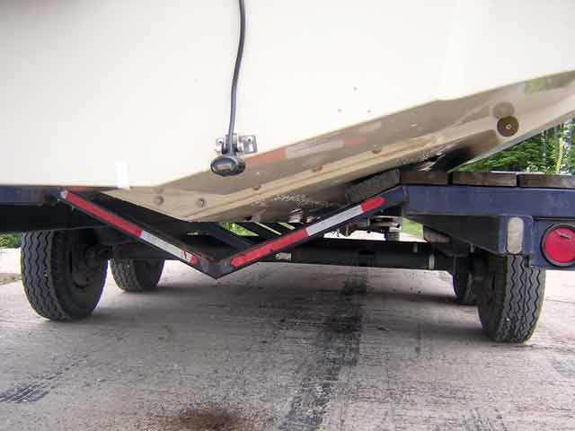
A V-hull boat with much deeper-V would have a problem with this trailer.
The boat sits nicely centered on the "universal" trailer. I couldn't see how the fit was with the hull strakes which are more forward. At this point, it was too late to do much about it!
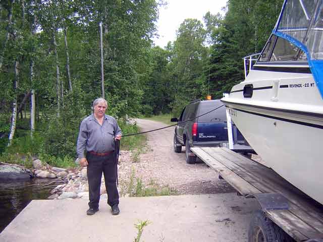
Roger, our friendly portage agent, speaks both English and French. He gave us the proper pronunciation for Des Joachim and explained the corrupted English variant, "Da Swisha".
Chris's smile is a sign of our relief that our boat is back in the water and has made the portage without any difficulties. Behind her is the hydro-electric dam. It extends 190-feet above the bedrock of the original river and raises the water level here over 125 feet.
The launching ramp and dock on the upper lake are on property owned by the hydro-electric company and do not seem to be available to the public.
As soon as we are in the water and made fast to the dock, I turn around to wave goodbye to Roger, but he is gone. He was a very nice fellow, and he even left us his home telephone number so we could more easily coordinate with him on our return trip. Before he left, he also warned us to keep a lookout for trees in the water. A very big storm blew through here a week ago, and there is still debris floating down.
Roger's quick departure underscores how alone we are at this point. We're in the waters above this huge dam, but there are few shoreline facilities from this point until we get to Mattawa, about 59 miles upstream. The hydro-electric company seems to own the shoreline in the region of the dam and for several miles upstream, as you might expect.
For this stretch of about 47-miles of the waterway we need Chart 1554, which has been more recently revised and re-printed than our other chart, and its dimensions are all in metric units. To accommodate this, I switch the units of measurement on the depth sounder over to meters. We don't have to immediately worry about finding the bottom—a mile or so from the dam we are in 95-meters of water (over 300-feet). This river really is deep!
About three miles and a half—or should I say about five kilometers—up from the dam we pass the very large control dam above Lake McConnell. This dam is used to regulate the water level in the reservoir. It is an imposing structure, too. Roger's advice to watch out for timber in the water is right-on. We see and dodge around several tree limbs afloat and drifting toward the dam. Shortly after that we pass the sail boater. We slow for a gam. He plans to go all the way to Mattawa today. "We'll see you tonight at the marina," we say as we get back on plane and head north at three times his speed.
About eight miles upstream, we stop the boat for lunch and shut off the motor. We are just adrift in the middle of the stream, off the mouth of Riviere A l'Ours, preparing for lunch, when we are startled by a crashing sound. It is our own boat wake rolling up on the shore to the south. It is so amazingly quiet out here that the noise of the boat's wake hitting the shore is carried out to us and is quite loud. (It may also have been aided by the weather conditions, which were beginning to get misty. It is often remarked that sound travels strangely in a fog.)
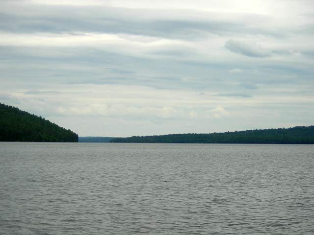
The weather starts to change as we stop for lunch. This view is looking back east and south towards Rapides Des Joachim. It shows the relative slope of the land on the two sides of the river.
The railroad line had to relocate its tracks to higher ground along much of its route in this region when the dam was built. My guess is that this portion may be the original trackage. It ended up quite close to the water's edge, and it might have been just high enough to not need to be moved. The highway was moved about a mile away at this point.
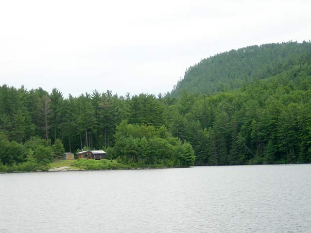
This cabin at the mouth of Riviere A L'Ours is about the only sign of inhabitation on the Quebec shoreline.
The darn weather is starting to go again, and that warm bright sunshine we started out in has disappeared. The sky is now completely gray with indistinct clouds, and the temperature has dropped. Rain is imminent. The rain starts as we finish our lunch. As we get back underway, I am forced to look at the river through the droplets on my isinglass windshield, and to keep a constant vigil for logs and debris. It makes it hard to take in all of the surrounding scenery, and the gray skies and low cloud cover take much of the color out of our vision.
We press on all afternoon like this, rain coming and going, and miles clicking off under the keel on the knot log. On the northern shore, the Quebec side, the terrain is steep and there are almost no roads or towns. The southern shore has a lower profile, and we pass the small towns of Mackay and Stonecliffe, but they have almost undetectable presence on the waterfront. We pass Maraboo Point and turn into Bissett Bay, and we can see some signs of habitation down at Bissett Creek. However, we don't stop to investigate, and continue on our cruise upstream.
At Deerhorn Rock we encounter about the only pair of red/green buoys on this stretch of the river, and we safely pass this hazard. I think the only reason for the pair of buoys is to make it unambiguous about which side to leave the red. In this case, if you picked the wrong side it would lead to a huge rock ledge just under the dark water.
Around the town of Bissett Creek a local pontoon boat came along heading downstream. Here the once spectacular Rapides-des-Rocher Captaine were submerged when the dam was built. Instead of boiling over the bedrock, the water flows quietly over the river bottom 30 to 40 feet below.
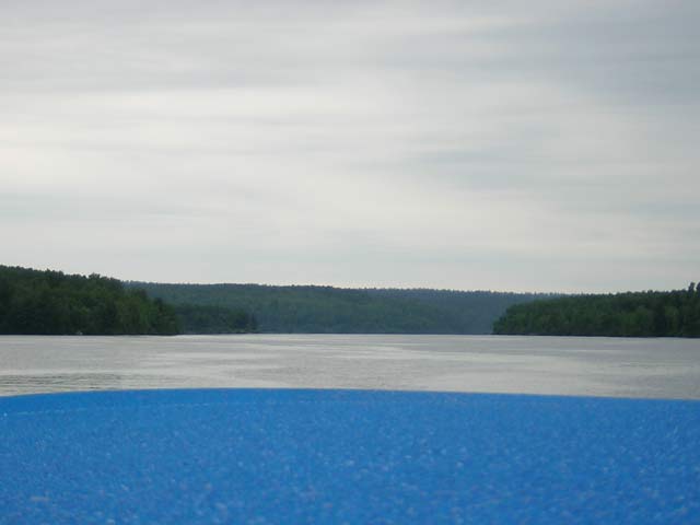
Approaching Deux-Rivieres the rain stops momentarily, leaving a lot of water beaded up on our blue canvas. There is very little wind, so we anticipate this low-pressure system will be hanging around for a while.
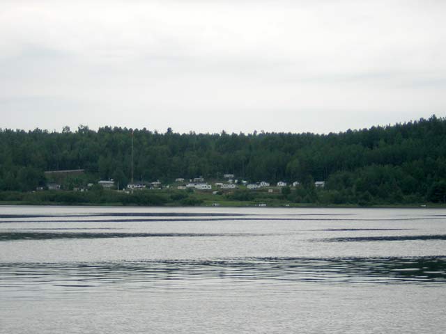
In late afternoon we pass slowly by Deux-Rivieres (Two Rivers). This town, like most settlements up here, was once on the banks of the Ottawa River's original stream, but it was submerged when the dam was built and has been relocated to higher ground. It now appears to be a collection of house trailers on the side of a hill on the south bank of the river. The cruising guide says there is a small dock there which can accommodate four boats. We decline to stop to investigate. Highway access across the river is provided by a small car/truck ferry. On the Quebec side, the road only runs a mile or so before ending, so it is not a major thoroughfare.
The town of Deux-Rivieres. The Trans-Canada Highway runs parallel to the river on this whole stretch, but here makes one of its few appearances. This is our point of closest approach to the little village.
This rustic car/truck ferry services the north shore local road at Deux-Rivieres. Our wake is the only disturbance in the calm water.
Chart 1554 is a small-craft strip chart with three accordion-folded sheets. We keep working our way upstream, flipping from panel to panel, and changing from sheet to sheet. By late afternoon we are on Sheet 3 of 3, and we pass Santa Island. There are two noteworthy observations. A rustic sign announces that fuel is available 10-kilometers upstream, and we observe a great number of fallen trees. Just one week ago an unusual thunderstorm system came through the region and created very high winds. It may have spawned tornadoes. On the shoreline here we see many toppled trees, evidence of the storm's passing. The river is in a ravine here, and no doubt the wind was funneling down it with great force. We remark about our good fortune to have not picked the prior week for our trip. The water is still remarkably deep here. We just passed a 40-meter sounding (over 130-feet), and it would be very difficult to go to anchor.
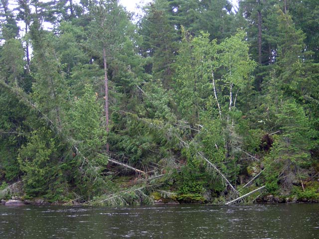
As we approach Mattawa we see more signs of the high winds from last week's unusual thunderstorm and tornado. Here at Santa Island the width of the river narrows to its tightest passage, and there is a noticeable increase in the current as a result.
The rain stays with us, and this accounts for a lack of more photographs of beautiful scenery to show you. Both Chris and I lament this foul weather, as we anticipated that this portion of the river would be some of the wilder and more scenic of the trip. Glancing at it through the water droplets on the windshield and side curtains, it does look pristine, but I have to keep most of my attention on the water directly ahead. We are still seeing debris from the storm afloat.
Quite cooperatively, the rain stops as we near the end of our 59-mile run from the dam. As we approach Mattawa, we can actually roll up the center portion of the windshield canvas and see clearly.
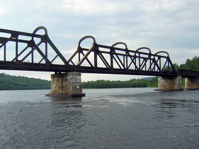
This long railroad trestle spans the Ottawa River and connects Ontario and Quebec. This represents the limit of vertical clearance for navigation on the river (6.5-meters/21-feet). Which span to pass under is not clear until we finally see the faded day marks. Ripples on the water reveal the substantial current flowing under the bridge.
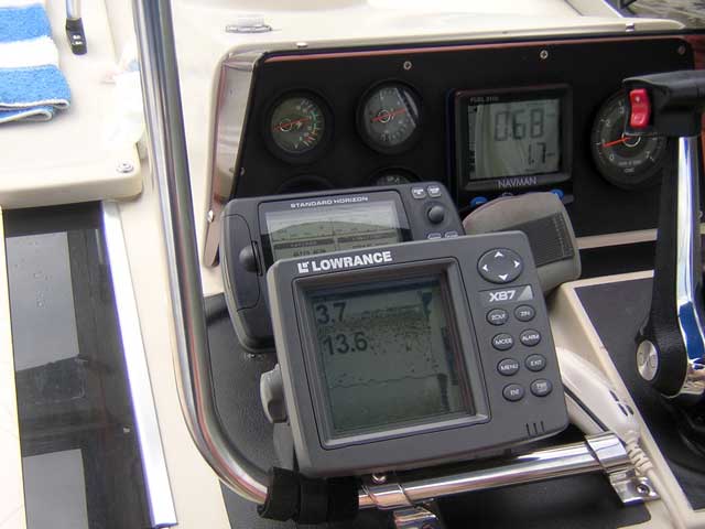
At slow forward under the bridge at 900-RPM our speed over the ground slows to 1.7-MPH and fuel economy is a miserable 0.68-MPG against the current. The shallow depth here (3.7-meters or about 11-feet) causes the speed of the water to accelerate.
The Mattawa Marina's floating docks are very stable and there is electricity available to make some hot coffee. Wet gear is hung up to dry. Behind our Boston Whaler is the launching ramp facility.
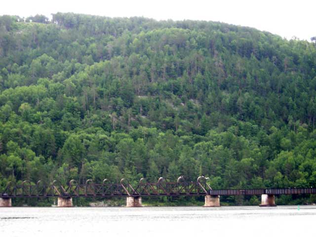
Our view from the marina has these two prominent landmarks: the very long railroad trestle across the river, of which only a portion can fit into this view, and (in the upper left) three very large white crosses erected on the Quebec hilltop facing the town.
Mattawa is about two miles below the Otto Holden dam and is located at the mouth of the Mattawa River which is the largest stream to flow into the Ottawa from the west. Here the two rivers are still at their historical levels, unaffected in the main by the dam at Des Joachim far downstream. If you could remove the railroad trestle and other artifacts of modern inhabitation, the scene would be similar to that found by Etiene Brule, the first European to arrive, when he stepped ashore in 1610, almost 400 years ago. Five years later, 1615, Samuel de Champlain followed. The Voyageurs turned their canoes west here, paddling up the Mattawa River and into Lake Nipissing, then on to the French River and into Georgian Bay.
Across the river from the town of Mattawa and atop the very large hill are three white crosses. These were first erected in 1686 as part of the celebration of the first Mass at these shores, and have been maintained more or less continuously ever since. The effort required to climb the 100-meter hill and clear the ground for them must have been considerable, and it serves as a reminder of how prominent the Catholic Church's role was in the early exploration of this region.
With the boat secure for the evening, the rain returns. We strike out on foot in search of dinner. Most of the town is back to the east, across the highway bridge over the Mattawa River. We duck in, out of the rain, at a small Chinese restaurant, and enjoy a few minutes indoors as we split the evening's dinner special. By the time we get back to the boat we are both ready to crawl into the cuddy cabin and read.
Mattawa has two interesting sounds. Trucks hauling logs and coming down the hill from the north use their "Jake brakes" to decelerate, creating an annoying rumble. Fortunately, the truck traffic thins out as the evening progresses, and eventually this sound goes away. Mattawa is also the junction of several rail lines, and we hear train whistles all evening long. This sound is much more pleasant, and we are lulled to sleep with the gently rising or falling doppler shift of two-toned railroad locomotive whistles blowing for the many grade crossings as the trains approach and leave Mattawa.
Later in the evening the weather deteriorates further, and a thunderstorm moves in. Just as I happen to be up in the boat's cockpit, lighting strikes very close by, and there is a very bright flash of light coupled with instantaneous thunder. Something very near to the marina has been hit with lightning.
The nine-day narrative continues in Day Four.
Copyright © 2006 by James W. Hebert. Unauthorized reproduction prohibited!
This is a verified HTML 4.0 document served to you from continuousWave
URI: http://continuouswave.com
Last modified:
Author: James W. Hebert
This article first appeared August, 2006.