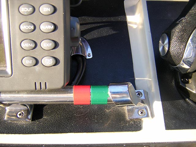
To help keep track of the orientation of the red and green lateral channel marker buoys I made this memory aid: two pieces of Scotch 35 vinyl electrical tape applied near the helm. We will pass more than one thousand buoys on the canal route.
The boat trip begins. The waves are calm, but there are a few rough spots to overcome.
| Date: | Sunday, June 17, 2007 |
| Weather: | Warm and sunny |
| Winds: | Light |
| Departure: | Rideau Marina, Kingston |
| Destination: | Jones Falls |
| Distance: | 32 miles by water |
| Elevation: | 243.3 feet above Great Lakes Datum |
Sunday morning begins with some cloudy skies and a brief sprinkle of rain, but the weather soon improves. We enjoy our usual breakfast on board: I make drip coffee by heating a pot of water using shore power, and we have either cold or hot cereal, as appropriate for the morning temperature. Chris takes care of rearranging the cabin from sleep mode to underway mode, while I work on the boat topsides and cockpit. On a cool morning we leave all the canvas up and let the solar gain warm the cockpit. On a warm morning the first order of business is to fold and stow the drop curtain to get some air flow on the boat. I rinse off any dew on the deck, and wipe it down with some old towels we keep aboard. The showers and bath are a short walk away, and we make use of them before departure. Our boat does not have any facilities, and we depend on shore rest rooms.
We make a final check on our truck and trailer. We have the trailer backed into a spot up the hill among some derelict boats that don't look like they'll be seeing the water anytime soon, while our truck is in the parking lot with other customers' cars. We've prepaid the modest fee for a week of parking. Given the marina's out of the way location, it looks like they'll be safe and sound for a week.
Before getting underway, there are some housekeeping details to record. I turn on our NAVMAN 3100 Fuel instrument, and make a few adjustments. I like to record some data, so I have to reset some previously recorded measurements.
ENGINE HOURS = 325.0 (Hobbs meter, which continuously
                      accumulates engine running time)
GALLONS REMAINING = 40.8 (shows 3/4-FULL on boat's gauge)
LOG = 0 (reset from 54.8, left over from last leg of last trip)
Tracking these three measurements will be a daily ritual which will help accumulate some data about our trip.
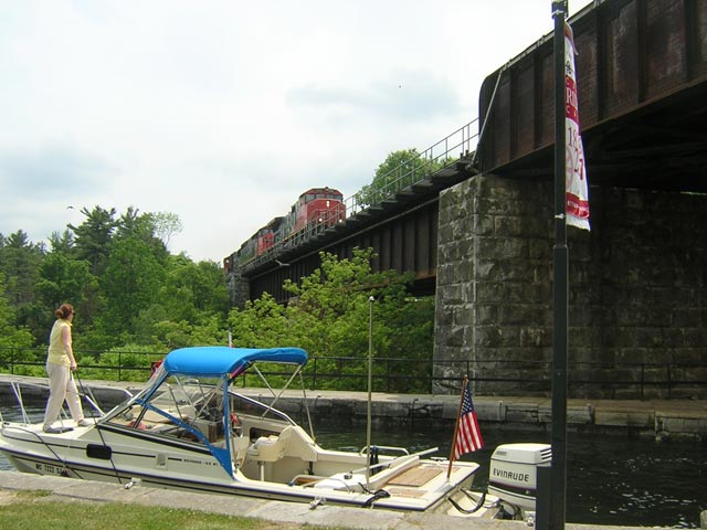
We are sitting about a mile inland from the St. Lawrence River and the eastern end of Lake Ontario. Before heading up the Cataraqui River to start our canal passage, I decide we ought to head downstream and see the sights. It will also give me a chance to check on the engine. It seemed to be running a bit rough yesterday. Slightly later than our usual start time, at 10:30 a.m. we cast off from the dock and head for the open water of Lake Ontario which is 243.3-feet above Great Lakes datum.
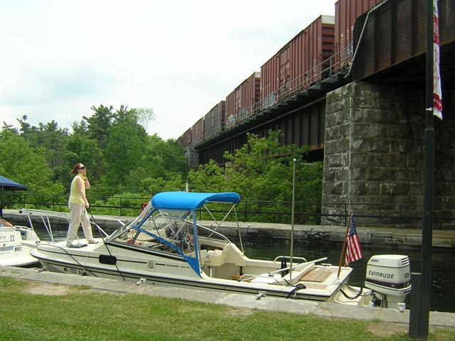
We proceed at idle until we reach the La Salle Causeway Bridge. Its 14-feet of vertical clearance is plenty for us, so we don't need to wait for the bascule bridge on the other end of the causeway to open. We turn into a big open expanse of the St. Lawrence River. I push the throttle ahead, and the boat comes up on plane. We run for a mile or so toward Lake Ontario. The boat's engine seems to be balking a bit. Around 3,500-RPM, a good spot for slow cruising, the engine is running poorly. But if the throttle is advanced the power comes on dramatically, and at 4,000-RPM she runs as smoothly as ever. It feels like there is a bad mid-speed jet in one carburetor. Running at low speed, the engine also is not as smooth as it ought to be. The fuel economy numbers from the NAVMAN look terrible: only 1.3-MPG at no-wake speed. This is discouraging news. Much of our trip is going to be at no-wake speed, and the fuel economy ought to be more like 1.6-MPG or higher. I am concerned. Not only will this drive the fuel consumption up significantly (20-percent more), but I would not like to run the engine for days and days if there is a problem with a carburetor not getting fuel. About two miles out we slow down to a drift and take in the beautiful setting. We'll have to return here one day to cruise the St. Lawrence; that's for sure. It is clean, clear, open water, and you can run on plane for miles. Just the kind of boating we usually prefer.
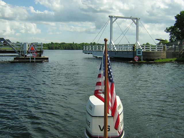
We turn around and head back to our starting point. As we return to Kingston Harbour, we pass the Royal Military College located on a prominent point. Then back under the causeway bridge and into the river. And back to no-wake boating. At this point we are returning from the sea, and all buoys are oriented with red on the right of the channel.
Idling along at 5-MPH seems quite slow. We work our way upstream into the Cataraqui River. The river is very shallow but wide, with marshy banks. Dozens of paired red and green lateral buoys mark a narrow, deep channel in the shallow river. The starboard shoreline is a bluff with residential development. The port side is a big marsh that leads to low-lying and vacant shore. The water clarity is not good, and the flow seems quite low. We are green-water boating.
After a mile or two of passing between paired buoys spaced eight to the mile, I am already getting bored. I begin to wonder if this trip is going to be very entertaining. I do not think I can stand 125-miles of this, and particularly with the NAVMAN flashing 1.3-MPG at me. That is like a poke in the eye. The two-stroke motor still seems to be running rougher than usual, and I can just see the dollars flowing out its exhaust. I am calculating the fuel cost in my head: 125 miles at 1.3-MPG is about 100 gallons. At $4.44 per gallon, this is going to cost a small fortune in gasoline. I am getting depressed already.
Chris and I have a few words about the whole concept of this trip: the water way, the fuel prices, the currency exchange. "If the whole way looks like this," I say as I gesture at the not too particularly scenic marsh on either side, "this is going to be the trip from hell."
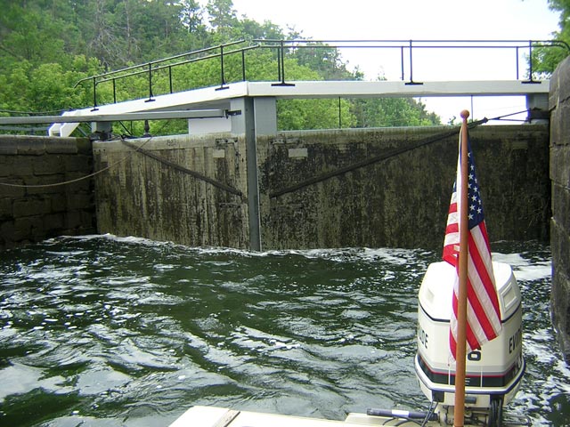
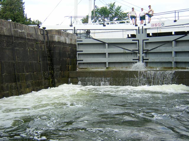
We putt-putt along the river for another mile. Finally, the terrain makes a dramatic change. We leave the lowland marsh and enter a steep sided rocky gorge filled with pine trees clinging on ledges. This is more like it! The gorge narrows, we round a bend, and then finally we reach our first lock: Kingston Mills. It will lift us 45-feet. Things are looking up--literally. In front of us towers a flight of locks that ascend the granite clifts.
We ease up to the lock and moor to a floating dock. Another boat is there waiting. The Kingston Mills lock is a flight of four lock chambers, and it is currently cycling another boat down. We will have a short delay before we can enter. This will give us an opportunity to decide on the type of lock pass we will purchase.
Our options reduce to two choices: we can buy a one-way pass, the least expensive, which allows us one transit of each lock without a time limit, or we can buy a six-day pass which permits us to go as we please, but only for six days. The difference in price is about $20, which is also the amount that an extra single lock passage would cost. So if we decided to reverse our route, even for just one lock, we would be better off with the six-day pass. The cost of the passes varies with the length of the boat. For us (22-foot boat) a six-day pass is $106.70-Canadian.
As we fill out the paperwork and make our payment, we are greeted with a very pleasant surprise. This year, 2007, is the 175th anniversary of the Rideau Canal, and to commemorate it we receive a special lock pass book. At each lock station, we can get an endorsement to affix in our pass book to record our passing. This will became a very cool addition to the trip and a fun side activity to the passage itself.
The crew of the other boat, about six folks from a 27-foot express cruiser with twin stern drives, are enjoying the stopover. They're casting lines into the clear and swift current of the tail waters of the lock and dam, hoping to catch one of the abundant Perch or Smallmouth Bass we can see swimming around the docks and float. At one point, a small Honda gasoline powered generator appears from their cockpit and is hoisted onto the dock. The generator is started. A blender comes out of the cabin and is connected to the 115-VAC power. A pitcher of Margaritas are quickly whipped, and the generator stowed. We get a laugh out of that maneuver. This canal cruising is a different style of boating than our usual!
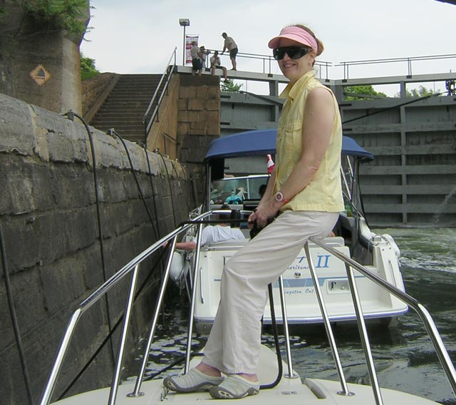
After about thirty minutes, the lock opens, the down bound boat departs, and we are able to enter the lock chamber. A word about lock dimensions: the lock chambers are about 125-feet long and 26-feet wide. The depth over the miter sill is usually about 6-feet, and the fixed vertical clearance is 22-feet. We idle into the first lock chamber for our assent.
In addition to discovering the 175-year-old age of the locks, we also are surprised to find out that they are still operating in exactly the same manner as in 1832. Everything is done by hand! There are no electric motors or hydraulic pumps used. To close the miter doors, two canal men turn an iron crank that pulls the doors closed by attached chains. Gate valves are also operated by chains and cranks. It is a very unique system, 175-years-old and still working as well as the day it started. The original design and engineering was simple mechanical perfection.
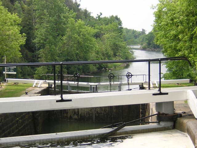
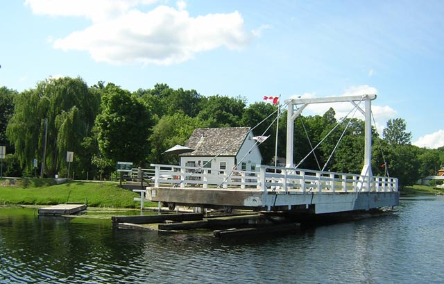
When flooding a chamber the fill rate is kept low to reduce turbulence, so it takes longer to rise than to fall. In about ten minutes our chamber is gently filled, the upper miter doors opened, and we proceed to the next chamber. The process is repeated three times, we exit to a large turning basin, then onto the final lock chamber. A highway now crosses over the lock at this point, so traffic has to be stopped and the highway bridge swung out of the way. This structure is a modern addition, and operates with electro-hydraulic assistance. Traffic on the side road comes to a stop for about 15 minutes as our lock chamber rises and we finally exit onto Colonel By lake. Our elevation is now approximately 290.6-feet above Great Lakes Datum. We pull ahead to the floating dock and tie up for a lunch break.
Since I handle the morning coffee and breakfast preparation, Chris traditionally handles lunch. From our cooler she produces some fine cold cuts, garnishes, sauces, and other seasonings, and prepares a wonderful meal in a sandwich. We eat under the shade of a tree at a picnic table. On a warm day like this, a Molson CANADIAN Light may also be on the menu.
After lunch we take a long tour of the grounds of the Kingston Mills lock station. Here we learn even more surprising information about the history of the waterway.
To our great surprise we learn that the decision to construct the Rideau Canal was made as a military defensive effort. The British Army thought it necessary to have an alternative route from Montreal to Upper Canada (as Ontario was called in the 1800's), something other than the St. Lawrence River. With the United States in control of the south shore of the St. Lawrence, the British feared they could be easily blockaded from Upper Canada, should hostilities arise between the U.S. and Britain. Today this seems like a strange notion, but in the aftermath of the War of 1812 between Britain and America, it probably was a good idea.
The larger and more strategic lock stations, such as this one at Kingston Mills, were built with defensible lock houses or blockhouses, intended to be able to defend the works from infantry attack. We learn the seriousness of purpose when we see the four-foot thick masonry walls of the blockhouse. This quite amazing structure is open for tours and manned by a guide in British military uniform of the period. We tour the rest of the lock station, visiting the museum exhibit and its rest rooms. Then back to the boat and underway around 1 p.m.
Thanks to a dam at Kingston Mills, above the locks we enter an artificial lake system, one of many created in the process of building the waterway. We can increase to planing speed, and run several miles through the weedy lake. At Charon Point narrows, we enter River Styx, where we can again run on plane in deeper water (10-feet or more) but with a heavy weed content. Along the way the operation of the motor seems to have smoothed itself out. I experiment with different no-wake speeds to see what gives the best fuel economy. It appears that we can manage about 1.6-MPG if we hold it down to about 1,100-RPM, which produces a boat speed of around 5.5-MPH. Perhaps the lower reading I was getting earlier was due to a foul current. Here in the relatively open lake there is probably very little flow opposing us. The improved fuel economy is very welcome. My overall mood about the trip has now flipped 180-degrees. I am totally enthusiastic! The motor is running normally, the scenery is much improved, and the historical nature of the waterway is just beginning to amaze us. We motor onward, finally entering the narrow gorge of the Cataraqui River, where more locks await.
The single chamber at Lower Brewers is a simple exercise for us, now that we are Rideau Canal lock veterans. We are lifted 13 feet, and continue the scenic passage of the gorge. This is a very pretty stretch, and we enjoy it at no-wake speeds. At Upper Brewers we are lifted 13-foot more. We are now 320.7-feet above Great Lakes level.
Above Lock 43 we have a long run, 11-miles or more, without any locks. As it is getting late in the afternoon, we take most of this at a nice planing speed. Due to the quirks of our boat and motor, we actually get better fuel economy on plane at speeds of 25 to 28-MPH, where the MPG peaks around 2.0 or higher. There are long stretches here with no buoys, just open lakes and shorelines. It is very pleasant to put some miles under the keel. Between the lake systems we slow down for Murphy's Narrows. Finally, around 5 p.m. (which is just when we like to begin shutting down) we arrive at Jones Falls, our destination for the evening.
Overnight mooring is available at most lock stations, however there is an additional charge ($0.85-per-foot) and space may be limited. Approaches to the locks are identified by two types of wharfs: the BLUE line and the GRAY line. The normal rules prohibit use of the BLUE line except for boats awaiting transit of the locks. The GRAY line is available for tie up for daily or overnight mooring. Here at Jones Falls wharf (175-feet long) below the locks is all BLUE line, but we get permission to tie up overnight from the Lockmaster. It is early in the season and there are few boats transiting the canal. Tomorrow will be Monday, and there is no traffic anticipated from downstream. (The Lockmasters communicate with one another via telephone to inform the upstream and downstream locks of how many boats will be approaching.) There is no electricity at the wharf, but we can use the outlet in the wash rooms to heat the water for coffee and breakfast. We also get a key, as they're locked overnight. The only disadvantage is the hike up the hill. It is about a 150-foot climb to the wash rooms.
Our usual mode of cruising requires a place to eat dinner each night. Although we are staying at the lock and not in a town, we are fortunate to have the services of one of the finest small hotels in Canada, Hotel Kenney. It is located just a few feet from the lock wharf, and has been serving the canal since 1877. The same family has owned and operated the establishment during that time, some 130-years. We make reservations for a 7 p.m. dinner, and relax on the boat.
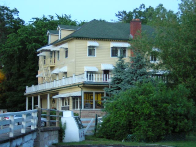
This is Father's Day, and Hotel Kenney is serving a special dinner. We enjoy a multi-course meal: appetizer, soup, salad, bread, main course, side dishes, and dessert. The multi-course meal is served to us by a young waitress wearing an old-fashioned white waitress uniform with her hair pulled back in a bun. She is very polite and quiet, and something of the antithesis of the way too forward "Hi--I'm Rachel, I'm going to be your waiter. How are you guys doing?" type of service you often get these days. It is a nice change of pace, a return to an older way of dining. It is a relaxing and very nice way to end a long day of boating. Chris has poached Salmon and I go for Prime Rib. They are both very well prepared and tasty. After the leisurely dinner we are back at the BLUE line wharf. There is no wave action or wind, and we have a perfect night's sleep. The evening sky is clear and tomorrow's weather is forecast as fair. The waxing moon and Venus have switched places in the western sky. It is funny how when you are basically living outdoors you become aware of celestial events like this.
Every day I will close with a summary of the sailing data for the day. This helps track our progress and record our fuel and engine use. Here's the data for today:
Instrument data:
ENGINE HOURS = 0328.9
GALLONS REMAINING = 21.8
LOG = 31.3 miles

Today's Increments:
HOURS   = 3.9
GALLONS = 19
MILES   = 31.3

Today's averages:
GPH = 4.97
MPH = 8.02
MPG = 1.65
The fuel economy turns out to be quite reasonable. At 1.65-MPG we are a bit below our long term average with the boat, 1.85-MPG, but considering all the slow speed boating where the motor runs inefficiently, it is not bad. It's much better than the numbers we were seeing on the 3100 Fuel instrument when we first left the dock.
The nine-day narrative continues in Day Three.
Copyright © 2007 by James W. Hebert. Unauthorized reproduction prohibited!
This is a verified HTML 4.0 document served to you from continuousWave
URI: http://continuouswave.com
Last modified:
Author: James W. Hebert
This article first appeared July, 2007.