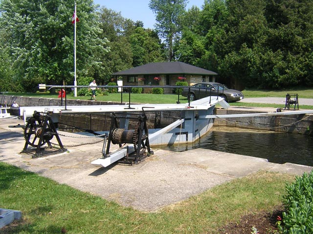
Poonamalie Lock. We are tied to the BLUE line wharf as we await passage.
A little rain must fall.
| Date: | Tuesday, June 19, 2007 |
| Weather: | Cooler and cloudy, rain threatening |
| Winds: | Fresh Breeze from SW |
| Departure: | Westport |
| Destination: | Smith Falls |
| Distance: | 32.5 miles by water |
| Elevation: | 407 feet above Great Lakes Datum |
We have our breakfast off the boat, moving our portable galley over to a picnic table on the island. The weather is still fair, but there is a strong breeze coming up from the southwest and it is bringing in a line of clouds and possible thunderstorms. Chris makes a visit to town where she stocks up on fresh baked goods from the bakery, run by a woman from Switzerland who makes elegant little cookies that are very tasty. After 10:15 a.m. we cast off from Westport and resume our trip, retracing our path eastward on Upper Rideau Lake to rejoin the main route of the canal toward Ottawa.
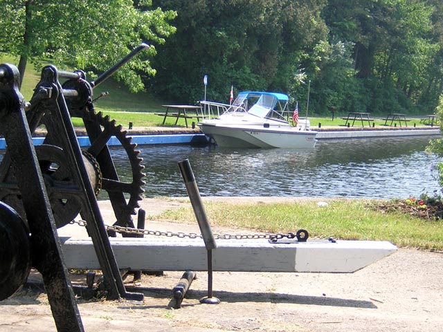
As we approach the single lock at The Narrows there is already another boat in the lock chamber, and we hurry our approach and motor quickly in so we can be dropped a modest three feet to the level of the lower lake. The split in level between the two parts of the lake was added by the canal engineers in order to raise the level of Upper Rideau Lake. This saved a great deal of excavation of rock in the canal from the Lake to Newboro, which was blasted through rugged granite.
We've taken off the side curtains of our weather protection system, and ironically as we exit the lock the weather turns foul and it begins to sprinkle. We stop briefly at the wharf below the lock to get the side curtains back in place, then we head out into Big Rideau Lake in a light rain shower.
As its name implies, Big Rideau Lake is a large lake and it is filled with many bays and islands. The southwest breeze is starting to kick up some waves, but they are not a problem for us, and we are completely sheltered under our canvas. We overtake a sailboat, its crew sitting in the cockpit in foul weather gear, a situation we are familiar with from our many years of sailing.
Several miles later we divert to have a look at the docks and facilities at the park on Colonel By Island. There are some camping sites and other recreational facilities, but the park's dock is not protected from this southwesterly, and we decline to lay against it for our lunch. We return to our passage, heading east again and through the narrows at Tar Island, then on to pass through Rocky Narrows at Murphy Point. Around noon the rain lets up and the sun returns.
We make a U-turn around Murphy Point and ease into a long inlet where we can get out of the wind and have lunch. We anchor in 8-feet of water at the head of the small cove, and Chris breaks out the lunch supplies from the cooler. The shore here is part of a provincial park, and there are campsites and trails nearby, but as it is early in the summer season, we don't see or hear any park visitors while we relax and enjoy the wooded beauty of the surrounding forest.
After lunch we haul the anchor and get underway, still enjoying many lock-free miles of Big Rideau Lake's water. The southwest wind continues to blow, but we are going with it; the downwind course helps give us improved fuel economy as we idle along enjoying the view.
Just west of the highway bridge at Rideau Ferry I notice a large marina on the northern shore with a prominent gas dock. This prompts a short discussion about where fuel will be available ahead, and Chris turns to her Rideau Canal cruising guide for advice. Our destination today is Smith Falls, but although it is the largest city along the way, it does not have any gasoline available on the water. We decide we had better not pass up this chance to take on more fuel, so we turn for the gas dock.
At Rideau Ferry Marina we add 75-liters of fuel at CA-$1.25 per liter (US-$4.73/gallon) which restores our tank level indicator to just shy of 3/4-FULL. We also visit their restrooms and shower facilities, which we discover are rustic. I would not recommend them for an overnight stopping point. However they are a large marina and appeared very busy with customer's boats, and their docks were filled with large yachts which looked like they would be more at home on some larger bodies of water. People love boats and boating, so no matter where there is water there are boats, and here is no exception. However, a 40-foot sport-fisherman is probably overkill for this lake.
Passing under the big highway bridge we enter Lower Rideau Lake. To the north there is a side canal leading up to the town of Perth via Beveridge Locks 33 and 34, but we do not take this diversion. Instead we continue on course, reaching the eastern end of the lake which shoals to a long winding passage through Bacchus Marsh marked with many paired red and green buoys, ultimately flowing into the Rideau River. Here we see some rather shallow soundings on our SONAR, but we pass several rather large yachts going in the other direction, so we are reassured that there is sufficient water for us to get through.
The Rideau River begins here and flows all the way to Ottawa, and it will be our path for the next several days. We will be leaving this complex system of interconnected lakes and sailing on a more natural river water course. This afternoon we just have a few miles to go, and we follow the weedy deep water passage as marked by closely set pairs of buoys. After a mile or two we come to our first lock since early morning.
Poonamalie Lock is in the middle of about a half-mile long cut which was constructed to bypass a portion of the river which was very winding and had several very sharp turns. Its name is quite unusual and departs from most of the other locks, so I am curious about its origin. Chris, consulting the cruising guide, finds that the name was given by the British Royal Engineers. They had previously been in India, and the setting for this lock reminded them of a location there which had similar cedar trees.
The lock has just been cycled down, and two boats are reported to soon be coming upstream to be lifted, so the lockmaster informs us there will be a short delay before we can proceed down. This gives us a chance to get off the boat for a while, sit in the shade and enjoy the beautiful afternoon, which has stayed sunny and fair.
After about thirty minutes, the two upbound boats arrive and are lifted, and the lock is ready for us. Although we did not realize it at the time, Poonamalie Lock is just about exactly at the half way point in the canal, and it was quite appropriate to pause here for a few extra minutes. When we resume the second half of the trip, we drop six more feet and motor onward toward our destination today, Smith Falls, which is just a little more than a mile away. Once out of the cut, the land becomes quite open and low lying. The river channel is flanked by marshes, and the wind speed has picked up, giving us a strong cross wind in some areas.
Approaching the lock at Smith Falls we have finally caught up with a small fleet of steam-powered boats which have been traveling the canal in the same direction as us but about a day ahead. They are only going as far as Smith Falls, where they will remain for a few days on display at the docks as part of an organized event. Although there is still room in the lock chamber, the lockmaster waves us over and indicates we should wait for the next lock cycle. Concern about the open flames in the boilers on these steam powered boats requires that we keep our gasoline tanks and any fumes far away. We tie up on the BLUE line wharf to wait. The wind is very strong and even with 225-HP it takes a bit of throttle to bring the boat to the dock against the wind.
Also waiting is a Parks Canada boat, a nice new 18-foot Lund with a Mercury VERADITO ("FourStroke") motor on the transom. The young skipper with a Parks Canada khaki shirt informs us he just towed the two little steam boats out of the weeds when they were blown out of the channel by the strong winds.
"I dinged up my brand new propeller, too," he laments. "Hit something in the shallows, but it looks like the motor is OK--it's just the propeller that's bent."
After being lowered seven feet in the lock, we briefly stop traffic on Abbott Street as they swing open the bridge to allows to pass. After a few hundred feet more of cut canal, we proceed to the Smith Falls basin and tie up to a finger pier at Victoria Park.
The town of Smith Falls runs a small dock with about six finger piers and several hundred feet of wharf on the south side of the river adjacent to Victoria Park, which is a popular trailer park campsite. Although we are arriving quite late in the afternoon, there is still a slip available. We moor on the upwind side of a finger pier, and shut the motor off for the day. Chris heads up to the office to make arrangements for the berth, pay the fees, and get the key to the marina restroom and showers. It is a warm afternoon and the wind is still blowing, making for a pleasant setting at the dock. After we get settled in, a couple of swimmers come by the stern of the boat, two women a bit our senior. They report the water is quite nice, so Chris and I change into our bathing suits and join them. The water is about 8-feet deep but the weeds are few, and it makes for a refreshing dip after a long afternoon in the sun.
Around 7 p.m. we head off on foot into town for some dinner. Not far away we find a family-style restaurant, Gerbo's, which had received some endorsement from fellow cruisers. The setting was fine, but the food turned out to be quite mediocre. They claimed to specialize in Italian, and that evening offered a special lasagna dish. Normally we try to find fresh fish for dinner, and locally caught fish if possible, but on this trip so far we have not been able to get anything like that, and thus I strayed from my usual preferences and ordered the special lasagna. When the main course came it was immediately suspect; a plate of not-too-broad pasta noodles in a thin tomato sauce with some cheese melted atop it. A slice of pepperoni under the cheese was the "special" ingredient, and the taste was reminiscent of something I once ate in a junior high school lunch cafeteria.
Back at the boat we enjoy a quiet evening of reading in the cabin. The weather threatens to rain a bit, and some dark clouds roll in.
Here are the sailing data from today:
Instrument data:
ENGINE HOURS = 0336.2
GALLONS REMAINING = 26.7
LOG = 81.1 miles

Today's increments:
HOURS   = 4.0
GALLONS = 18.7
MILES   = 32.5

Today's averages:
GPH = 4.68
MPH = 8.13
MPG = 1.73
The nine-day narrative continues in Day Five.
Copyright © 2007 by James W. Hebert. Unauthorized reproduction prohibited!
This is a verified HTML 4.0 document served to you from continuousWave
URI: http://continuouswave.com
Last modified:
Author: James W. Hebert
This article first appeared July, 2007.